Skip to content
Join our Newsletter

Next Storm/Next Snow Forecast Discussion from the Cherrywood Observatory – Nov 6-7, 2019

This content was originally published by the Longmont Observer and is licensed under a Creative Commons license.

In Brief:

Cool but dry weather is the story for Tuesday night and Wednesday day. A front comes through (dry) in the afternoon with wind and cooling temperatures. Clouds move in later in the afternoon followed by drizzle and then freezing drizzle overnight. Precipitation (with maybe a few flurries later in the night) comes to an end before dawn. Bridges and driveways and shaded spots might get pretty slick by morning Thursday. Drive safely before the sun warms things enough to melt that glaze. We stay cool and dry until another front might do this again Sunday afternoon into Monday.

Forecast Discussion:

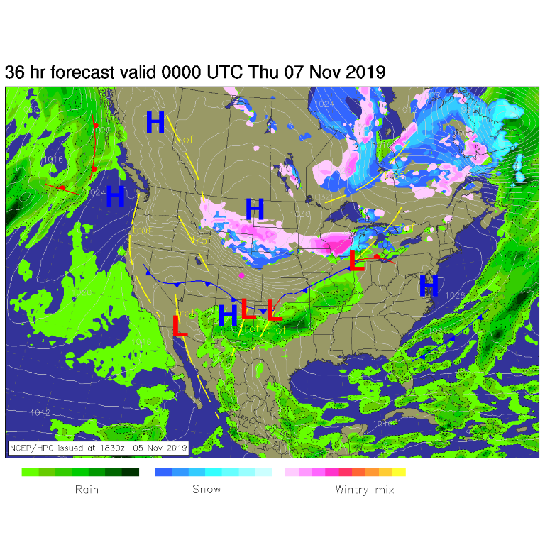
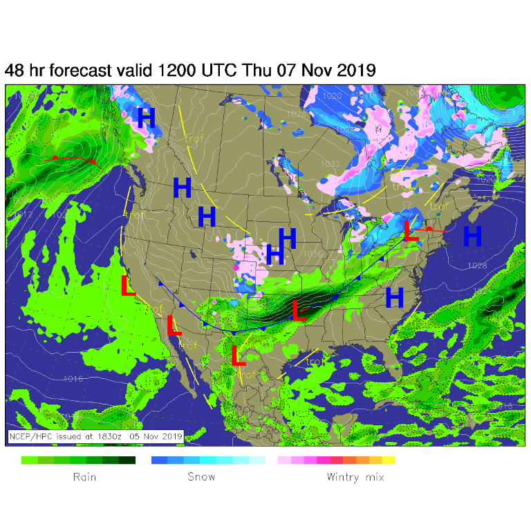
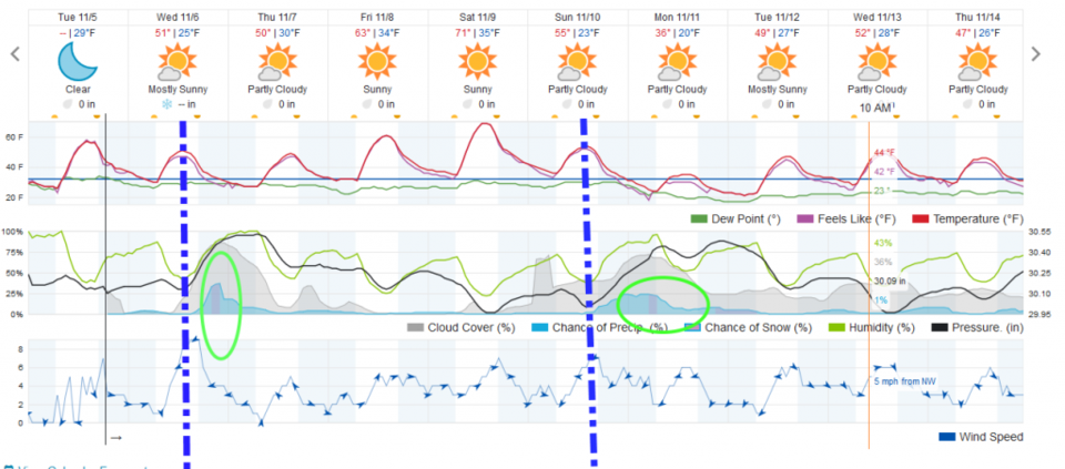
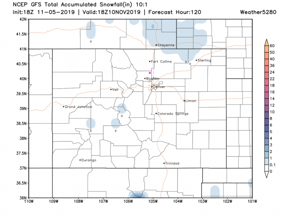
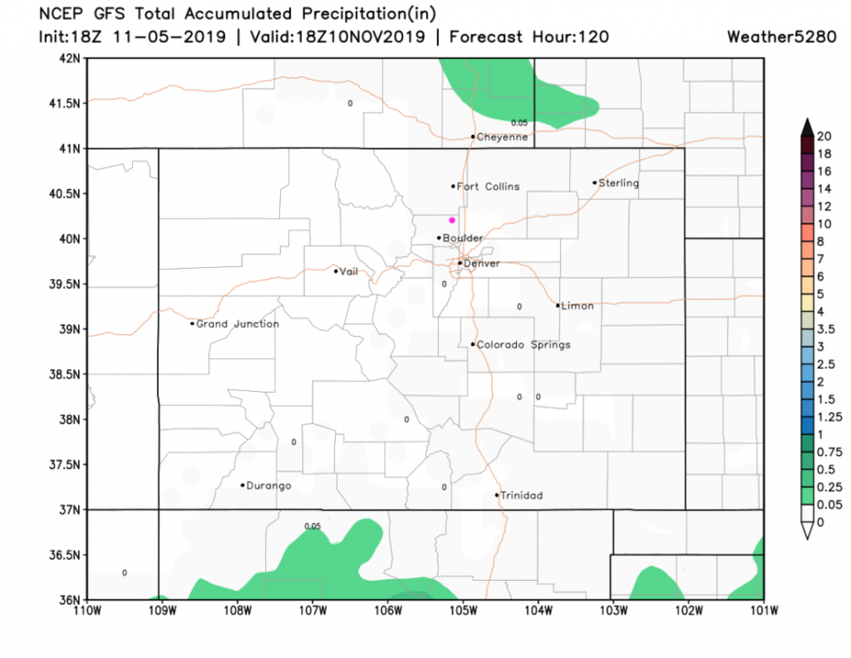
A dry and not too cold cool front will blow things around Wednesday afternoon (Figure 1). Clouds will begin to increase a few hours later with light drizzle beginning in the evening. As temperatures drop below freezing, it will change to freezing drizzle (Figure 2 and 3). We only drop to the mid 20'sF Thursday morning. This isn't super cold. Bridges and cool roadway surfaces might be very slick for the Thursday morning commute. The sun will be out again by late morning Thursday and melt most of those spots. The total snowfall and rainfall over the next five days is below the minimal shaded threshold (Figure 4 and 5). This won't make much of a water impact.

The Longer Range Forecast:

We slowly warm until another front slides over Sunday afternoon. Will we get snow, or freezing drizzle Monday morning? We'll watch it all week.

I'm in Leesburg, VA for my annual work meeting - but I am watching Colorado from here!

Figure 1: The forecast surface map for Wednesday PM from NCEP.
Figure 2: The forecast surface map for Thursday AM from NCEP.
Figure 3: the graphical forecast for the next 10 days for Longmont, CO from weatherunderground.com
Figure 4 : The forecast snowfall totals for the next 5 days from the GFS and weather5280com for Colorado made Tuesday noon.
Figure 5 : The forecast rainfall totals for the next 5 days from the GFS and weather5280com for Colorado made Tuesday noon.

Current Weather

Cloudy

Cloudy

71°F

UV Index
4 Moderate
Pressure
30.21 Falling
Visibility
6 miles
Dewpoint
60 °F
Humidity
67%
Wind
NE 1.7 mph
Gust
3.8 mph
Wind Chill
71 °F

Hourly Forecast

Today
12 PM
73°F
Mostly cloudy
Today
1 PM
76°F
Mostly cloudy
Today
2 PM
78°F
Mostly cloudy
Today
3 PM
80°F
Mostly cloudy
Today
4 PM
82°F
Mostly cloudy
Today
5 PM
84°F
Intermittent clouds
Today
6 PM
82°F
Intermittent clouds
Today
7 PM
79°F
Intermittent clouds
Today
8 PM
77°F
Intermittent clouds
Today
9 PM
73°F
Partly cloudy
Today
10 PM
69°F
Partly cloudy
Today
11 PM
65°F
Intermittent clouds

7 Day Forecast

Mostly cloudy

Saturday

84 °F

Clouds and breaks of sun; smoke from area fires will lead to poor air quality


Partly cloudy

Saturday Night

58 °F

Partly cloudy


Partly sunny w/ showers

Sunday

94 °F

Partly sunny with a passing shower in the afternoon


Partly cloudy

Sunday Night

61 °F

Partly cloudy


Mostly cloudy

Monday

91 °F

Considerable cloudiness


Mostly clear

Monday Night

60 °F

Clear to partly cloudy


Intermittent clouds

Tuesday

92 °F

Sun through high clouds


Partly cloudy

Tuesday Night

58 °F

Partly cloudy


Intermittent clouds

Wednesday

84 °F

Not as warm with times of clouds and sun; a thunderstorm in spots in the afternoon


Intermittent clouds

Wednesday Night

58 °F

An evening thunderstorm; otherwise, partly cloudy


Sunrise and Sunset

Sunrise
5:41 AM
Sunset
8:30 PM

Based on AccuWeather data