Skip to content

Next Storm/Next Snow Forecast Discussion from the Cherrywood Observatory – November 10th, 2018

This content was originally published by the Longmont Observer and is licensed under a Creative Commons license.

Forecast Discussion:

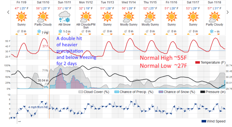
We warm up to near normal for a day today as a short wave ridge zips past. (As seen in Figure 6, normal highs are around 55F and lows around 27F this week of the year.)

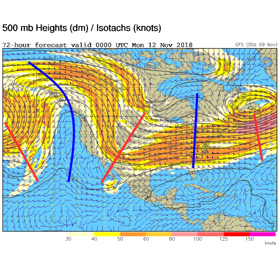
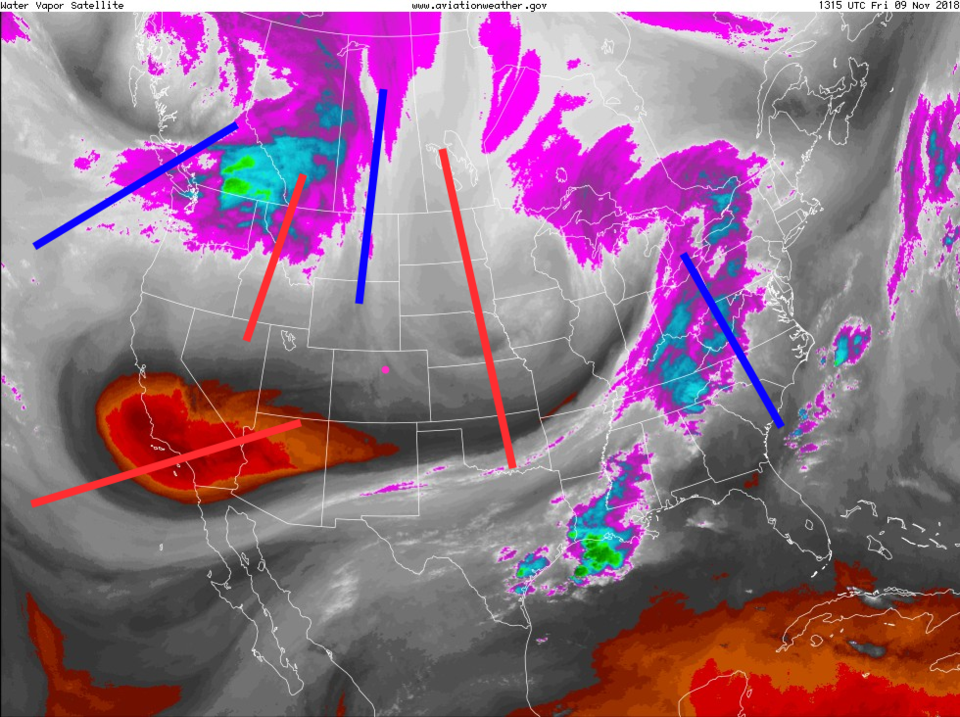
The ridge is the blue line to our west-ish in Figure 1.  Our big trough, for the weekend storm, is down to the southwest of us. We'll cover that in Figure 2 and the longer range forecast below...

Figure 1: The water vapor satellite image from Friday AM from NOAA. Longmont is the pink dot. Red lines are approximate locations of upper air troughs, blue lines upper air ridges.

The longer range forecast:

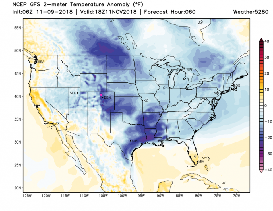
The upper air pattern for Sunday PM show the big trough consolidating north to south and is sliding towards us (Figure 2). That is the lift needed for the next snow storm.  Figure 3 is the abnormally cold air (in blue). There are three blobs, one coming out of Canada, one pressed up against the Rockies over us, and one down in Texas.

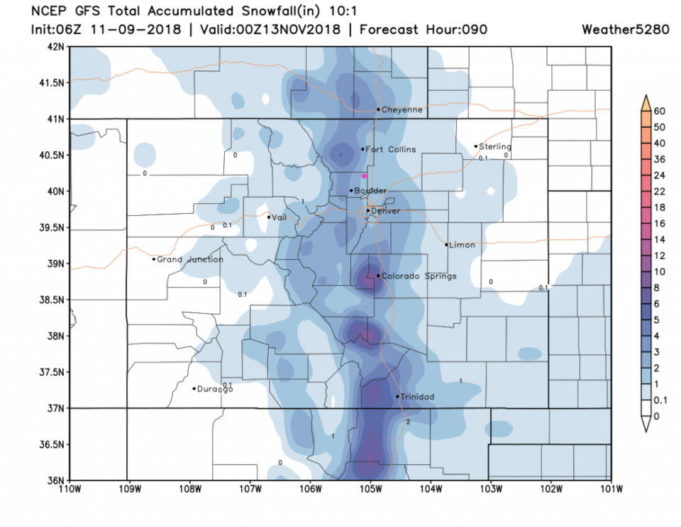
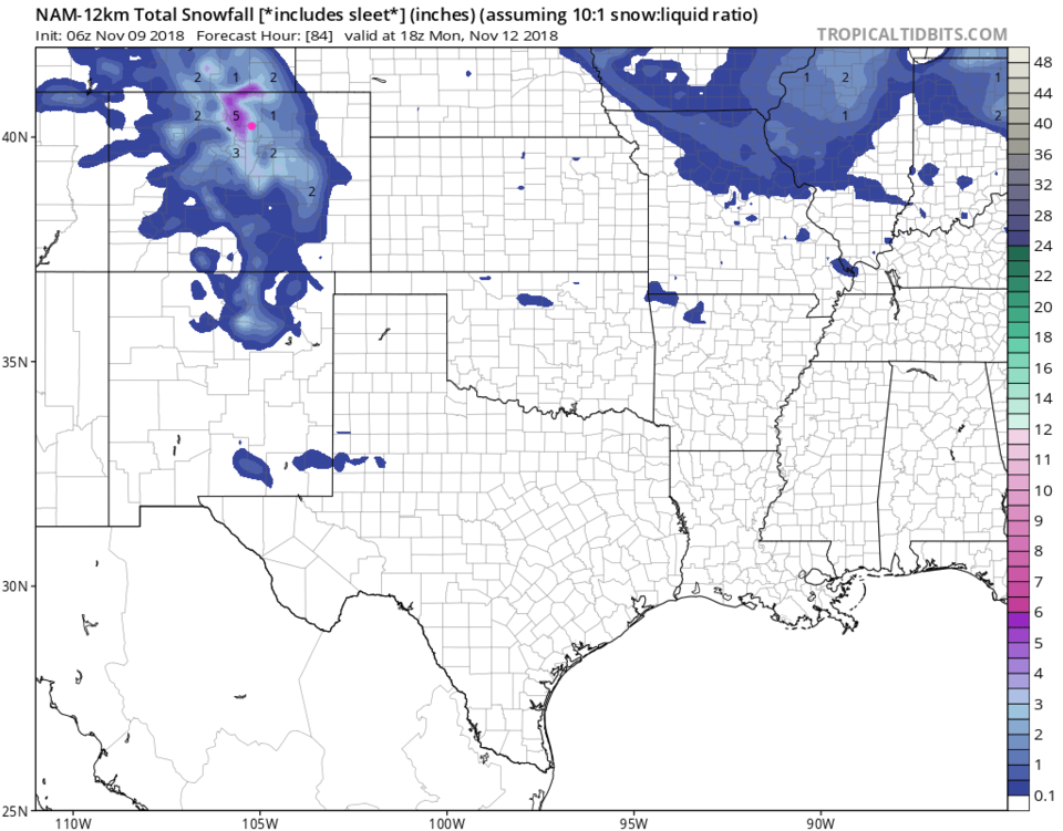
What do the models say currently about snow amounts?  Weatherunderground is calling for 1-3 inches (Figure 6). The GFS has about the same 1-3 inches (Figure 4). The NAM has about 2.5 to 3.5 inches (Figure 5).

Figure 2: The 500mb forecast upper air analysis for Sunday PM. Pink dot is Longmont. Red lines are troughs, blue lines are ridges.

Figure 3: The temperature departure from normal national forecast map for Sunday midday. Longmont is the pink dot.

Figure 4: The forecast accumulated snow map from the GFS and weather5280.com for Colorado for the next 4 days, through Monday PM. Longmont is the pink dot, as always.

Figure 5: The forecast accumulated snow map from the NAM and tropicaltidbits.com for Colorado for the next 3 days, through Monday noon. Longmont is the pink dot, as always.

Figure 6: the piece of the next 10 days of the graphical forecast for Longmont, CO from weatherunderground.com

Current Weather

Sunny

Sunny

56°F

UV Index
8 Very High
Pressure
30.09 Falling
Visibility
8 miles
Dewpoint
32 °F
Humidity
40%
Wind
SE 3.2 mph
Gust
7.8 mph
Wind Chill
56 °F

Hourly Forecast

Today
2 PM
61°F
Partly sunny
Today
3 PM
63°F
Partly sunny
Today
4 PM
65°F
Intermittent clouds
Today
5 PM
66°F
Intermittent clouds
Today
6 PM
65°F
Intermittent clouds
Today
7 PM
63°F
Intermittent clouds
Today
8 PM
60°F
Mostly clear
Today
9 PM
57°F
Mostly clear
Today
10 PM
55°F
Mostly clear
Today
11 PM
52°F
Mostly clear
Tomorrow
12 AM
50°F
Mostly clear
Tomorrow
1 AM
48°F
Mostly clear

7 Day Forecast

Intermittent clouds

Saturday

66 °F

Not as warm with intervals of clouds and sunshine


Mostly clear

Saturday Night

39 °F

Clear to partly cloudy


Mostly cloudy

Sunday

77 °F

Mostly cloudy and warmer; breezy in the afternoon


Mostly cloudy

Sunday Night

45 °F

Rather cloudy; breezy late


Windy

Monday

60 °F

Very windy; cloudy and cooler


Intermittent clouds

Monday Night

43 °F

Partly cloudy


Intermittent clouds

Tuesday

62 °F

Times of clouds and sun; windy in the afternoon


Partly cloudy

Tuesday Night

36 °F

Partly cloudy


Intermittent clouds

Wednesday

60 °F

Times of clouds and sun


Intermittent clouds

Wednesday Night

35 °F

Partly cloudy


Sunrise and Sunset

Sunrise
5:55 AM
Sunset
7:59 PM

Based on AccuWeather data