Skip to content

7PM Totals Update: Next Storm/Next Snow Forecast Discussion from the Cherrywood Observatory – November 11, 2018

This content was originally published by the Longmont Observer and is licensed under a Creative Commons license.

Forecast Discussion:

7PM Update for Storm Snow Totals (2 days)

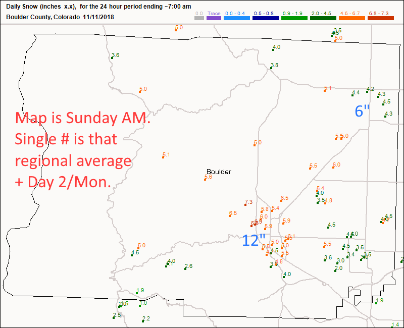
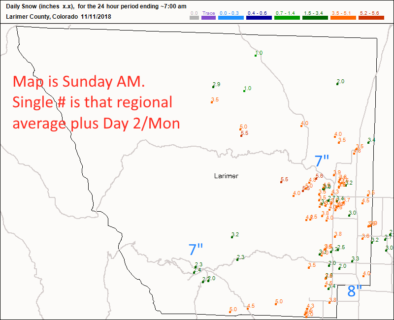
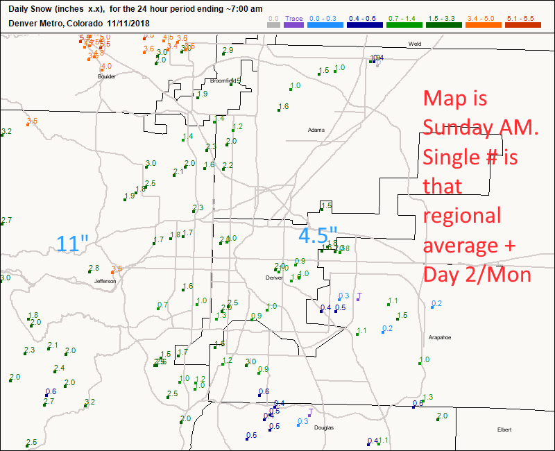
I conducted an eyeball estimate adding the values from the first day of the storm (pictured) to the smaller totals seen before 7am this morning and wrote them in large blue numbers.  This is just to get a feel for some of our surrounding communities (there was some melting, sublimation, and compaction, of course). Figure 1 update, Figure 2 update, Figure 3 update.

This storm over produced compared to my prediction, and that of some of the models.

Figure 1 update: CoCoRaHS new snow totals as of 7am Sunday with eyeballed additional snow by city through 7am Monday. Boulder County.

Figure 2 update: CoCoRaHS new snow totals as of 7am Sunday with eyeballed additional snow by city through 7am Monday. Larimer County.

Figure 3 update: CoCoRaHS new snow totals as of 7am Sunday with eyeballed additional snow by city through 7am Monday. Denver Metro.

End 7pm Update

I'll update this post in the AM when the storm pulls out with snow totals. In the meantime, we return to normal temperatures and dry weather very quickly for most of the next week (Figure 1).

Figure 1: the piece of the next 10 days of the graphical forecast for Longmont, CO from weatherunderground.com

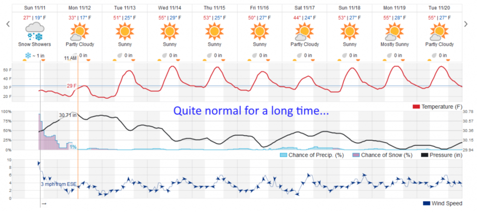
The longer range forecast:

Quiet and pleasant (a bit of a chill with a dry cold front next Saturday).

Current Weather

Cloudy

Cloudy

41°F

UV Index
0 Low
Pressure
29.95 Falling
Visibility
7 miles
Dewpoint
38 °F
Humidity
90%
Wind
NNW 1.6 mph
Gust
3.8 mph
Wind Chill
41 °F

Hourly Forecast

Today
1 AM
40°F
Showers
Today
2 AM
39°F
Rain
Today
3 AM
39°F
Rain
Today
4 AM
38°F
Cloudy
Today
5 AM
37°F
Cloudy
Today
6 AM
37°F
Cloudy
Today
7 AM
38°F
Cloudy
Today
8 AM
40°F
Cloudy
Today
9 AM
44°F
Cloudy
Today
10 AM
47°F
Mostly cloudy
Today
11 AM
50°F
Mostly cloudy
Today
12 PM
53°F
Mostly cloudy

7 Day Forecast

Rain and snow

Saturday

43 °F

Chilly with a mix of snow and rain; travel in the foothills and mountains will be slippery due to snow


Rain and snow

Saturday Night

37 °F

Cloudy; rain and drizzle this evening followed by a bit of snow and rain at times late; travel in the foothills and mountains will be slippery due to snow


Thunderstorms

Sunday

61 °F

Mostly cloudy and warmer; a thundershower in spots in the afternoon


Partly cloudy w/ t-storms

Sunday Night

37 °F

A thunderstorm in spots in the evening; otherwise, partly cloudy


Partly sunny

Monday

71 °F

Partly sunny, pleasant and warmer


Intermittent clouds

Monday Night

42 °F

Partly cloudy


Mostly sunny

Tuesday

73 °F

Mostly sunny and pleasant


Mostly cloudy

Tuesday Night

43 °F

Mostly cloudy


Intermittent clouds

Wednesday

65 °F

Times of sun and clouds with a passing shower in the afternoon


Rain

Wednesday Night

42 °F

Overcast; a couple of evening showers followed by rain and drizzle late


Sunrise and Sunset

Sunrise
6:04 AM
Sunset
7:52 PM

Based on AccuWeather data