Skip to content

Next Storm/Next Snow Forecast Discussion from the Cherrywood Observatory – November 14, 2018

This content was originally published by the Longmont Observer and is licensed under a Creative Commons license.

Forecast Discussion:

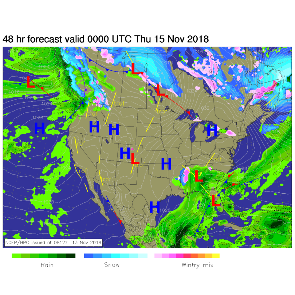
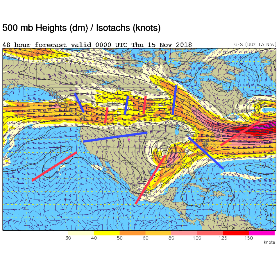
Today is a normal day. Mostly clear skies with temperatures within a degree or so of normal will greet you outside your front door. Nice! High pressure at the surface, a bit of down-slope flow (Figure 1) and a ridge aloft (Figure 3) are responsible for this normal-ness.

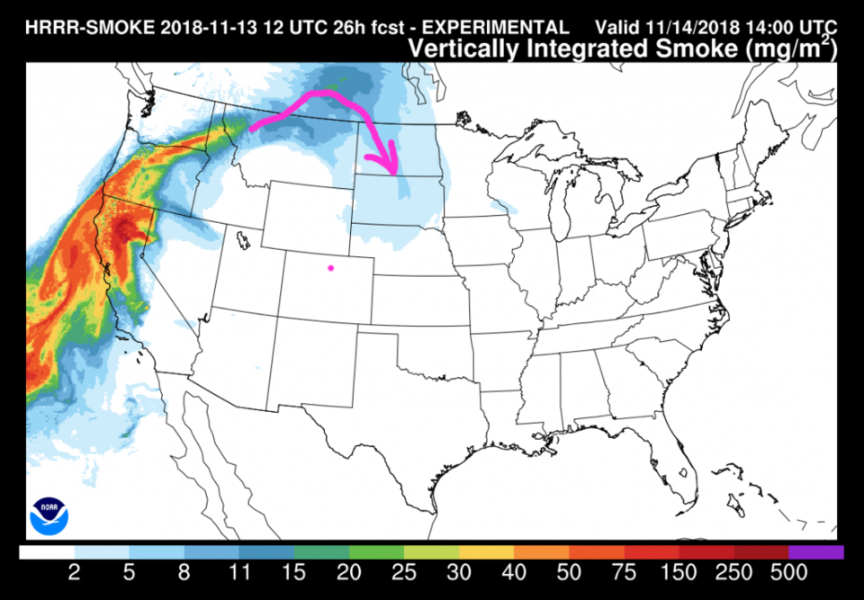
With big fires fanned by the dense blobs of cold air/high pressure in the center of the nation, out on the West Coast, I thought we should keep an eye on atmospheric smoke again. Figure 2 shows a bit of smoke leaking over the top of the western ridge into the Dakotas, but nothing has made it here, quite yet.

Figure 1: The forecast surface map for Wednesday PM. From NCEP.

Figure 2: The 26 hour forecast for smoke at all levels from the HRRR model valid Wednesday mid-morning.

Figure 3: The 500mb forecast upper air analysis for Wednesday PM. Pink dot is Longmont. Red lines are troughs, blue lines are ridges.

The longer range forecast:

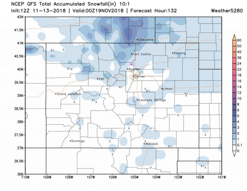
A check on the Friday PM and Saturday day snow storm (Figure 4) shows snow totals backing off according to the GFS. Now we are only in the trace to 1 inch zone. We'll have to keep an eye on it. (Note the NAM is still giving us 2-3 inches for this weekend, so it is not definite that this is going to fade out.) In the meantime, daytime temperatures will melt most of the snow away this week.

Figure 4: The forecast accumulated snow map from the GFS and weather5280.com for Colorado for the next 5 days, through Sunday PM. Longmont is the pink dot, as always.

Current Weather

Mostly cloudy

Mostly cloudy

49°F

UV Index
0 Low
Pressure
30.09 Rising
Visibility
8 miles
Dewpoint
35 °F
Humidity
59%
Wind
W 3.5 mph
Gust
6.9 mph
Wind Chill
48 °F

Hourly Forecast

Today
10 PM
47°F
Showers
Today
11 PM
45°F
Partly cloudy
Tomorrow
12 AM
43°F
Partly cloudy
Tomorrow
1 AM
41°F
Partly cloudy
Tomorrow
2 AM
41°F
Partly cloudy w/ showers
Tomorrow
3 AM
40°F
Partly cloudy w/ showers
Tomorrow
4 AM
39°F
Partly cloudy
Tomorrow
5 AM
39°F
Partly cloudy
Tomorrow
6 AM
37°F
Partly sunny
Tomorrow
7 AM
39°F
Partly sunny
Tomorrow
8 AM
42°F
Partly sunny
Tomorrow
9 AM
46°F
Partly sunny

7 Day Forecast

Mostly cloudy w/ showers

Friday

76 °F

Some sun, then increasing clouds, becoming breezy this afternoon with a shower in spots late in the afternoon


Partly cloudy w/ showers

Friday Night

37 °F

Partly cloudy with a couple of showers


Partly sunny

Saturday

66 °F

Not as warm with sun and some clouds


Mostly clear

Saturday Night

39 °F

Clear to partly cloudy


Mostly cloudy

Sunday

76 °F

Mostly cloudy and warmer; breezy in the afternoon


Mostly cloudy

Sunday Night

51 °F

Rather cloudy; windy late


Windy

Monday

60 °F

Winds gusting past 40 mph; cloudy and cooler


Intermittent clouds

Monday Night

43 °F

Breezy in the evening; otherwise, partly cloudy


Intermittent clouds

Tuesday

62 °F

Times of clouds and sun; windy in the afternoon


Intermittent clouds

Tuesday Night

36 °F

Clearing


Sunrise and Sunset

Sunrise
5:57 AM
Sunset
7:58 PM

Based on AccuWeather data