This content was originally published by the Longmont Observer and is licensed under a Creative Commons license.
In Brief:
After a surprise splash of rain (snow in the air?) Thursday morning, the weather for the next week will remain mild and above average (which is mid 50'sF this time of year). A front will kick off a very small chance of rain Saturday night. Another, more significant front is over the horizon slated for Wednesday. This will cool us to below normal temperatures and bring in rain/snow chances again.
11/15 10am update:
Just checking in to affirm that the Saturday front is still looking to have a very minor impact on our weather. There is a small chance of precipitation overnight and about a 5-8F cooling on Sunday from temperatures on Saturday. BUT the mid-week storm (Wednesday into Thursday) is coming into focus as a more significant weather maker; i.e. snow.
End 11/15 10am update.
Forecast Discussion:
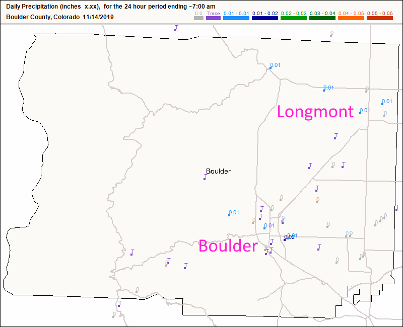
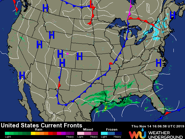
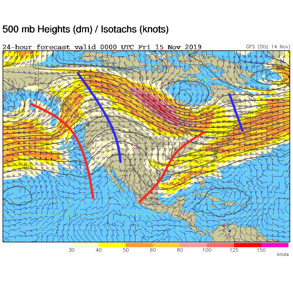
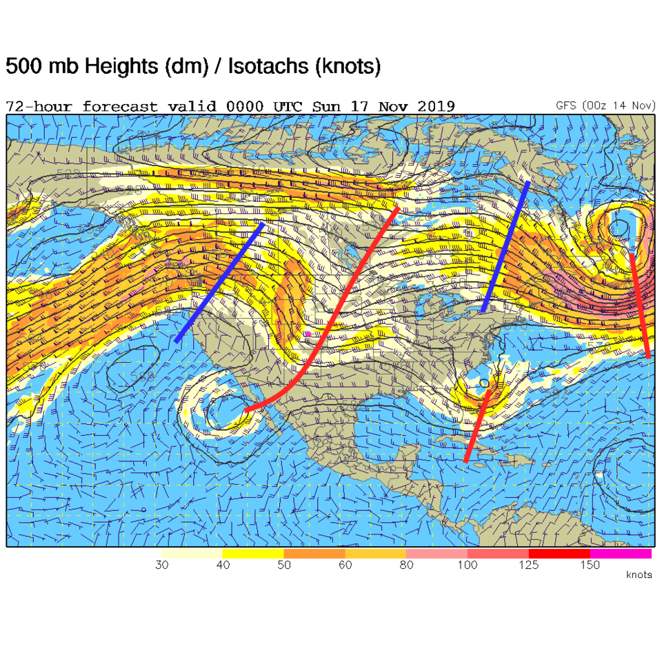
A weak cool front slid down the state with some upper level support overnight. This system put down about 1/2 inch of snow out on the NE plains and wet the ground around town this morning (Figure 1). The weather has already returned to our regularly schedule dryness (Figure 2) with the main front far away to the south and high pressure overhead. Aloft, we are on the eastern side of a big ridge with sinking air over the state (Figure 3).
The Longer Range Forecast:
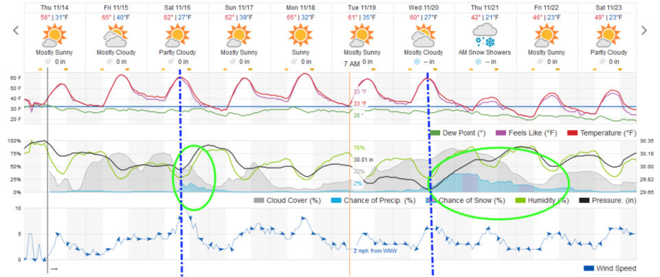
Our next front isn't looking strong, cold, or wet. It hits midday Saturday and increases clouds and creates a small chance of rain Saturday evening (Figure 4). This is powered by a trough sliding quickly by the state (Figure 5 - red line to our east). There is a hint of another system coming in and changing things for the wetter and colder Wednesday (Figure 4). More on that later!
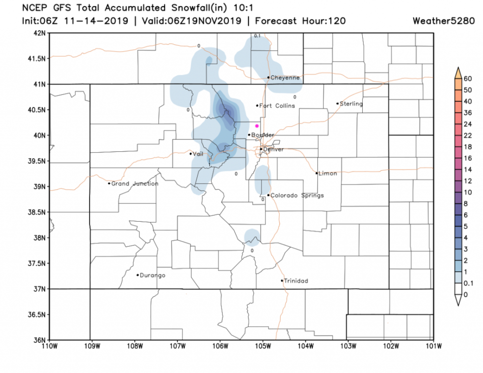
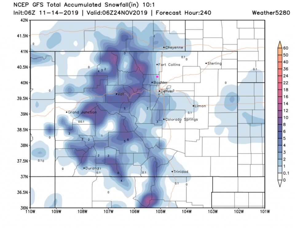
The five day snow total (catching the Saturday storm) really doesn't give us any notable rain or snow - the northern mountains do pick up a bit (Figure 6). The 10 day snow fall total (also from the GFS - Figure 7 - which picks up the start of the storm next week) shows more real snow for the mountains, but just a bit forming at our low altitude Plains location.
A programming note: unless a big storm moves in around Thanksgiving, I'll be taking a week vacation to somewhere warm and spending a bit less time on these articles. IF a big storm threatens, I'll cover it all! For fun, our crystal ball (fantasy) Thanksgiving Day forecast from accuweather.com is for the weather to be partly cloudy, dry, a high of 42F and a low of 14F. Thanksgiving week (according to accuweather again) starts off with highs in the upper 40'sF and lows in the 20'sF. Later in the week, we hover around highs in the upper 30'sF lower 40'sF and lower teens upper single digits at night. There isn't a big storm visible yet!