Skip to content

3pm Update: Next Storm/Next Snow Forecast Discussion from the Cherrywood Observatory – November 25, 2018

This content was originally published by the Longmont Observer and is licensed under a Creative Commons license.

Forecast Discussion:

3pm Update.

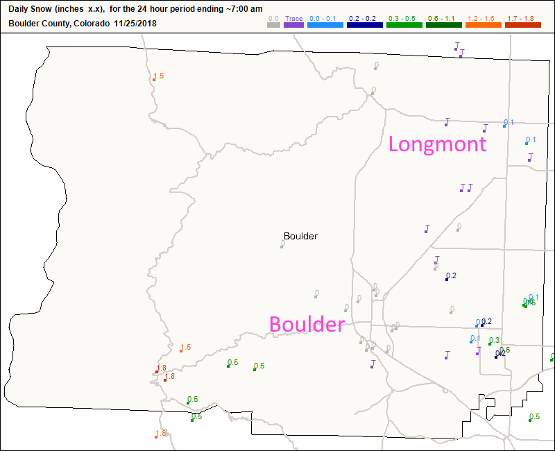
There was a coating of snow in the evening in Longmont while Boulder, that normally gets hit, saw nothing.  The nearby foothills only pulled 1-2 inches.  It turned out to be pretty minor overall.

Denver saw a trace to about 2 inches (down in the SE).

Estes Park stayed below an inch. Berthoud received a trace of snow.  Ft. Collins saw a trace to 1/2 inch of snow in spots.

Figure 1 update: The CoCoRaHS new snow report as of 7am Sunday for Boulder county.

End 3pm Update.

The storm is underway, and I drove through some lowered visibilities in blowing dust, snow, and tumbleweeds. Crazy! My forecast is a bit tarnished by a trace of snow building up in places as of 10 p.m. We'll see if more happens overnight. I'll update this post with snow totals later today.

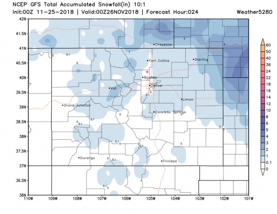
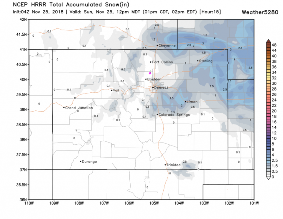
The short range GFS and HRRR models still show no notable snow in Longmont (Figures 1 and 2) but heavy squalls can still make it to the ground. More tomorrow!

Figure 1: The forecast accumulated snow map from the GFS and weather5280.com for Colorado for the next 1 days, through Sunday evening. Longmont is the pink dot, as always.

Figure 2: The forecast accumulated snow map from the HRRR and weather5280.com for Colorado for the next 1 days, through Sunday noon. Longmont is the pink dot, as always.

Current Weather

Sunny

Sunny

45°F

UV Index
3 Moderate
Pressure
30.02 Steady
Visibility
8 miles
Dewpoint
24 °F
Humidity
43%
Wind
SSE 3.8 mph
Gust
8.4 mph
Wind Chill
43 °F

Hourly Forecast

Today
9 AM
47°F
Sunny
Today
10 AM
51°F
Mostly sunny
Today
11 AM
55°F
Mostly sunny
Today
12 PM
58°F
Mostly sunny
Today
1 PM
60°F
Partly sunny
Today
2 PM
62°F
Intermittent clouds
Today
3 PM
63°F
Mostly cloudy
Today
4 PM
65°F
Mostly cloudy
Today
5 PM
63°F
Cloudy
Today
6 PM
62°F
Cloudy
Today
7 PM
59°F
Mostly cloudy
Today
8 PM
56°F
Mostly cloudy

7 Day Forecast

Mostly cloudy

Thursday

65 °F

Becoming cloudy


Mostly cloudy

Thursday Night

36 °F

Mostly cloudy


Partly sunny

Friday

70 °F

Partial sunshine


Partly cloudy

Friday Night

38 °F

Partly cloudy


Partly sunny

Saturday

66 °F

Partial sunshine


Mostly clear

Saturday Night

41 °F

Clear to partly cloudy


Mostly cloudy

Sunday

76 °F

Rather cloudy; breezy in the afternoon


Intermittent clouds

Sunday Night

43 °F

Partly cloudy


Cloudy

Monday

60 °F

Cloudy and cooler with a shower in spots; windy in the afternoon


Mostly cloudy

Monday Night

43 °F

Breezy in the evening; otherwise, mostly cloudy


Sunrise and Sunset

Sunrise
5:58 AM
Sunset
7:57 PM

Based on AccuWeather data