This content was originally published by the Longmont Observer and is licensed under a Creative Commons license.
Forecast Discussion:
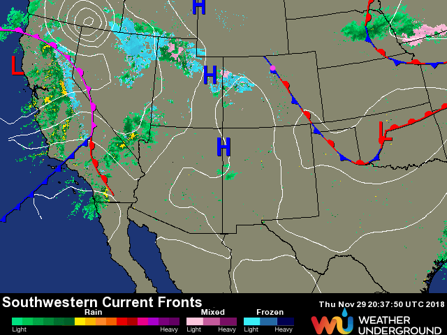
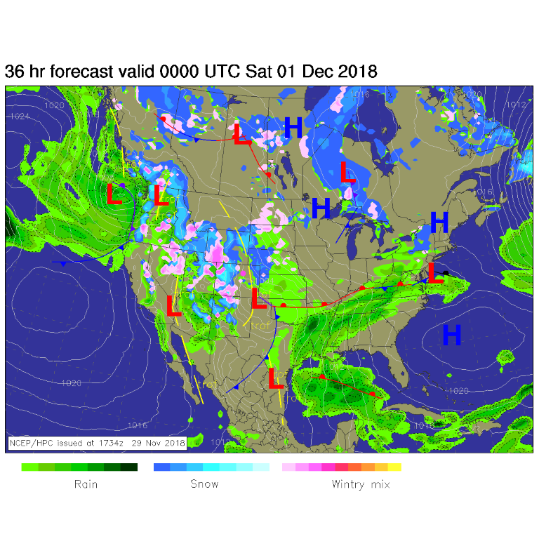
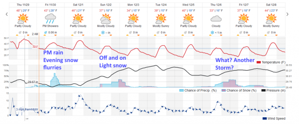
Snow has begun in western Colorado Thursday (Figure 1) and will increase today (Figure 2). The cool down has begun. We hit 60°F on Wednesday, only 51°F on Thursday and should only see 45°F today. Night time temperatures will sink into the teens again (Figure 3).
We will also see a chance of afternoon rain probably changing over to light snow showers before it tapers off later tonight. IF lucky, we may see 1/10th of an inch of water and a dusting of snow.
The longer range forecast:
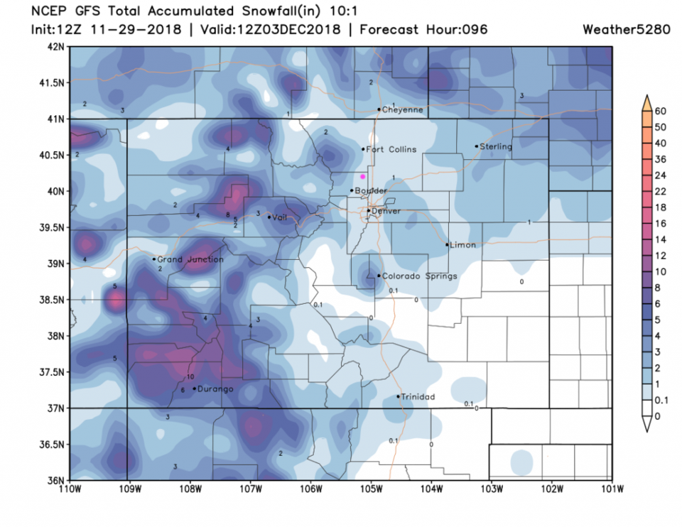
Our next storm will be pretty snowy for the western slopes and mountains, but down-slope flow will limit the precipitation on Sunday (Figure 3). Light snow showers will begin pre-dawn on Sunday and continue into Monday early AM. The Monday commute may be a bit slick next week.
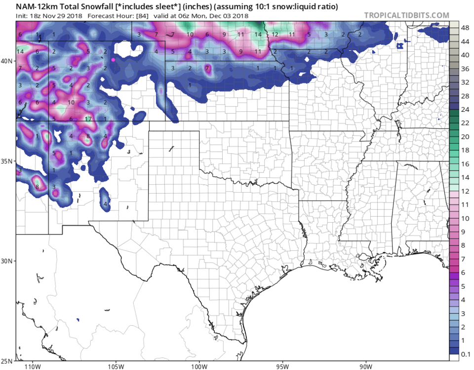
Figure 4 shows the weekend snow, according to the GFS, as being only about a coating to an inch. Figure 5, from the NAM shows maybe 1-2 inches. Weatherunderground's model has only a dusting (not really enough to measure, it thinks).
The fantasy Christmas Forecast:
With 27 days to go, we can look at the goofy forecasts that very long range models attempt to create. Between now and Christmas, from Accuweather, we don't rise to the 50's F again until around 12/12-12/14. By 12/19 we sink to the 30's F for highs again.
This model does not create any big snows between now and then. Christmas Eve is sunny with a high of 34°F a low of 2°F. Christmas Day has a high of 42°F and a low of 9°F.
We'll see!