This content was originally published by the Longmont Observer and is licensed under a Creative Commons license.
In Brief:
We are dry and warming to above freezing levels each day for the next 10 days. Very low rain/snow chances pass late Thursday night and again next Monday. No significant weather is visible in the models for the next week. We stay below normal, temperature-wise, for this entire time period.
12pm Update 11/1:
I was poking around weather stations in town Thursday morning just before sunrise and found 0F on Main St. and -4F in South Longmont and over around County Rd 1. So it got cold. I had about 65 trick-or-treaters visit the observatory last night. A few clouds did move through but it was clear 90% of the time. I think the cold and ice scared a few folks away (I had about 140 two years ago and 120 three years ago). We did enjoy Jupiter, Saturn, the Moon, Neptune, and the Andromeda Galaxy.
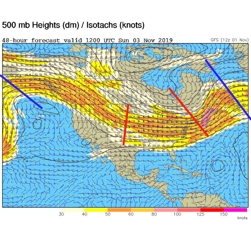
Things will remain chilly and dry this week. The big story is the upper air pattern (Figure 1 update). There is a large ridge off the west coast and a big trough over the eastern U.S. This give us northwest flow aloft with a steady stream of colder northerly air feeding in. Small cool fronts will pass (almost one a day) for at least the next 5 days and keep our temperatures below normal.
We'll do an analysis of the forecast for October made at the start of the month and the October that resulted - I believe it ended up being much cooler than was forecasted! Can we believe the November forecast I'll post?
End 12pm Update 11/1.
Forecast Discussion:
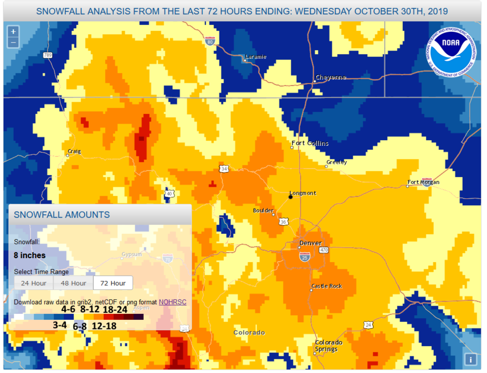
The storm has passed. My yard (adding the last 5 days of new-snowfall measurements together) received at least 9.2 inches in NE Longmont. The snowfall analysis from NOAA confirms this putting Longmont in the yellow shading that represents 8-12 inches of 72 hour accumulation (Figure 1).
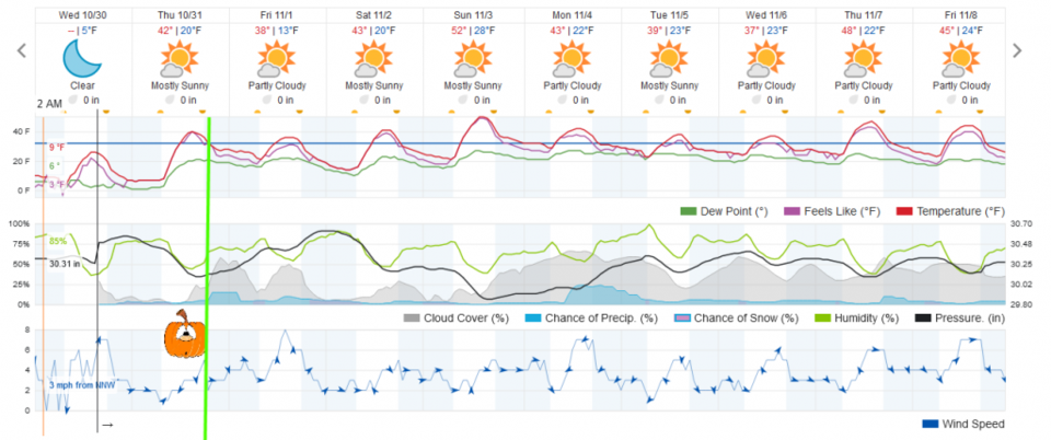
It's Halloween! Last week, we had a giant discrepancy between forecasts with the GFS giving us a high on Halloween in the 60'sF while the European model put us in the low 20'sF. Weatherunderground had us in the upper 40'sF. It now looks like weatherunderground won the Halloween temperature-smack-down (Figure 2). But the same model brings in some clouds and a tiny chance of rain/snow overnight. Other sources don't see this happen.
For those who want to stop by and look through the telescopes, come on by the Cherrywood Observatory during trick-or-treating hours for Trick or Peek. I'm east of Alpine and south of 17th Ave. on Cherrywood and Cherrywood. Come in through the gates on the side-yard. I'll have signs and lights set up.
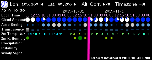
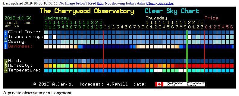
The 7! Timer (GFS based) model shows clear skies and temperatures around freezing in the evening (figure 3). Clear Sky Chart, out of Canada, has clear skies as well (Figure 4). Both do show a batch of clouds coming through during the 8-9pm hour.
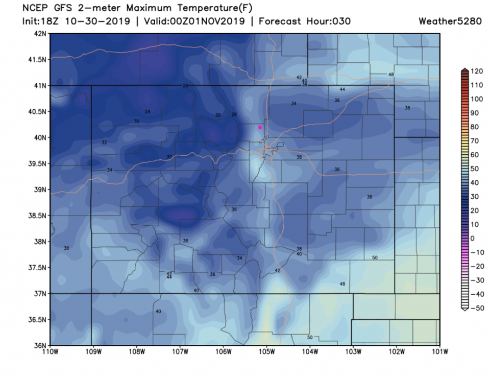
The high temperature on Halloween will be a bit warmer just west of I-25 with a high around 40F (according to the GFS (Figure 5)). It will drop to below freezing between 6 and 7pm.
The Longer Range Forecast:
Things are cooler than normal and quiet for the next week and beyond (Figure 2). There is a hint of 'something' next Monday/Tuesday but it isn't much at this point. I need to catch up on grading and life stuff - I'll post updates as needed over the next couple of days! Have a fun spooky night.