Skip to content
Join our Newsletter

Next Storm/Next Snow Forecast Discussion from the Cherrywood Observatory – October 5, 2019

This content was originally published by the Longmont Observer and is licensed under a Creative Commons license.

In Brief:

Our next cold front is headed in this evening to blow your trash cans around around (peak winds after midnight). We cool to the upper then lower 60'sF for the weekend. Down slope flow and a passing ridge take us almost to 80F Tuesday followed by the next front that might send us into the 30'sF for a high Thursday and a chance of our first SNOW for the season. Stay tuned.

Forecast Discussion:

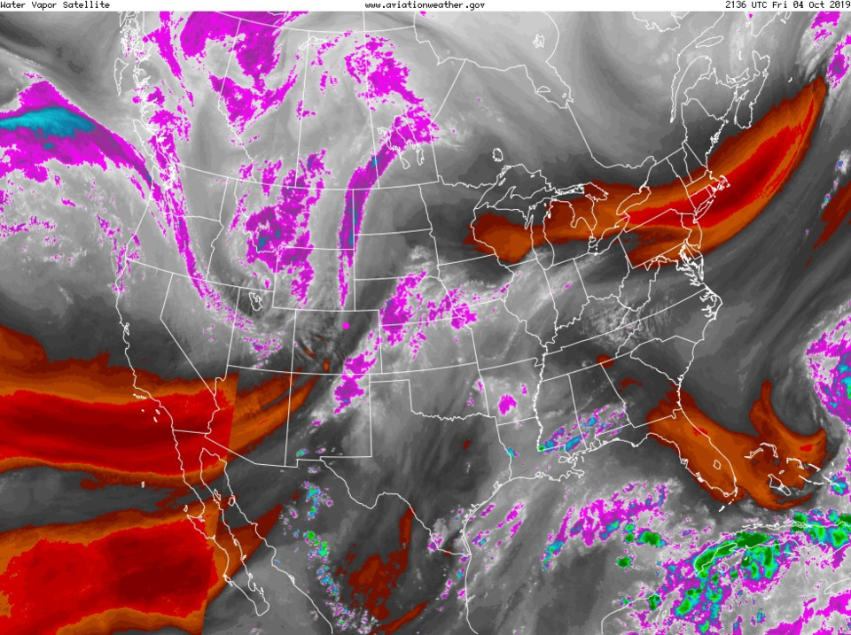
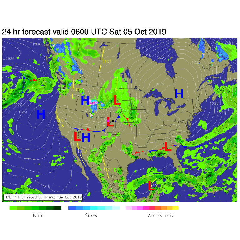
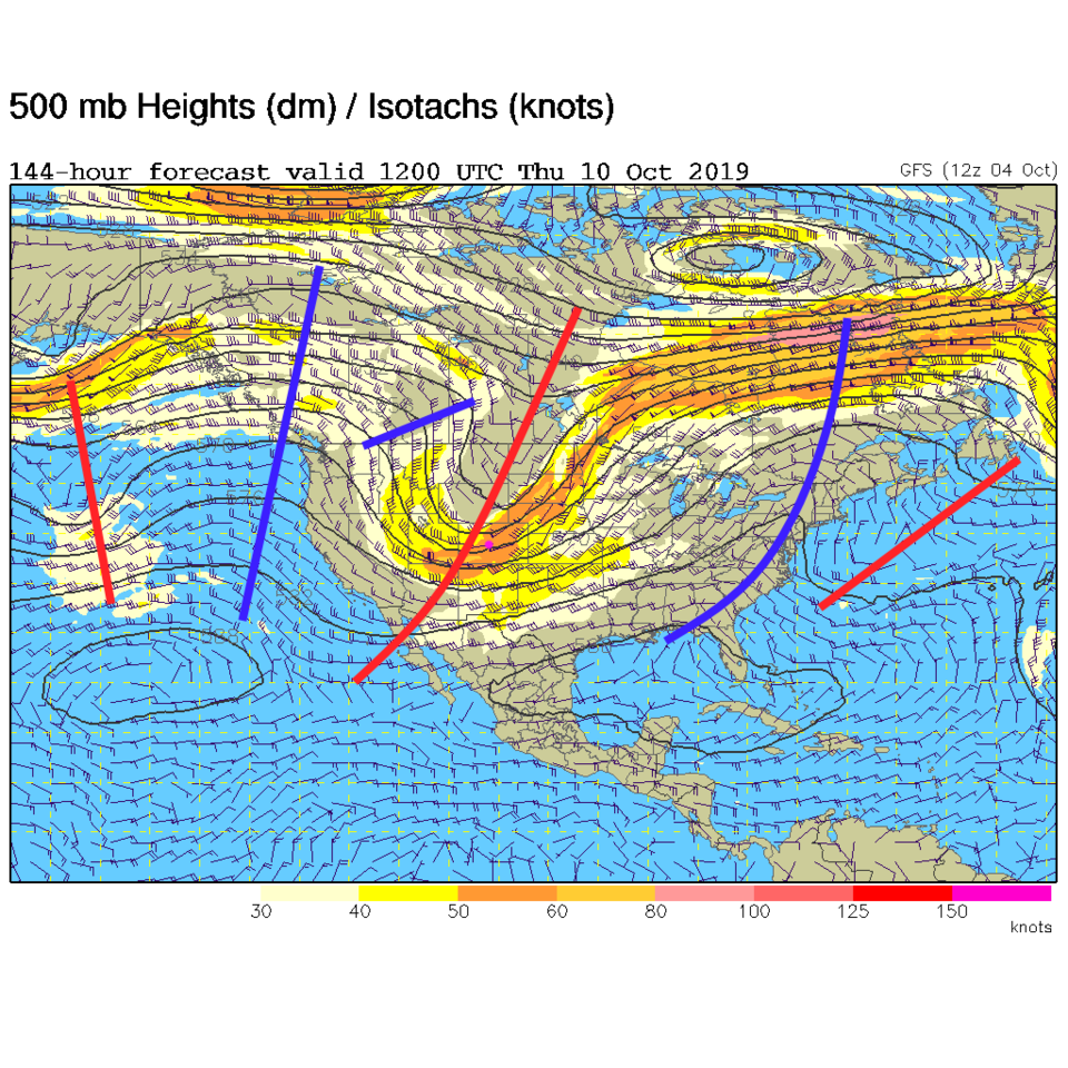
Winds are creating dangerous fire conditions in the mountains Friday afternoon as a deep trough (U shaped purple clouds/moisture to our northwest in Figure 1) approaches. The front this trough pushed through passes later tonight (with a low tracking overhead - Figure 2 and 4 - blue line) and winds will be briefly pretty strong around and after midnight. By Saturday evening, the front is clear of the area with very little precipitation falling in Colorado (Figure 3) at all.

The Longer Range Forecast:

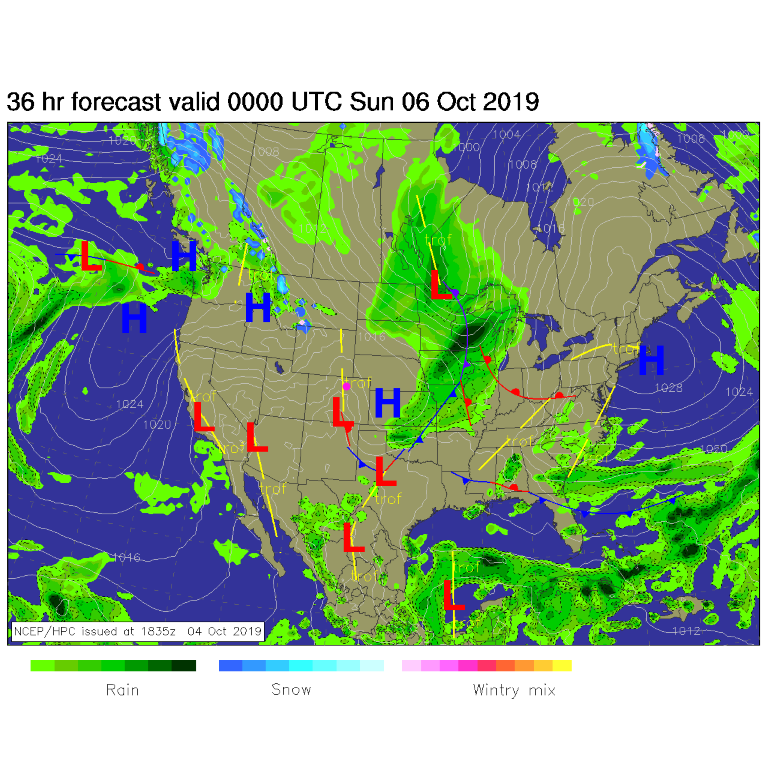
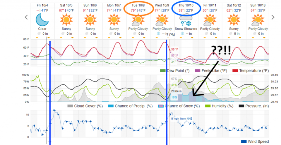
We cool further on Sunday as northerly winds keep draining down (Figure 4). We warm to almost 80F on Tuesday with a passing ridge and down slope flow (not shown, but portrayed in Figure 4).

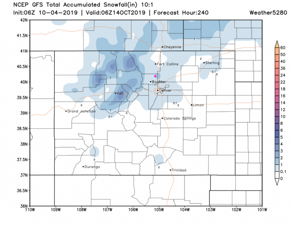
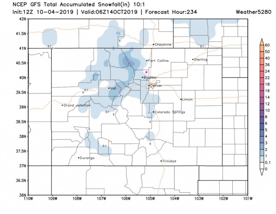
The really interesting news is SNOW! Figure 4 shows snow Thursday AM and PM and Friday AM. Winds will gust to around 15-20mph and we have a high in the 30'sF IF this holds together. This weather is created by a deep, fast moving trough sweeping the nation (Figure 5). In an earlier run of the GFS, this trough passed as a closed low that created more snow. This run is more of an open wave.

Figure 6 is the same forecast as Figure 7 (they are for snow totals between now and midnight going into Oct 14). The figure 6 forecast was made this morning at midnight and had 1-2 inches of snow falling in Longmont Thur/Fri. Figure 7, made 6 hours later, keeps the snow to the areas just west of town and up into the mountains.

This could certainly end up just being rain showers once the day arrives, or even a merely cloudy day. What is really interesting is this is the day I picked a couple of weeks (or so) ago for Denver's first snow. That would be cool (literally).

Figure 1: the water vapor satellite image (browns/reds are dry air, whites and light grey is moist air, purple/blue is ice and high cloud tops). From the the NWS from Friday PM.
Figure 2: The forecast surface map for midnight Friday into Saturday from NCEP.
Figure 3: The forecast surface map for Saturday evening from NCEP.
Figure 4: the graphical forecast for the next 10 days for Longmont, CO from weatherunderground.com
Figure 5: The 500mb forecast upper air analysis for Thursday AM. Pink dot is Longmont. Red lines are troughs, blue lines are ridges.
Figure 6: The forecast rainfall totals for the next 10 days from the GFS and tropicaltidbits.com for Colorado made at midnight Friday AM.
Figure 7: The forecast rainfall totals for the next 10 days from the GFS and tropicaltidbits.com for Colorado made at Friday 6am.

Current Weather

Cloudy

Cloudy

95°F

UV Index
1 Low
Pressure
29.88 Falling
Visibility
36 miles
Dewpoint
38 °F
Humidity
14%
Wind
ESE 5.1 mph
Gust
7.9 mph
Wind Chill
95 °F

Hourly Forecast

Today
5 PM
94°F
Partly sunny
Today
6 PM
92°F
Intermittent clouds
Today
7 PM
90°F
Intermittent clouds
Today
8 PM
86°F
Intermittent clouds
Today
9 PM
82°F
Intermittent clouds
Today
10 PM
79°F
Intermittent clouds
Today
11 PM
75°F
Intermittent clouds
Tomorrow
12 AM
72°F
Intermittent clouds
Tomorrow
1 AM
69°F
Intermittent clouds
Tomorrow
2 AM
68°F
Intermittent clouds
Tomorrow
3 AM
67°F
Intermittent clouds
Tomorrow
4 AM
66°F
Intermittent clouds

7 Day Forecast

Partly sunny

Thursday

95 °F

Very warm with sunshine mixing with some clouds


Intermittent clouds

Thursday Night

64 °F

Partly cloudy


Partly sunny w/ t-storms

Friday

89 °F

Partly sunny with a thundershower in spots in the afternoon


Clear

Friday Night

61 °F

Clear


Partly sunny

Saturday

93 °F

Partly sunny


Clear

Saturday Night

56 °F

Clear


Partly sunny

Sunday

89 °F

Partly sunny with a stray thunderstorm


Clear

Sunday Night

57 °F

Clear


Partly sunny

Monday

93 °F

Partly sunny


Clear

Monday Night

57 °F

Clear


Sunrise and Sunset

Sunrise
5:36 AM
Sunset
8:33 PM

Based on AccuWeather data