This content was originally published by the Longmont Observer and is licensed under a Creative Commons license.
In Brief:
We have most of one more day (Wednesday) of nice weather before the front of the century arrives (OK, that was click-bait-verbiage). A strong front sweeps down through town around 5-6pm with a dry period after it (different from yesterday's forecast). Then a brief splash of rain will turn to snow around midnight. Snow chances increase through morning Thursday then decrease to snow showers now and then in the afternoon on to about midnight Thursday PM. We warm to the mid 40'sF Friday and then the 60'sF again for the weekend. It will be very windy and very cold with a hard freeze with temperatures dropping to 10-14F Friday AM. Be careful, dress in layers, and have your car, yard, and camper winter-ready.
10/9 11am Update:
Everything in the forecast is on track. The winds shift to coming out of the north between 4-5pm. Temperatures start to drop. After about 9-10pm showers and/or freezing drizzle may sweep by, then things change to snow around midnight. With some snow bands giving folks local bigger hits of snow, the low lands will get a trace to 2 inches (Figure 1 update) of snow on grassy surfaces and bridges. The mountains will see 3-6 inches in places. The best snow chances move south of Longmont in the late morning Thursday. Snow showers may come and go through 9pm.
Winds will make the, already cold temperatures, feel bad, blowing at 10-15mph sustained with gusts into the 20mph range. Temperatures will remain in the 20'sF Thursday along I-25 then drop to the lower teens by Friday morning before the entire storm fades like a memory. Bundle up!
End 10/9 11am Update.
Forecast Discussion:
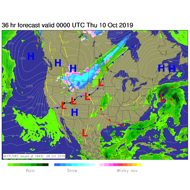
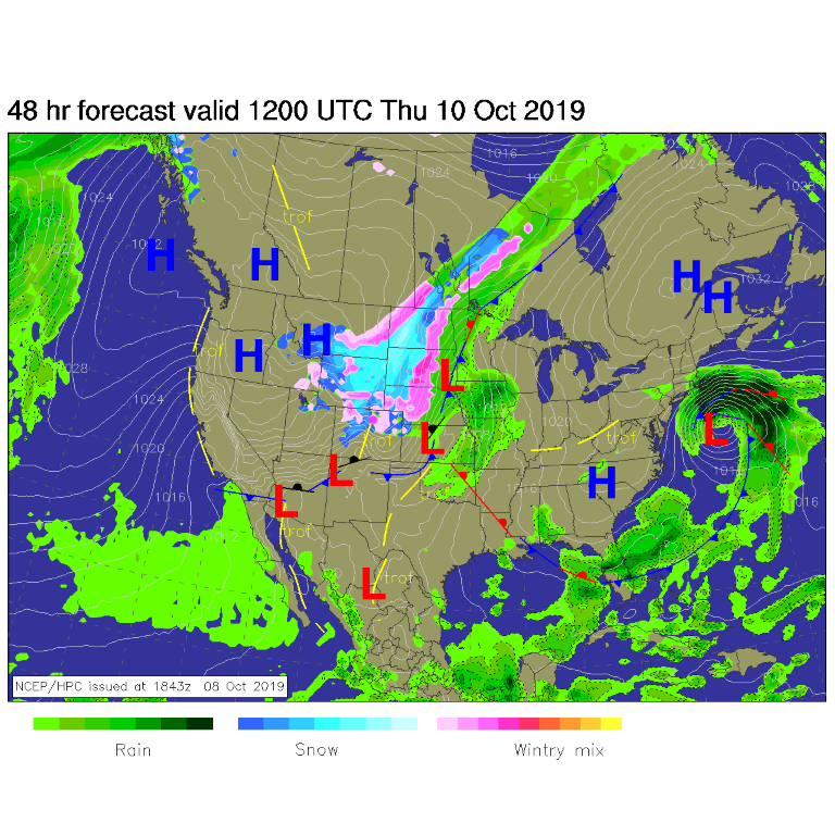
Here we go (as Peter Pan says)! Around 6pm Wednesday, the front is passing Longmont and a deepening down-stream low is intensifying east of Denver (Figure 1). The snow and rain may still be up in Wyoming at frontal passage. By sunrise Thursday, the front is in Texas and New Mexico, the Low is in Kansas, and snow/ice is falling over the northern half of the state (Figure 2).
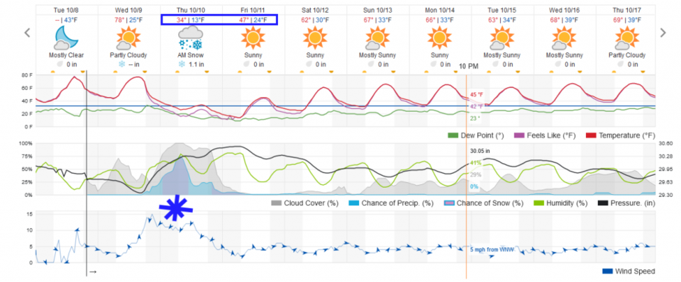
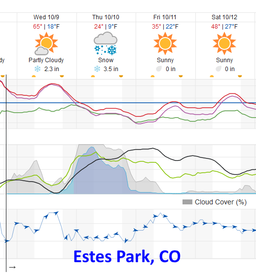
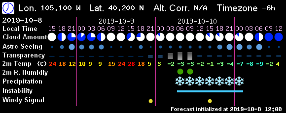
Figure 3 shows the rain chances beginning (very low) at 6pm then increasing towards midnight. The change over to snow will occur between 10pm and 1am (Figure 3). Thursday morning will see maximum snow fall periods and some snow banding (discussed yesterday). Weatherunderground.com gives us around 1 inch (mainly on grassy surfaces and bridges). Up in Estes Park, the timing is similar but with about 4-6 inches of snow falling Wednesday PM through Thursday (Figure 4).
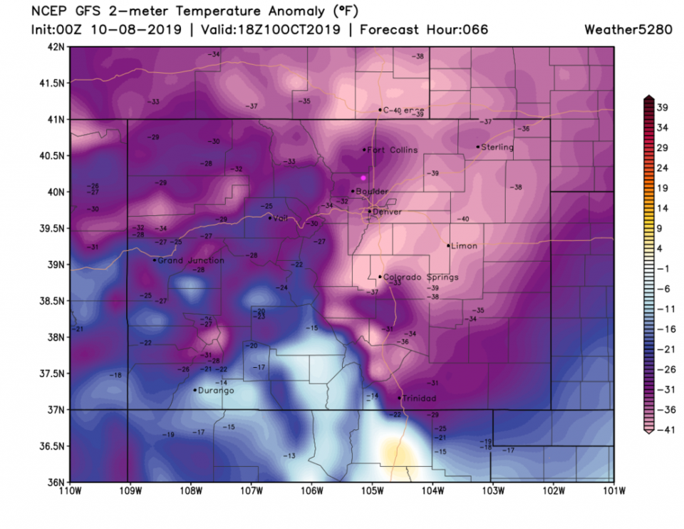
The GFS actually holds off on significant snow until after 3am Thursday (Figure 5). The Cold is amazing. Figure 6 shows areas around Longmont staying a 'bit' warmer at only 25-30F below normal with a down-slope component to the flow, while areas south of Denver, out on the Plains, and up in Wyoming dropping below 40F below normal on Thursday midday. Holy cow.
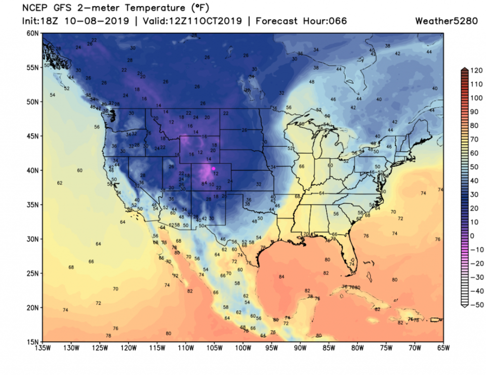
Figure 7 shows the progress of the cold air across the nation on Friday. This one will push almost to Georgia and the Carolina's (but not quite).
Snowfall Roundup:
We already saw weatherunderground giving us about 1 inch (Figure 3).
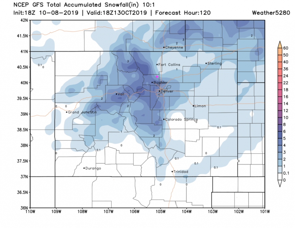
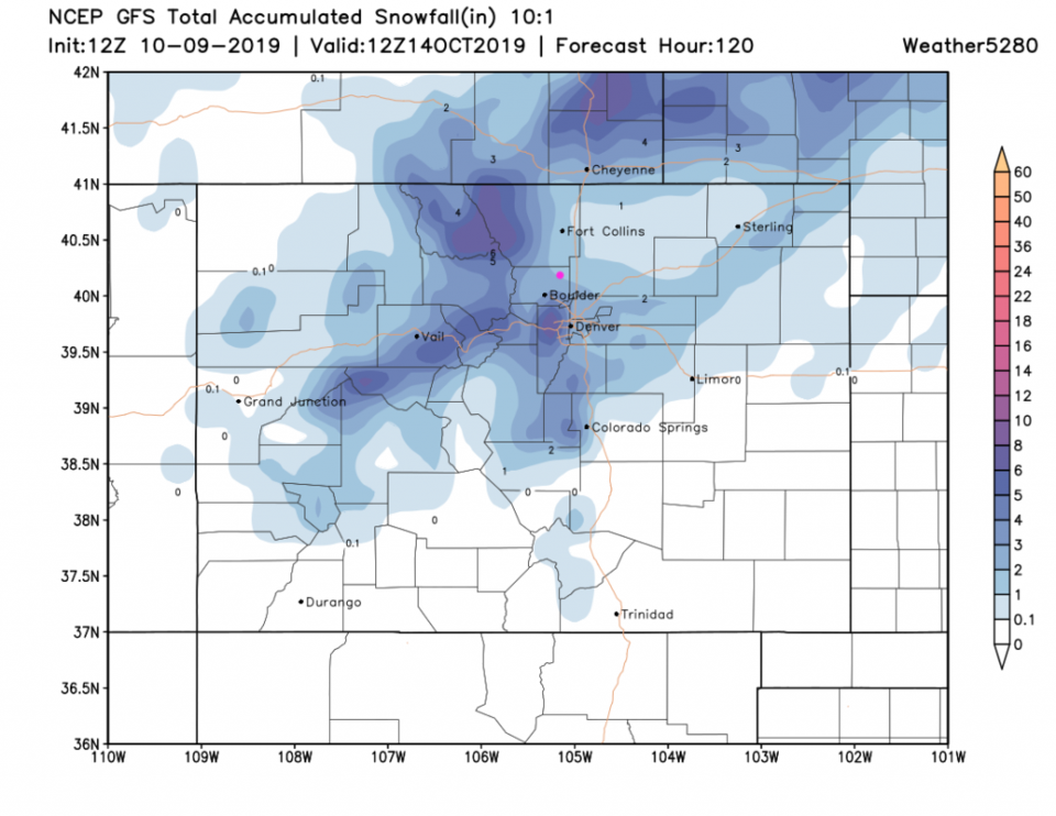
The GFS gives us 2-3 inches (Figure 8).
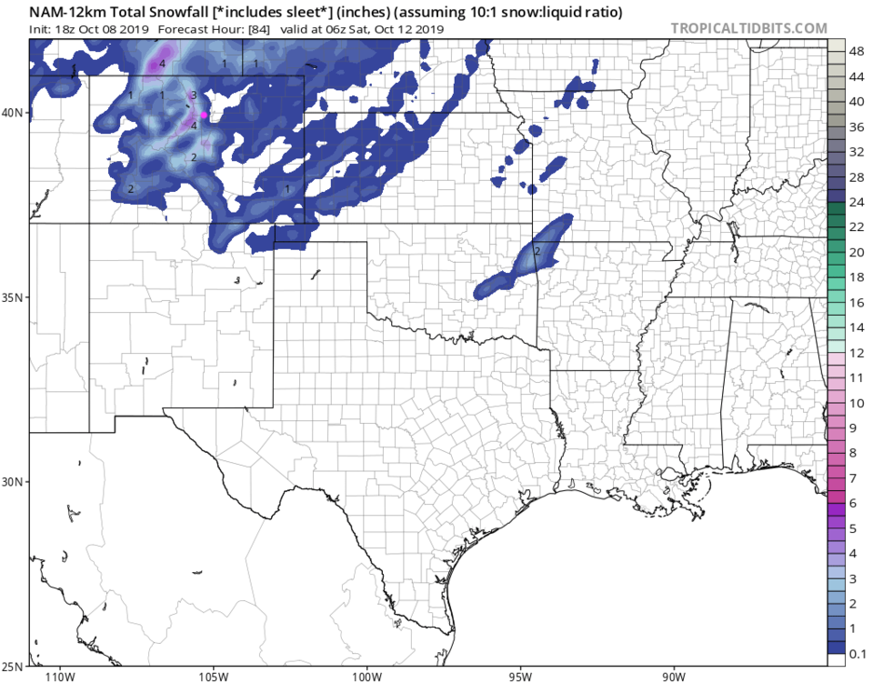
The NAM gives us 1/2-2 inches (Figure 9).
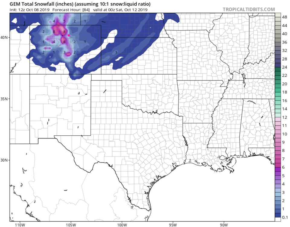
The GEM gives us 2-3 inches (Figure 10).
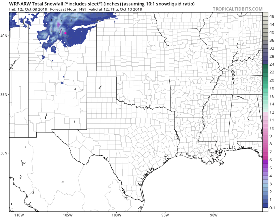
The WRM (over just the next 48 hours from Tuesday evening) gives us 1-2 inches (Figure 11).
The Longer Range Forecast:
After this, we get quiet and dry, with somewhat below normal temperatures for the rest of the 10 day period (Figure 3). It will be boring weather to make up for this exciting week!