This content was originally published by the Longmont Observer and is licensed under a Creative Commons license.
In Brief:
A passing shortwave in the northern Rockies may spark isolated severe weather (hail and high winds) north of Denver today. We experience a cold front passage around 3-4pm today (Wednesday) and get to experience another taste of Fall Thursday. We warm to upper 80'sF for the weekend. There is a sign of a big cool down with showers coming to the state middle of next week.
12PM 9/12 Update:
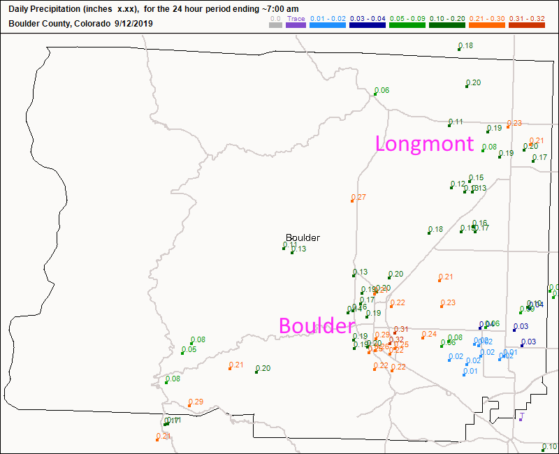
We received 1/5th to 1/4th inch of water and repeated hits of hail on Wednesday (Figure 2 update). The largest hail stone in Longmont was reported at 1.5" in size ( reported on Channel 7 news this morning -probably in north or northeast Longmont - Figure 3 update).
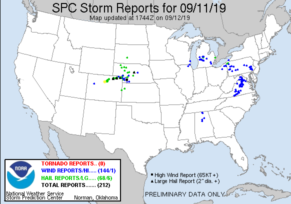
The Longmont storm reports are reproduced from the SPC here (Sorry about the strange table formatting - it won't "fix."):
| Time | Size | Location | County | State | Lat | Lon | Comments |
|---|
| 2237 | 125 | 1 NW LONGMONT | BOULDER | CO | 4019 | 10512 | . (BOU) |
| 2234 | 100 | 1 W LONGMONT | BOULDER | CO | 4018 | 10513 | REPORT FROM MPING: QUARTER (1.00 IN.). (BOU) |
| 2230 | 100 | 1 NNE LONGMONT | BOULDER | CO | 4019 | 10511 | . (BOU) |
| 2228 | 100 | LONGMONT | BOULDER | CO | 4018 | 10511 | . (BOU) |
| 2227 | 150 | 2 N LONGMONT | BOULDER | CO | 4021 | 10511 | . (BOU) |
End 12PM 9/12 Update.
8PM 9/11 Update:
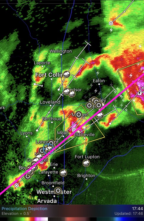
There are still showers forming along a line that runs from Boulder to Longmont and off onto the Plains. Here, upper level support combined with the cold front to create a lot of pea sized hail (getting larger in the higher risk zones to the northeast - Figure 1 update). We drew the long straw on getting the phenomena of "training" set up, where storms form along a boundary and move like boxcars along with the upper air flow.
At least the hail (by the reports I've seen so far) remained small in town.
End 8PM 9/11 Update.
Forecast Discussion:
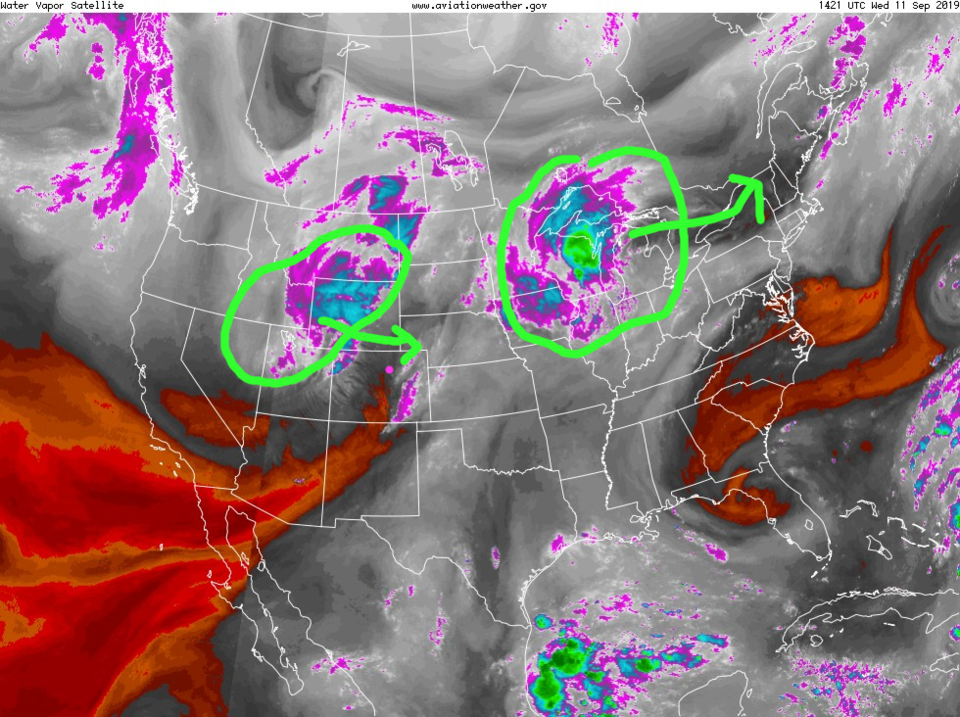
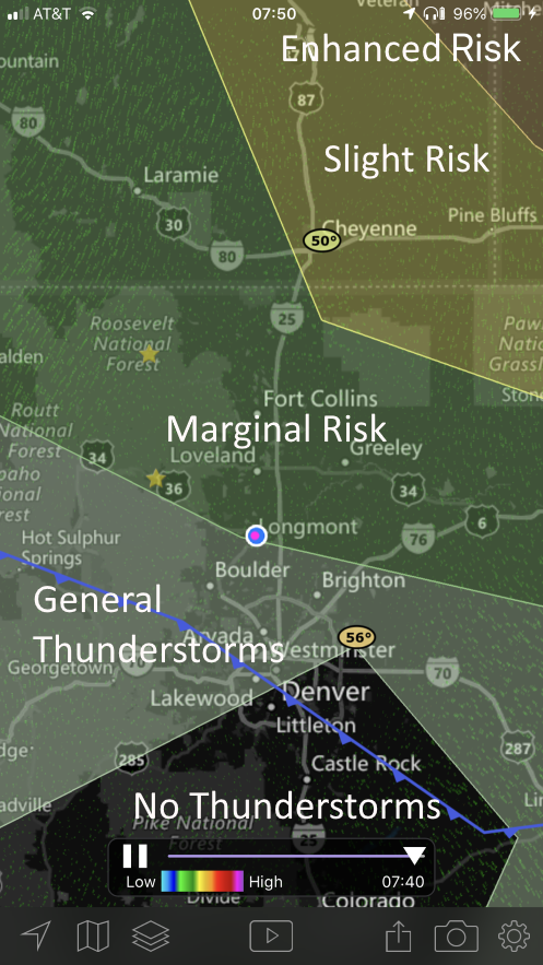
One blob of instability is departing across the Great Lakes today as the next swings by northern Colorado today (Wednesday - Figure 1). The SPC has painted a tight gradient of risk across the state (Figure 2) that stretches from an Enhanced Risk (3 on a 1-5 scale) in the far northeast corner of the state to a Slight risk (2 out of 5) by Cheyenne, to a Marginal Risk (1 out of 5) around Longmont and north. There could be a few garden variety thunderstorms for northern parts of Denver but no convection near the Palmer Divide. Wow.
The primary risk Wednesday is for super cell formation. These strong rotating storms can create large hail and high winds. Tornado chances are confined mainly to the Slight and Enhanced risk zones.
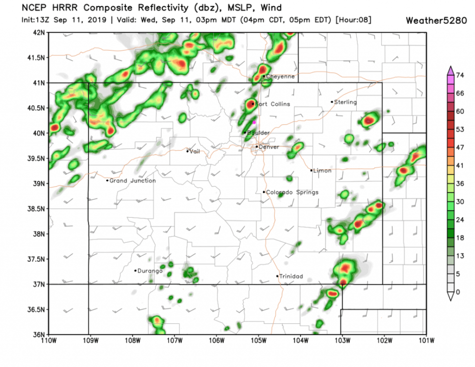
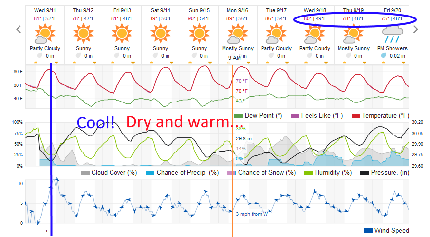
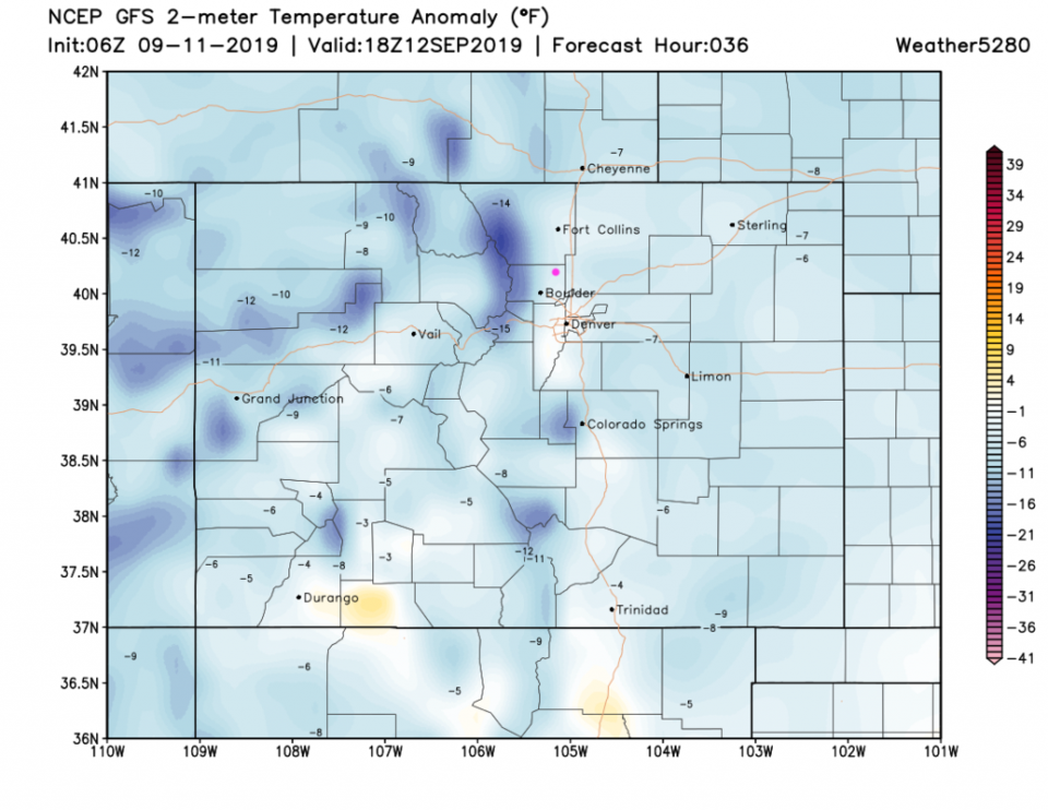
Around Longmont, storm cells look to be quite isolated and zip by around 2-4pm (Figure 3). This is also the time the cold front, sliding down the Front Range, passes (Figure 4). Thursday will be the coolest day this week with mid 70'sF possible and temperatures about 5F below normal (Figure 5).
The Longer Range Forecast:
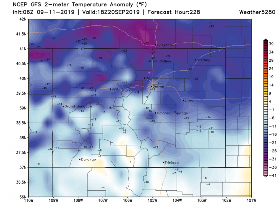
We dry out again Thursday through Sunday and sneak to almost 90F for highs each day (but not for many hours each day - Figure 4). There is a hint that next week, a series of cold fronts will cool us down and bring back rain chances. The coolest day is sitting way out at the 10 day mark with temperatures similar to this Thursday according to the weatherunderground.com model (Figure 4) but dramatically colder (20-25F below normal) according to the GFS (Figure 6). We'll watch it here!