This content was originally published by the Longmont Observer and is licensed under a Creative Commons license.
In Brief:
What looks to be the last gasp of Summer occurs Saturday through Tuesday this week. Mostly dry conditions and above normal temperatures will be the story. Temperatures might make it to 90F at least once more (Sunday and maybe Saturday and Monday). Next week we return to normal temperatures (or or below normal) and see rain chances return.
10:30pm Update 9/15:
Things are on track with our forecast with a cool down beginning today! More later today!
End 10:30pm Update 9/15.
10:30am update 9/14:
We are on track for highs around 88F today and mostly clear skies. Go have fun as summer really ends and fall begins (this upcoming week).
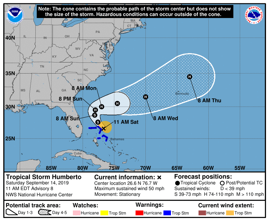
As for our tropical system, it did achieve tropical storm strength and was named Humberto last night. The approaching cold front (related to what we enjoyed the last couple of days) will shove it out to sea. Wind shear looks like it will keep much of the heaver rain/thunderstorms tilted off to the east side of the storm, so there will be less impact on much of the Bahamas than we might have seen and almost no effect seen on the mainland U.S. (Figure 1 update). It is expected to at least become a minimal hurricane Sunday afternoon out in the ocean.
End 10:30am update 9/14.
Forecast Discussion:
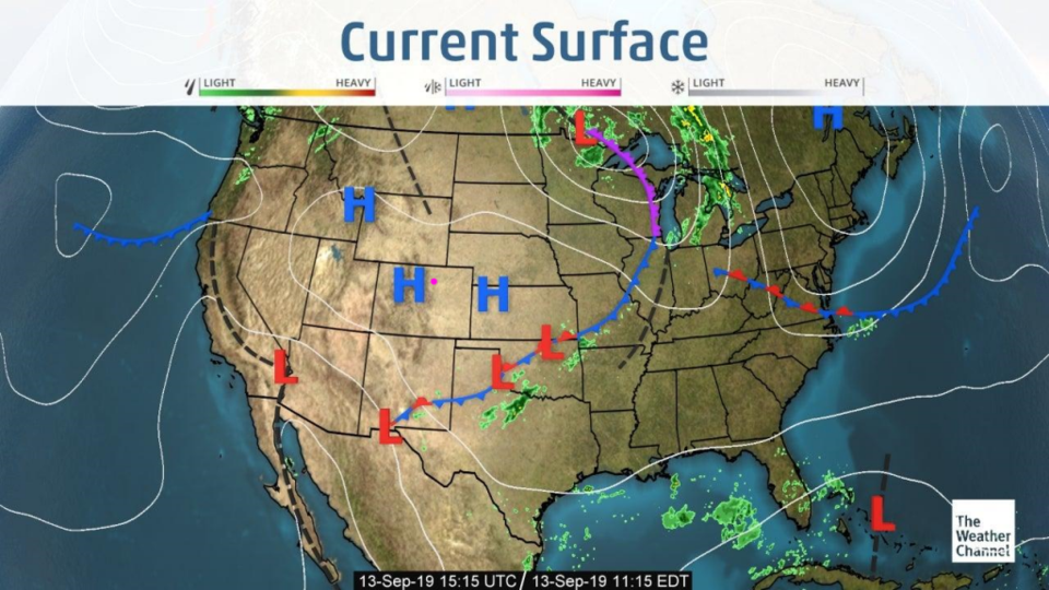
A cool high pressure system sits over Colorado Friday (Figure 1). We are comfortable and dry.
That's all I've got to say about that.
The Longer Range Forecast:
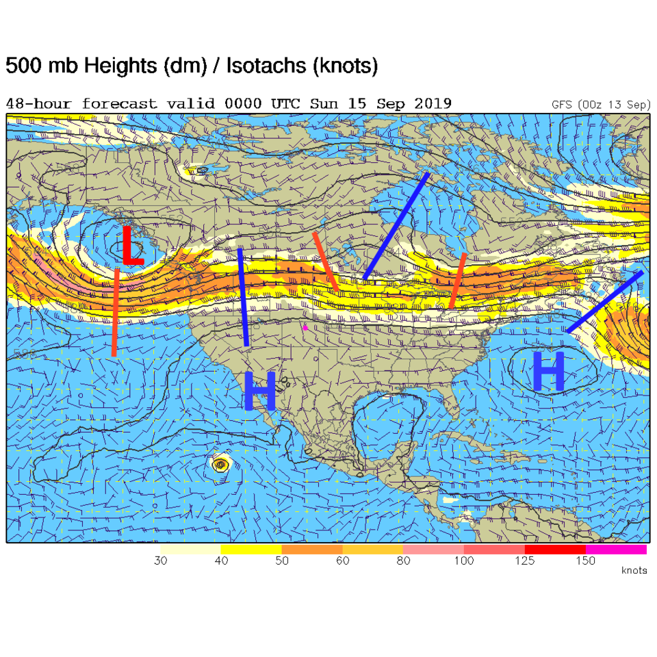
The long-entrenched high pressure center to our south begins to exert its influence over us again through the weekend (Figure 2). We stay much above normal with some 90'sF possible through Tuesday next week. Channel 7's weather speculated that these might be the last 90F+ temperatures for the year 2019 in Denver. I might buy that.
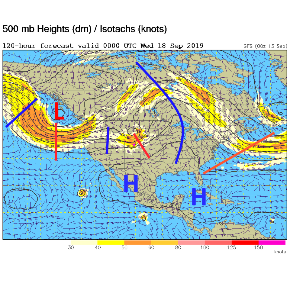
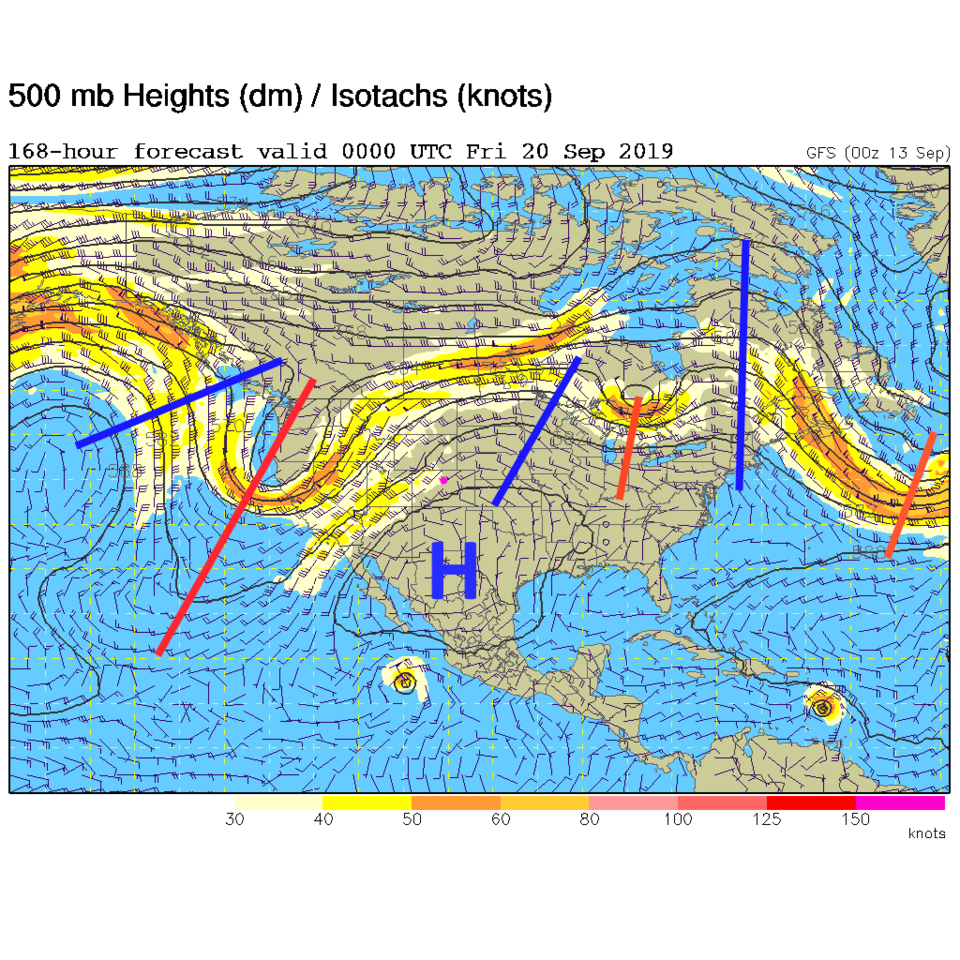
The next trough (that looks a lot like the hail-maker of Wednesday) passes Tuesday night. We at least get a cold front with this and cool towards normal temperatures (Figure 3). For Thursday, we see a deeper trough entering the West with strong southwest flow over the state (Figure 4). It should be cooler and wetter starting Wednesday.
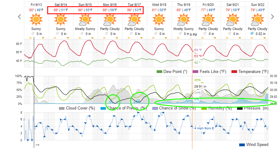
I've put the days of above normal temperature in a red box in Figure 5 and have circled the rain chances later in the period in green. It is a pretty simple picture for now.
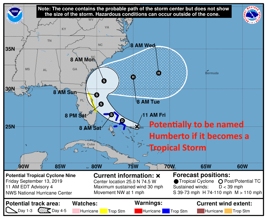
Just because the Bahamas don't need any more difficulties, I am pointing out that an admittedly much weaker, tropical system has the potential to develop over the next day or two in that region. It may get named and threaten many of the same areas as Dorian did. This is currently expected to only achieve tropical storm strength before it gets suddenly shoved out to sea next week when it may reach hurricane status. We'll watch it if it forms (Figure 6).