Skip to content
Join our Newsletter

Next Storm/Next Snow Forecast Discussion from the Cherrywood Observatory – September 17, 2019

This content was originally published by the Longmont Observer and is licensed under a Creative Commons license.

In Brief:

We say goodby to upper 80'sF after Tuesday. A pretty strong cold front slides across Colorado Tuesday afternoon/evening. The western slopes will see rain and thundershowers over the next week, but the eastern Plains won't see much. The higher elevations will pick up a bit of snow over the next 5 days; really up high, and just a bit.

Forecast Discussion:

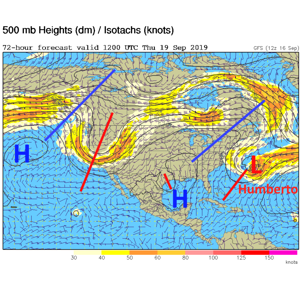
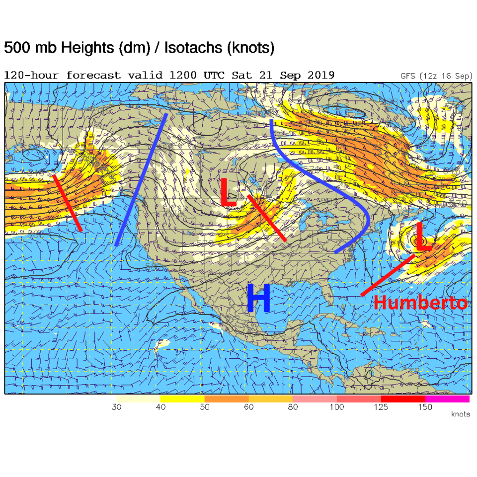
The pattern change that is bringing in more Fall-like weather is visible as the trough coming in on the West Coast and the low center off the coast of Canada (Figure 1). This first short wave will usher in a cold front that is visible sweeping out of Wyoming later today (Tuesday - Figure 2, and the first blue lie in Figure 4).

The Longer Range Forecast:

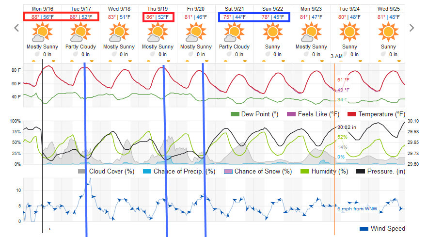
Wednesday we drop to lower 80'sF then another cold front Thursday (pushed in by another deep trough - Figure 3) gives us a small chance of showers and another cool down (from mid 80'sF) to first 80F Friday and then another front (another trough - Figure 4) and a cool down to about
75 F temperatures for the weekend (Figure 5).

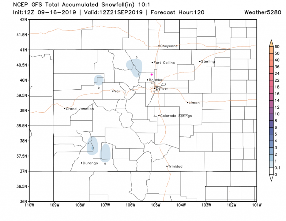
Just for fun, the higher elevations should see a dusting of snow over the next 5 days (Figure 6). Can coats, sledding, and Christmas presents be far off...?

You can also say goodbye to hurricane Humberto out in the Atlantic, if you wish (Figures 1,2,3,4).
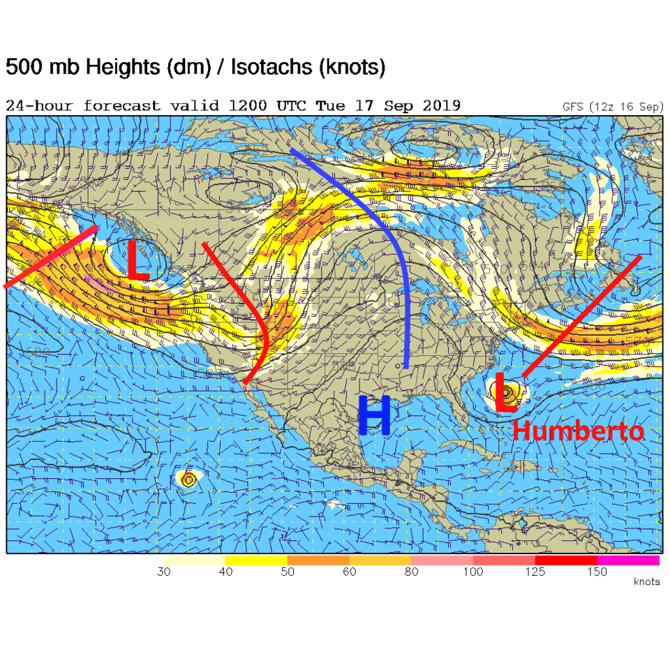
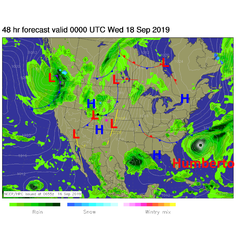
Figure 1: The 500mb forecast upper air analysis for Tuesday AM. Pink dot is Longmont. Red lines are troughs, blue lines are ridges.
Figure 2: The forecast surface map for Tuesday PM from NCEP.
Figure 3: The 500mb forecast upper air analysis for Thursday AM. Pink dot is Longmont. Red lines are troughs, blue lines are ridges.
Figure 4: The 500mb forecast upper air analysis for Saturday AM. Pink dot is Longmont. Red lines are troughs, blue lines are ridges.
Figure 5: the graphical forecast for the next 10 days for Longmont, CO from weatherunderground.com
Figure 6: The forecast snow totals for the next 5 days from the GFS and weather5280.com

Current Weather

Mostly cloudy

Mostly cloudy

70°F

UV Index
5 Moderate
Pressure
30.21 Falling
Visibility
6 miles
Dewpoint
60 °F
Humidity
70%
Wind
NNE 1.8 mph
Gust
3.9 mph
Wind Chill
70 °F

Hourly Forecast

Today
12 PM
72°F
Mostly cloudy
Today
1 PM
76°F
Mostly cloudy
Today
2 PM
78°F
Mostly cloudy
Today
3 PM
80°F
Mostly cloudy
Today
4 PM
82°F
Mostly cloudy
Today
5 PM
84°F
Intermittent clouds
Today
6 PM
82°F
Intermittent clouds
Today
7 PM
79°F
Intermittent clouds
Today
8 PM
77°F
Intermittent clouds
Today
9 PM
73°F
Partly cloudy
Today
10 PM
69°F
Partly cloudy
Today
11 PM
65°F
Intermittent clouds

7 Day Forecast

Mostly cloudy

Saturday

84 °F

Clouds and breaks of sun; high levels of ozone will lead to poor air quality


Partly cloudy

Saturday Night

58 °F

Partly cloudy


Partly sunny w/ showers

Sunday

94 °F

Partly sunny with a passing shower in the afternoon


Partly cloudy

Sunday Night

61 °F

Partly cloudy


Mostly cloudy

Monday

91 °F

Considerable cloudiness


Mostly clear

Monday Night

60 °F

Clear to partly cloudy


Intermittent clouds

Tuesday

92 °F

Sun through high clouds


Partly cloudy

Tuesday Night

58 °F

Partly cloudy


Intermittent clouds

Wednesday

84 °F

Not as warm with times of clouds and sun; a thunderstorm in spots in the afternoon


Intermittent clouds

Wednesday Night

58 °F

An evening thunderstorm; otherwise, partly cloudy


Sunrise and Sunset

Sunrise
5:41 AM
Sunset
8:30 PM

Based on AccuWeather data