Skip to content
Join our Newsletter

Next Storm/Next Snow Forecast Discussion from the Cherrywood Observatory – September 18, 2019

This content was originally published by the Longmont Observer and is licensed under a Creative Commons license.

In Brief:

Our first cold front is moving in to knock 5F off the temperatures and give the western slopes some rain/thundershowers. We'll mainly see increased clouds east of the Rockies with a possible sprinkle. A couple of additional cool fronts will lower us to the 70'sF for highs over the weekend with afternoon showers possible. Next week seems dominated by 70'sF weather for highs and better rain chances.

Forecast Discussion:

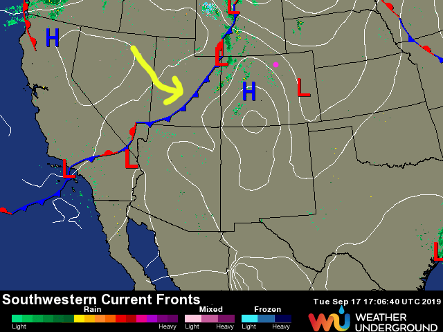
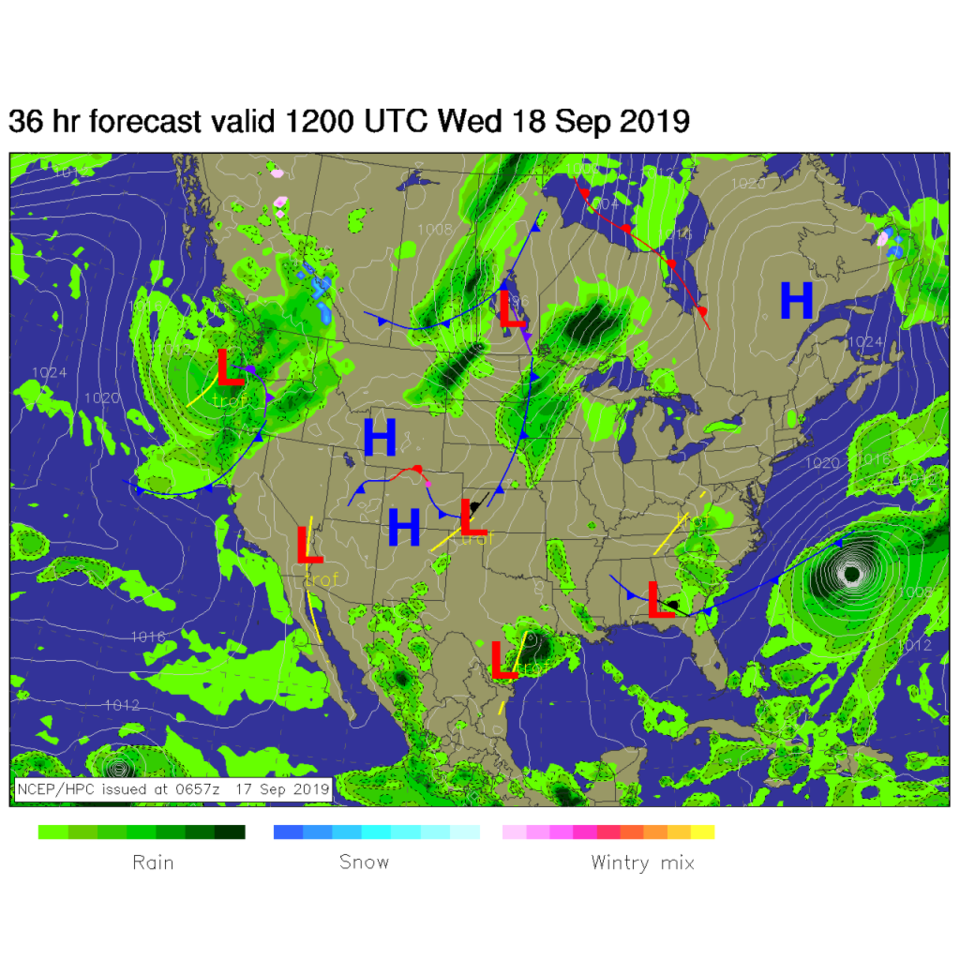
Our first cool front is on its way and is kicking off showers over the western counties of Colorado (Figure 1). Down slope flow on this side of the mountains will assure that very little water falls from the sky. By Wednesday morning, the front will be draped down the Front Range into the southeastern parts of the state. A bit more moisture will return behind the front (Figure 2).

The Longer Range Forecast:

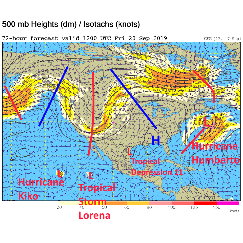
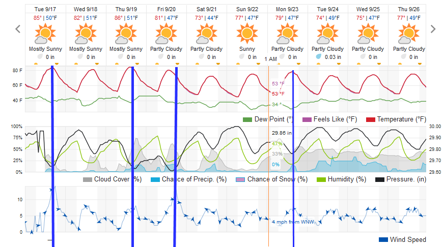
Later in the week, a deeper trough starts its trek across the nation (Figure 3). This will kick a couple more cool fronts past us, cooling us to the 70'sF for the weekend. The warmth before the weekend will feel a contribution from that same down slope warming/drying we are experiencing today (Figure 4).

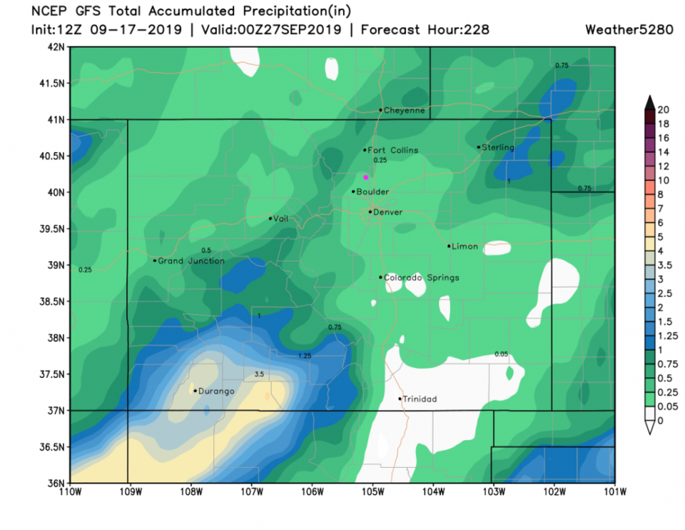
Next week, the trough seems to hold on (or get reinforced) and we stay cool with better rain chances returning (Figure 4). The GFS gives the somewhat dry western and southwestern parts of our state the best rainfall over the next 10 days (Figure 5).

Figure 1: SW US current surface map analysis from Tuesday midday from weatherunderground.com
Figure 2: The forecast surface map for Wednesday AM from NCEP.
Figure 3: The 500mb forecast upper air analysis for Friday AM. Pink dot is Longmont. Red lines are troughs, blue lines are ridges.
Figure 4: the graphical forecast for the next 10 days for Longmont, CO from weatherunderground.com
Figure 5: The forecast rainfall totals for the next 10 days from the GFS and weather5280.com

Current Weather

Mostly cloudy

Mostly cloudy

53°F

UV Index
0 Low
Pressure
30.11 Steady
Visibility
7 miles
Dewpoint
39 °F
Humidity
60%
Wind
SW 2.8 mph
Gust
4.9 mph
Wind Chill
53 °F

Hourly Forecast

Today
5 AM
50°F
Mostly clear
Today
6 AM
49°F
Clear
Today
7 AM
52°F
Sunny
Today
8 AM
57°F
Sunny
Today
9 AM
64°F
Sunny
Today
10 AM
72°F
Sunny
Today
11 AM
77°F
Mostly sunny
Today
12 PM
82°F
Mostly sunny
Today
1 PM
84°F
Partly sunny
Today
2 PM
87°F
Partly sunny
Today
3 PM
85°F
Mostly cloudy w/ t-storms
Today
4 PM
85°F
Intermittent clouds

7 Day Forecast

Partly sunny w/ t-storms

Monday

87 °F

Partly sunny and warmer; a thunderstorm around this afternoon


Partly cloudy

Monday Night

52 °F

Partly cloudy


Partly sunny w/ t-storms

Tuesday

74 °F

Not as warm with times of clouds and sun; a thunderstorm in the area in the afternoon; thunderstorms can bring localized damaging wind gusts


Mostly cloudy w/ t-storms

Tuesday Night

51 °F

A thunderstorm in spots in the evening; otherwise, increasing clouds


Mostly cloudy w/ t-storms

Wednesday

67 °F

Some sun, then turning cloudy with a couple of thundershowers in the afternoon


Clear

Wednesday Night

47 °F

Clear


Mostly sunny

Thursday

72 °F

Mostly sunny and pleasant


Mostly clear

Thursday Night

47 °F

Mainly clear


Mostly sunny

Friday

81 °F

Mostly sunny


Mostly clear

Friday Night

44 °F

Mainly clear


Sunrise and Sunset

Sunrise
6:41 AM
Sunset
7:09 PM

Based on AccuWeather data