This content was originally published by the Longmont Observer and is licensed under a Creative Commons license.
In Brief:
We sit with temperatures about 5-10F above normal for much of this week. A trough ejects from the southwest Friday cooling us and bringing a chance of rain. Our median temperatures drop another 5-10F next week with 60'sF visible on the horizon.
Forecast Discussion:
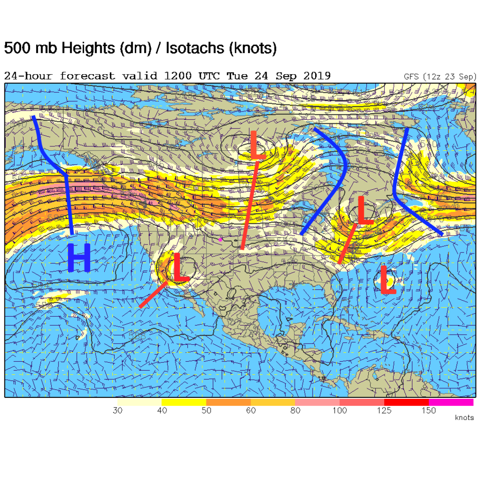
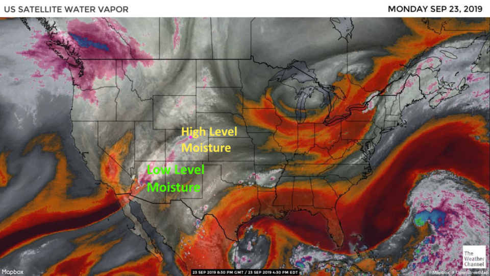
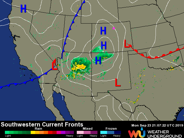
The cutoff in the desert southwest is pulling in moisture from a dead tropical system further south (Figure 1). The weekend trough is past our state with a ridge moving in to warm us up. In AZ, we have lots of low level moisture but just very high altitude moisture creating cloudy skies here at home (Figure 2). Flooding and severe thunderstorms are wandering around AZ and even northern NM (Figure 3) Monday afternoon.
We climb to mid 80'sF Tuesday and remain dry.
The Longer Range Forecast:
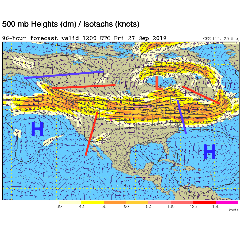
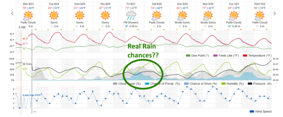
We bounce around with highs in the lower and upper 80'sF through Thursday (Figure 5) under this ridge until that cutoff low finally gets connected to the flow again and ejects to the northeast (Figure 4) Friday and brings us a chance of rain and seasonably cool weather (Figure 5).
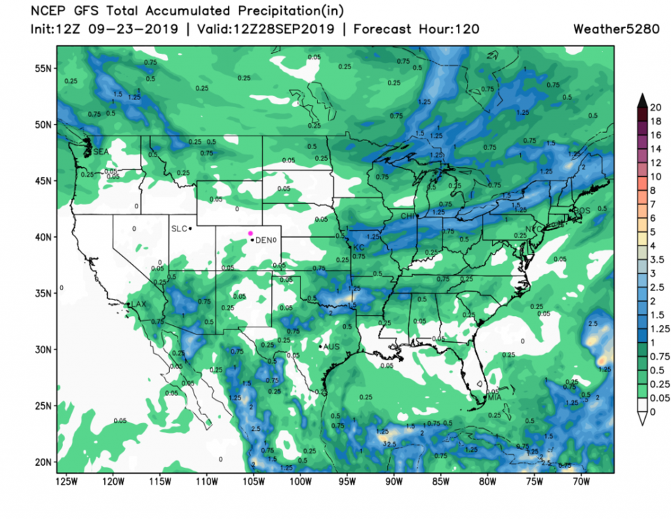
For the next 5 days, northern CO isn't going to see much rain according to the GFS (Figure 6). There is a hint of a much more fall-like spell of cool weather next week. 60'sF for highs? We'll see!