This content was originally published by the Longmont Observer and is licensed under a Creative Commons license.
In Brief:
The cold front of Tuesday pulls away and an upper high pressure center passes on Thursday. We warm up 10 F Tuesday to Thursday, then cool with another cool front and a return of tropical moisture/afternoon storms through the weekend.
Wednesday 9/4 9am update:
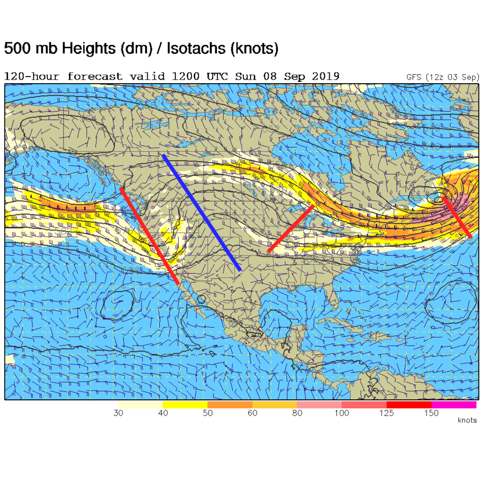
We are inching up into the 90'sF today as one blob of moisture exits the state and another approaches from the southwest (Figure 1 update). With very dry air still at the surface across the Plains, the mountains will see most of the afternoon convection from this flow.
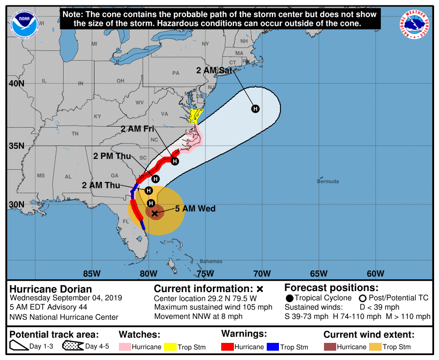
Hurricane Dorian is finally on the move, to the NNW at 8mph in this update. It will scrape very close to the coast of the Carolinas (if not make a short lived landfall- Figure 2 update). It stands as a Cat 2 storm with 105mph sustained winds.
End Wednesday 9/4 9am update.
Forecast Discussion:
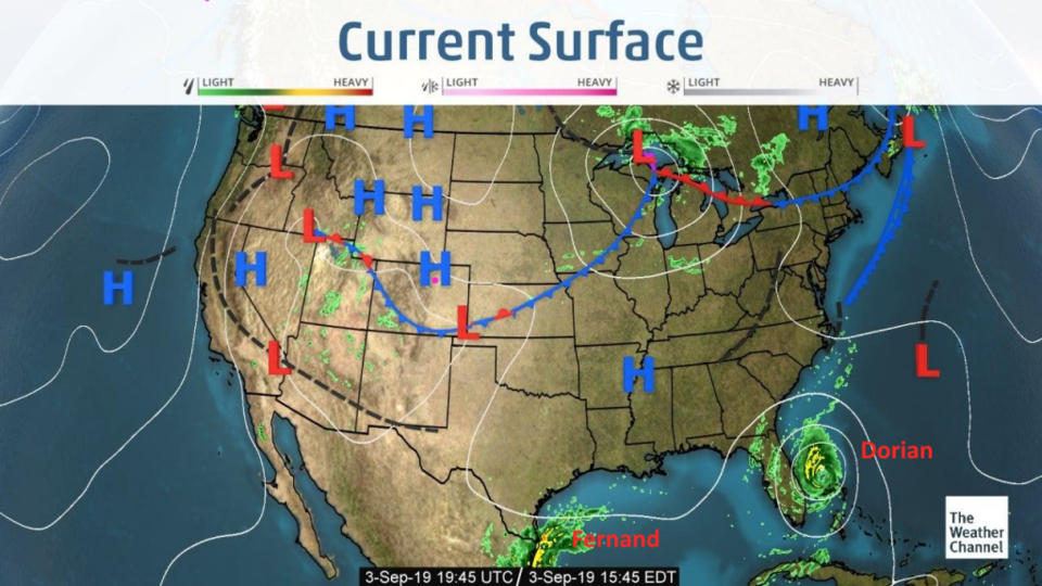
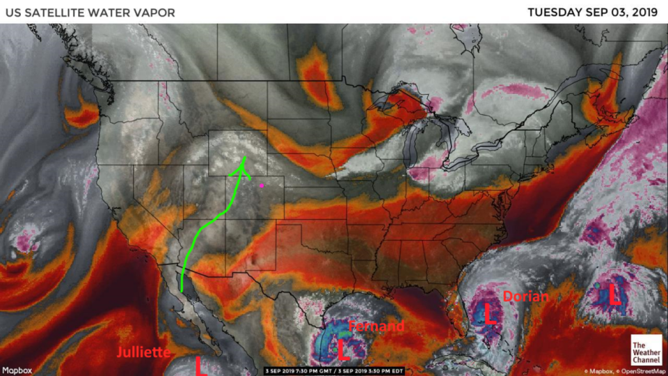
That was a very notable cool front Tuesday (Figure 1). We saw a 15F drop from 100F on Monday (a new record for DIA for September breaking the previous record of 99F set Sunday, breaking a previous record this month of 97F). There is a bit of moisture flow into the West from the tropics (Figure 2).
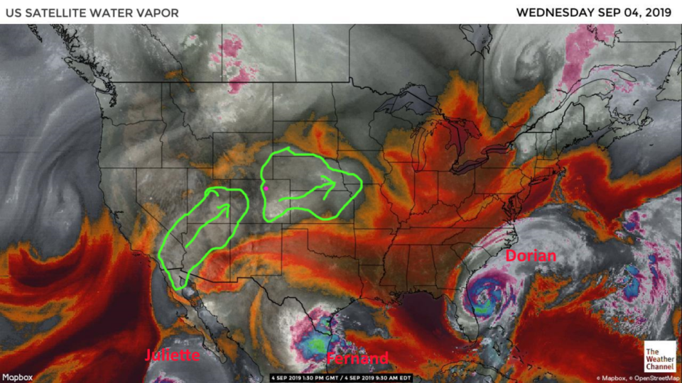
Note, there is an interesting sequence of tropical systems from Julliette off the tip of Baja California, Fernand in the Gulf, Dorian in the Atlantic, and another system further out in the Atlantic. Watch out for a possible big tropical system to threaten the DC-NYC-Boston area around Wednesday/Thursday next week , according to the GFS model (just a heads up between you and I).
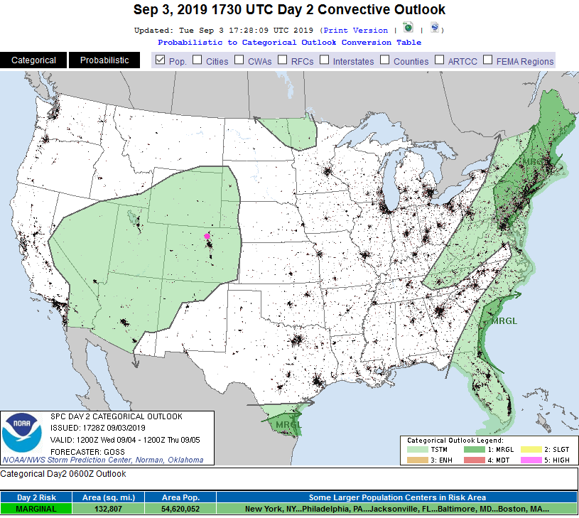
With moisture in the West, we do have a chance of afternoon showers/thundershowers each day this week (Figure 3). The only Marginal Risks of severe weather are in south Texas, New England, and around Dorian.
The Longer Range Forecast:
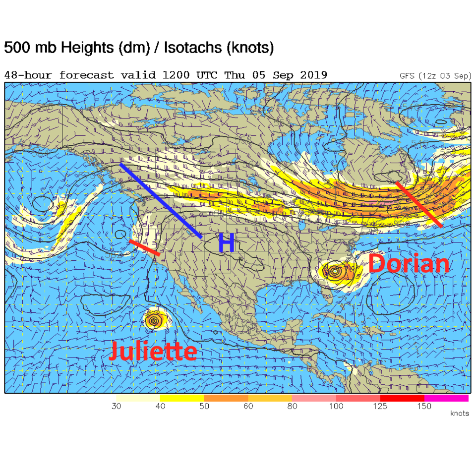
We do hit mid 90'sF for one day Thursday (Figure 4) with a passing upper high pressure center (Figure 5). A trough approaching from the west will cool us off and we'll see even better chances of afternoon showers through the weekend (Figure 3 and Figure 6).
The latest on Hurricane Dorian is that it has weekend to a Category 2 storm after churning up all its warm surface ocean water (Figure 7). It has started moving NW at about 2mph and is expected to not make landfall with the U.S., but slide along just off the coast. We'll keep an eye on it here too (an update will be posted Wednesday AM). For now, the weather is so quiet and slow to change, that my posts are covering things well for a couple of days at a time with just a quick update to freshen coverage on some features. I'm trying to save some time to complete the construction of my backyard observatory before the nights get long, clear, and cold.