Skip to content

9/9 11am Update: Next Storm/Next Snow Forecast Discussion from the Cherrywood Observatory – September 8-9, 2019

This content was originally published by the Longmont Observer and is licensed under a Creative Commons license.

In Brief:

A strong short wave and in-place moisture will interact to create a lot of thunderstorm activity today (Sunday) in the mountains that will merge into a couple of lines of occasionally severe storms this afternoon. After that, we have seasonable weather this week with mostly dry conditions.
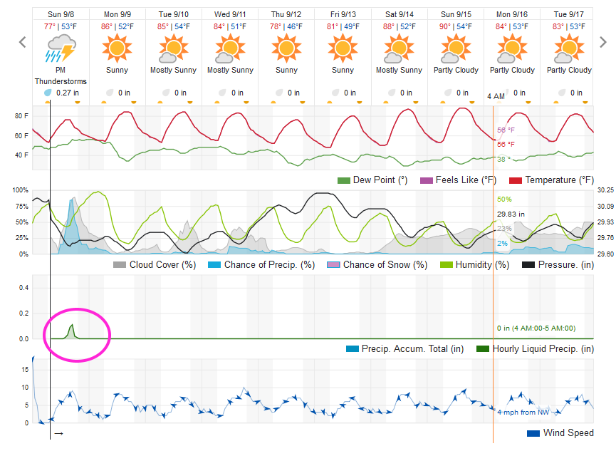
9/9 11am update:

The storms performed as advertised dumping 1/10th to a quarter inch across our fair city (Figure 1 update). Storm reports so far (Figure 2 update) show most of the damaging wind reports came from the Western Slopes but there seem to have been few tornadoes out to our east. Wild times!

Figure 1 update: 24 hour rainfall reports through 7am Monday from CoCoRaHS.
Figure 2 update: the storm reports received by the SPC and the NWS through 7am Monday.

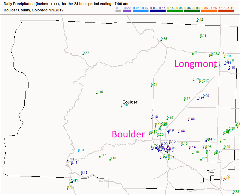
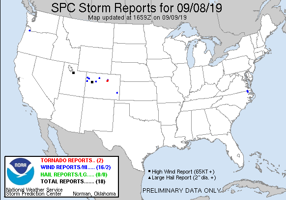
End 9/9 11am update.

Forecast Discussion:

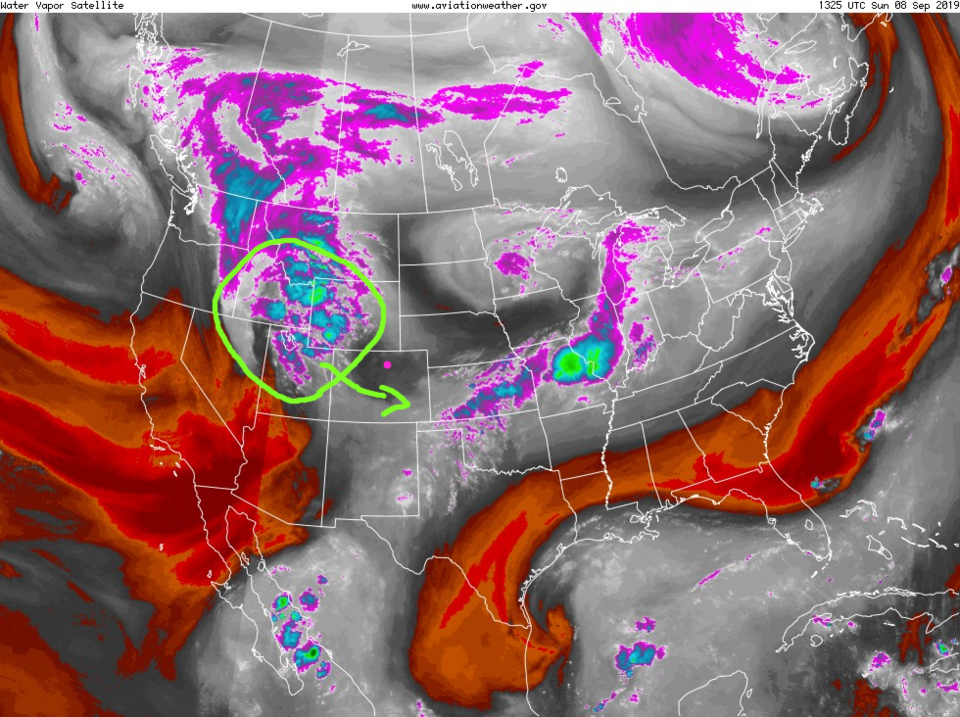
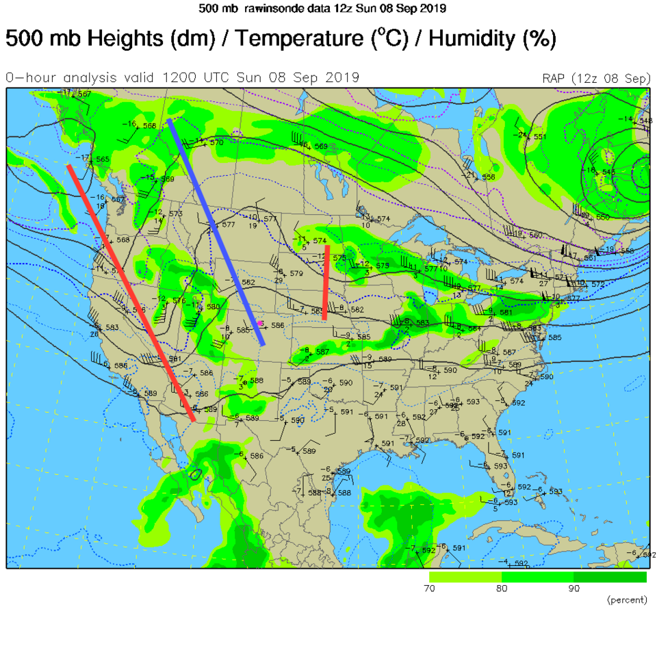
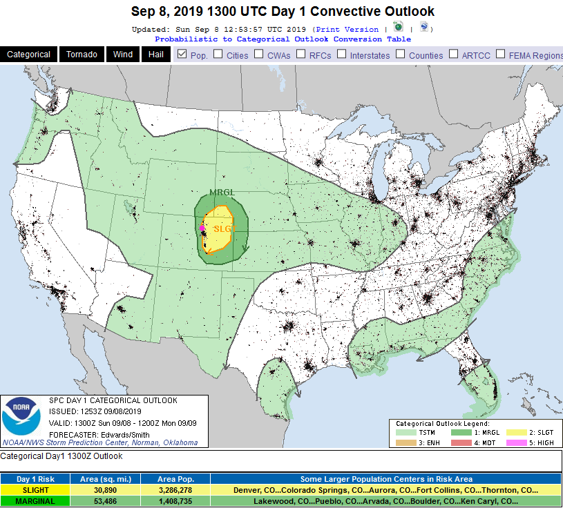
There is a blob of notable instability approaching the state today (green circle over Utah and neighboring states - Figure 1). This is being created by a strong short wave coming in from the west (Figure 2). These ingredients have led the SPC to paint a bullseye of Marginal (1 on a scale of 1-5) and Slight (2 on a scale of 1-5) severe weather risk over the Front Range and NE portions of our state (Figure 3). The primary risk from the (forming) lines of nearly continuous thunderstorms will be strong winds, but some hail is possible as well.

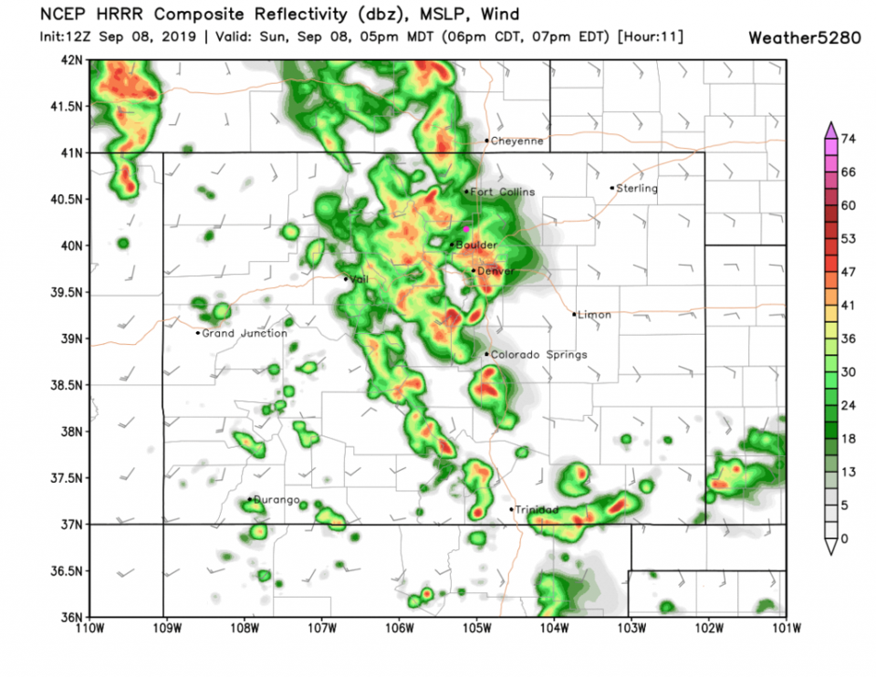
Storms will fire around 12p-1pm in the mountains and begin to fill in hitting the urban corridor between 4-7pm (Figure 4) but a few storms will be possible all afternoon and in spots later in the evening.

The Longer Range Forecast:

We resume our gentle glide into Fall on Monday with some comfortable weather by mid-week. There still is a 90F in the distance (Figure 5).

Figure 1: the water vapor satellite image (browns/reds are dry air, whites and light grey is moist air, purple/blue is ice and high cloud tops). From the the NWS from Sunnday AM.
Figure 2: The 500mb current upper air analysis for Sunday AM. Pink dot is Longmont. Red lines are troughs, blue lines are ridges.
Figure 3: The severe storm weather forecast for the U.S. from the Storm Predication Center in Norman, OK. Made Sunday for Sunday.
Figure 4: the forecast radar map from the GFS and weather5280.com for Colorado, for 5pm Sunday.
Figure 5: the graphical forecast for the next 10 days for Longmont, CO from weatherunderground.com

Current Weather

Sunny

Sunny

64°F

UV Index
3 Moderate
Pressure
29.99 Falling
Visibility
7 miles
Dewpoint
36 °F
Humidity
37%
Wind
ESE 2.6 mph
Gust
7 mph
Wind Chill
64 °F

Hourly Forecast

Today
5 PM
66°F
Partly sunny
Today
6 PM
65°F
Intermittent clouds
Today
7 PM
63°F
Intermittent clouds
Today
8 PM
60°F
Mostly clear
Today
9 PM
57°F
Mostly clear
Today
10 PM
54°F
Mostly clear
Today
11 PM
51°F
Mostly clear
Tomorrow
12 AM
49°F
Mostly clear
Tomorrow
1 AM
48°F
Mostly clear
Tomorrow
2 AM
46°F
Mostly clear
Tomorrow
3 AM
45°F
Mostly clear
Tomorrow
4 AM
43°F
Mostly clear

7 Day Forecast

Intermittent clouds

Saturday

66 °F

Not as warm with intervals of clouds and sunshine


Mostly clear

Saturday Night

39 °F

Clear to partly cloudy


Mostly cloudy

Sunday

78 °F

Cloudy most of the time, breezy and warmer


Mostly cloudy

Sunday Night

47 °F

Rather cloudy and windy


Windy

Monday

60 °F

Very windy; cloudy and cooler


Intermittent clouds

Monday Night

41 °F

Partly cloudy


Intermittent clouds

Tuesday

59 °F

Cool with times of clouds and sun; windy in the afternoon


Partly cloudy

Tuesday Night

32 °F

Partly cloudy


Intermittent clouds

Wednesday

60 °F

Times of clouds and sun


Intermittent clouds

Wednesday Night

35 °F

Partly cloudy


Sunrise and Sunset

Sunrise
5:55 AM
Sunset
7:59 PM

Based on AccuWeather data