This content was originally published by the Longmont Observer and is licensed under a Creative Commons license.
Forecast Discussion:
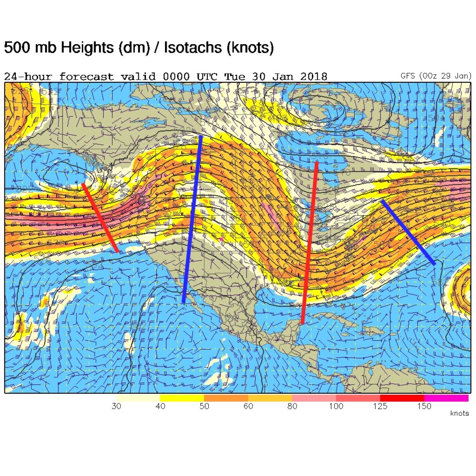
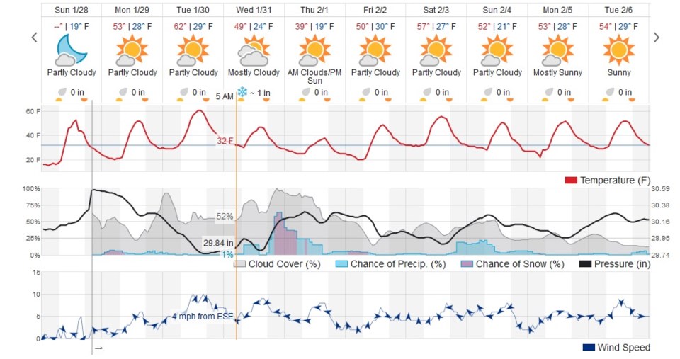
Nothing is constant in the universe except for change... and decreased snowfall potential as we approach possible snow days. But first, our warm and windy conditions today and tomorrow come from down slope flow and the big ridge overhead (Figure 1). The 10 day graphical glance (Figure 2) has us getting up to the lower 60's on Tuesday (with a fair amount of cloudiness).
The big news is the 'blue blood super moon eclipse' Wednesday morning before sunrise (you are invited to the Cherrywood Observatory - see the post last Wednesday). The orange line is during the onset of the eclipse at 5am. We are 50/50 with clouds with a low, but soon to increase, chance of precipitation. Things are trending upwards as clouds go during this time as well. Temperatures are right at freezing.
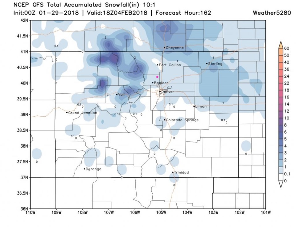
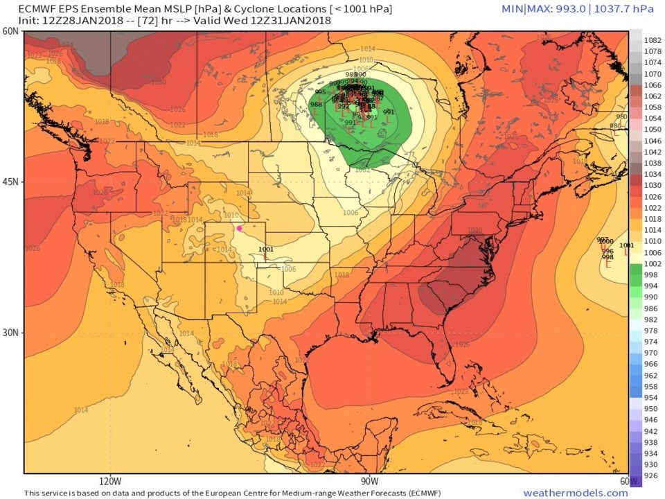
Figure 3 sees the return of our ensemble cycle location map. There is a front, at least, pushing down and draping up the Front Range. The main storm is up in Canada though. That means that snowfall is now down to a coating to an inch possible Wednesday later in the day into Thursday morning (Figure 4). Yep, it's happening again.
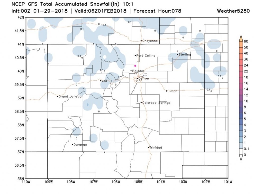
The longer range forecast:
In Figure 1, temperatures stay cooler into the weekend and there is another small chance of precipitation next weekend. Figure 5 suggests 1/10th of an inch to 1 inch may come out of that by next Sunday. Who do we need to write to get a big snow storm?