This content was originally published by the Longmont Observer and is licensed under a Creative Commons license.
Forecast Discussion:
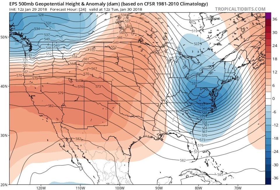
Bring on the heat! The ridge overhead is at a maximum today (Figure 1). The forecast high for today is 62F - some 17 degrees above normal. The westerly jet flow will still bring clouds overhead at times.
Now let's turn to the change in the weather AND the eclipse Wednesday morning. You are still invited to come to the Cherrywood Observatory at 4:45am to 6am at 507 Cherrywood Dr. IF it is not thickly overcast and/or raining or snowing. I will post a Go or No Go here on the active/current post for Wednesday morning (probably around 4:15 to 4:30am). Check back on the Wednesday post that will go live at 1am.
____________________________________________________________
Tuesday AM Update: The cloud forecasts for the morning eclipse don't look significantly different. All of the models but one have some to significant cloudiness at 4:45am through 6am. The forecast discussion for tomorrow will appear at 1am, as usual.
I'll post a Go or No Go on that post around 4:15am. I hope to see you there!
____________________________________________________________
Storm timing - The front should come through around 8am. Rain chances (later snow) rise after 5pm on Wednesday. Cloud cover from weatherunderground.com is at 50% rising to overcast later in the day.
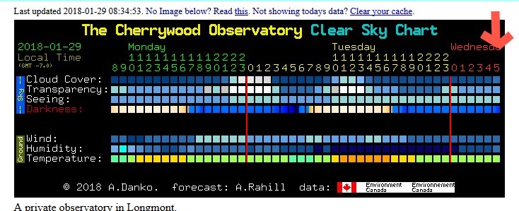
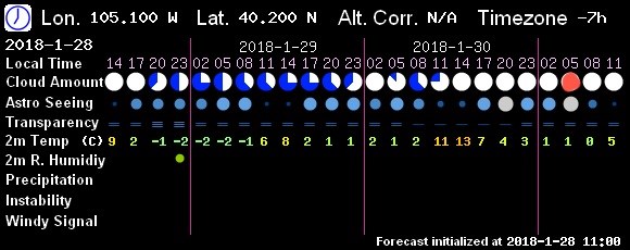
Figure 2 shows cloud cover on the top line and sky transparency on the second line. According to this model, it looks pretty good for the eclipse!
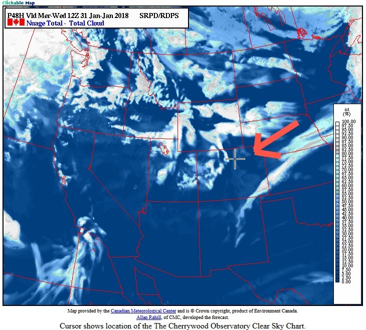
Figure 3 is the top line in this chart (Figure 2) in map form. There are mountain clouds, but things are good at the Plus sign for Longmont.
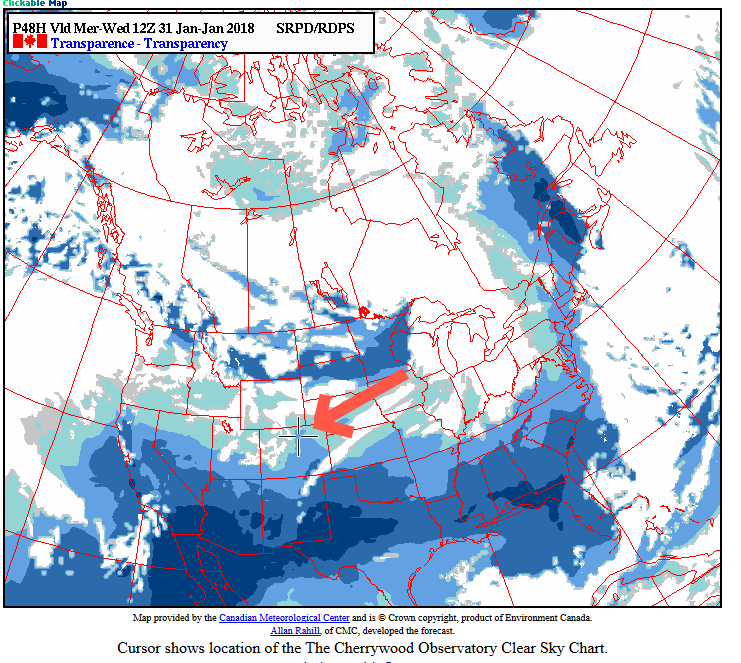
Figure 4 is the second line in the chart (Figure 2) in map form. Transparency doesn't look as good, so dim galaxies and star clusters I might be able to normally show as a side-show, will be invisible.
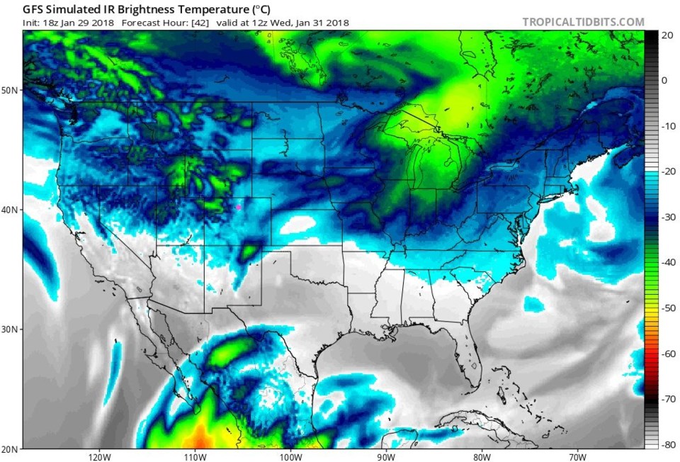
Figure 5 is the GFS's idea for cloud cover and it has us fairly cloudy, but not as bad as the mountains to our west.
Figure 6 is a Chinese model for sky conditions and IT has us completely overcast. Bad news.
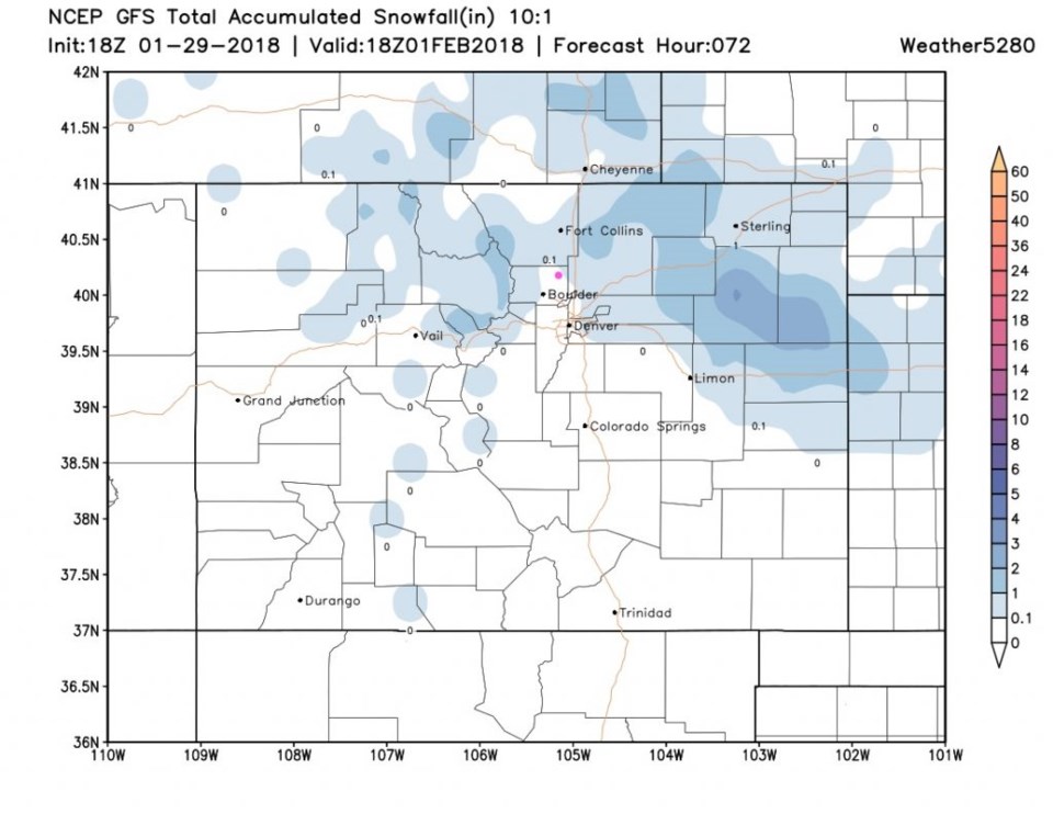
Finally, Figure 7 shows the snowfall from the GFS and it has us surrounded by a trace to 1 inch of snow - we are in a down slope hole it seems. Blah.
The longer range forecast:
We see another small storm for Saturday/Sunday and cooler temperatures for the next week, but we'll look at that after the Wednesday storm shapes up.


