This content was originally published by the Longmont Observer and is licensed under a Creative Commons license.
Forecast Discussion:
The eclipse is here (just a few hours after this post goes live at 1am).
_______________________________________________________________
Here is where I'll call the Go or No Go depending on clouds: We are a Go!
Note: There are batches of clouds moving in from the west, so we still might miss portions of the eclipse, but I'm set up and aligning telescopes now!
______________________________________________________________
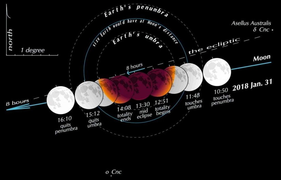
Figure 1 is the image of the Earth's shadow in space. You can see the very light penumbra is much larger than the dark umbra and that part of the eclipse begins at 3:50am. It is very difficult to notice, so I'm starting the viewing when the dark orange bite begins to appear at 4:48am.
The National Weather Service is not optimistic, in their forecast discussion, they say:
Also increased cloud cover tonight. Satellite imagery shows thereshould be a break in the cloud cover late this evening and after
midnight. This will be short lived as the next batch of Pacific
moisture moves in behind it and brings more cloud cover 09z-12z. (Translation 2am to 5am.)
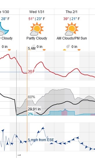
Figure 2 is a close up on the weather for the day. We have a cloud maximum during the eclipse before a brief partial clearing. Then the clouds increase and rain, ice and snow chances (though low in totals) pick up after 6pm.
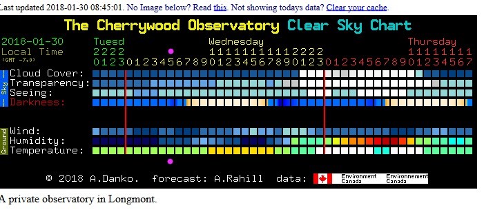
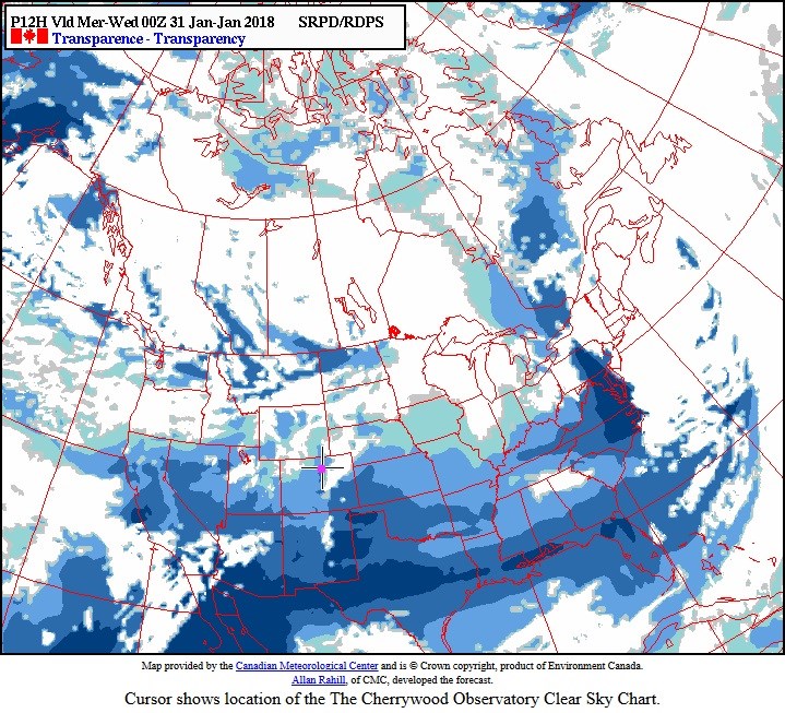
Figure 3 is the graphical forecast for astronomers from clear sky chart/Canada - and it has haze/high clouds but little in the way of thicker clouds.
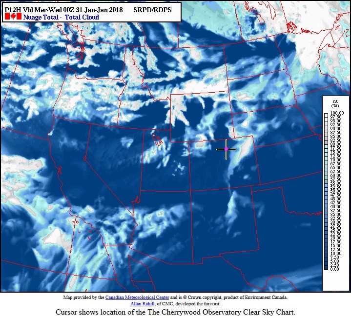
Figure 4 is the top line as a future satellite image and we have a big batch of clouds that has passed to the east and some clouds approaching from the west. The eclipse will be very low in the west. That would normally make it harder to see (cloud cover looks thicker as one looks low on the horizon) - but we can also get a strip of clear skies during down-slope conditions just east of the Rockies.
Figure 5 shows very hazy conditions (second line in map/satellite view form)- so dimmer objects like galaxies and star clusters might not look very good.
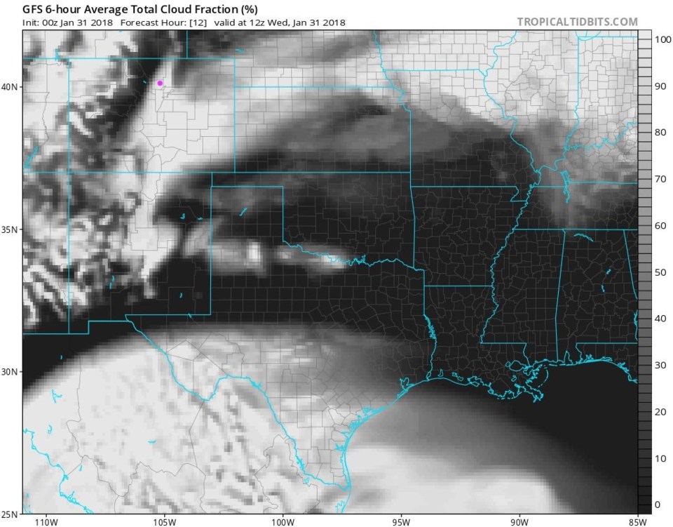
Figure 6 is the future satellite image from the GFS and it has us under thick clouds, but there is clearing to the west that might allow us to see the eclipse under the western cloud edge.
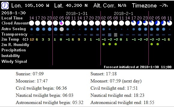
Figure 7 - is a pretty reliable cloud chart for the Front Range, by my observation. It has us overcast, but a small fraction of clearing around 5am (and clouds on either side of that hour).
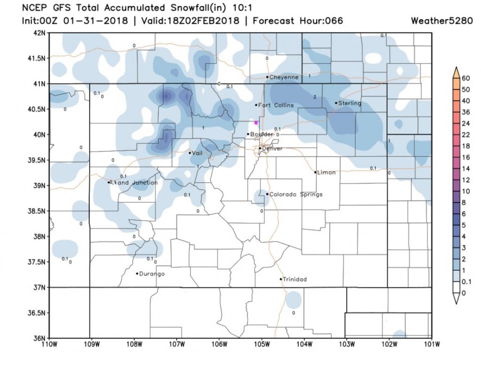
Looking back at the storm for tonight into Thursday morning - we are on the edge of a dusting to an inch of snow. There may be a brief period of evening rain, followed by freezing rain as the cold air comes in, before light snow begins. Travel might get nasty tonight.
The longer range forecast:
We have another small chance of snow on Saturday PM and Sunday... but it is not exciting. Temperatures will bounce up and down from seasonal to cold now and then. We'll follow all that after the eclipse and this small storm passes.


