
This content was originally published by the Longmont Observer and is licensed under a Creative Commons license.
By John Ensworth
It is now a story of the short waves in the northwest flow (as the ridge draws closer and warms us up a bit). Figure 1 shows surface station plots (we’ll get into the details of these too as time goes on, but the wind barbs on the circles are what we’ll look for our moisture flow). The circle is the actual location of the station (percent cloud cover is related to how filled-in the circle is) and the stick coming off it with feathers on it is like an arrow that was blowing along with the wind then stuck into the ball at the station. It shows where the wind is coming from. The green arrows parallel where wind is coming from – and it is still moist. (Sorry Colorado is awkwardly placed in this image). The upper left number at each station is the temperature (in degrees F in this map) and the lower left is the dew point (in degrees F in this map). In Kansas, the dew point is really moist around 70F. In eastern Colorado, they are in the 60’s and up in the foothills - dew points are in the 50’s. Nice and wet.
Figure 1: Surface station plot from UNISYS.
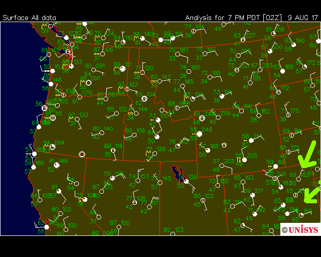
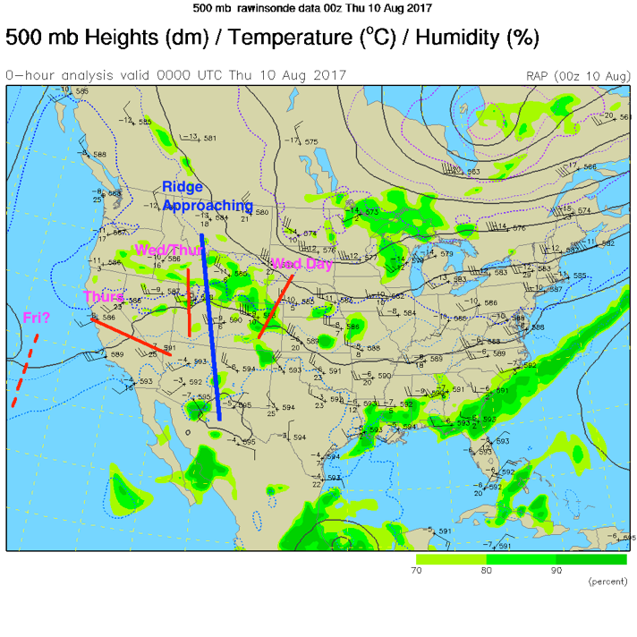
Figure 2 shows the mean ridge position, and that it is closer to Colorado than it has been for a week plus. The red lines show the short waves that created the thunderstorms of Wednesday, that will create, at least, mountain showers and storms overnight, and the ripple that is expected to make things ‘exciting’ around Longmont on Thursday. The NWS forecast discussion states that they expect this short wave to time well with maximum daytime heating/instability. That can mean severe weather… (There is another ripple, if it is real, off coast that might do it again on Friday).
Figure 2: The 500mb map from Wednesday night.
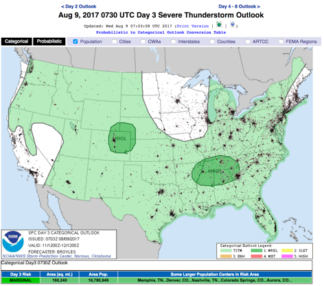
With the shortwaves expected to line up with the best daytime heating hours Thursday (and Friday), we have a chance of severe weather (a Marginal Risk – a 1 on a scale of 1-5) issued by the Storm Prediction Center in Norman, Oklahoma (the SPC) for both days – mainly for supercell related large hail and damaging winds. Soils are wet as is the air, so always be aware that local flooding may occur under the bigger storms. There is a Slight Risk (2 on the scale of 1-5) just a bit further east covering much of the Colorado Plains.
Figure 3: The SPC forecast Day 2 for Thursday issued on Wednesday.
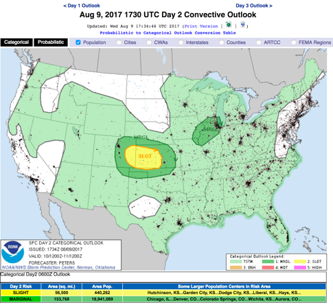
Figure 4: The SPC forecast Day 3 for Friday issued on Wednesday.
In a look at the longer range:
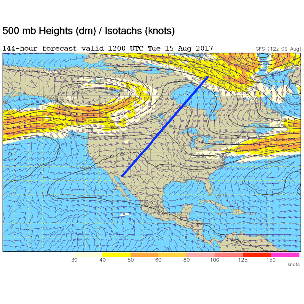
Nothing really changes through the weekend except the ridge keeps inching closer warming us up. Figure 5 shows the ridge passing overhead Monday/Tuesday, but the lower level atmosphere is not expected to completely dry out. Things will be somewhat warmer and drier, but still cooler than normal.
Figure 5: The Tuesday morning upper air pattern, 500mb GFS forecast. The ridge is drawn in blue.
*** This feature will run as close to daily as possible in this location on the Longmont Observer. This article will provide a brief discussion concerning the ‘why’ behind the weather with a focus on severe weather, unusual weather, and snow (especially trying to predict snow depth and its human impact in Longmont).***
Bio:
John Ensworth works from Longmont as the Principle Investigator for the NASA Science Mission Directorate Earth and space science education product review through the IGES (The Institute for Global Environmental Strategies – www.strategies.org) . He is in his 14thyear running this review. He is an astronomer (from the 2nd grade onward) and became a meteorologist (in the 5th grade) when a thunderstorm in Arizona rained on his telescope when the weather service had only forecasted a 10% chance of rain. He has college degrees in physics and astronomy and climatology and a graduate degree in meteorology and earth science. He lectures at the Little Thompson Observatory in Berthoud, the Estes Park Memorial Observatory in Estes Park, and for a number of online universities. He built and runs a backyard observatory near Pace and 17th in northeast Longmont where he has lived for 8 years with his wife, daughter, son, and two cats. Invitations to open house nights at this observatory, LTO, and EPMO will be posted with future discussions when they are scheduled.
Forecasting severe weather and snow amounts via text lead to this column. He began texting friends about the weather right after the September 2013 flood. The readers of this column will, hopefully, keep him honest in what he ‘thought’ he had forecasted for ‘the most recent’ storm.


