
This content was originally published by the Longmont Observer and is licensed under a Creative Commons license.
Issued: Friday July 14, 2017
By John Ensworth
This feature will run as close to daily as possible in this location on the Longmont Observer.
This article will provide a brief discussion concerning the ‘why’ behind the weather with a focus on severe weather, unusual weather, and snow (especially trying to predict snow depth and its human impact in Longmont).
Discussion:
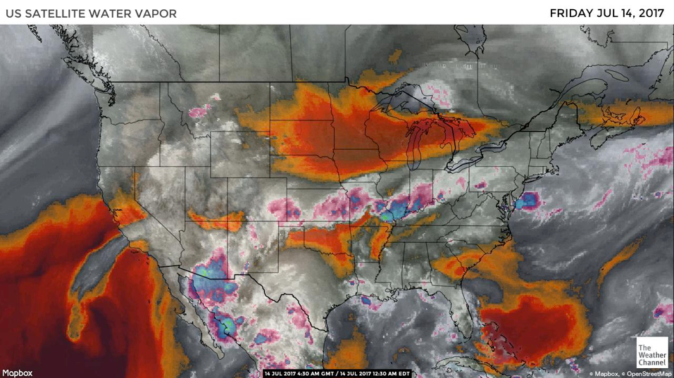
The band of tropical moisture has been pushed to the southern part of the state by the building ridge to the west. Areas west and south of Colorado Springs saw up to 2 inches of rain in spots. The high temperatures in Longmont jumped from 72F to 87F today as skies cleared and sinking air associated with the high compressed and warmed the atmosphere in northern Colorado. Because we’ve seen one cycle of monsoon moisture, we’ll end our sequence of water vapor images with tonight’s image added on below.
We’ll stay dry-ish through the early part of next week (except that lingering moisture might fuel a storm any afternoon in the foothills) as this high takes over again.
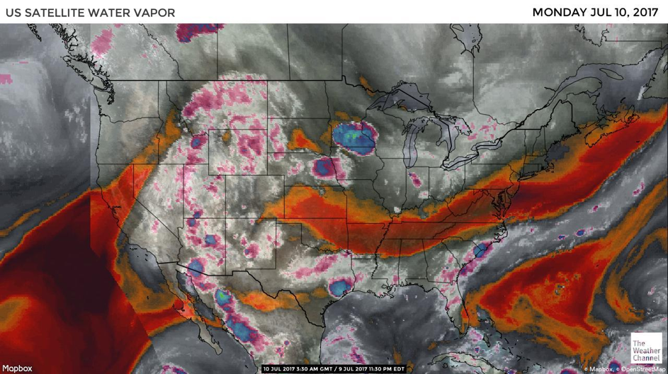
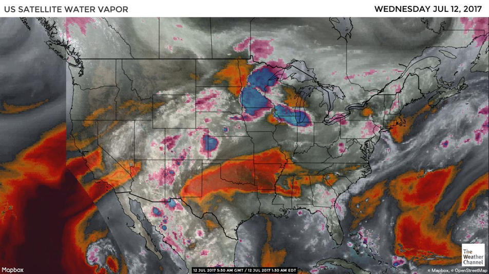
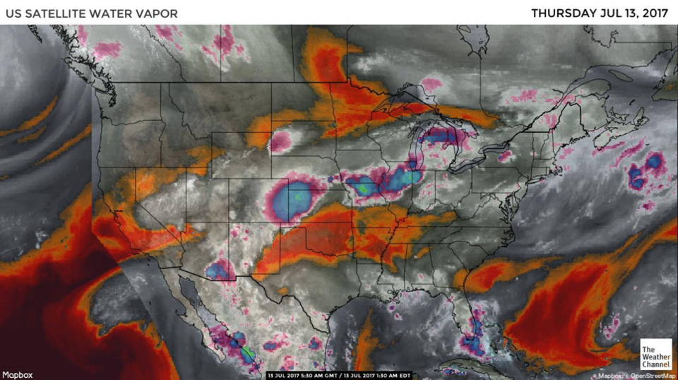
Today is day 5, and the final day, of our moisture-flow-watch associated with this first hit of the summer monsoon. In the images below (takenSunday through Thursday night locally) we see the water vapor image from the Weather Channel’s Website. As described in this series, the satellite is looking at frequencies of light emitted by the Earth that are absorbed by moisture in the atmosphere. The deep red and orange colors are places where the atmospheric moisture content is very low from the surface up to the top of the troposphere. The grey areas have some moisture. The white and pink regions have a high moisture content.
You can see that most robust feed of moisture is now down to our southeast. The plume that originally pushed into Canada is thinning out to our northwest. We have a bit of really dry air forming over the four corners region. There is still a good amount of moisture in Mexico and southern Arizona waiting a chance to return (Wednesday?).
Tropical Storm Eugene has all but vanished in this latest image.

In a look at the longer range: it is not looking like the returning ridge will be as strong as it was a week ago, so even though we go back into the 90’s in a few days, it looks like lower 90’s rather than upper 90’s. (I’m always looking for the silver lining – literally). Then a return to monsoon conditions is in the offing for the middle and end of next week when modeling indicates the ridge will head back to our east again. Yea!
Bio:
John Ensworth works from Longmont as the Principle Investigator for the NASA Science Mission Directorate Earth and space science education product review. He is in his 14th year running this review. He is an astronomer (from the 2nd grade onward) and became a meteorologist (in the 5thgrade) when a thunderstorm in Arizona rained on his telescope when the weather service had only forecasted a 10% chance of rain. He has college degrees in physics and astronomy and climatology and a graduate degree in meteorology and earth science. He lectures at the Little Thompson Observatory in Berthoud, the Estes Park Memorial Observatory in Estes Park, and for a number of online universities. He built and runs a backyard observatory near Pace and 17th in northeast Longmont where he has lived for 8 years with his wife, daughter, son, and two cats. Invitations to open house nights at this observatory, LTO, and EPMO will be posted with future discussions when they are scheduled.
Forecasting severe weather and snow amounts via text lead to this column. He began texting friends about the weather right after the September 2013 flood. The readers of this column will, hopefully, keep him honest in what he ‘thought’ he had forecasted for ‘the most recent’ storm.


)