
This content was originally published by the Longmont Observer and is licensed under a Creative Commons license.
The moisture was at its peak Friday for Longmont and northeast Colorado. Things were much calmer in the state on Saturday. Figure 1 shows radar estimated rainfall totals for the eastern half of the state. The yellow colors are around 1” of water. The dark blue colors are 0.25”. So not much water hit many people. It mostly happened in the mountains and southern portions of the state and a bit along the front near Wyoming. With weather quite quiet, I’ll make it short this time.
Figure 1: Radar estimated rainfall totals.
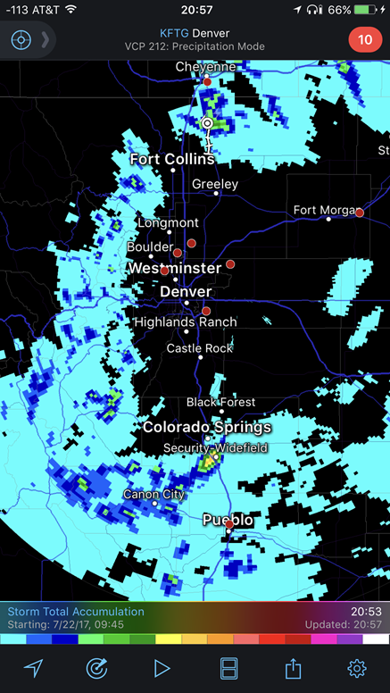
Figure 2 shows the stationary front over the northern part of the state (so we are a bit cooler than we have been recently) and the more active thunderstorm activity shifted south - ahead of that front and the jet stream flow aloft.
Figure 2: Radar and frontal/pressure system map. Saturday night.
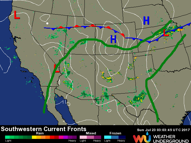
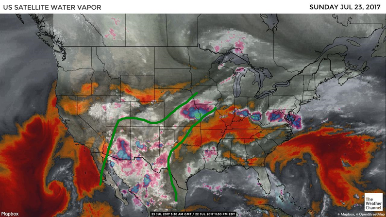
Figure 3 is our familiar water vapor satellite image showing the ribbon of tropical moisture down to our southeast.
Figure 3: Water vapor satellite image, dry air is red/orange, moderately dry air in grey, moist air in white, very moist (or cold) water/clouds are pink or turquoise. This was Friday night.
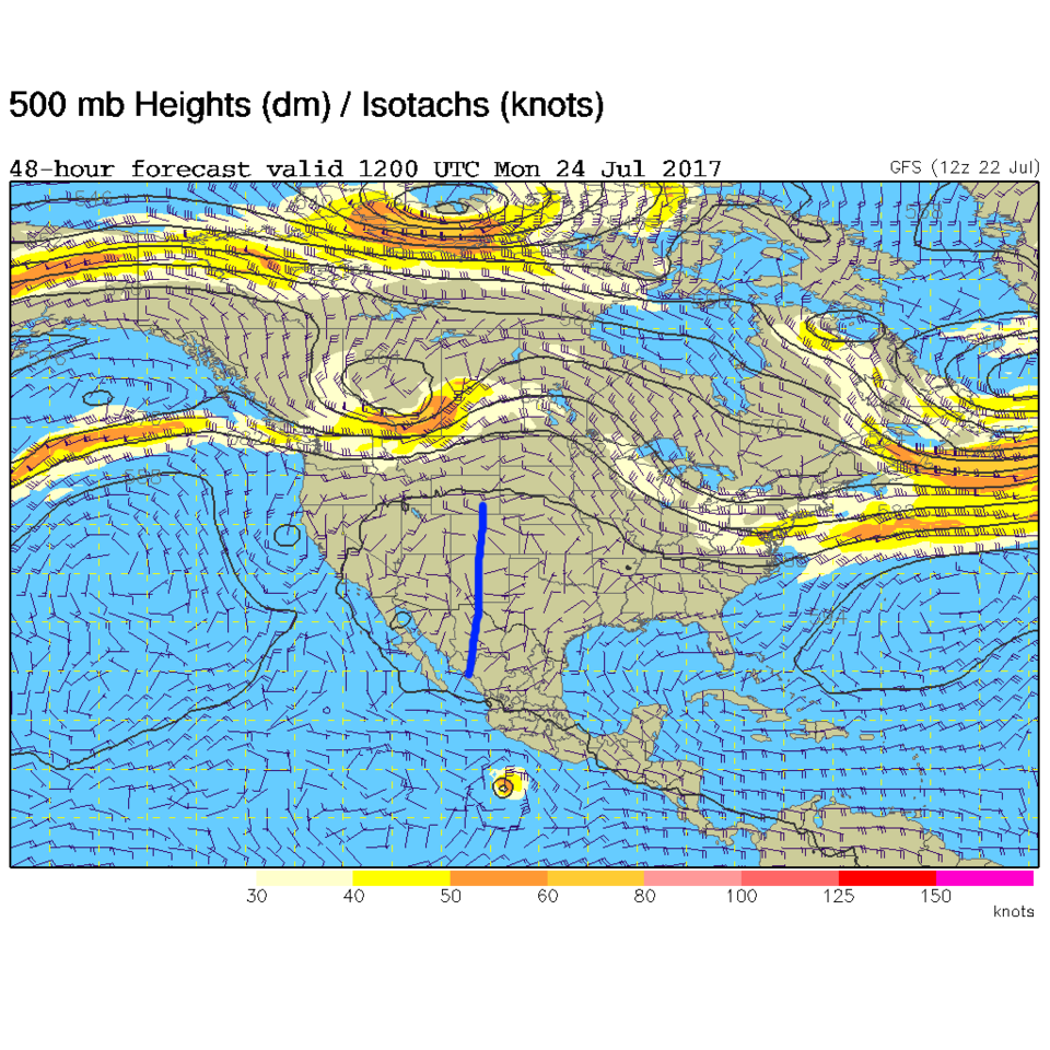
In a look at the longer range: The ridge will strengthen in the west by Monday. Figures 4 and 5 show our 500mb map for Monday morning and Thursday morning according to the GFS (Global Forecast System) model. In Figure 4, you can see the ridge centered on us Monday – so Monday and Tuesday will be our hotter days next week. By Wednesday and Thursday this ridge axis has progressed out east again and we can see the return of monsoon moisture (green arrow in Figure 5). This is remaining very consistent from the last couple days of model runs… I did use almost the same structure for this section three days in a row.
Figure 4: The 500mb map for Monday morning.
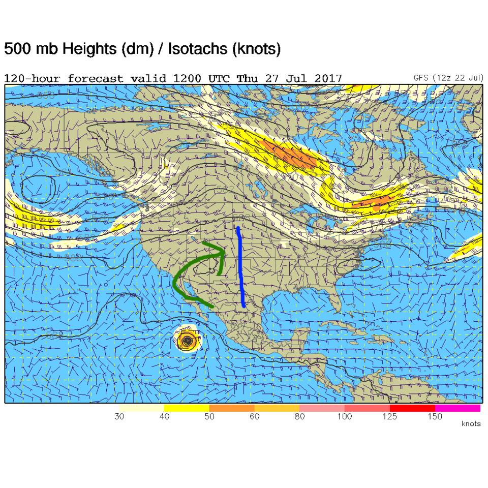
Figure 5: The 500mb map for Thursday morning.
 *** This feature will run as close to daily as possible in this location on the Longmont Observer. This article will provide a brief discussion concerning the ‘why’ behind the weather with a focus on severe weather, unusual weather, and snow (especially trying to predict snow depth and its human impact in Longmont).***
Bio:
John Ensworth works from Longmont as the Principle Investigator for the NASA Science Mission Directorate Earth and space science education product review through the IGES (The Institute for Global Environmental Strategies – www.strategies.org) . He is in his 14th year running this review. He is an astronomer (from the 2nd grade onward) and became a meteorologist (in the 5th grade) when a thunderstorm in Arizona rained on his telescope when the weather service had only forecasted a 10% chance of rain. He has college degrees in physics and astronomy and climatology and a graduate degree in meteorology and earth science. He lectures at the Little Thompson Observatory in Berthoud, the Estes Park Memorial Observatory in Estes Park, and for a number of online universities. He built and runs a backyard observatory near Pace and 17th in northeast Longmont where he has lived for 8 years with his wife, daughter, son, and two cats. Invitations to open house nights at this observatory, LTO, and EPMO will be posted with future discussions when they are scheduled.
Forecasting severe weather and snow amounts via text lead to this column. He began texting friends about the weather right after the September 2013 flood. The readers of this column will, hopefully, keep him honest in what he ‘thought’ he had forecasted for ‘the most recent’ storm.


