This content was originally published by the Longmont Observer and is licensed under a Creative Commons license.
By John Ensworth
Discussion:
Our moisture stream has been shoved gently to the south leaving us high and dry in fairly seasonable temperatures (it hit 92F yesterday where our normal in Longmont is about 88F). Figure 1 shows how quiet the radar was Sunday afternoon with all the thundershower activity down in the southwestern corner of Colorado (the monsoon rolls on for Arizona, Nevada, southern Utah, and New Mexico).
Figure 1: Sunday afternoon reflectivity radar.
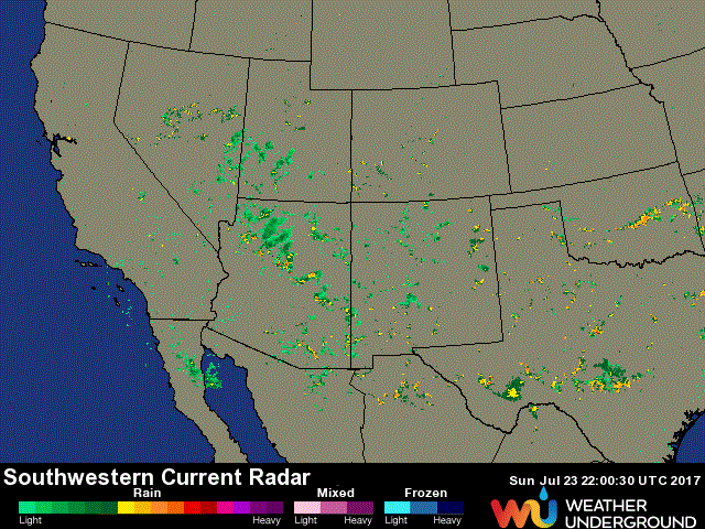
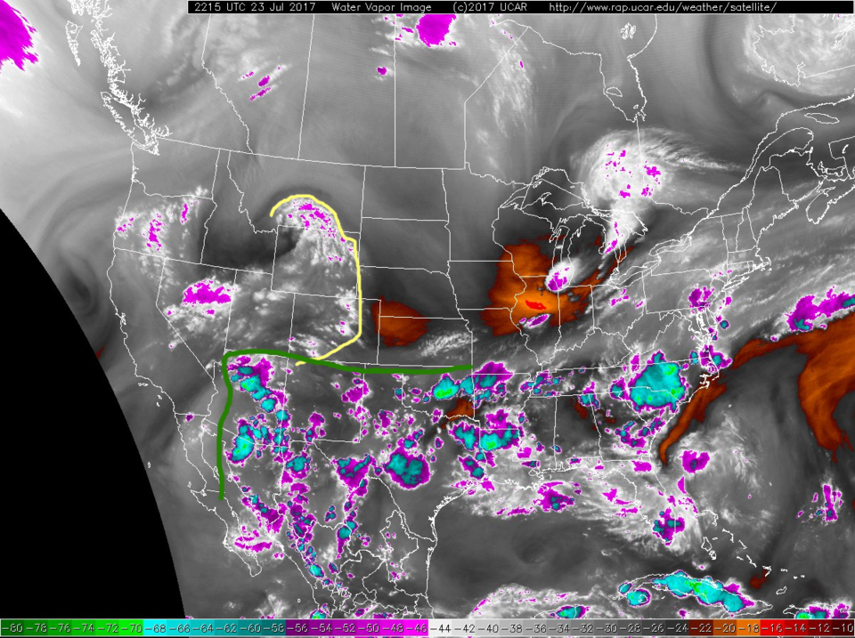
Figure 2 shows the suppressed (approximate) limit of our deeper atmospheric moisture below the green line. There is an upper level wave traveling over the state that kicked off a few smaller convective cells. I marked the leading edge in yellow. Still, overall sinking and drier air meant very little precipitation for the northeast half of the state.
Figure 2: Water vapor satellite image, dry air is red/orange, moderately dry air in grey, moist air in white, very moist (or cold) water/clouds are pink or turquoise. This was Sunday afternoon.
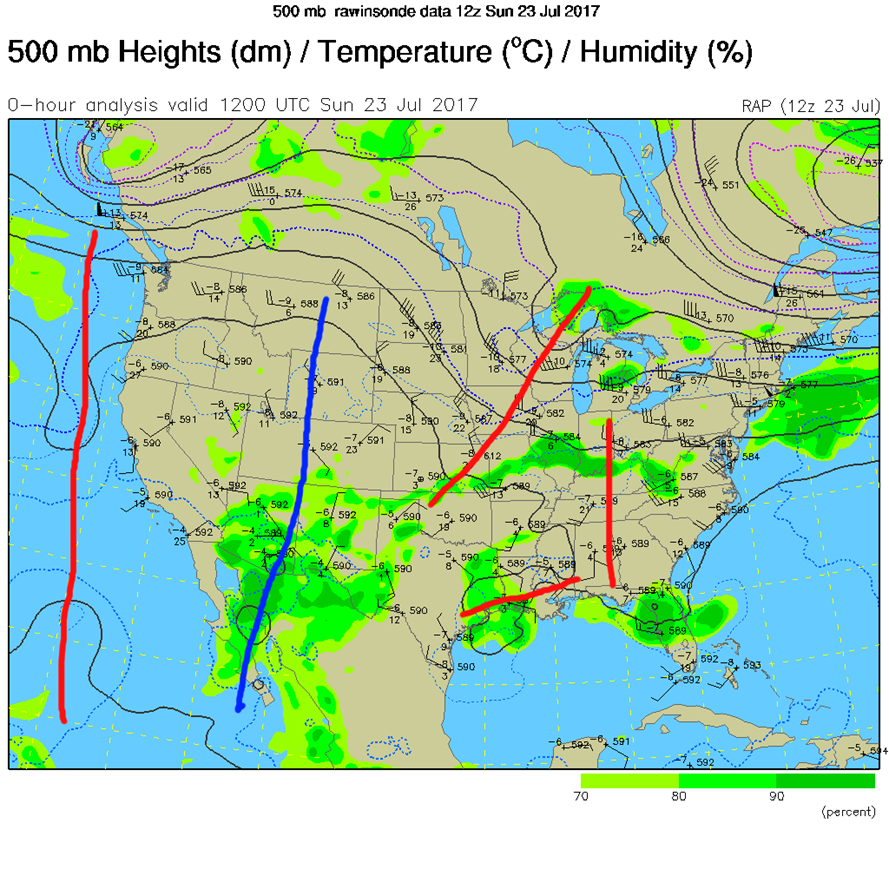
In figure 3, I’ve marked the ridge, growing in the west, with a blue axis, and marked (for fun) the troughs in the upper air pattern to our west and east. It is pretty complex in the eastern US right now!
Figure 3: 500mb contour map for Sunday morning.

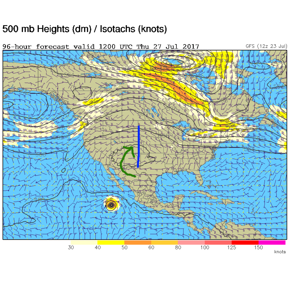
In a look at the longer range: By Tuesday, the ridge will already have passed us, and our 95F ish highs across the region Monday will begin to drop again. Figures 4 and 5 show our 500mb map for Tuesday morning and Thursday morning according to the GFS (Global Forecast System) model. In Figure 4, you can see the ridge centered east of us on Tuesday. By Thursday the ridge has been just to our east for a few days - we can see the return of monsoon moisture (green arrow in Figure 5). The ridge will build AGAIN to our west, shutting off the moisture flow again by Friday and into the weekend.
Figure 4: The 500mb map for Tuesday morning.
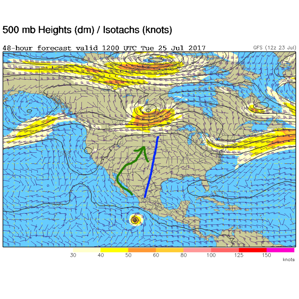
Figure 5: The 500mb map for Thursday morning.
*** This feature will run as close to daily as possible in this location on the Longmont Observer. This article will provide a brief discussion concerning the ‘why’ behind the weather with a focus on severe weather, unusual weather, and snow (especially trying to predict snow depth and its human impact in Longmont).***
Bio:
John Ensworth works from Longmont as the Principle Investigator for the NASA Science Mission Directorate Earth and space science education product review through the IGES (The Institute for Global Environmental Strategies – www.strategies.org). He is in his 14th year running this review. He is an astronomer (from the 2nd grade onward) and became a meteorologist (in the 5th grade) when a thunderstorm in Arizona rained on his telescope when the weather service had only forecasted a 10% chance of rain. He has college degrees in physics and astronomy and climatology and a graduate degree in meteorology and earth science. He lectures at the Little Thompson Observatory in Berthoud, the Estes Park Memorial Observatory in Estes Park, and for a number of online universities. He built and runs a backyard observatory near Pace and 17th in northeast Longmont where he has lived for 8 years with his wife, daughter, son, and two cats. Invitations to open house nights at this observatory, LTO, and EPMO will be posted with future discussions when they are scheduled.
Forecasting severe weather and snow amounts via text lead to this column. He began texting friends about the weather right after the September 2013 flood. The readers of this column will, hopefully, keep him honest in what he ‘thought’ he had forecasted for ‘the most recent’ storm.


