Skip to content

The Next Storm/Next Snow Forecast Discussion from the Cherrywood Observatory – November 10, 2017

This content was originally published by the Longmont Observer and is licensed under a Creative Commons license.

Forecast Discussion:

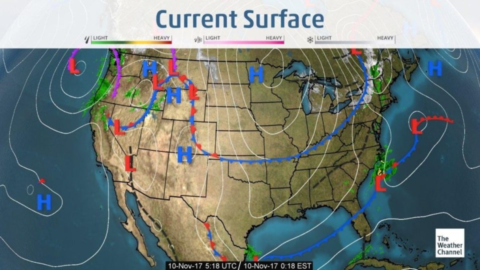
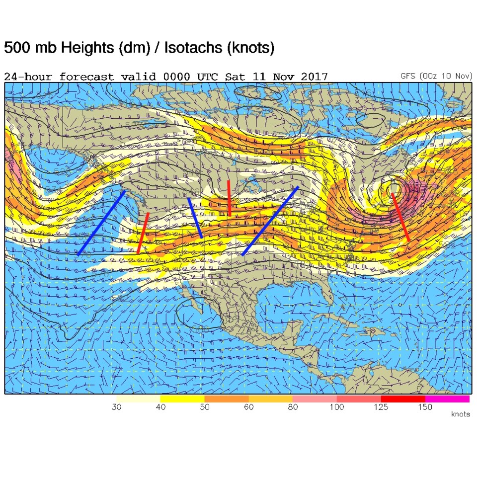
I'll save you a bit of time today by keeping it short... we are in the "very quiets" before a pattern change that is at least 7 days off in the future (or more).  The surface map (Figure 1) shows our back door front that is sitting down the axis of the Rockies and just as far south as northern New Mexico. The upper air map shows the jet stream flow is very flat with just small ridge and trough ripples in the flow (Figure 2).  Nothing is creating much weather.

Figure 1: Surface analysis map from Thursday PM from The Weather Channel.

Figure 2: 500mb upper air analysis forecast map for Friday PM.

In the longer range forecast:

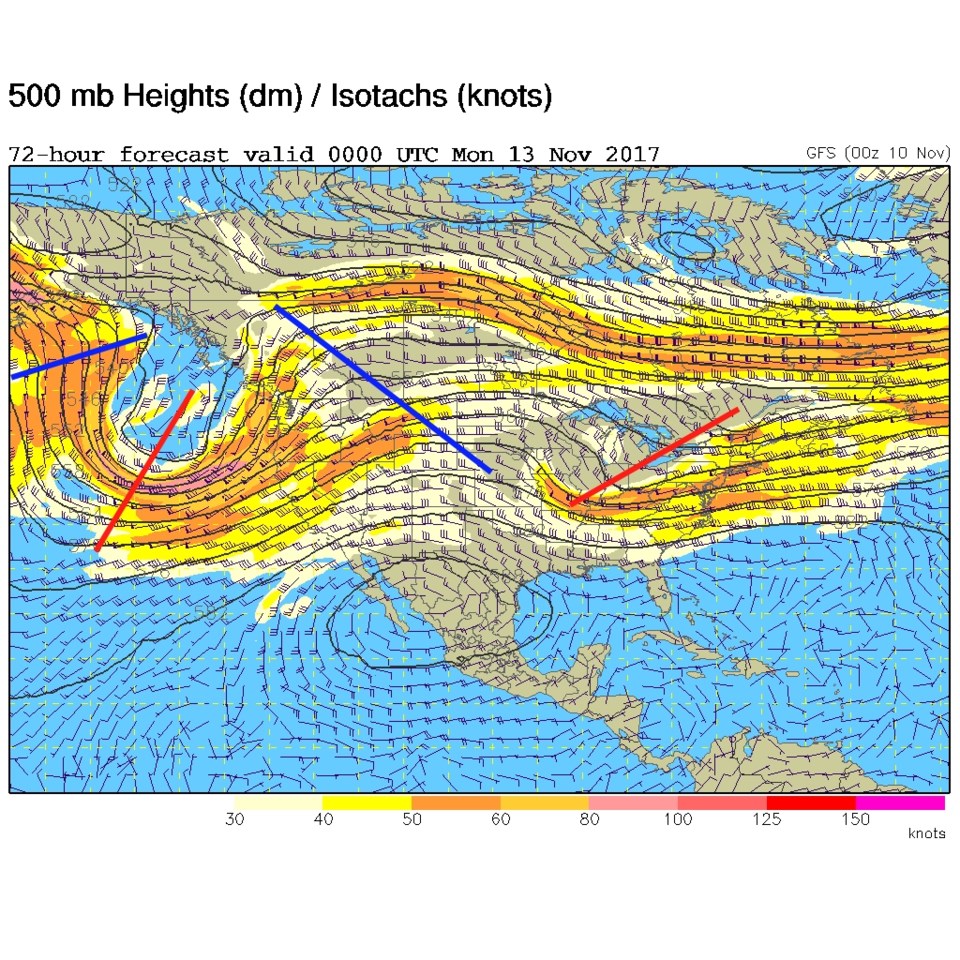
By Sunday - we see some more warbling in the flow, but a ridge is basically sitting over Colorado - so quiet and moderate weather will just continue!

Figure 3: 500mb upper air analysis forecast map for Sunday PM.

Current Weather

Partly sunny

Partly sunny

60°F

UV Index
4 Moderate
Pressure
29.81 Steady
Visibility
4 miles
Dewpoint
20 °F
Humidity
22%
Wind
WNW 6 mph
Gust
12.4 mph
Wind Chill
60 °F

Hourly Forecast

Today
5 PM
58°F
Intermittent clouds
Today
6 PM
57°F
Intermittent clouds
Today
7 PM
56°F
Intermittent clouds
Today
8 PM
54°F
Intermittent clouds
Today
9 PM
51°F
Intermittent clouds
Today
10 PM
48°F
Intermittent clouds
Today
11 PM
45°F
Intermittent clouds
Tomorrow
12 AM
44°F
Intermittent clouds
Tomorrow
1 AM
43°F
Intermittent clouds
Tomorrow
2 AM
42°F
Cloudy
Tomorrow
3 AM
41°F
Cloudy
Tomorrow
4 AM
41°F
Cloudy

7 Day Forecast

Partly sunny

Wednesday

61 °F

Partly sunny and cool


Mostly cloudy

Wednesday Night

40 °F

Increasing clouds


Partly sunny w/ showers

Thursday

52 °F

Times of clouds and sun with a couple of showers; cooler


Partly cloudy

Thursday Night

42 °F

Partly cloudy


Mostly cloudy

Friday

61 °F

Mostly cloudy and warmer


Partly cloudy

Friday Night

39 °F

Partly cloudy


Mostly sunny

Saturday

66 °F

Mostly sunny


Mostly cloudy w/ t-storms

Saturday Night

43 °F

Mostly cloudy with showers and thunderstorms late


Mostly cloudy

Sunday

72 °F

Mostly cloudy with a thunderstorm in spots in the afternoon


Intermittent clouds

Sunday Night

44 °F

A thunderstorm in the evening; otherwise, becoming clear


Sunrise and Sunset

Sunrise
5:51 AM
Sunset
8:03 PM

Based on AccuWeather data