Skip to content

The Next Storm/Next Snow Forecast Discussion from the Cherrywood Observatory – November 3, 2017

This content was originally published by the Longmont Observer and is licensed under a Creative Commons license.

Forecast Discussion:

Figure 1 shows the front that pressed into Colorado on Thursday. That put low clouds and a few periods of mist in place for most of Thursday. Figure 2 shows that the wind speeds at the surface had dropped to much lower levels than the day before.

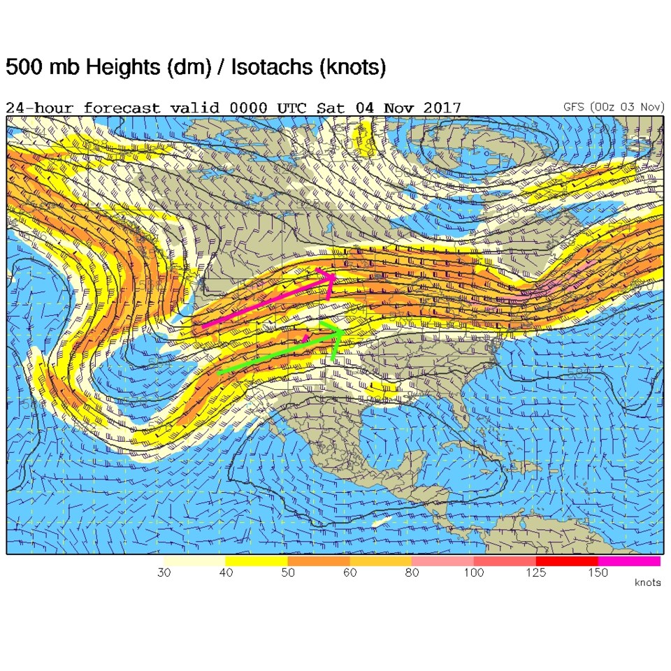
Still, the jet stream is nearby. The southern branch of the jet is overhead and the northern branch is a state further north (Figure 3). We expect the surface front to get pushed out and will see a return of strong surface westerlies that dump snow on the western slopes and create down slope winds and heating into Saturday.
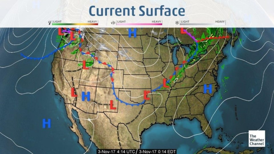
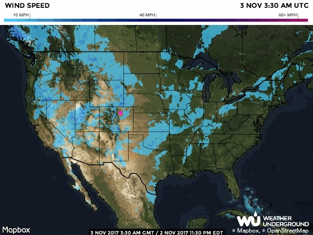
Figure 1: Surface analysis map from weather.com from Thursday PM.

Figure 2: Current surface wind speeds from Thursday PM.

Figure 3: The 500mb upper air forecast map for Friday PM. Tropical jet stream in light green, polar jet stream in pink.

The longer range forecast:

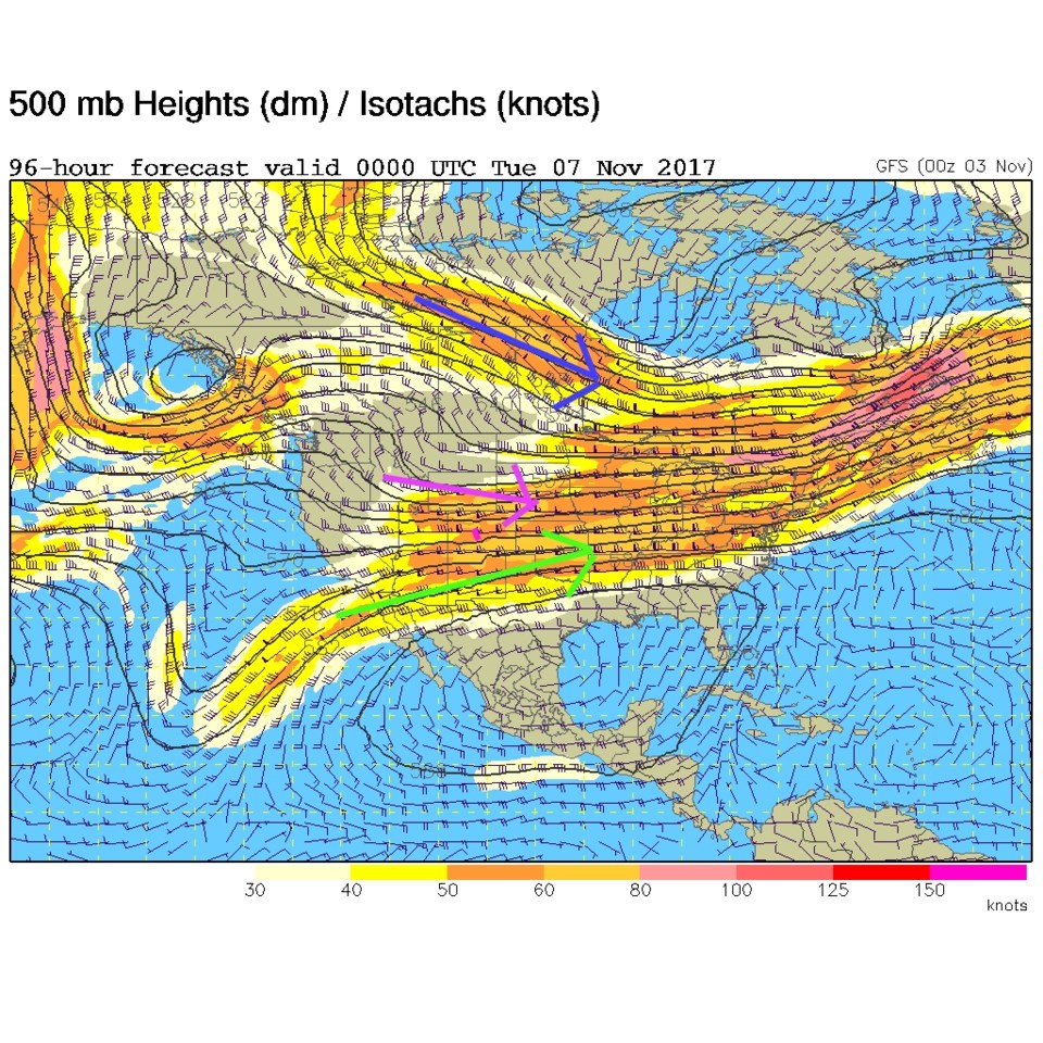
The weather5280.com GFS graph (Figure 4) shows the weekend warmth and the dropping of temperatures into early next week.  Some models give us morning and evening snow chances on Tuesday, but this run of the GFS does not. Temperatures only approach freezing. Maybe local cooling in heavier precipitation at the end of the Tuesday rain chances will turn to snow. Figure 5 is the upper air map again for Monday PM and the jet streams have moved south... but there isn't a big trough rolling through.  Other models have both lesser impacts and a more extended Sunday PM to Tuesday PM chance of rain.  We'll have to wait until we get a bit closer to know for sure.  Enjoy the warmth in the meantime, but tie down your lawn furniture and trash cans again.
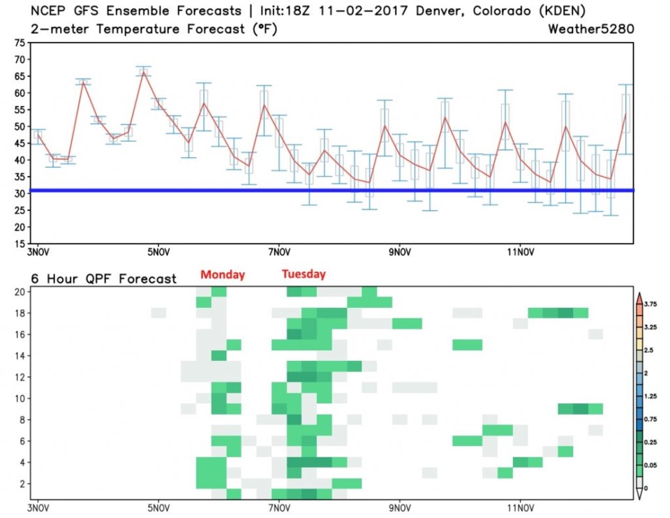
Figure 4: The 10 day temperature forecast graph and ensemble precipitation map from weather5280.com. Thick blue line is freezing temperatures.

Figure 5: The 500mb upper air forecast map for Monday PM. Tropical jet stream in light green, polar jet stream in pink, arctic jet in dark blue.

Current Weather

Clear

Clear

59°F

UV Index
0 Low
Pressure
29.35 Falling
Visibility
8 miles
Dewpoint
33 °F
Humidity
37%
Wind
S 5.6 mph
Gust
12.8 mph
Wind Chill
59 °F

Hourly Forecast

Today
4 AM
52°F
Showers
Today
5 AM
50°F
Cloudy
Today
6 AM
49°F
Cloudy
Today
7 AM
47°F
Cloudy
Today
8 AM
49°F
Cloudy
Today
9 AM
51°F
Cloudy
Today
10 AM
53°F
Cloudy
Today
11 AM
54°F
Cloudy
Today
12 PM
55°F
Cloudy
Today
1 PM
55°F
Cloudy
Today
2 PM
55°F
Cloudy
Today
3 PM
55°F
Cloudy

7 Day Forecast

Intermittent clouds

Sunday

76 °F

Warmer with intervals of clouds and sunshine


Mostly cloudy w/ showers

Sunday Night

47 °F

Turning cloudy; windy late with a stray shower


Windy

Monday

55 °F

Winds gusting past 40 mph; cloudy and cooler


Windy

Monday Night

42 °F

Very windy this evening; partly cloudy


Partly sunny w/ showers

Tuesday

59 °F

A couple of showers in the morning; otherwise, windy and cool with times of clouds and sun


Partly cloudy

Tuesday Night

32 °F

Partly cloudy


Intermittent clouds

Wednesday

60 °F

Times of clouds and sun


Intermittent clouds

Wednesday Night

38 °F

Partly cloudy


Intermittent clouds

Thursday

56 °F

Cool with times of clouds and sun


Cloudy

Thursday Night

39 °F

Cloudy


Sunrise and Sunset

Sunrise
5:54 AM
Sunset
8:00 PM

Based on AccuWeather data