Skip to content

The Next Storm/Next Snow Forecast Discussion from the Cherrywood Observatory – November 5, 2017

This content was originally published by the Longmont Observer and is licensed under a Creative Commons license.

Forecast Discussion:

The giant up slope cloud that dumped rain on the higher foothills and snow on the western slopes and higher elevations all Saturday, dominated our western horizon all day.  Where the cloud evaporated, due to the start of its sinking motion (down slope), the warming of the air from precipitation formation, was added to by the sinking/compression of the air.  We had some gusty winds a times in Longmont. Temperatures rose to the mid 70's.

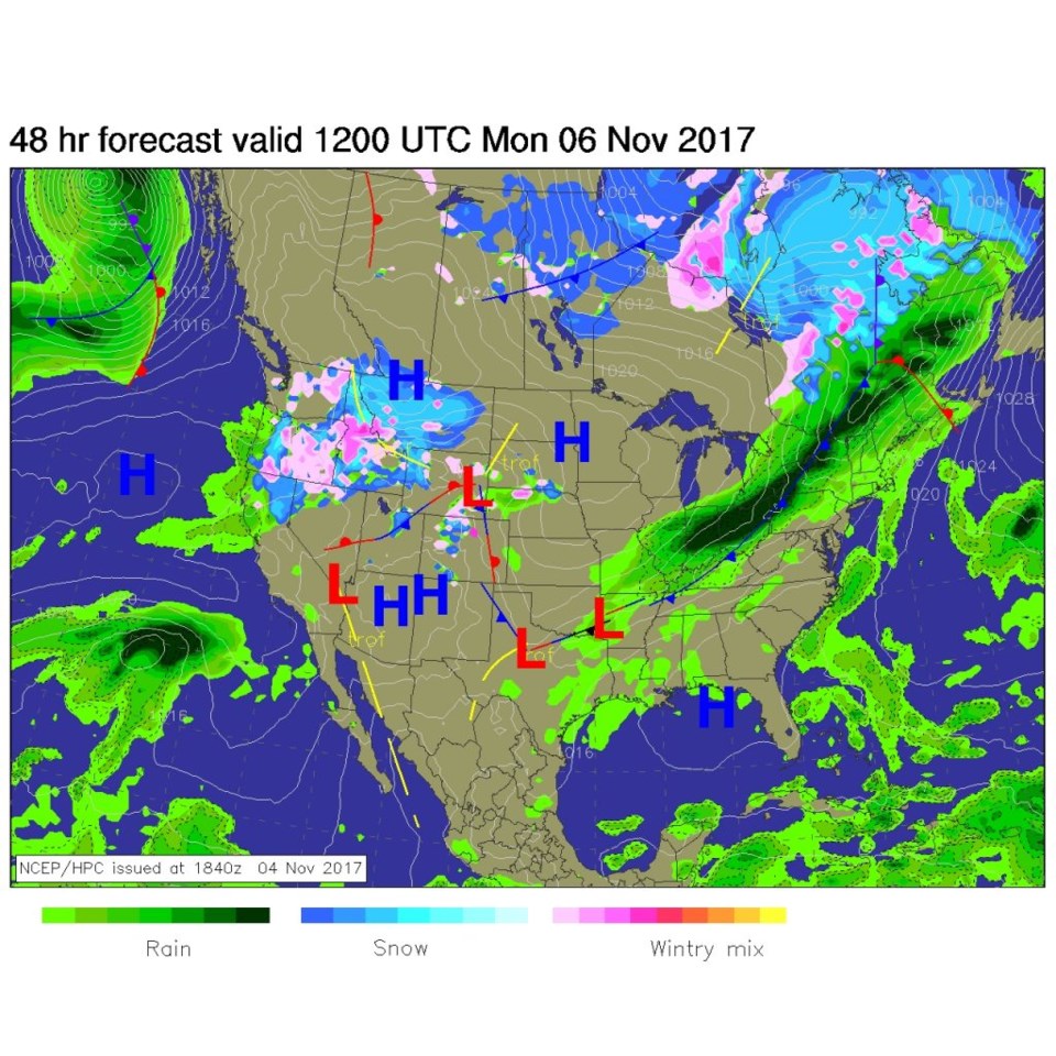
A cold front came in overnight Saturday into Sunday and will cut temperatures today (Sunday) by 10-15 degrees. Light rain will fall behind the front up near Wyoming. You can see the front down to Colorado Springs by midday Sunday in Figure 1.

Before the next front arrives Monday night, we may warm a bit on Monday with some more strong breezes.  The Monday front means business though (Figure 2)...

Figure 1: NCEP surface analysis forecast for Sunday midday.

Figure 2: NCEP surface analysis forecast for Monday morning.

The longer range forecast:

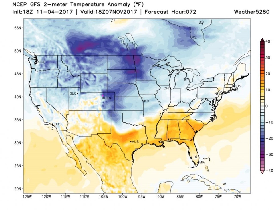
Once the Monday PM front pushes in, rain will form and change over to snow at lower elevations including Longmont. Temperatures Tuesday midday (Figure 3) will be 20 to 25 F below normal!

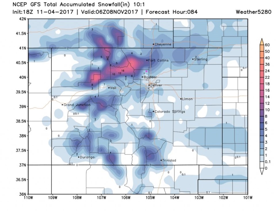
Figure 4 shows the GFS's total snowfall through Tuesday night around 2-3" for Longmont (this 'could' be a long period of light snow). Fort Collins gets more snow at around 4-6".

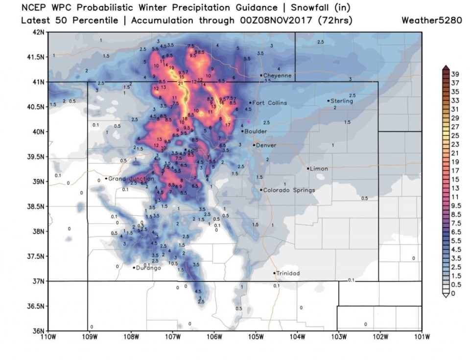
Figure 5 is the WPC model take on total snowfall for the same period and we are in the 3-4" area there.   This is shaping up to be a fairly notable 36 hours of cold and snow and/or very cold rain Monday PM to Tuesday PM and maybe into Wednesday AM.   We'll keep watching it as the time approaches.

Figure 3: GFS surface temperature anomaly (degrees F above or below normal) for Tuesday midday.

Figure 4: GFS total snofall accumulation between Sat PM and late night Tuesday.

Figure 5: WPC total snow accumulation between Sat PM and Tuesday late PM.

Current Weather

Mostly sunny

Mostly sunny

61°F

UV Index
1 Low
Pressure
29.91 Rising
Visibility
8 miles
Dewpoint
29 °F
Humidity
30%
Wind
ESE 3.8 mph
Gust
8 mph
Wind Chill
61 °F

Hourly Forecast

Today
7 PM
59°F
Intermittent clouds
Today
8 PM
57°F
Mostly cloudy
Today
9 PM
53°F
Mostly cloudy
Today
10 PM
51°F
Mostly cloudy
Today
11 PM
48°F
Mostly cloudy
Tomorrow
12 AM
45°F
Cloudy
Tomorrow
1 AM
43°F
Cloudy
Tomorrow
2 AM
43°F
Cloudy
Tomorrow
3 AM
42°F
Cloudy
Tomorrow
4 AM
40°F
Mostly cloudy
Tomorrow
5 AM
39°F
Intermittent clouds
Tomorrow
6 AM
37°F
Partly sunny

7 Day Forecast

Mostly cloudy

Thursday

65 °F

Becoming cloudy


Mostly cloudy

Thursday Night

35 °F

Mostly cloudy


Partly sunny

Friday

71 °F

Pleasant with partial sunshine


Partly cloudy

Friday Night

38 °F

Partly cloudy


Partly sunny

Saturday

66 °F

Partial sunshine


Mostly clear

Saturday Night

41 °F

Clear to partly cloudy


Mostly cloudy

Sunday

76 °F

Rather cloudy; breezy in the afternoon


Intermittent clouds

Sunday Night

46 °F

Partly cloudy


Cloudy

Monday

60 °F

Cloudy and cooler with a shower in spots; windy in the afternoon


Mostly cloudy

Monday Night

41 °F

Breezy in the evening; otherwise, mostly cloudy


Sunrise and Sunset

Sunrise
5:58 AM
Sunset
7:57 PM

Based on AccuWeather data