Skip to content

The Next Storm/Next Snow Forecast Discussion from the Cherrywood Observatory – November 9, 2017

This content was originally published by the Longmont Observer and is licensed under a Creative Commons license.

Forecast Discussion:

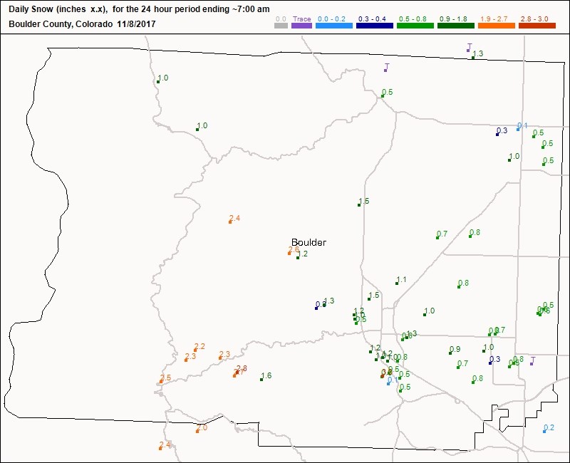
The melt is already underway. We climbed to the mid 40's in Longmont on Wednesday after waking up to about 1/2" more snow across the town (Figure 1). The total snow depth with compression and some melting (from below) was about 3" Wednesday morning.

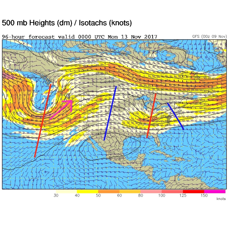
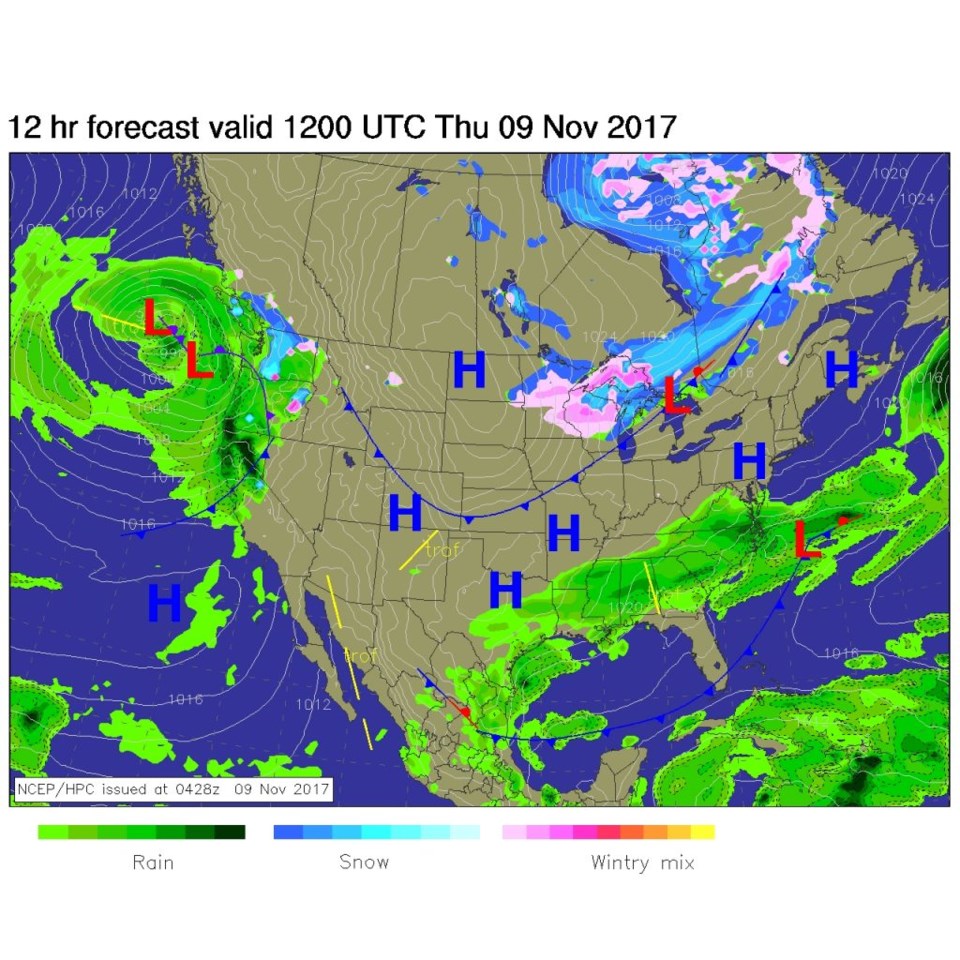
Today (Thursday) - a 'back door' cold front - or cold front coming from the northeast - will keep us only in the mid to upper 40's for a high today (Figure 2). We could be warmer except for the dry front with a ridge overhead today (Figure 3 blue line).  There is quite a jet stream flow heading towards and north of our state (pink arrow). But things are dry and warming.

Figure 1: The new snowfall reports reported 7am Wednesday.

Figure 2: Thursday morning forecast surface map from NCEP.

Figure 3: The 500mb upper air forecast map for Thursday PM.

The longer range forecast:

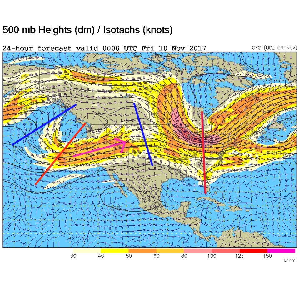
Things are still quiet and semi-warm in the 7-10 day forecast.  As an example, Figure 4 is the upper air pattern for Sunday night, and there is a ridge overhead again. The fast flowing jet even retreats to the west.  Enjoy the mildness!

Figure 4: The 500mb upper air forecast map for Sunday PM.

Current Weather

Cloudy

Cloudy

44°F

UV Index
2 Low
Pressure
30.22 Falling
Visibility
7 miles
Dewpoint
32 °F
Humidity
63%
Wind
SE 2.9 mph
Gust
5.6 mph
Wind Chill
43 °F

Hourly Forecast

Today
10 AM
48°F
Mostly sunny
Today
11 AM
51°F
Mostly sunny
Today
12 PM
54°F
Mostly sunny
Today
1 PM
58°F
Mostly sunny
Today
2 PM
61°F
Partly sunny
Today
3 PM
63°F
Partly sunny
Today
4 PM
65°F
Intermittent clouds
Today
5 PM
66°F
Intermittent clouds
Today
6 PM
65°F
Intermittent clouds
Today
7 PM
63°F
Intermittent clouds
Today
8 PM
60°F
Mostly clear
Today
9 PM
57°F
Mostly clear

7 Day Forecast

Partly sunny

Saturday

66 °F

Not as warm with partial sunshine


Mostly clear

Saturday Night

39 °F

Clear to partly cloudy


Mostly cloudy

Sunday

77 °F

Mostly cloudy and warmer; breezy in the afternoon


Mostly cloudy

Sunday Night

45 °F

Rather cloudy; breezy late


Windy

Monday

60 °F

Very windy; cloudy and cooler


Intermittent clouds

Monday Night

43 °F

Partly cloudy


Intermittent clouds

Tuesday

62 °F

Times of clouds and sun; windy in the afternoon


Partly cloudy

Tuesday Night

36 °F

Partly cloudy


Intermittent clouds

Wednesday

60 °F

Times of clouds and sun


Intermittent clouds

Wednesday Night

35 °F

Partly cloudy


Sunrise and Sunset

Sunrise
5:55 AM
Sunset
7:59 PM

Based on AccuWeather data