Skip to content

The Next Storm/Next Snow Forecast Discussion from the Cherrywood Observatory – October 11, 2017

This content was originally published by the Longmont Observer and is licensed under a Creative Commons license.

Forecast Discussion:

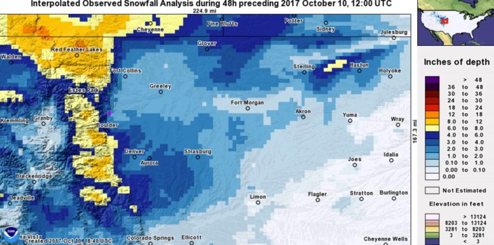
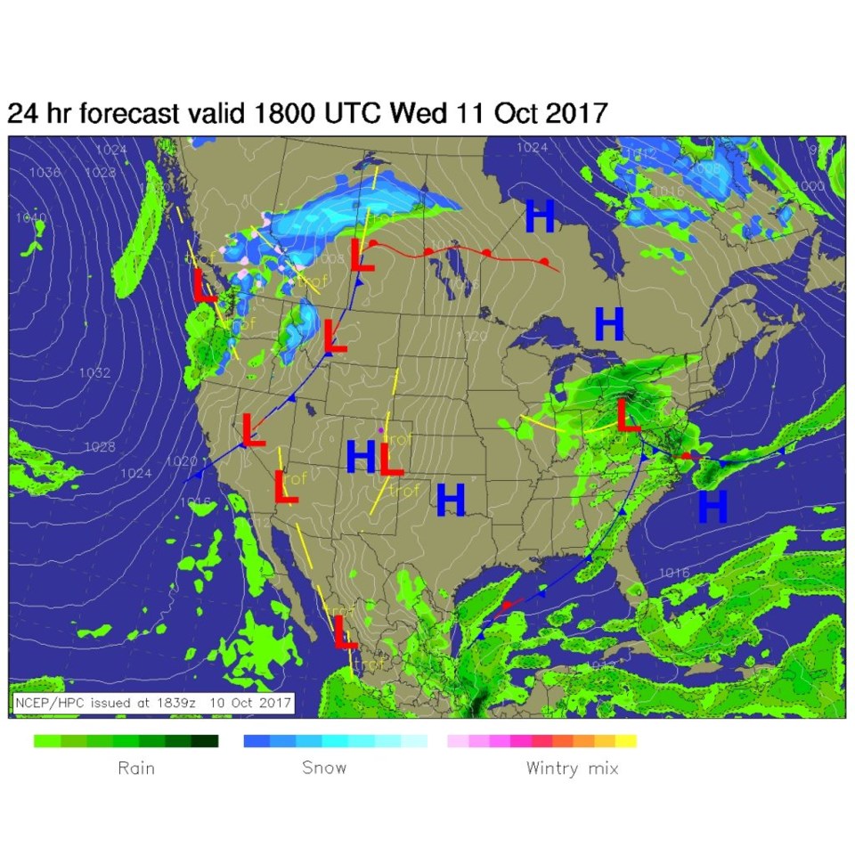
Things are really quiet and becoming mild again, so I won't take too much of your time today. The great folks at weather5280.com posted an interpolated graphic of actual snowfall from our most recent storm.  Impressive mountain snow amounts were seen north of I70 (Figure 1).  Figure 2 shows the surface map for midday today (Wednesday) and Colorado is sitting high and dry under high pressure.  Nothing notable but a gentle warm up.

Figure 1: Interpolated Observed Snowfall from yesterday's storm from the folks at weather5280.com Pink dot = Longmont.

Figure 2: NCEP surface analysis forecast for Wednesday midday. Pink dot = Longmont.

In the Longer Range:

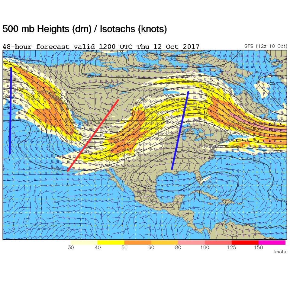
Figure 3 shows the jet stream pattern for Thursday morning and we are on the warm side of the jet with warm southwest winds sending us into the upper 70's.

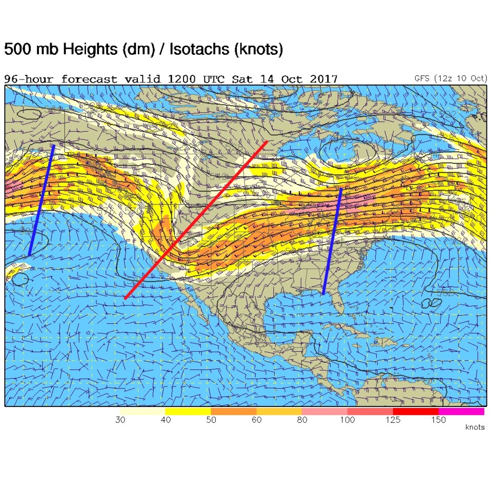
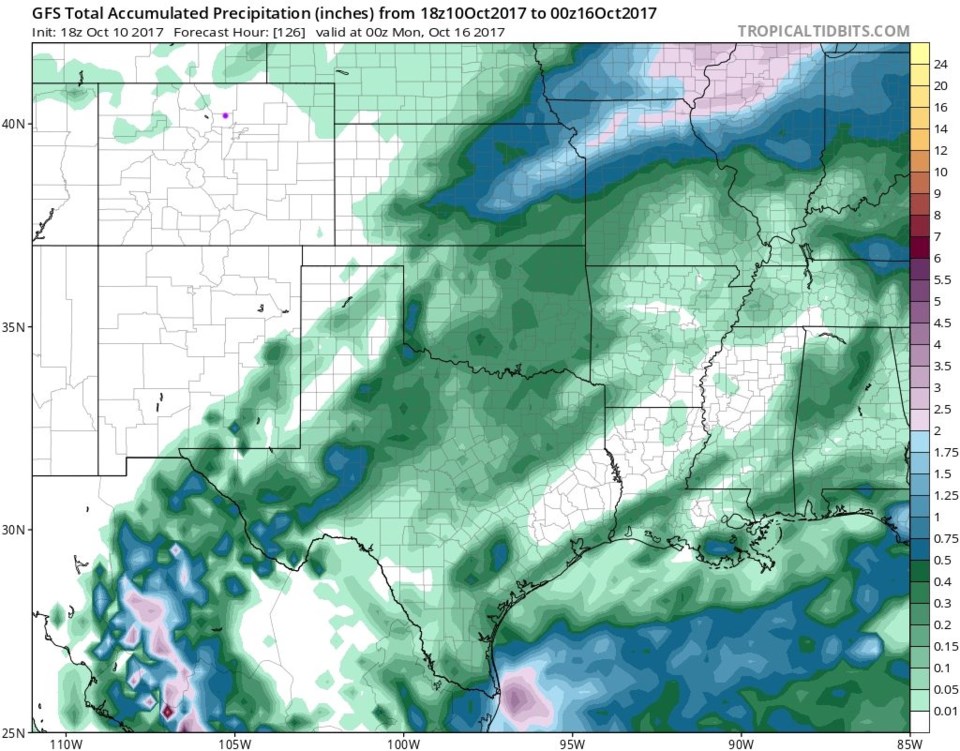
Our next storm, Figure 4, comes Saturday afternoon when an approaching trough puts a jet maximum over Colorado (higher speed winds in the high speed winds) that can kick off some afternoon and early evening showers. Figure 5, though, from the GFS, doesn't show any measurable rainfall in our part of the state- at all - at this time.

Figure 3: 500mb upper air forecast map from the GFS for Thursday morning. Troughs= red line, ridges = blue.

Figure 4: 500mb upper air forecast map from the GFS for Saturday morning. Troughs= red line, ridges = blue.

Figure 5: GFS accumulated precipitation Tue PM to Sun PM. Pink dot = Longmont.

Current Weather

Mostly clear

Mostly clear

54°F

UV Index
0 Low
Pressure
29.84 Falling
Visibility
9 miles
Dewpoint
34 °F
Humidity
47%
Wind
SSW 2.8 mph
Gust
6.7 mph
Wind Chill
54 °F

Hourly Forecast

Today
11 PM
53°F
Partly cloudy
Tomorrow
12 AM
51°F
Intermittent clouds
Tomorrow
1 AM
50°F
Intermittent clouds
Tomorrow
2 AM
48°F
Intermittent clouds
Tomorrow
3 AM
47°F
Intermittent clouds
Tomorrow
4 AM
46°F
Intermittent clouds
Tomorrow
5 AM
45°F
Intermittent clouds
Tomorrow
6 AM
44°F
Intermittent clouds
Tomorrow
7 AM
46°F
Intermittent clouds
Tomorrow
8 AM
50°F
Mostly sunny
Tomorrow
9 AM
55°F
Mostly sunny
Tomorrow
10 AM
60°F
Mostly sunny

7 Day Forecast

Mostly cloudy

Monday

67 °F

Turning cloudy


Intermittent clouds

Monday Night

44 °F

Partly cloudy


Mostly sunny

Tuesday

73 °F

Windy in the morning; mostly sunny


Intermittent clouds

Tuesday Night

43 °F

Clearing


Partly sunny w/ showers

Wednesday

65 °F

Periods of clouds and sun, becoming breezy with a passing shower in the afternoon


Mostly cloudy

Wednesday Night

39 °F

A thundershower in parts of the area in the evening; otherwise, mostly cloudy


Intermittent clouds

Thursday

59 °F

Windy in the morning; intervals of clouds and sun


Mostly clear

Thursday Night

32 °F

Mainly clear


Partly sunny

Friday

65 °F

Some sun


Partly cloudy

Friday Night

36 °F

Partly cloudy


Sunrise and Sunset

Sunrise
6:02 AM
Sunset
7:54 PM

Based on AccuWeather data