Skip to content

The Next Storm/Next Snow Forecast Discussion from the Cherrywood Observatory – October 12, 2017

This content was originally published by the Longmont Observer and is licensed under a Creative Commons license.

Forecast Discussion:

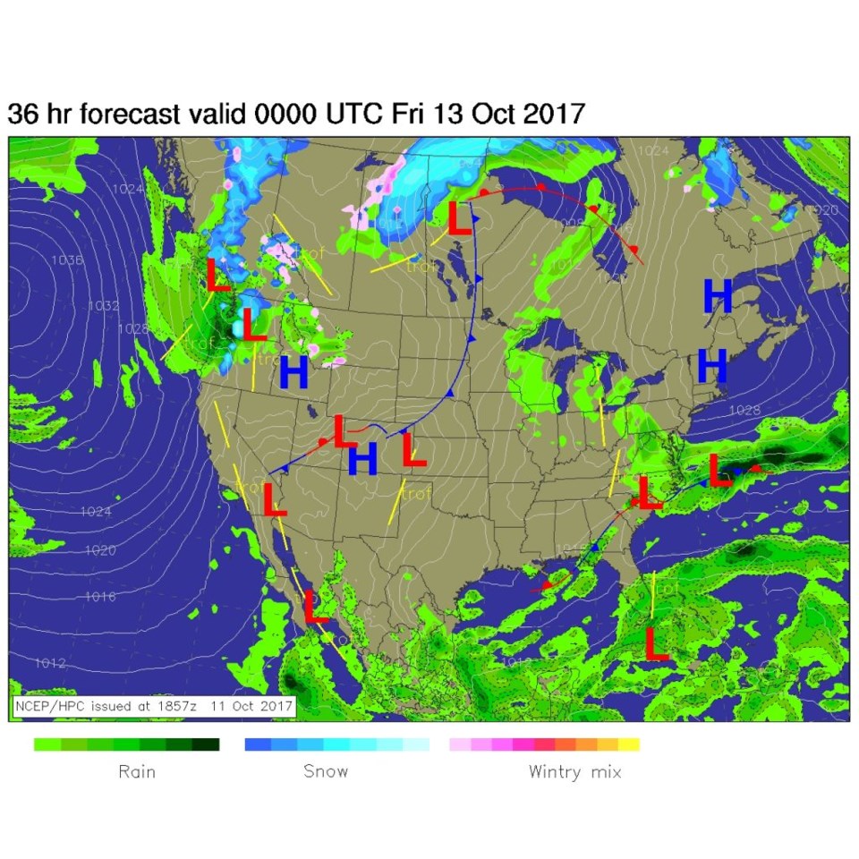
If Wednesday was nice weather to you, today will be even better with a warm afternoon in the mid-upper 70's for a high temperature.  And dry. Figure 1 is the surface analysis for Thursday afternoon showing a dry front poised to enter the state (that will cool us a bit on Friday) - the best heating is often seen right before the front arrives with southwest winds and some downslope compression of the air. Friday will be nice and dry, breezy and a bit cooler.

Figure 1: The NCEP Thursday afternoon surface analysis map.

In the Longer Range:

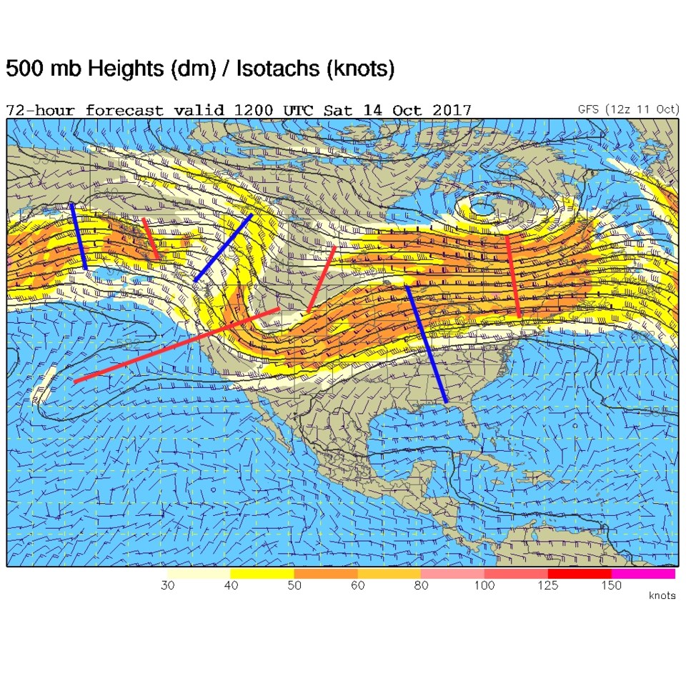
The jet stream buckles over Colorado on Saturday with a sort-of split trough stretching from the eastern Pacific up into Montana.  But there is really very little moisture associated with this. Small troughs (red lines) and ridges (blue lines) are marked in the colored lines across the continent (Figure 2).

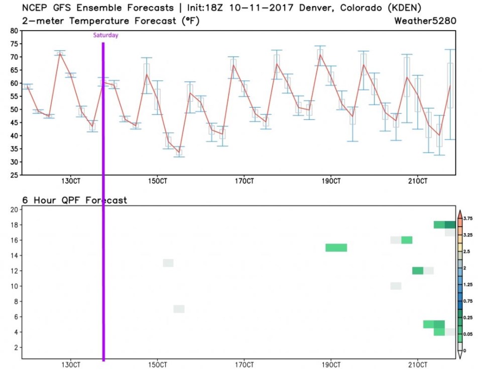
Again, from the weather5280.com folks, we have a new product for this column in Figure 3. You can see the rise and fall of daily temperatures for the next 10 days across the top graph. The bottom graph is a vertical stack of 20 GFS computer runs that don't show rainfall until way out around the 19th to 21st. Saturday (purple line) looks dry - but it may be windy.

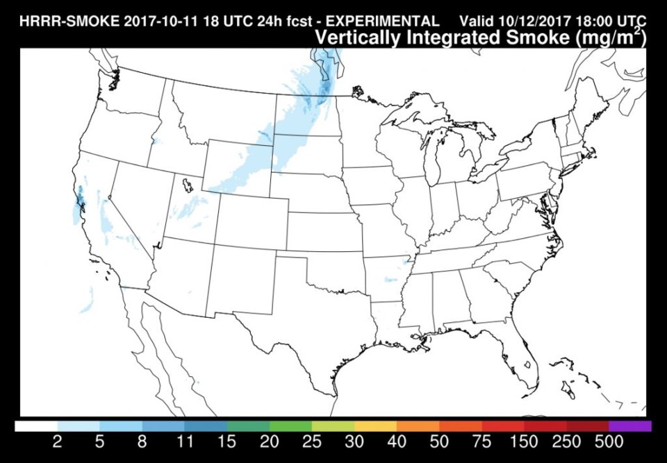
As a bonus, for Thursday (not the long term) - I've checked in on the HRRR smoke forecast to see if the California fires may darken our skies yet... and though it is forecasted to eventually make it into Colorado, Figure 4 shows it is not here by Thursday.

Figure 2: The GFS 500mb forecast map for Saturday midday.

Figure 3: The 10 day GFS Ensemble forecast (20 runs in the vertical on precipitation) from the GFS for Denver.

Figure 4: The HRRR smoke forecast for midday Thursday.

Current Weather

Cloudy

Cloudy

42°F

UV Index
1 Low
Pressure
30.23 Rising
Visibility
8 miles
Dewpoint
31 °F
Humidity
65%
Wind
SE 2.4 mph
Gust
5.2 mph
Wind Chill
42 °F

Hourly Forecast

Today
9 AM
45°F
Mostly sunny
Today
10 AM
49°F
Mostly sunny
Today
11 AM
53°F
Mostly sunny
Today
12 PM
55°F
Mostly sunny
Today
1 PM
59°F
Mostly sunny
Today
2 PM
61°F
Partly sunny
Today
3 PM
63°F
Partly sunny
Today
4 PM
64°F
Intermittent clouds
Today
5 PM
66°F
Intermittent clouds
Today
6 PM
64°F
Intermittent clouds
Today
7 PM
62°F
Intermittent clouds
Today
8 PM
59°F
Mostly clear

7 Day Forecast

Partly sunny

Saturday

66 °F

Not as warm with sun and some clouds


Mostly clear

Saturday Night

39 °F

Clear to partly cloudy


Mostly cloudy

Sunday

77 °F

Mostly cloudy and warmer; breezy in the afternoon


Mostly cloudy

Sunday Night

45 °F

Rather cloudy; breezy late


Windy

Monday

60 °F

Very windy; cloudy and cooler


Intermittent clouds

Monday Night

43 °F

Partly cloudy


Intermittent clouds

Tuesday

62 °F

Times of clouds and sun; windy in the afternoon


Partly cloudy

Tuesday Night

36 °F

Partly cloudy


Intermittent clouds

Wednesday

60 °F

Times of clouds and sun


Intermittent clouds

Wednesday Night

35 °F

Partly cloudy


Sunrise and Sunset

Sunrise
5:55 AM
Sunset
7:59 PM

Based on AccuWeather data