Skip to content

The Next Storm/Next Snow Forecast Discussion from the Cherrywood Observatory – October 18, 2017

This content was originally published by the Longmont Observer and is licensed under a Creative Commons license.

Forecast Discussion:

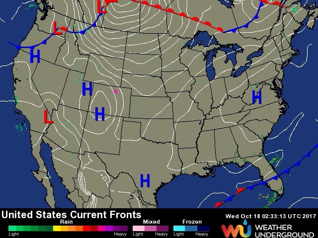
And the unnaturally beautiful weather goes on and on.  True confession time, I called for no more 80's this year, and we hit 80F in Longmont on Tuesday.  The record was 81F.  Today, the record is 79F and we might tie or break it.  High pressure dominates with the cold fronts and warm fronts all lingering way up in Canada and the Pacific Northwest (Figure 1).

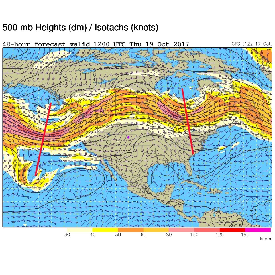
The frontal systems are always under the jet stream that is equally far north (Figure 2).  There is a trough in the Eastern US and off in the Pacific.  That Pacific trough (red line) may bring a bit of rainfall relief to the fires in California in a few days.

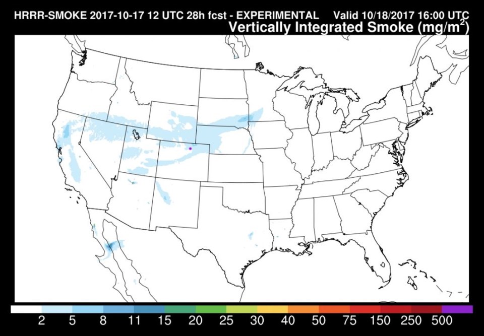
Speaking of fires, we might see a return of some smoke today as the HRRR model is forecasting a bit of a plume making it across northern Colorado and eastward in Figure 3.

Figure 1: Surface analysis from Tuesday PM from the weatherunderground.

Figure 2: 500mb upper air analysis map for late Wednesday night early Thursday (Longmont is the pink dot, as always).

Figure 3: The HRRR model smoke forecast for all levels. Longmont is the pink dot again.

In the longer range forecast:

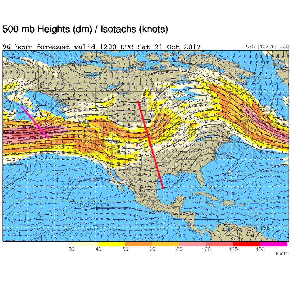
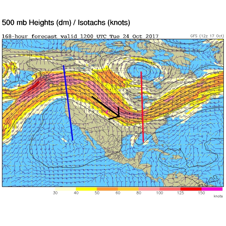
There will be a weak cold front to cool us down later on Friday then a bigger cool down as the trough (Figure 4) passes over Colorado Saturday.  The mountains may see some rain and high elevation snow, but rain chances are now very small for down here in town. Saturday will be cooler than normal, but the ridge begins to build right away to our west and we go back to normal on Sunday, then above normal again next week with strong northwest flow and a big ridge out west (Figure 5).  No winter weather is visible in the crystal ball.

I'll begin a Halloween weather watch soon, it is too early to guess right now.

Figure 4: 500mb upper air analysis map for late Friday night early Saturday (Longmont is the pink dot, as always).

Figure 5: 500mb upper air analysis map for late Monday night early Tuesday (Longmont is the pink dot, as always).

Current Weather

Sunny

Sunny

44°F

UV Index
2 Low
Pressure
29.73 Rising
Visibility
8 miles
Dewpoint
18 °F
Humidity
36%
Wind
SW 2.9 mph
Gust
7.6 mph
Wind Chill
43 °F

Hourly Forecast

Today
8 AM
42°F
Partly sunny
Today
9 AM
47°F
Intermittent clouds
Today
10 AM
51°F
Intermittent clouds
Today
11 AM
54°F
Intermittent clouds
Today
12 PM
56°F
Intermittent clouds
Today
1 PM
57°F
Intermittent clouds
Today
2 PM
58°F
Intermittent clouds
Today
3 PM
58°F
Intermittent clouds
Today
4 PM
58°F
Intermittent clouds
Today
5 PM
57°F
Intermittent clouds
Today
6 PM
56°F
Intermittent clouds
Today
7 PM
54°F
Intermittent clouds

7 Day Forecast

Intermittent clouds

Wednesday

58 °F

Breezy and cool with times of clouds and sun


Mostly cloudy w/ showers

Wednesday Night

39 °F

Increasing clouds with a shower in spots late


Partly sunny w/ showers

Thursday

54 °F

Times of clouds and sun with a couple of showers; cool


Partly cloudy

Thursday Night

43 °F

Partly cloudy


Mostly cloudy

Friday

60 °F

Mostly cloudy


Clear

Friday Night

42 °F

Clear


Mostly sunny

Saturday

68 °F

Mostly sunny


Mostly cloudy w/ t-storms

Saturday Night

43 °F

Mostly cloudy with showers and thunderstorms late


Mostly cloudy

Sunday

68 °F

Becoming cloudy with a thunderstorm in spots in the afternoon


Partly cloudy

Sunday Night

47 °F

A thunderstorm in the evening; otherwise, partly cloudy


Sunrise and Sunset

Sunrise
5:51 AM
Sunset
8:03 PM

Based on AccuWeather data