Skip to content

The Next Storm/Next Snow Forecast Discussion from the Cherrywood Observatory – October 23, 2017

This content was originally published by the Longmont Observer and is licensed under a Creative Commons license.

Forecast Discussion:

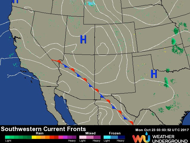
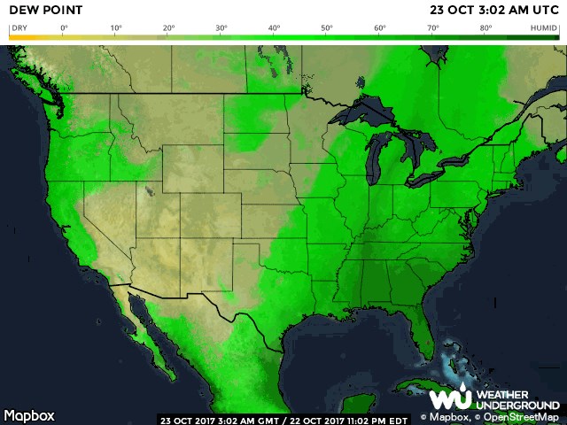
With northwest flow dominating the weather over Colorado - short lived cold fronts will come and go. (I covered the upper air situation in depth yesterday.) This morning, one of those cold fronts is moving in to cool us about 10 degrees. Sunday night, there wasn't anything significant on the map around Colorado (Figure 1) and almost no moisture (Figure 2). The dew point map in Figure 2 is a map of the actual amount of water in the air with green colors being pretty moist.  Colorado is high and dry.

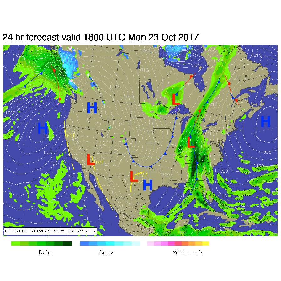
Figure 3 is the forecasted surface map Monday midday showing the front that has formed and raced down across Colorado. The high mountains, foothills, and wind prone areas will see periods of good wind today.  The I-25 corridor and Longmont will have breezy to windy periods as temperatures drop a bit.  Temperatures rebound on Tuesday and Wednesday with continued dry conditions.

Figure 1: Surface analysis from Sunday PM from weatherunderground.com

Figure 2: Surface Dew Point (atmospheric moisture content) from Sunday PM.

Figure 3: NCEP forecast surface analysis for Monday midday.

The longer range forecast:

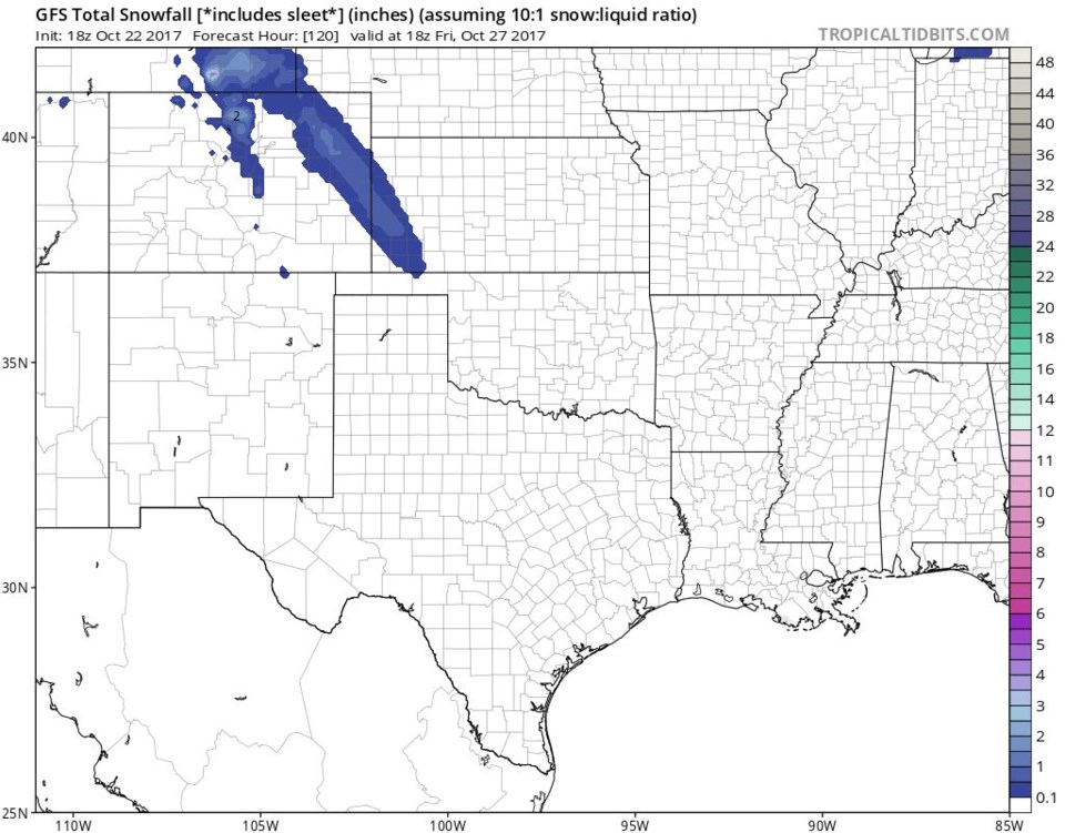
The next weather maker is our Thursday short wave and, what looks a this time, to be a one-two cold front punch Thursday morning and Thursday afternoon.  The afternoon front looks like it pushes enough moisture uphill (upslope flow) to create precipitation and brings in cold enough air (a high of 48F dropping in the afternoon) for a brief heavy shot of snow.  The GFS has a roughly 2" total as seen in Figure 4 right down I-25 and in the foothills (and another band out on the NE Plains of Colorado) falling in just a few hours before clearing out.  I'll get into the details of this storm more as the week goes on.  We warm up and dry out right after Thursday.

Figure 4: Snowfall total according to the GFS from Sundaay PM to Friday midday.

Current Weather

Cloudy

Cloudy

48°F

UV Index
2 Low
Pressure
30.18 Falling
Visibility
8 miles
Dewpoint
28 °F
Humidity
46%
Wind
SSE 2.9 mph
Gust
6.7 mph
Wind Chill
47 °F

Hourly Forecast

Today
11 AM
50°F
Partly sunny
Today
12 PM
54°F
Mostly sunny
Today
1 PM
58°F
Mostly sunny
Today
2 PM
61°F
Partly sunny
Today
3 PM
63°F
Partly sunny
Today
4 PM
65°F
Intermittent clouds
Today
5 PM
66°F
Intermittent clouds
Today
6 PM
65°F
Intermittent clouds
Today
7 PM
63°F
Intermittent clouds
Today
8 PM
60°F
Mostly clear
Today
9 PM
57°F
Mostly clear
Today
10 PM
55°F
Mostly clear

7 Day Forecast

Intermittent clouds

Saturday

66 °F

Not as warm with intervals of clouds and sunshine


Mostly clear

Saturday Night

39 °F

Clear to partly cloudy


Mostly cloudy

Sunday

77 °F

Mostly cloudy and warmer; breezy in the afternoon


Mostly cloudy

Sunday Night

45 °F

Rather cloudy; breezy late


Windy

Monday

60 °F

Very windy; cloudy and cooler


Intermittent clouds

Monday Night

43 °F

Partly cloudy


Intermittent clouds

Tuesday

62 °F

Times of clouds and sun; windy in the afternoon


Partly cloudy

Tuesday Night

36 °F

Partly cloudy


Intermittent clouds

Wednesday

60 °F

Times of clouds and sun


Intermittent clouds

Wednesday Night

35 °F

Partly cloudy


Sunrise and Sunset

Sunrise
5:55 AM
Sunset
7:59 PM

Based on AccuWeather data