Skip to content

The Next Storm/Next Snow Forecast Discussion from the Cherrywood Observatory – October 25, 2017

This content was originally published by the Longmont Observer and is licensed under a Creative Commons license.

Forecast Discussion:

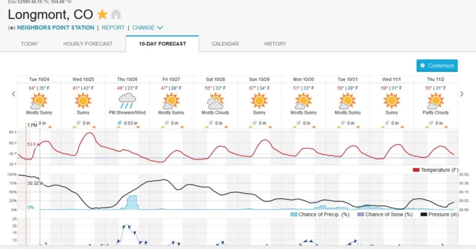
I'm on the road again Tuesday night, so I'm just going to focus, graphically, on the Thursday/Friday early AM snow chances.  Before that, we just might tie or exceed the DIA record of 80F for Wednesday.  It is always the hottest before the storm.  With some windy conditions and that dry heat, fire danger will be elevated across the Front Range today.

In the longer range:

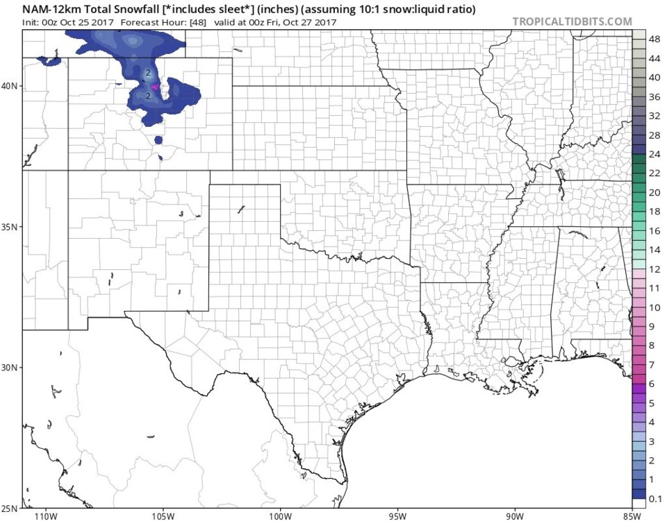
The National Weather Service is not excited about snow on Thursday - but mention a chance of rain and much colder temperatures and wind (get those long pants out and find your coat again). Figure 1 is the GFS total snowfall predication and puts Longmont at around 2 inches. The WFR model (Figure 2) puts us on the edge of snow and no snow (due to temperatures) but a Trace to an inch is possible. Figure 3 is the same with the NAM model and has us around 1 inch of snow.  The weatherunderground model doesn't drop the temperatures in Longmont low enough for snow until the precipitation chances drop to almost zero.  So no snow or just a dusting according to them.  Finally, the Weather5280 snow gamblers chart makes a Trace likely, but any more snow than that very unlikely.

More tomorrow!

Figure 1: The GFS total snowfall between midnight Wednesday and Thursday PM.

Figure 2: The WFR model total snowfall between midnight Wednesday and Thursday PM.

Figure 3: The NAM total snowfall between midnight Wednesday and Thursday PM.

Figure 4: The weatherunderground bestforecast model graphical 10 day forecast.

Current Weather

Partly sunny

Partly sunny

59°F

UV Index
8 Very High
Pressure
29.88 Falling
Visibility
8 miles
Dewpoint
42 °F
Humidity
53%
Wind
SSE 2.9 mph
Gust
7.6 mph
Wind Chill
59 °F

Hourly Forecast

Today
2 PM
59°F
Thunderstorms
Today
3 PM
60°F
Thunderstorms
Today
4 PM
61°F
Mostly cloudy
Today
5 PM
62°F
Mostly cloudy
Today
6 PM
60°F
Mostly cloudy
Today
7 PM
58°F
Intermittent clouds
Today
8 PM
55°F
Intermittent clouds
Today
9 PM
52°F
Intermittent clouds
Today
10 PM
49°F
Intermittent clouds
Today
11 PM
46°F
Intermittent clouds
Tomorrow
12 AM
45°F
Partly cloudy
Tomorrow
1 AM
43°F
Partly cloudy

7 Day Forecast

Partly sunny w/ t-storms

Sunday

62 °F

Warmer with times of clouds and sun; a thundershower in spots this afternoon


Intermittent clouds

Sunday Night

38 °F

Partly cloudy


Partly sunny

Monday

70 °F

Partly sunny, pleasant and warmer


Intermittent clouds

Monday Night

44 °F

Partly cloudy


Mostly sunny

Tuesday

73 °F

Mostly sunny and pleasant


Intermittent clouds

Tuesday Night

41 °F

Clearing


Intermittent clouds

Wednesday

65 °F

Times of sun and clouds


Intermittent clouds

Wednesday Night

39 °F

A thundershower in spots in the evening; otherwise, partly cloudy


Rain

Thursday

56 °F

Cooler with occasional rain and drizzle; breezy in the morning


Partly cloudy

Thursday Night

32 °F

Partly cloudy


Sunrise and Sunset

Sunrise
6:03 AM
Sunset
7:53 PM

Based on AccuWeather data