Skip to content

The Next Storm/Next Snow Forecast Discussion from the Cherrywood Observatory – October 29, 2017

This content was originally published by the Longmont Observer and is licensed under a Creative Commons license.

Forecast Discussion:

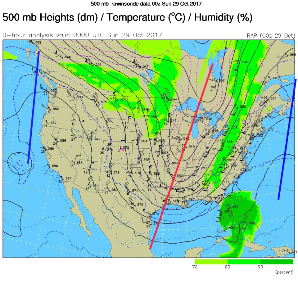
The forecast discussion from earlier Saturday (the 10/28 discussion) shows that we are only expecting a trace to maybe an inch of snow in places along I-25 Monday with maybe another dusting Tuesday AM.  The 500mb map from Saturday night shows the northerly flow over Colorado due to the big ridge out west (blue line) and deep trough out east (red line).

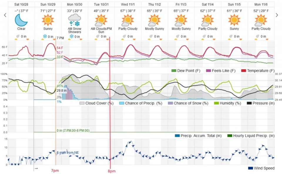
Figure 2 is the 10 day forecast graph. The orange line is the approximate time that the nice weather comes to an end and the northeast winds begin to blow. This occurs close to 7pm on Sunday with temperatures steadily dropping through to Tuesday morning. With shallow moisture, there is a chance that we won't see snow overnight Sunday into Monday, but - as the NWS points out - we might have freezing drizzle along I-25. The precipitation type will be marginal but hopefully more snow later on Monday morning (Figure 3).  Snow is easier to handle in a car than a glaze of ice.

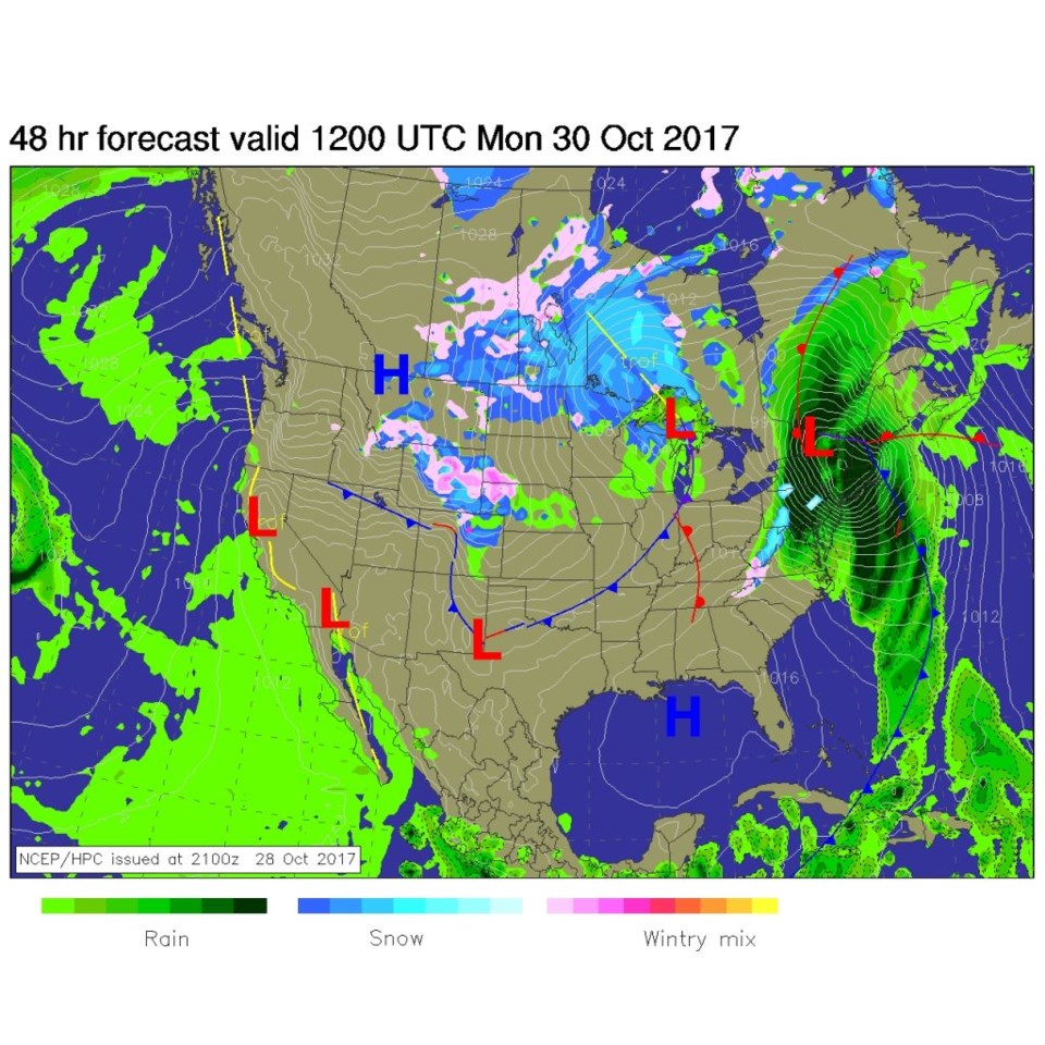
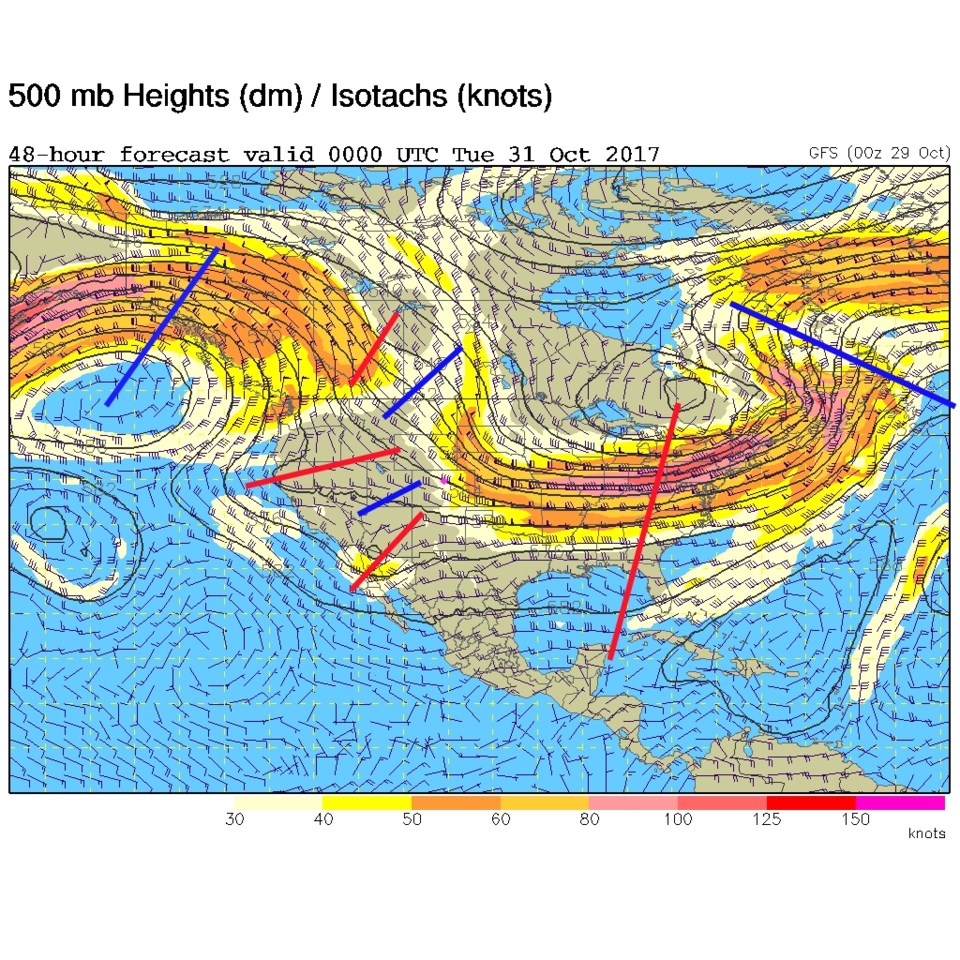
The overall pattern by Monday night (Figure 4) has a big ridge out west and big trough out east of us (in the Great Lakes) but there is a complex set of small short-wave troughs and ridges that will move over Longmont and Colorado throughout Monday and Tuesday mornings.

Figure 1: 500mb upper air analysis from Saturday PM.

Figure 2: The wunderground.com 10 day forecast graph. Orange line is the beginning of the next winter storm. The Red line is 8pm Halloween night.

Figure 3: The NCEP surface analysis forecast for Monday early morning.

Figure 4: The 500mb upper air analysis forecast from the GFS for Monday PM.

In the longer range forecast:

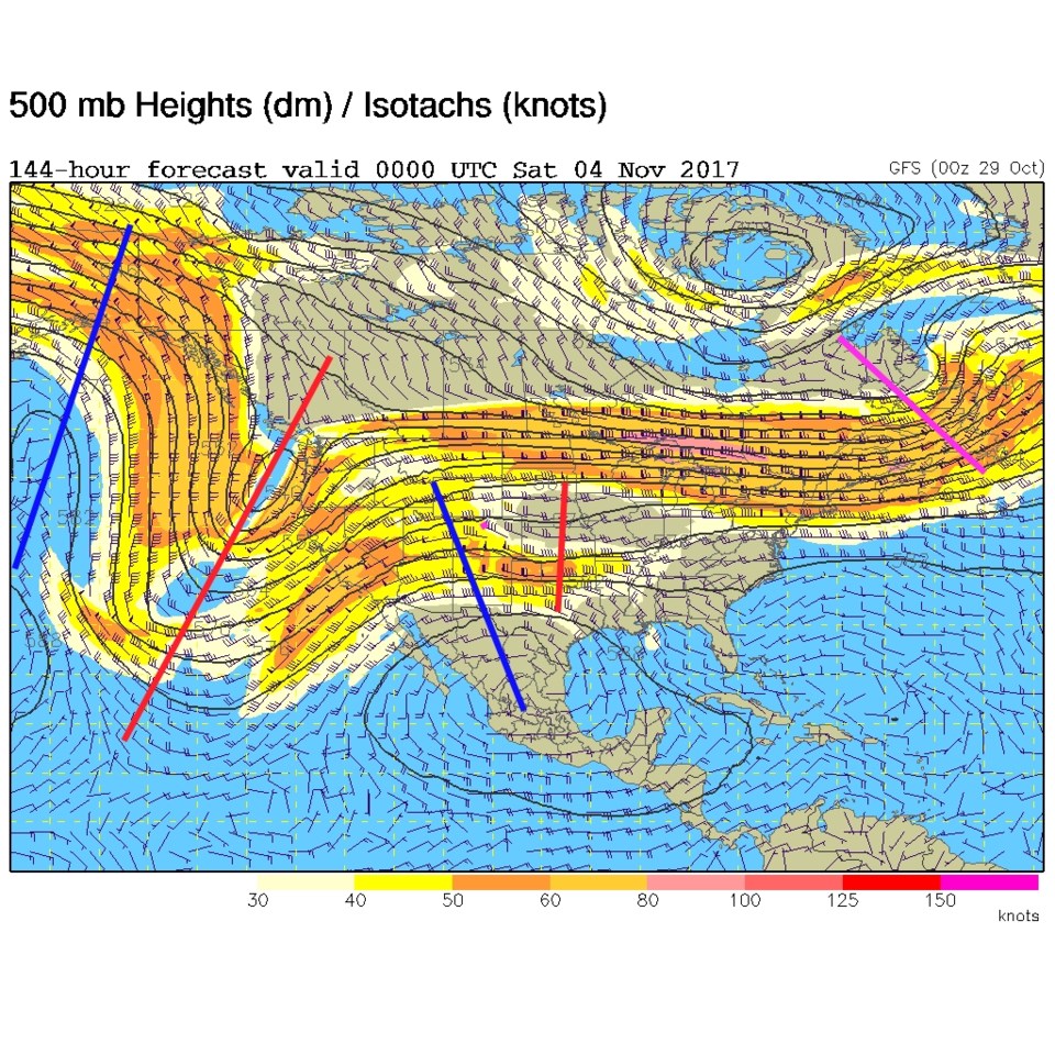
Figure 5 shows that the jet stream is somewhat further south that it has been, so temperatures don't approach record highs this week.  We do have a ridge in the flow over Colorado Friday night explaining the nice highs of ~65F and lows above freezing later in the week.

Figure 2 does hint at a brief window of clear skies during the trick-or-treat hours where my telescope will be useful showing the Moon and some deep sky objects on Halloween night at the corner of Cherrywood Dr. and Cherrywood Way in NE Longmont.  Come on by and say hi to Buzz Lightyear.

Figure 5: The 500mb upper air analysis forecast from the GFS for Friday PM.

Current Weather

Mostly clear

Mostly clear

50°F

UV Index
0 Low
Pressure
29.59 Steady
Visibility
8 miles
Dewpoint
21 °F
Humidity
32%
Wind
WNW 5.6 mph
Gust
14.3 mph
Wind Chill
48 °F

Hourly Forecast

Today
1 AM
47°F
Intermittent clouds
Today
2 AM
46°F
Mostly clear
Today
3 AM
44°F
Mostly clear
Today
4 AM
43°F
Partly cloudy
Today
5 AM
43°F
Intermittent clouds
Today
6 AM
42°F
Mostly cloudy
Today
7 AM
44°F
Cloudy
Today
8 AM
48°F
Mostly cloudy w/ showers
Today
9 AM
52°F
Intermittent clouds
Today
10 AM
54°F
Intermittent clouds
Today
11 AM
57°F
Intermittent clouds
Today
12 PM
59°F
Intermittent clouds

7 Day Forecast

Showers

Monday

57 °F

A few showers this morning; otherwise, mostly cloudy, breezy and cooler


Partly cloudy w/ showers

Monday Night

42 °F

A couple of brief showers late this evening; partly cloudy and breezy


Partly sunny w/ showers

Tuesday

60 °F

A couple of showers in the morning; otherwise, windy with times of clouds and sun


Partly cloudy

Tuesday Night

33 °F

Partly cloudy


Intermittent clouds

Wednesday

58 °F

Cool with times of clouds and sun


Mostly cloudy

Wednesday Night

35 °F

Increasing clouds


Partly sunny w/ showers

Thursday

56 °F

Times of clouds and sun with a couple of showers; cool


Cloudy

Thursday Night

43 °F

Cloudy


Mostly cloudy

Friday

62 °F

Mostly cloudy and warmer


Mostly clear

Friday Night

40 °F

Mainly clear


Sunrise and Sunset

Sunrise
5:53 AM
Sunset
8:01 PM

Based on AccuWeather data