This content was originally published by the Longmont Observer and is licensed under a Creative Commons license.
Forecast Discussion:
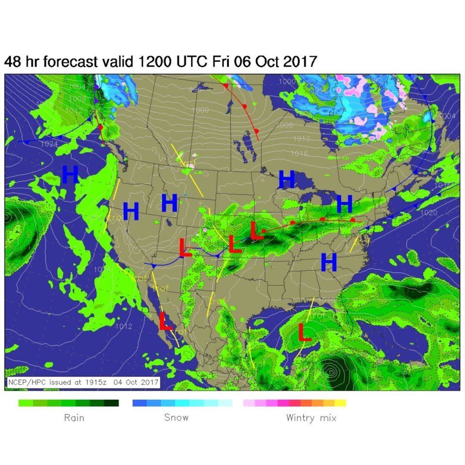
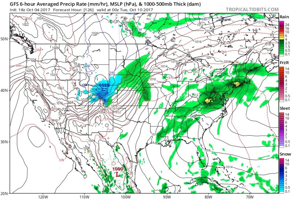
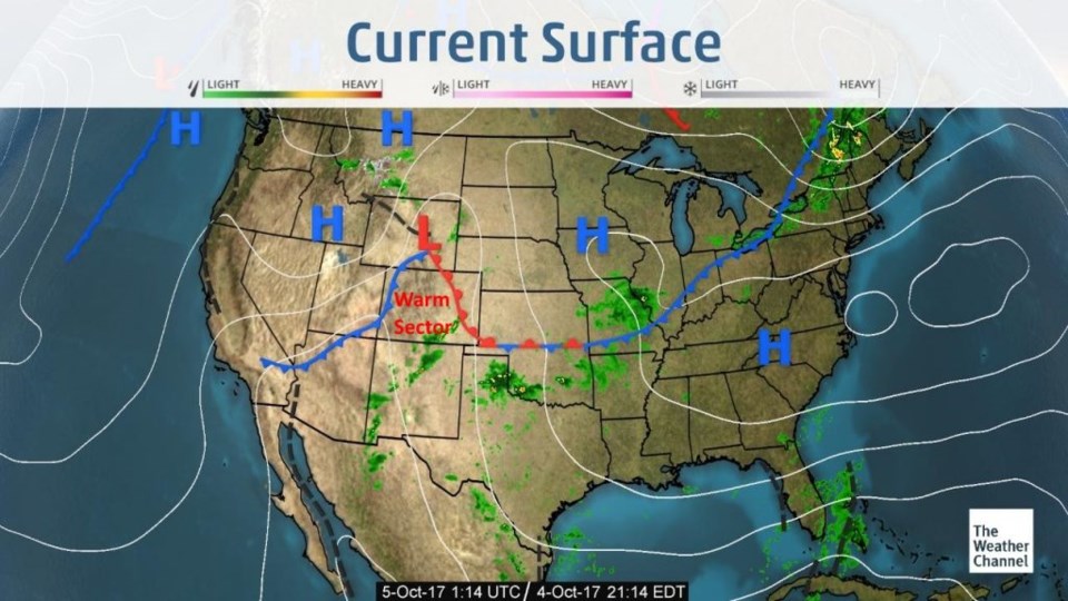
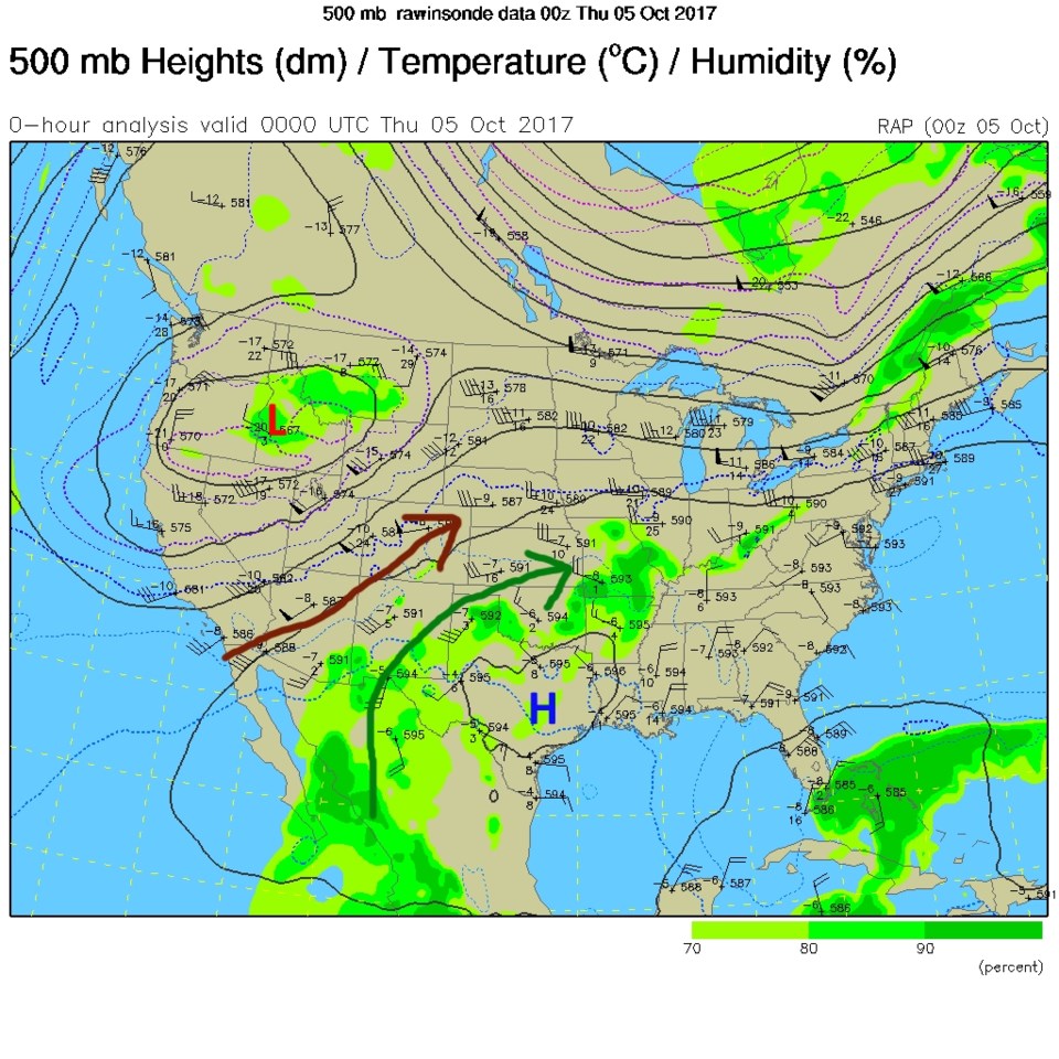
We had the clearest sky we've seen in a long time on Wednesday over Longmont. We are between fronts in the 'warm sector' as seen in Figure 1. The upper air pattern shows our strengthening upper level low over the northwest US and a high over Texas bringing in dry air over Colorado (brown arrow in Figure 2). The subtropical jet is bringing in moisture and rain to southern AZ, NM, TX and OK (green arrow in Figure 2) and just a bit into SE Colorado where fog will dominate Thursday morning.
In the longer range:
The trough moves over us Thursday PM to Friday morning and midday and really causes some up-slope flow and good amount of moisture. Models show 0.2-0.3 " of rain while other runs show 0.5-0.8" of water tonight to Friday afternoon when down-slope winds dry everything out (Figure 3).
Our sights then go to to the Monday-ish storm... will it be wet? Will it bring snow?
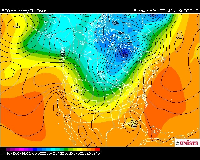
Figure 4 is the GFS sea level analysis and precipitation type showing a very healthy snow shield over almost all of Colorado on Monday night. Figure 5, though, is the European model (surface pressure lines are in black) that has a high pressure system pushing in and no tight gradient (read: front) over us. Rain is even unlikely to that model on Monday/Tuesday. So we'll have to see later.
Speaking of snow, the weather5280 site has just announced its first measurable snow contest for Fall/Winter 2017. You can go vote (and maybe win) at: https://www.weather5280.com/blog/2017/09/28/fifth-annual-first-snowfall-prediction-contest-starts-today/
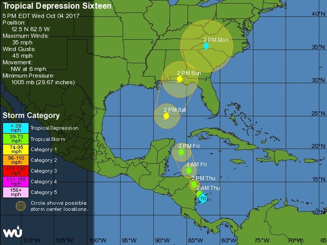
And don't forget the warm tropics... Figure 6 is the National Hurricane Center 5 day forecast for what is only a tropical depression (sixteen)- if it becomes a tropical storm or hurricane (they think Cat 1 only right now) - then it will be Nate. We'll have to watch that too, but you can see the maybe-Nate storm hitting the panhandle of Florida in both figures 4 and 5 below.