This content was originally published by the Longmont Observer and is licensed under a Creative Commons license.
Forecast Discussion:
I'm stuck in an area with poor data flow today, so I'll describe more than show.
First, the National Weather Service has issued a Winter Storm Watch for the I-25 corridor. I'll reproduce the text here (I don't modify NWS watches or warnings - but will add my opinion afterwards, if I feel I need to).
Heavy snow possible. Plan on possible hazardous travel
conditions, including the morning commute on Monday. Total
snow accumulations of 4 to 6 inches are possible.
* Where... Fort Collins, Boulder, Denver, and Castle Rock.
* When... from late Sunday night through Monday afternoon.
* Additional details... scattered power outages may occur due to
heavy wet snow accumulating on trees still bearing their
leaves.
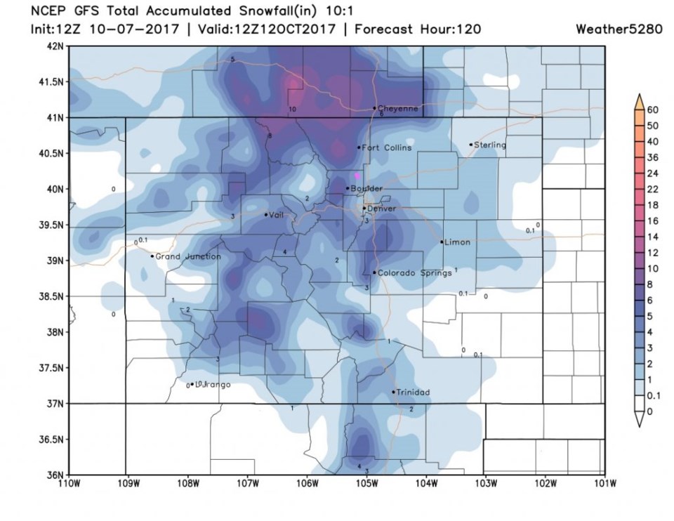
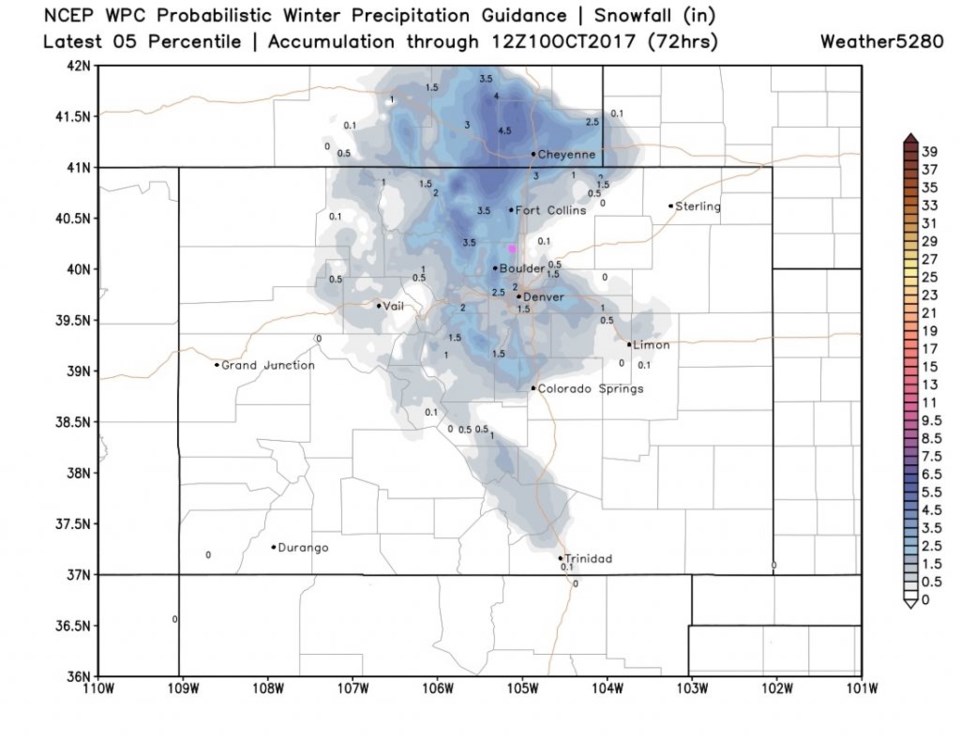
Figure 1 shows the snowfall potential according to the GFS, Longmont gets 3-4". Figure 2 shows the WPC guidance and it has Longmont (estimated differently statistically) has us at 2.5" or so (it is kinda hard to read even at the state scale). There will be a lot of melting, but cool surfaces will build up snow (hence the tree damage warning above). I'm still putting us in the 1-4" range. The mountains to our west will pick up 10" or more in places.
I'm sticking with the main cold front passage around 7pm Sunday with 45mph wind gusts. Rain chances start around 9pm and the change over to snow around midnight Sunday/Monday. It does look like the main part of the storm will be past late Monday morning, but some snow chances continue into the afternoon Monday.
Lows Monday night/Tuesday morning now appear to drop all the way to around 20F. You must prepare your pipes and yard for this kind of cold. This will probably be as significant or more significant than the snow itself.
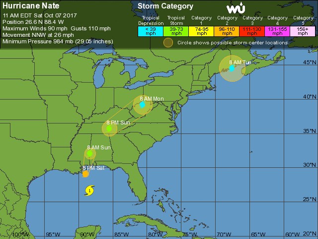
Figure 3 (Not in the Longer Range) is the Saturday afternoon NHC forecast for Hurricane Nate. It looks like it hit just east of New Orleans as a category 2 storm. The worse weather with this storm should be on the east side, so it could have been worse for New Orleans.
There is nothing in the longer range - there is plenty of excitement for all this weekend. Any my internet out here is slow!


