Skip to content

The Next Storm/Next Snow Forecast Discussion from the Cherrywood Observatory – September 2, 2017

This content was originally published by the Longmont Observer and is licensed under a Creative Commons license.

Forecast Discussion:

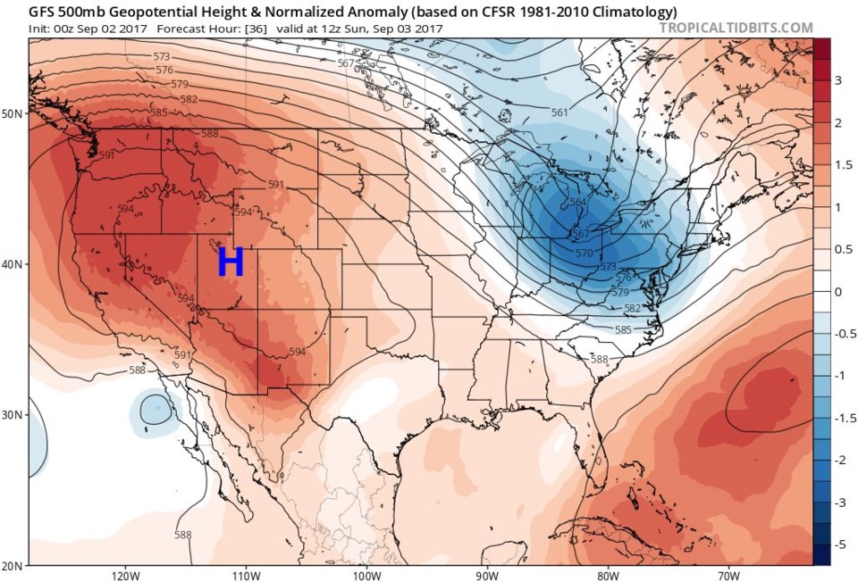
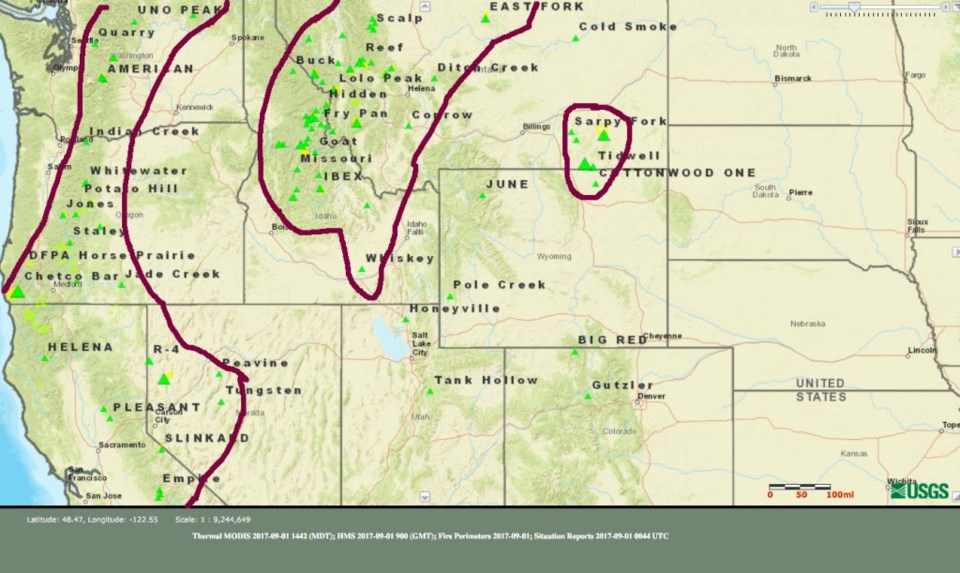
Things are quiet still, but with the ridge to the west of us and northwest flow in place, we have plenty of smoke in the air. Figure 1 shows the regions where the largest number of fires (named as well) are currently burning. Figure 2 shows the 500mb pattern and air flow responsible for sending this smoke our way.  Incredible (all time) record heat was observed in San Francisco today due to that giant powerful ridge.

Figure 1: Fires burning (including names) in the Western U.S. as of Friday PM.

Figure 2: 500 mb upper air map for Saturday early morning from Tropical Tidbits. "Smoke" vectors in grey.

A look into the future:

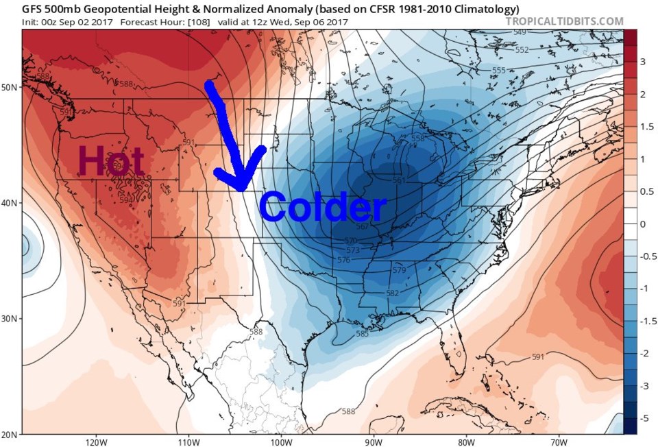
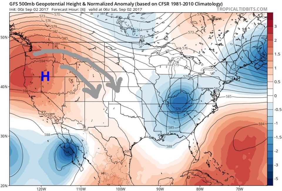
That ridge moves eastward over the holiday weekend (Figure 3) baking us some heat (not as much as San Francisco) but we still may break the Sunday record of 95F at DIA or the all time high record for September of 96F.  Stay tuned for that. Relief (for a few days) is in sight for Tuesday/Wednesday when the ridge pushes westward again and a big blob of cool air sends us, maybe, all the way down to 70F for a high on Tuesday (Figure 4). Still, the ridge pushes east AGAIN later in the week sending us back to nearly 90F.  Up and down weather indeed, but eventually it will get cold. September sees 1.3" of snow on average.  So it can happen!   (Thank you to tropicaltidbits.com for supplying the upper air GFS maps this time as NCAR's site was completely down this evening!).

Figure 3: 500 mb upper air map for Sumndau morning from Tropical Tidbits.

Figure 4: 500 mb upper air map for Wednesday morning from Tropical Tidbits. "Cold" air flow indicated in blue.

Current Weather

Cloudy

Cloudy

40°F

UV Index
0 Low
Pressure
30.17 Steady
Visibility
7 miles
Dewpoint
29 °F
Humidity
65%
Wind
SE 1.6 mph
Gust
3.2 mph
Wind Chill
40 °F

Hourly Forecast

Today
6 AM
37°F
Mostly cloudy
Today
7 AM
39°F
Partly sunny
Today
8 AM
42°F
Mostly sunny
Today
9 AM
45°F
Mostly sunny
Today
10 AM
49°F
Mostly sunny
Today
11 AM
53°F
Mostly sunny
Today
12 PM
55°F
Mostly sunny
Today
1 PM
59°F
Mostly sunny
Today
2 PM
61°F
Partly sunny
Today
3 PM
63°F
Partly sunny
Today
4 PM
64°F
Intermittent clouds
Today
5 PM
66°F
Intermittent clouds

7 Day Forecast

Partly sunny

Saturday

66 °F

Partly sunny and not as warm


Mostly clear

Saturday Night

40 °F

Clear to partly cloudy


Mostly cloudy

Sunday

76 °F

Mostly cloudy and warmer; breezy in the afternoon


Mostly cloudy

Sunday Night

47 °F

Rather cloudy; breezy late


Windy

Monday

60 °F

Very windy; cloudy and cooler


Intermittent clouds

Monday Night

43 °F

Partly cloudy


Intermittent clouds

Tuesday

62 °F

Windy with times of clouds and sun


Partly cloudy

Tuesday Night

36 °F

Partly cloudy


Mostly cloudy

Wednesday

60 °F

Turning cloudy


Intermittent clouds

Wednesday Night

35 °F

Partly cloudy


Sunrise and Sunset

Sunrise
5:55 AM
Sunset
7:59 PM

Based on AccuWeather data