This content was originally published by the Longmont Observer and is licensed under a Creative Commons license.
Forecast discussion:
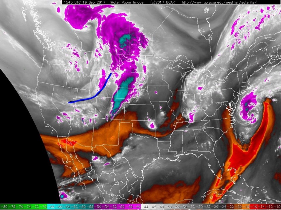
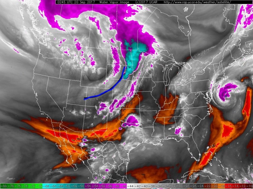
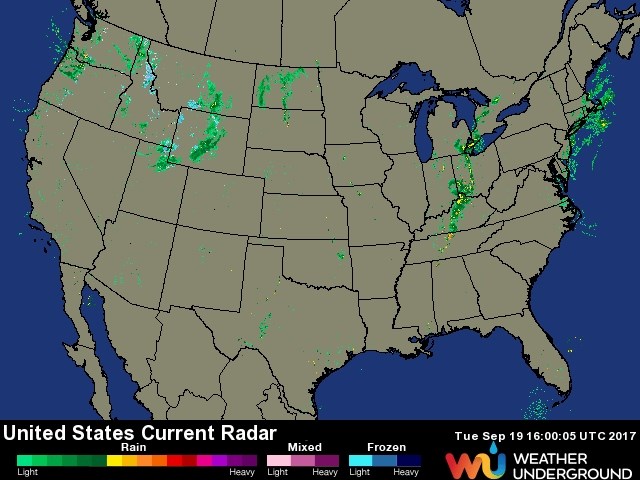
In this dry time, waiting for fall rains and the fall chill to arrive, I thought it would be fun to watch the pacific upper air moisture arrive ahead of our dry cold front. Figure 1 shows the surface frontal position with the lift and moisture far out ahead of the front (in blue) at about 10am Tuesday. Figure 2 shows the same image at about 9pm. That is a serious jump! Winds were pretty hefty in the late afternoon in Longmont as well, but I didn't see anything up in the 40mph or higher range right in Longmont. Figure 3 is the radar image for 10am Tuesday showing very little precipitation with the front, there was even less in the evening.
The Long Range forecast:
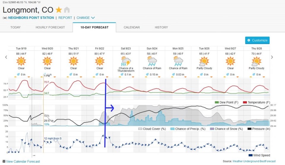
The real excitement is concerning the approaching big upper trough, cold fronts, and the promise of precipitation. Figure 4 shows the graphical forecast with the front still rolling in later Friday. Northeast winds and cooler air means upslope flow and chilly rain possibly all the way through Monday. Highs in the 50's Sunday and Monday will make everyone think Fall thoughts.
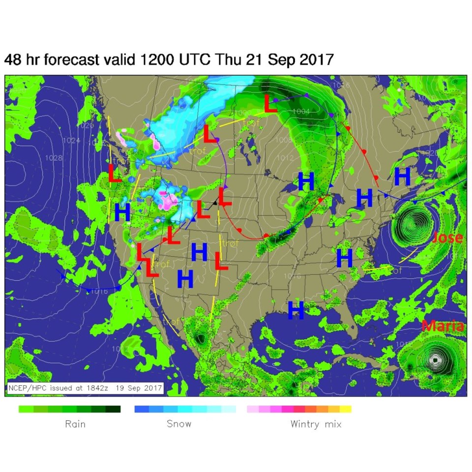
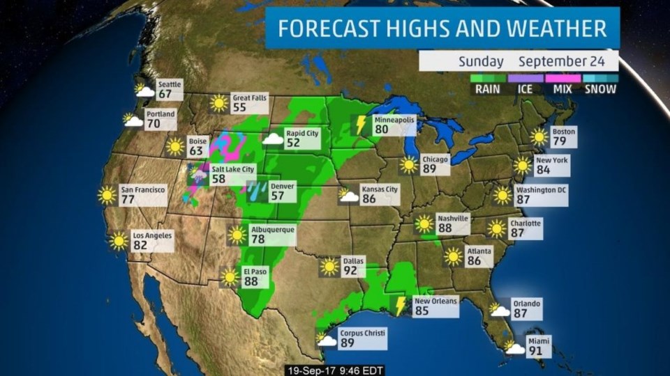
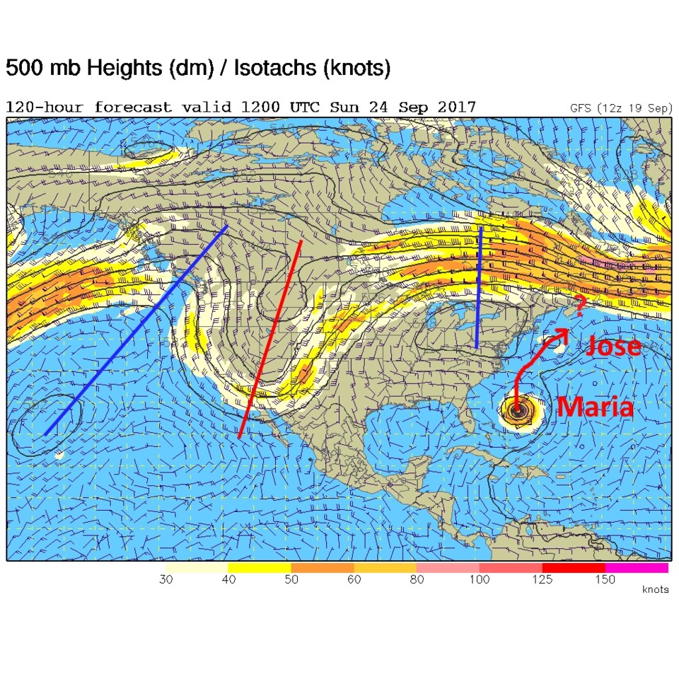
Figure 5 shows the real front on its way Thursday morning with snow and rain all over the West. Figure 6 shows the rainfall in Colorado Sunday (with thunderstorms out in Kansas to Texas). The upper air pattern for Sunday shows that big trough in Utah and Arizona in Figure 7. This also shows us the pattern that might save the East Coast from Maria. The remains of Jose should create a low pressure weakness to the northeast of Maria giving it a path to curve out squeezed between the big ridge on the East Coast and the Bermuda High to the east. We'll see.
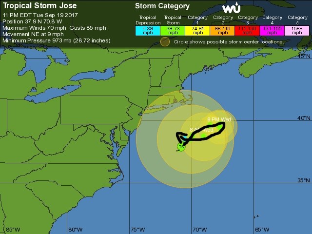
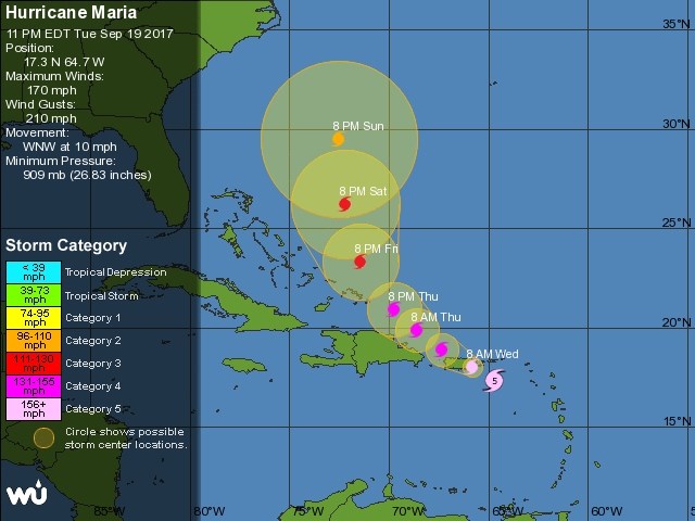
Speaking of the tropics, Figure 8 has the 5 day forecast for the remains of Jose - and it loops back to the west and (the ensemble models show) it heading back to the US - but in a very weakened state over the cold water. The 5 day forecast for Maria (a monster storm with 170mph sustained winds and gusts to 210mph headed right for Puerto Rico this evening) is shown in Figure 9. Man, what a tropical system for the Atlantic so far!