This content was originally published by the Longmont Observer and is licensed under a Creative Commons license.
Forecast Discussion:
We hit 90F yesterday in Longmont and the record was 87 set in 2015. Now I'm going to call it, that is our last day of 90F or higher temperatures for 2017. We had (if I counted correctly) 61 days at 90F or higher in Longmont. Of those, there were 3 days at 100F or higher, one of those was 102F).
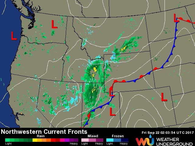
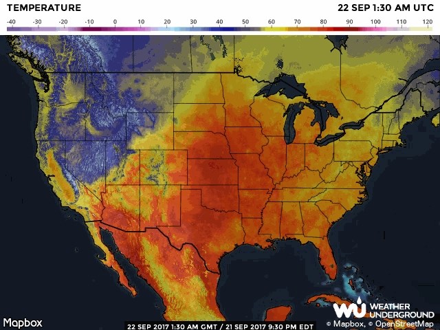
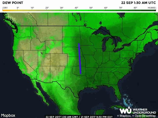
Figure 1 has the approaching wave of Fall clearly visible with rain showers, snow showers in the mountains and a big draping frontal boundary that will be on the move towards us shortly. Figure 2 shows the cool air behind the front while Figure 3 (with the last westward extent of deep moisture roughly marked in purple) showing that good moisture is headed westward, slowly.
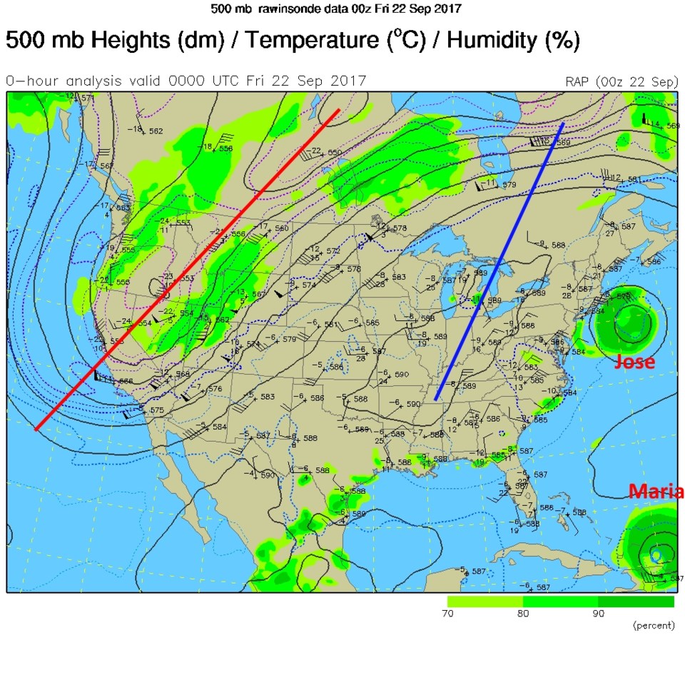
For fun, I've included the upper air map for Thursday evening as well (Figure 4)- that big trough (marked with the red line and "U" shaped dark isoheight lines) reflects the cold air nicely.
The wind shift to air coming from the north- should occur between 1pm and 3pm today with Fall officially beginning near 2pm. Right on time. It will take a while for moisture and subsequent cool fronts and upper air support to line up and give us rain- really good rain chances don't arrive until around 3pm Saturday (but they jump up on Friday evening for mountain locations). Models are indicating about 1/3rd inch of rain each of Saturday, Sunday, and Monday in Longmont. A few thunderstorms are possible, but severe weather should remain far to the southeast of the area.
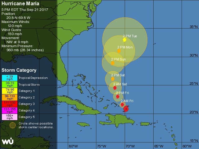
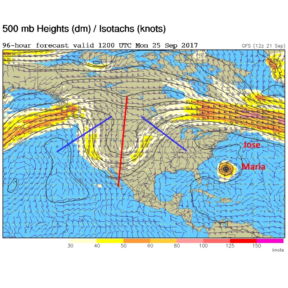
Figure 5 shows the upper air map again for Sunday night with the trough right on us and ridges symmetrically located on either side. Estes Park should see the rain turn to snow midnight Sunday into Monday pre-dawn hours. Maria is inching northward in the Atlantic.
Looking at the Longer Range:
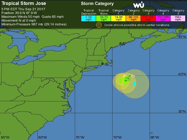
Since our local cold front and pattern change is sort of one entity, and it is here, I'll just touch on the tropics for the 5 day outlook. Today Jose still has a chance to go west into the U.S., but about 2/3rds of the models have it stay put or move out to sea now (Figure 6). Yesterday, all runs had the U.S. get hit. Maria, in Figure 7, is still a very powerful Category 3 storm with 120mph sustained winds and 150mph gusts. Over the next few days, the official forecast has it veering northward and northeastward. It should avoid the southeast US and probably the rest of our coastline. As of Thursday night, no model has Maria hit the U.S. Mainland (but a bit of Canada is possible in a couple of cases).