Skip to content

The Next Storm/Next Snow Forecast Discussion from the Cherrywood Observatory – September 28, 2017

This content was originally published by the Longmont Observer and is licensed under a Creative Commons license.

Forecast Discussion:

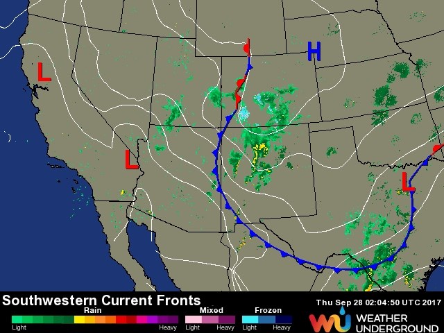
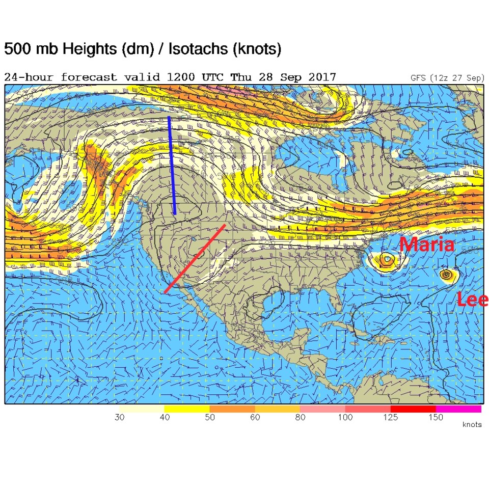
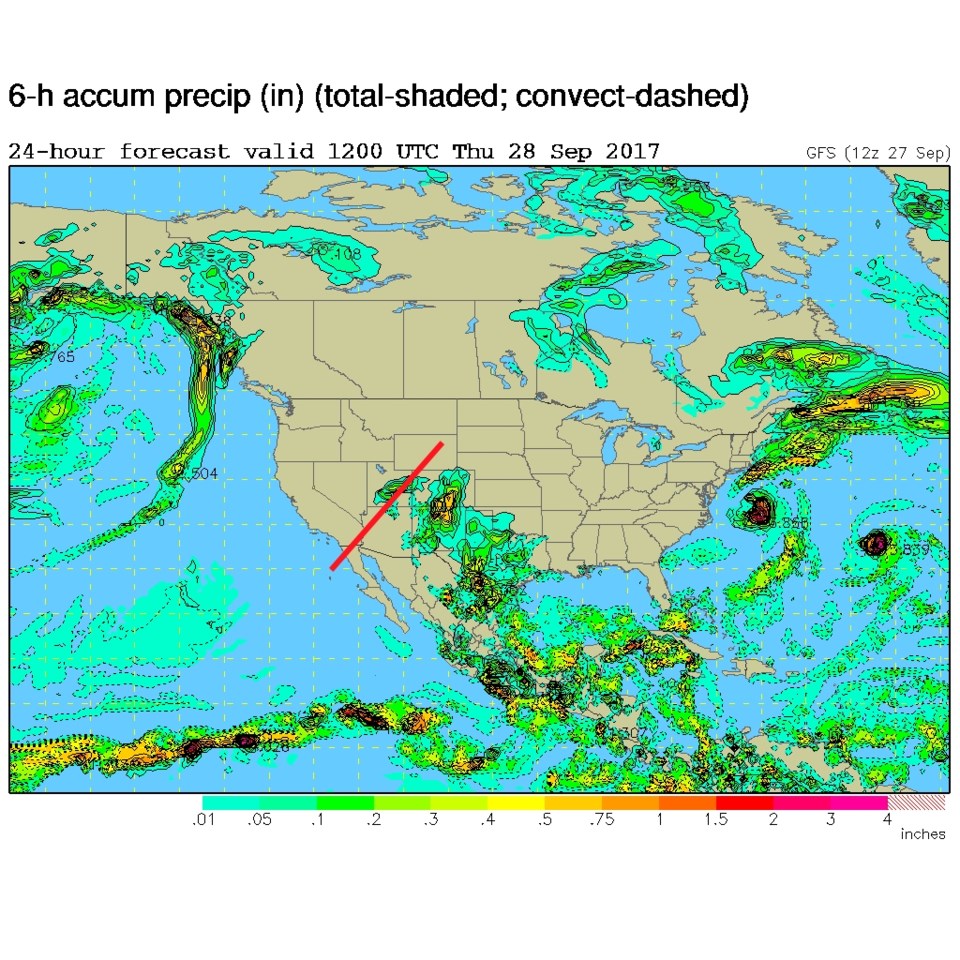
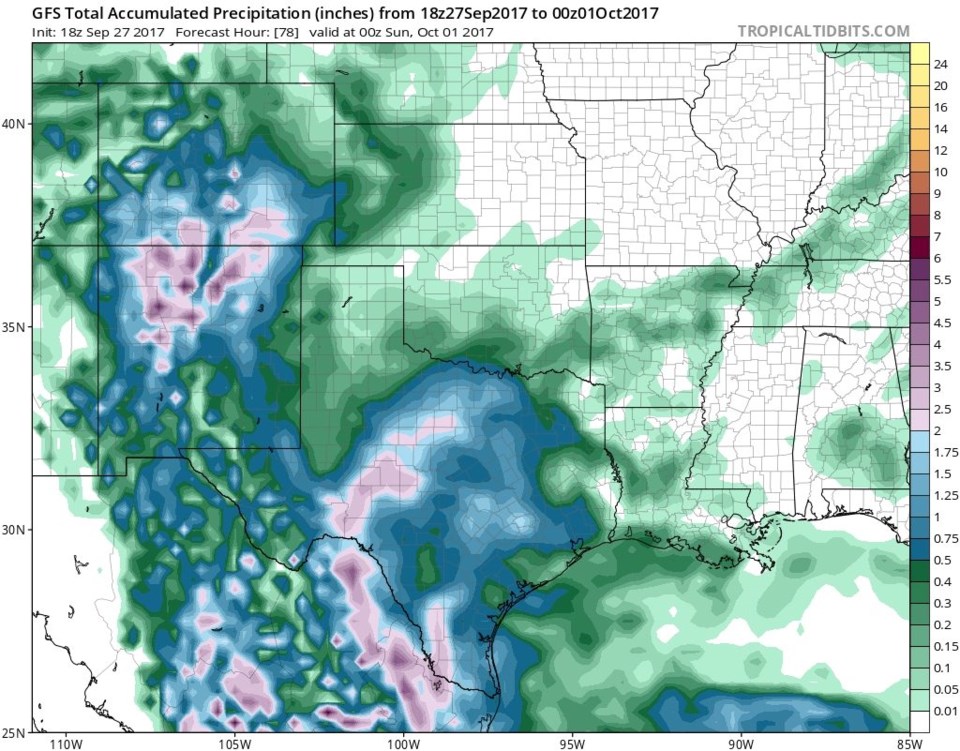
The clouds and moisture are in place, but the real lift will be focused over southern Colorado and New Mexico more than up here in Longmont. The front has pushed down to northern Mexico and New Mexico has has a bunch of rain falling (Figure 1). In Figure 2, the upper air map shows the big ridge building out west with the embedded trough under the ridge, but that trough is a bit further south than expected. Precipitation is just expected to make it to about the Wyoming border (Figure 3).  The GFS total precipitation through Saturday PM paints 2-3 inches in the southern reaches of our state, but now Longmont only seems to pick up about a tenth of an inch of rain or so.

Figure 1: Wednesday PM surface analysis and radar map

Figure 2: 500mb GFS forecast upper air map for Thursday AM.

Figure 3: Surface rainfall GFS forecast map for Thursday AM.

Figure 4: GFS total rainfall from Wed PM to Saturday PM.

In the longer range:

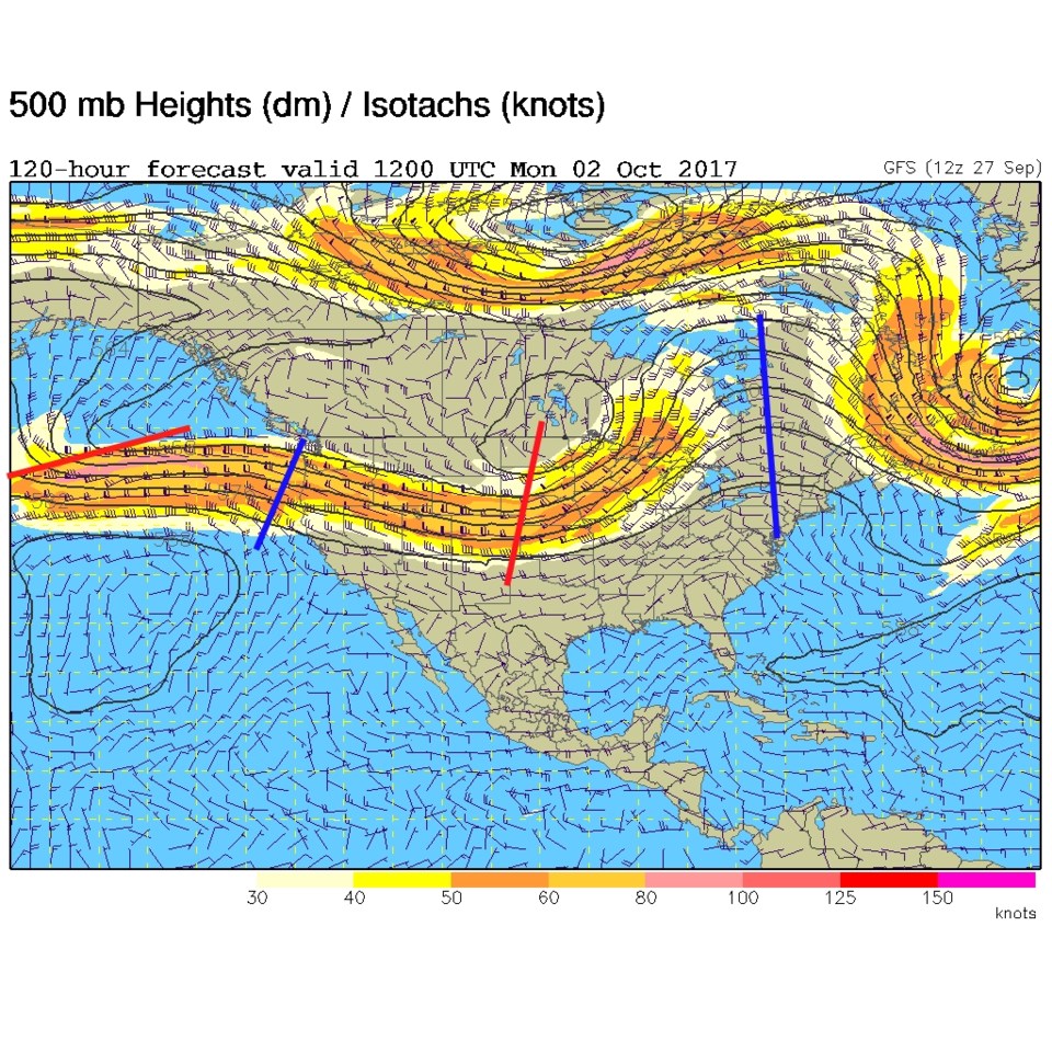
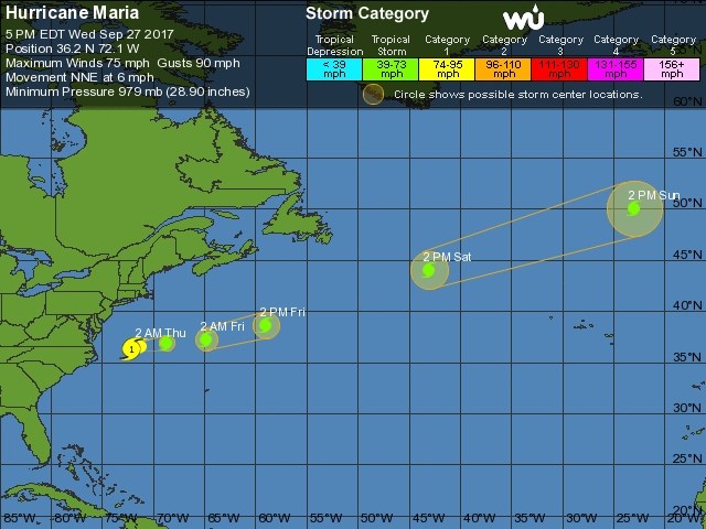
The trough on Monday that we looked at earlier this week is much less pronounced in the forecast map (Figure 5) so we don't expect much of a storm now at the end of the weekend - still no heat returns either.  Maria is 'just' back up to a Category 1 strength and is just beginning to turn east as of Wednesday PM.  It is expected to shoot across the Atlantic and rain on the British isles.

Figure 5: 500mb GFS forecast upper air map for Monday AM.

Figure 6: NHC forecast for Maria over the next 5 days.

Current Weather

Mostly sunny

Mostly sunny

57°F

UV Index
6 High
Pressure
29.6 Falling
Visibility
8 miles
Dewpoint
23 °F
Humidity
27%
Wind
WSW 9.6 mph
Gust
21.3 mph
Wind Chill
57 °F

Hourly Forecast

Today
12 PM
58°F
Showers
Today
1 PM
59°F
Mostly cloudy
Today
2 PM
60°F
Intermittent clouds
Today
3 PM
62°F
Intermittent clouds
Today
4 PM
60°F
Intermittent clouds
Today
5 PM
58°F
Intermittent clouds
Today
6 PM
56°F
Intermittent clouds
Today
7 PM
54°F
Intermittent clouds
Today
8 PM
51°F
Intermittent clouds
Today
9 PM
48°F
Partly cloudy
Today
10 PM
45°F
Partly cloudy
Today
11 PM
43°F
Partly cloudy

7 Day Forecast

Partly sunny w/ showers

Tuesday

62 °F

A brief morning shower or two; otherwise, windy with times of clouds and sun


Partly cloudy

Tuesday Night

34 °F

Partly cloudy and colder; there can be frost in the normally colder spots


Intermittent clouds

Wednesday

59 °F

Cool with times of clouds and sun


Mostly cloudy w/ showers

Wednesday Night

37 °F

Increasing clouds with a shower in spots late


Partly sunny w/ showers

Thursday

56 °F

Times of clouds and sun with a couple of showers; cool


Partly cloudy

Thursday Night

40 °F

Partly cloudy


Mostly cloudy

Friday

63 °F

Mostly cloudy and warmer


Clear

Friday Night

40 °F

Clear


Mostly sunny

Saturday

74 °F

Mostly sunny, pleasant and warmer


Mostly clear

Saturday Night

43 °F

Mainly clear


Sunrise and Sunset

Sunrise
5:52 AM
Sunset
8:02 PM

Based on AccuWeather data