This content was originally published by the Longmont Observer and is licensed under a Creative Commons license.
Forecast Discussion:
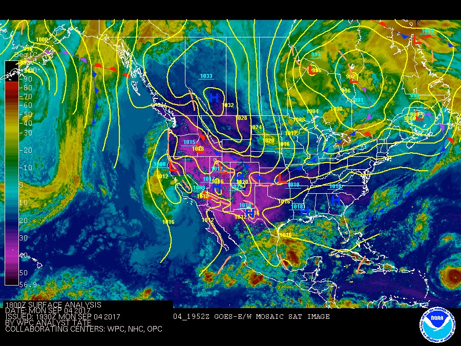
The first push of the cold front (coming through Longmont around 3:30pm on Monday) didn't drop temperatures much, but definitely mixed up the smoke. Figure 1 shows how squashed (to the southwest) the purple/hot temperatures got with the invasion of the Great Plains front. That cool/cold air will push down into New Mexico and Texas overnight into Tuesday. We are still looking at sub 70F highs and sub 50F lows Tuesday and Tuesday night.
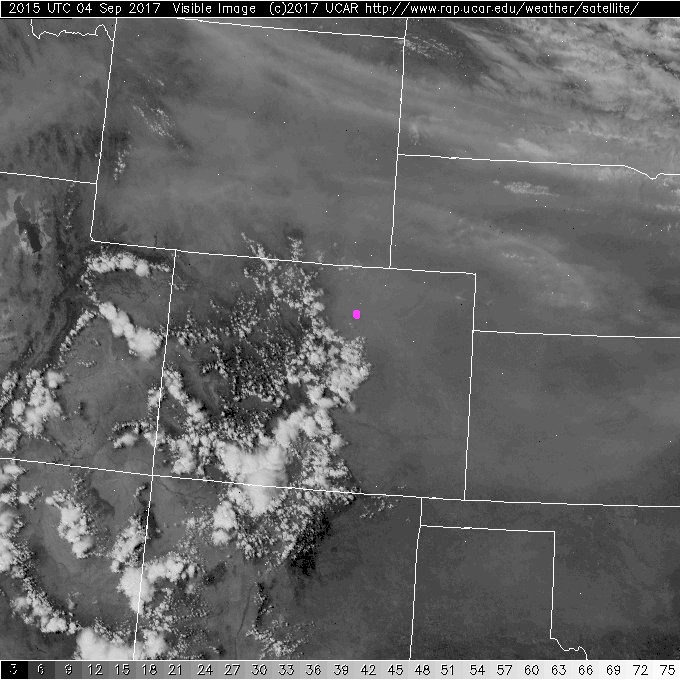
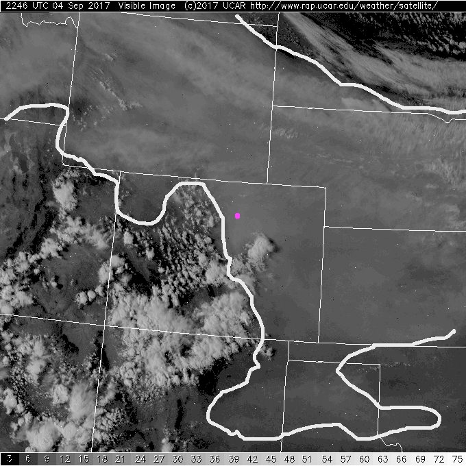
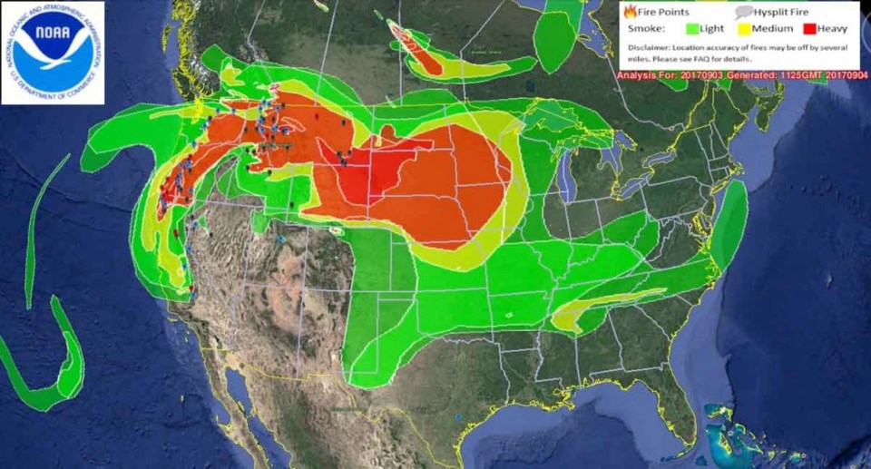
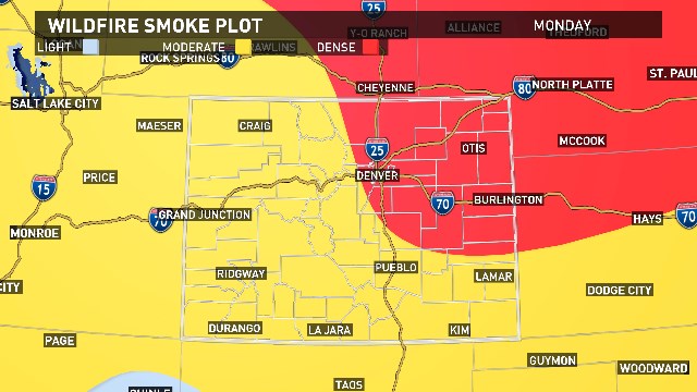
The smoke was the big story. It was dense enough to suppress high temperatures on Monday and limit the chance of convection/rain as the front moved in. Rain could have cleaned some of smoke out. Figure 2 (with Longmont in pink) shows a visible satellite image of Colorado and the states to our north with the smoke streaming down. Figure 3 is 2.5 hours later with the smoke outlined. You can see some clearing in the upper right of the image with the front pushing down. Figure 4 shows how truly massive in extent this smoke is. It is much worse north and northeast of us than here! Figure 5 is a local zoom-in on the smoke density.
The front should bring in cleaner air at the surface (somewhat cleaner), but upper level smoke should largely remain in place and the cold front will form some low stratus cloud deck that will remain in place over Longmont most of Tuesday. It will be a cool, breezy, cloudy, grey and somewhat smoky day.
The longer range forecast:
Things stay dry around Longmont as the western ridge (weakened) edges back nudging us back up towards around 90F as the week goes on. There is a hint that some southwest monsoon like moisture 'could' help bring back afternoon rain chances later in the week. We'll watch that in future discussions.
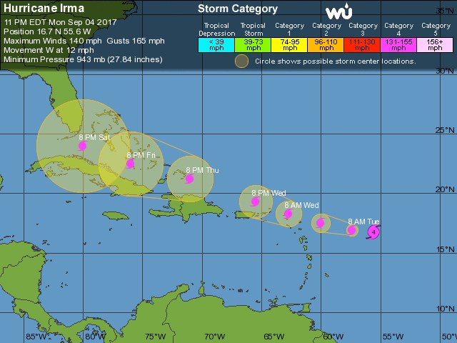
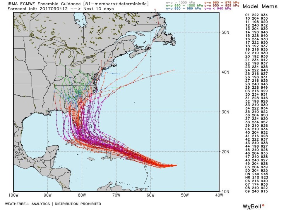
Hurricane Irma is getting more and more press. Figure 6 shows the latest conditions (a Category 4 hurricane with winds at 140mph) with it's forecast track headed for south Florida and the Keys. The European model had the better forecast yesterday (the other models are looking more like it today) so we are looking at all the ensemble forecast runs of the European in figure 7. None of them have it go very far into the Gulf before curving north. It looks like a rough weekend for Florida at the end of the week. This could be another major disaster for the U.S. to deal with and right on the heals of Harvey.