In Brief:
Heat and smoke for a couple days, thunderstorms, rain, and cooler weather for the end of the week.
Monday update:
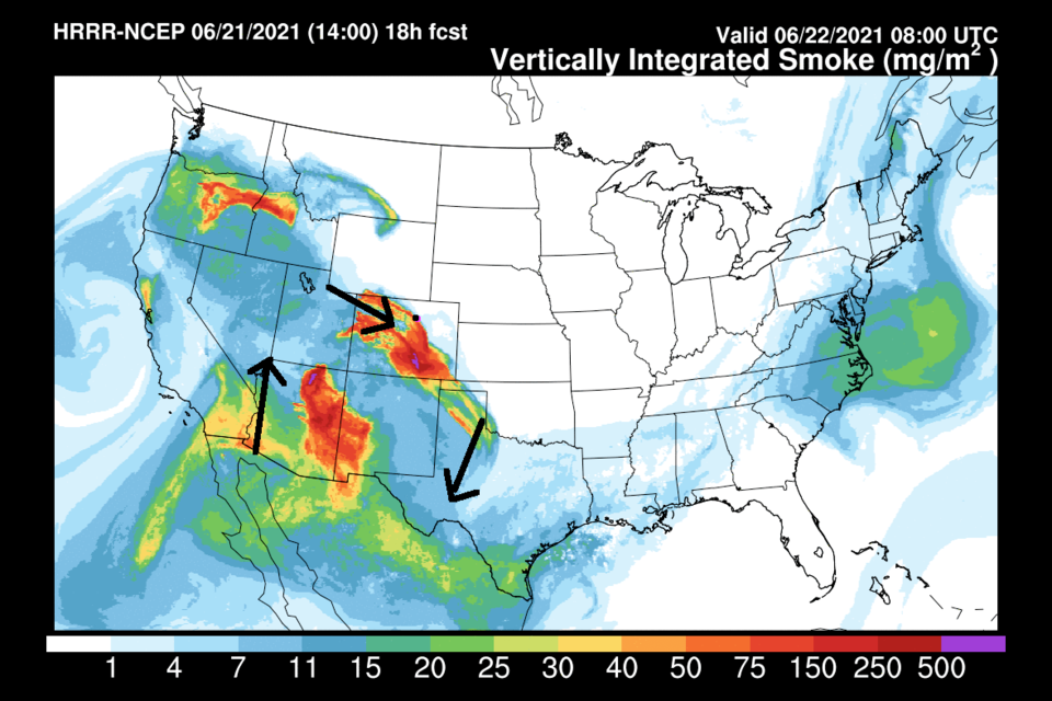
The wind will switch to coming out of the northwest again overnight. This will bring back the heat and smoke (Figure 3 update). We'll shoot back to the mid-90's again. Don't fret, though... a significant trough and cold front will return us to receiving thunderstorms, rain, and cooler weather starting midday Thursday, continuing through the weekend. More to come on a full post (the mountain library I'm in is a great place from which to watch the weather!).
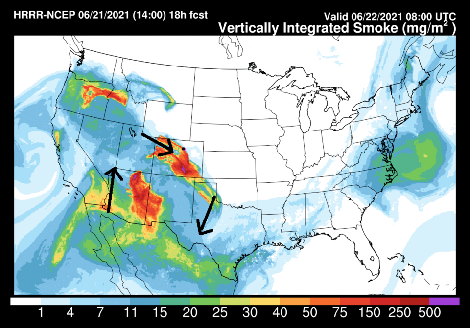 Figure 3 update: the HRRR smoke at all levels forecast for Tuesday AM by NOAA
End Monday update.
Saturday update:
A bubble of cool air aloft over Utah is moving our way. The heat we still have here, plus the remnant of the cool front in place, will give lift and focus needed for some severe weather across eastern Colorado today. The marginal risk (1 on a scale of 1-5) extends from a few miles west of I-25 off across all of the eastern Colorado Plains (Figure 1 update). The risk near Longmont and I-25 is for high winds and hail. There is a risk of an isolated tornado or two out in the Slight Risk zone further east. The storms should affect I-25 communities between 1-5 p.m. (Figure 2 update) today. The next front, or two, will come through on Sunday. Light rain and weak storm chances stretch from Sunday night into late morning Monday. What a beautiful cool down! (Don't look at Tuesday's high though... don't!).
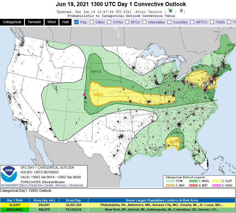 Figure 1 update: the SPC Day 1 (Saturday) severe weather forecast.
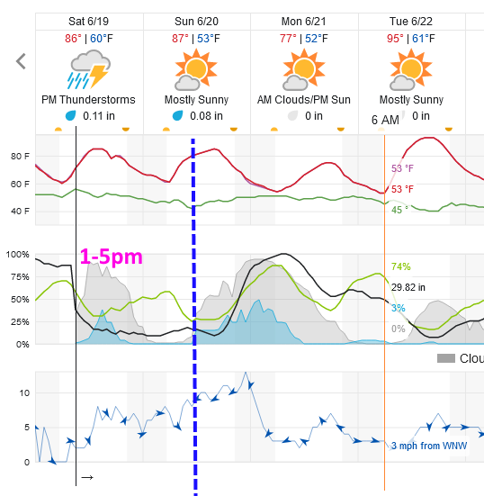 Figure 2 update: a snippet of the weatherunderground.com graphical forecast for Longmont.
End Saturday update.
Forecast Discussion:
A cool front swept down the I-25 corridor Friday and another cool shot arrives very early Monday morning (Figure 1). Amazingly, we drop from the lower 100s to the upper 70s for a short while. With these fronts, and an upper air pattern switch to northwest flow (air from the northwest aloft - Figure 2) we cool down and passing short waves can kick off thunderstorms and rain showers. Our first best batch of showers comes Saturday night (Figure 1 and Figure 3). There is another front arriving with this flow Sunday (Figure 4). Smoke levels are diminished a bit, and severe weather chances are removed for a bit as well (not shown graphically).
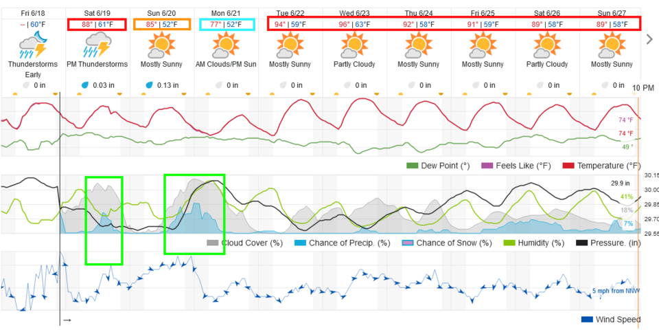 Figure 1: the 10 day graphical forecast from weatherunderground.com for Longmont, CO.
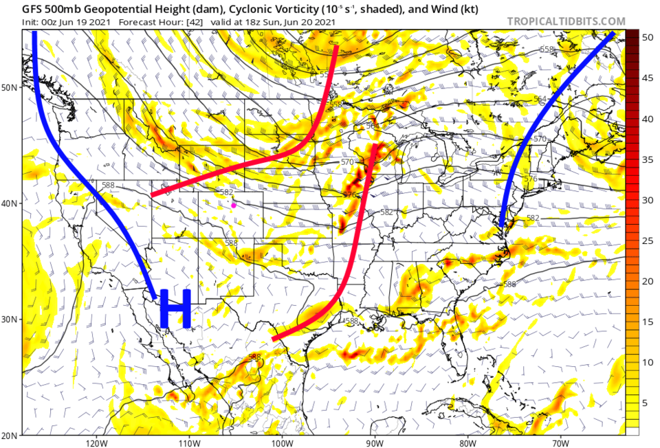 Figure 2: the 500mb upper air forecast map for Sunday noon from the GFS and tropicaltidbits.com
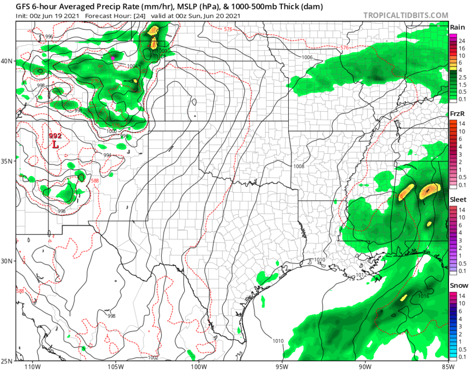 Figure 3: the 6 hour averaged precipitation around Saturday evening/sunset from the GFS and tropicaltidbits.com
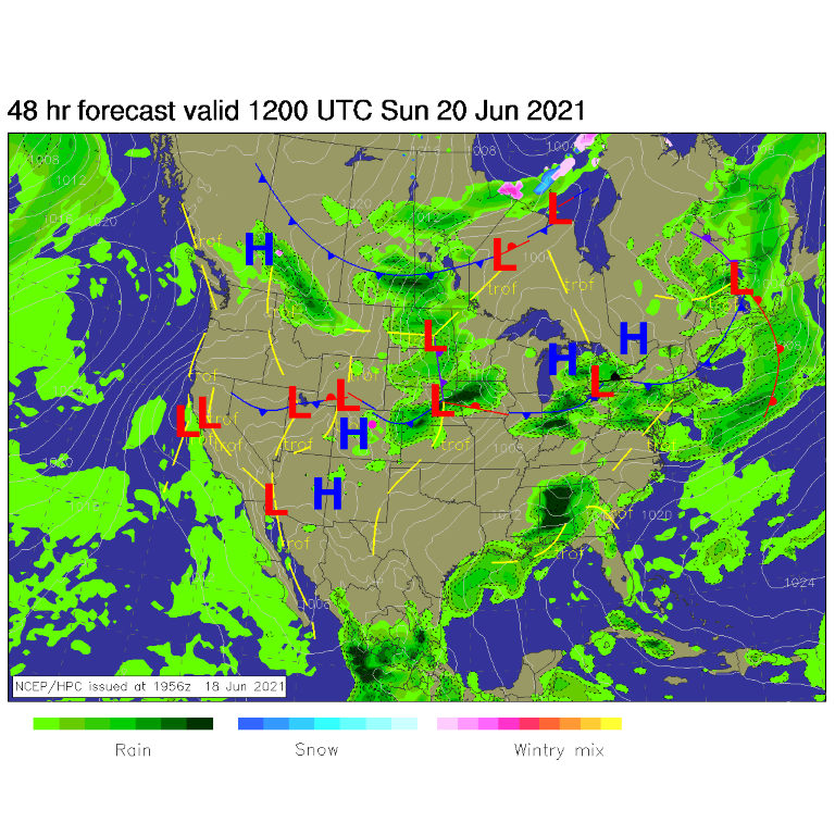 Figure 4: the surface forecast analysis for Sunday AM from NCEP.
The Longer-Range Forecast:
Another short wave will kick off a round of up-slope showers with the front Sunday night (Figure 5). Overall, rainfall totals will average less than a quarter-inch. This isn't a "too exciting" weather system other than the nice break from the heat (Figure 6). We do return to 'mainly' hot and dry conditions when the ridge returns Tuesday and beyond (Figure 1).
Programming note: I'll begin a two week camping trip this weekend. I'll be using a nearby library to post new posts and updates. Please be patient if there is a day or two missed. This is a typically a less dynamic time of year with only slight variations between hot and dry and warm and stormy. I'll do my best to keep up as I get some vacation time. Thanks for your understanding!
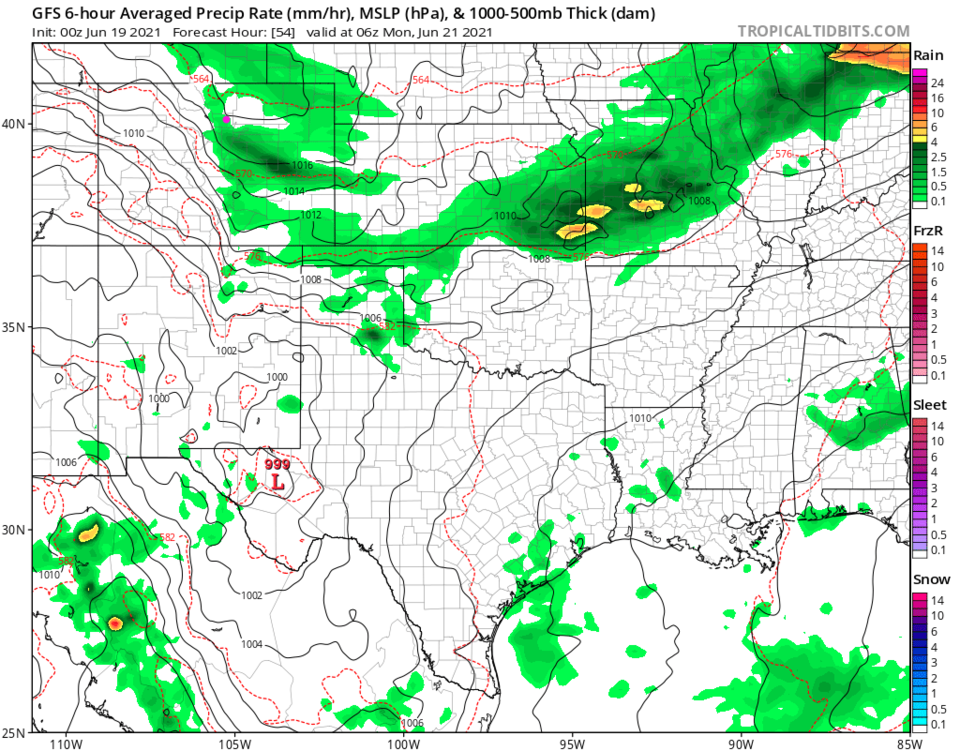 Figure 5: the 6 hour averaged precipitation around Sunday/Monday midnight from the GFS and tropicaltidbits.com
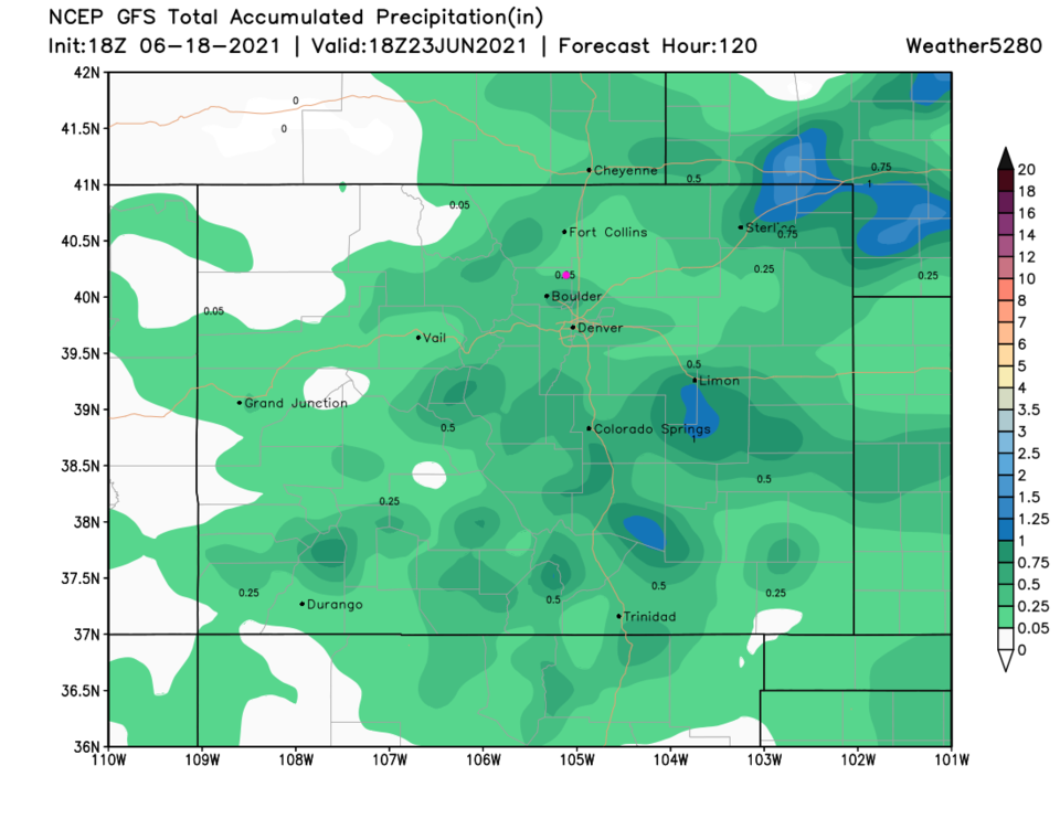 Figure 6: the 5 day precipitation total from the GFS and weather5280.com


