This content was originally published by the Longmont Observer and is licensed under a Creative Commons license.
Forecast Discussion:
Saturday PM update:
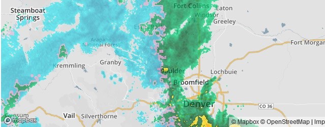
The storm continued until around 3-4pm, but Figure 1 update and Figure 2 update are snowfall and water content reports around Colorado up to 7am Saturday.
Around Longmont, we received about 1 inch of snow. Boulder saw 1/4th inch to 1 inch (low end of my forecast). For total water content, up to 7am we received about 1/3rd inch of water. My rain gauge shows we about doubled that by the afternoon for 2/3rds of an inch of water.
Not shown, but Estes Park received 3-5 inches of snow. Ft. Collins about 1/2 to 1 1/2 inches of snow. Berthoud received a coating to 1 inch of snow overall. Denver saw 1 1/2 inches of snow on the north side to 4 inches in the southwest suburbs. The Palmer Divide received about 1/2 to 2 inches across the region.
Little accumulation continued after sunrise and precipitation changed back to rain. I doubt we'll see more accumulation of snow in tomorrows reports except up in Estes Park and other mountain locations.


End Saturday PM update.
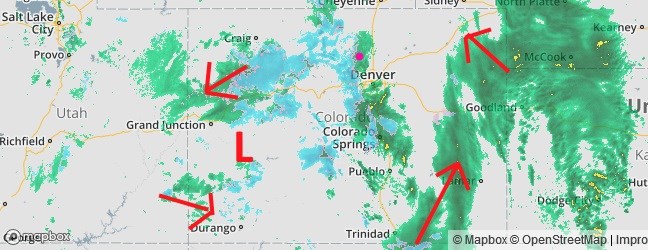
The storm is underway, so I'll be brief, and update on Saturday with some totals. Rain finally began to fall around 4pm Friday. Snow levels were just starting to lower in the mountains. Figure 1 shows the radar image at 4:30p. This is just the beginning of the storm. Figure 2 shows that the low didn't go into NE Utah, but moved from the four corners into western CO. The arrows show the circulation around the low. This might mean more water for us (and a touch more snow with a more southern track)!
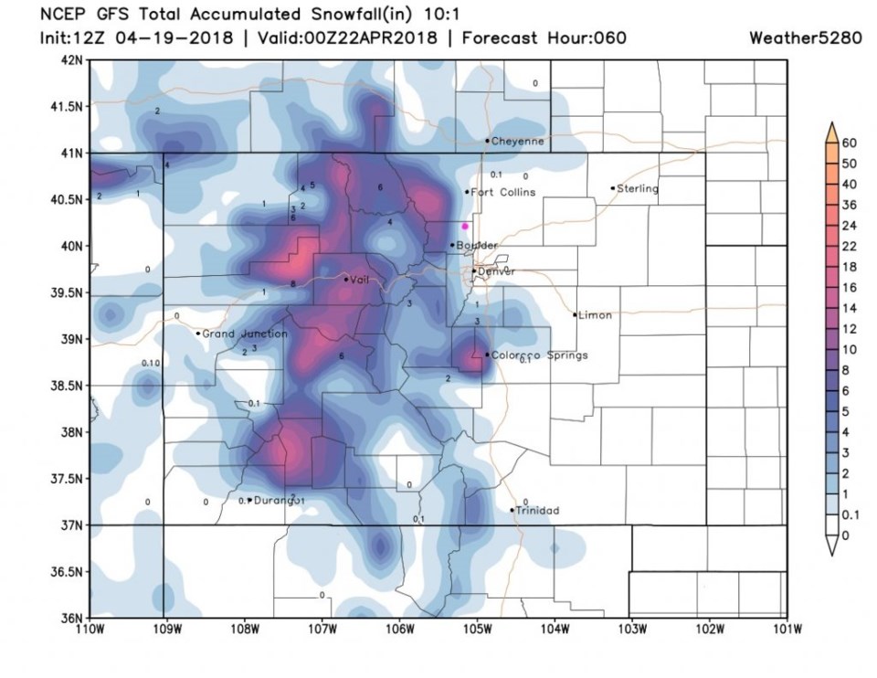
Figure 3 has snowfall amounts very similar to what the have been expected most of the week. Longmont maybe looks a bit cooler and may see a bit more of a coating of slush by morning.
Water totals (not shown) are now in the 3/4th to 1 inch area according to the GFS. Hurray! (I did put my April fertilizer down yesterday).
The longer range forecast:
Nice spring like weather will be briefly interrupted by a cold front Monday that will cool us to the 50'sF for just Tuesday.


