This content was originally published by the Longmont Observer and is licensed under a Creative Commons license.
In Brief:
Clouds are building Wednesday PM as a trough and cold front approaches. This system will dominate our weather all of Thursday with cold air, wind, rain, then snow. Another chance of rain/snow passes Friday afternoon/evening then we warm up to very nice Spring-like levels through the weekend and on to the middle of next week.
Update 4/3 3pm:
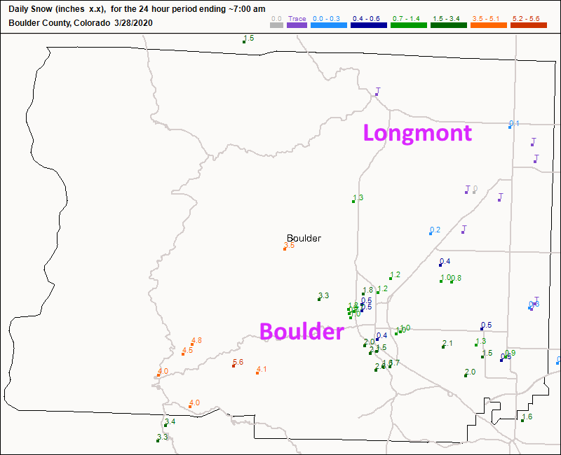
I'm just checking in Friday afternoon after work with our new snow reports from yesterday and this morning. Longmont received 1 inch of snow pretty much city wide (the bottom of my forecast window). Boulder received a coating to an inch - less than us overall. That is a change! See Figure 3 update.
End 4/3 3pm update.
Update 4/2 10am:
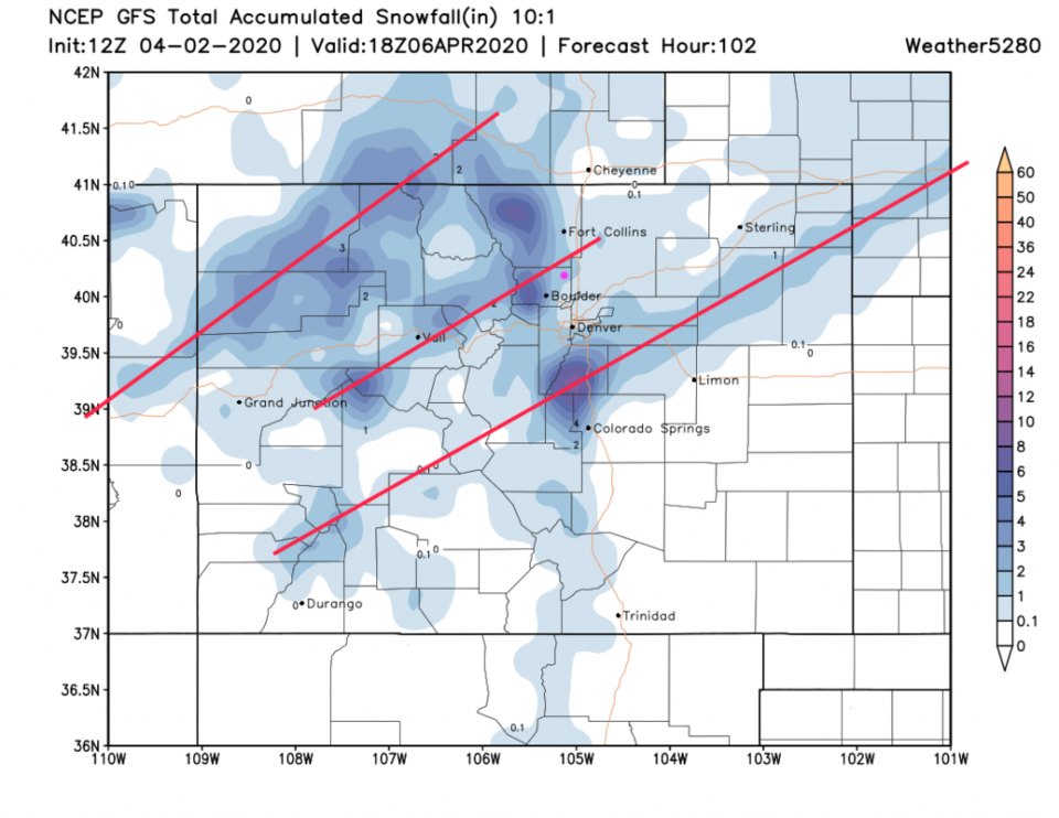
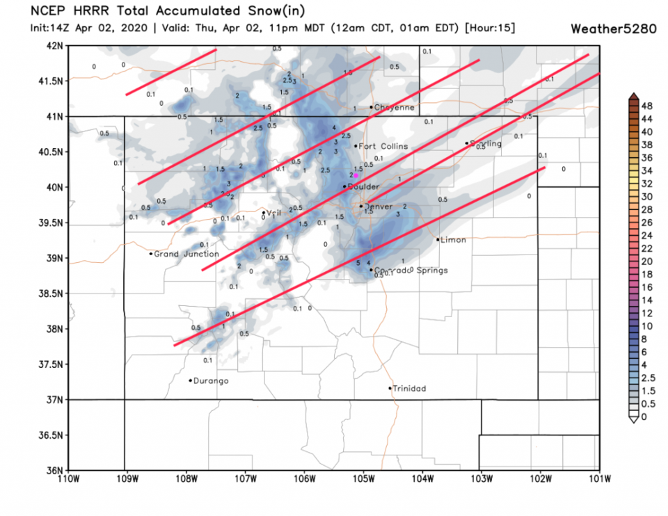
We've had drizzle early this morning followed by freezing drizzle as the cold air did arrive a bit early. Like the GFS ensemble predicted below, we are now in a big break in the precipitation before things pick up this afternoon with the arrival of the stronger cold front push. It looks like snow chances pick up quickly between 2-3 pm. The GFS (Figure 1 udpate) gives us 1-2 inches of snow (with a band of heavier snow just to the north of town). The HRRR (just through 11pm) has many banded features and gives us 1.5-2 inches (Figure 2 update). The last of the trailing snow showers should move off around 6am Friday. Our Friday PM rain/snow chances are somewhat diminished now as the approaching feature has weakened.
End 4/2 10am update.
Forecast Discussion:
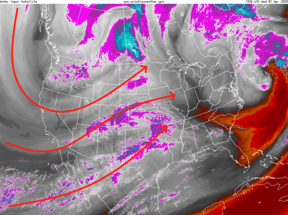
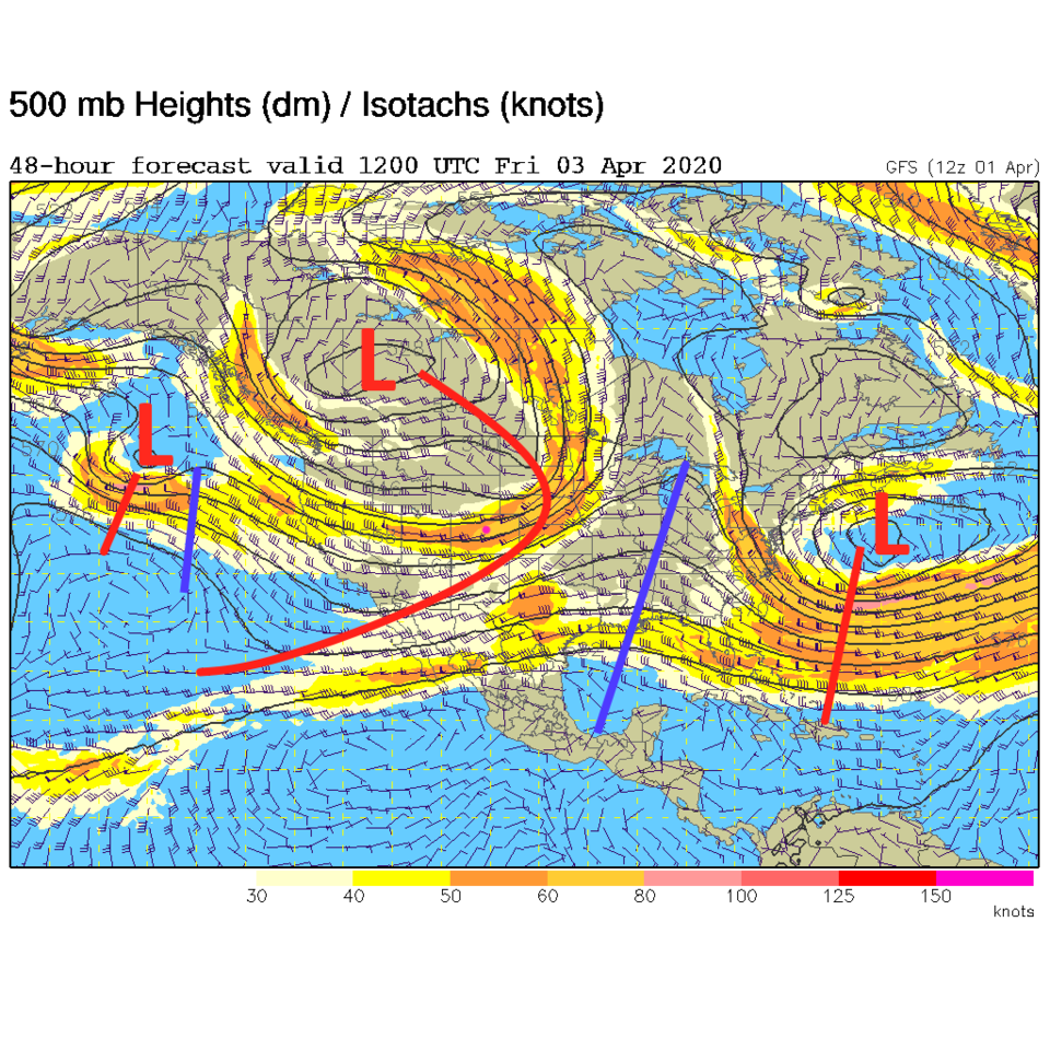
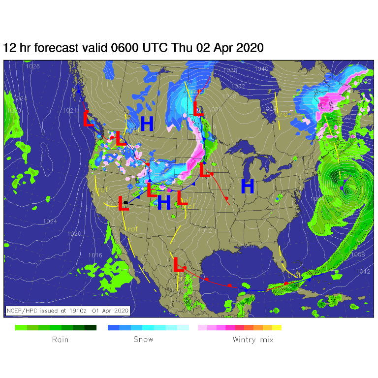
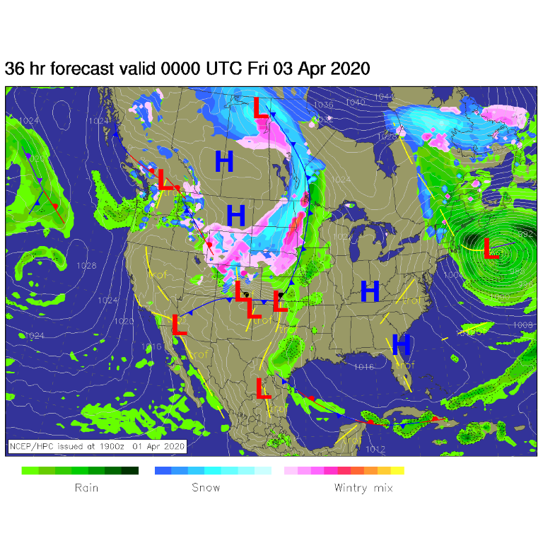
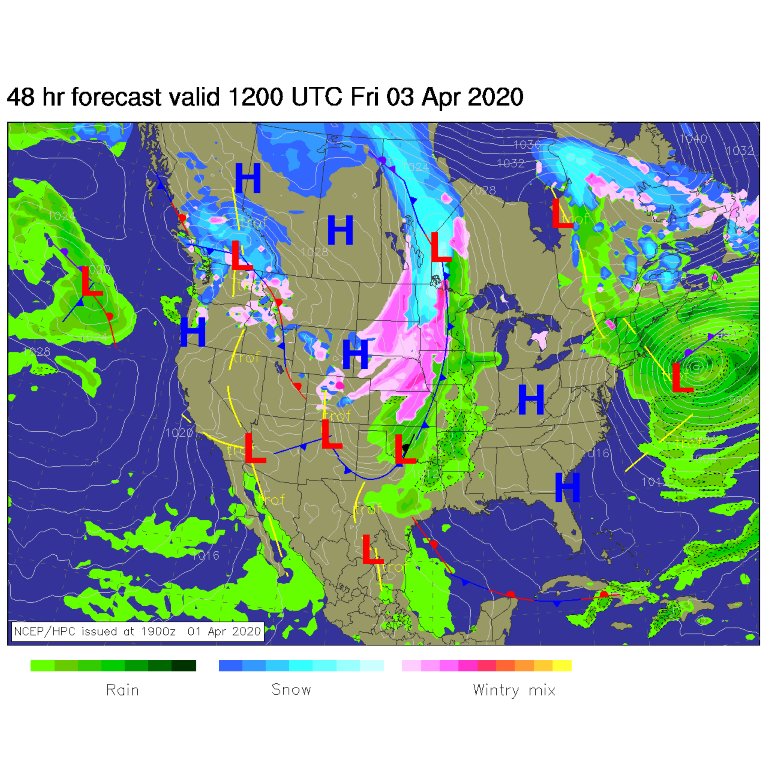
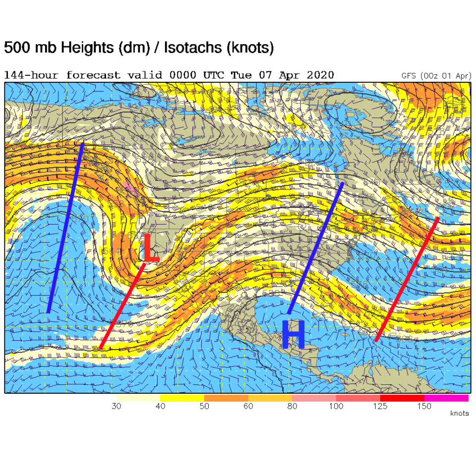
The trough, illustrated by the red arrows in Figure 1, is digging southward Wednesday into Thursday. Moisture is also riding in on the southern branch of the jet stream into Colorado and the southern Plains. By Friday morning, this trough will be very broad and will extend into Colorado (Figure 2). At midnight Wednesday/Thursday - the cold front powered by this trough - will be pushing down into the northern counties of Colorado (Figure 3). Some thunder may be possible with convection that initiates. By Thursday PM, the front will be exiting the southern border of our state with snow increasing in the northern counties (Figure 4). By Friday morning, the front is down into Texas with another bit of energy slipping down in what is now northwest flow across the state (Figure 5).
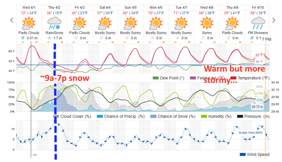
The weatherunderground.com model shows some rain chances late Wednesday PM on to sunrise Friday (Figure 6). The main frontal push hits around 10a-12p. We could see the front arrive sooner (they often accelerate overnight) and snow might begin by 9am. If the model is right, snow might hold of until noon. Snow showers fade out by dawn Friday.
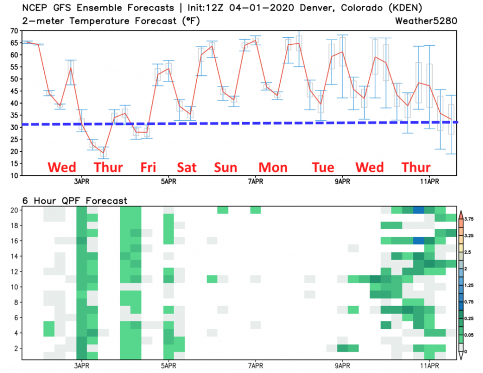
The GFS (Figure 7) sees three distinct precipitation periods - late Wednesday night, Thursday afternoon, then Friday night.
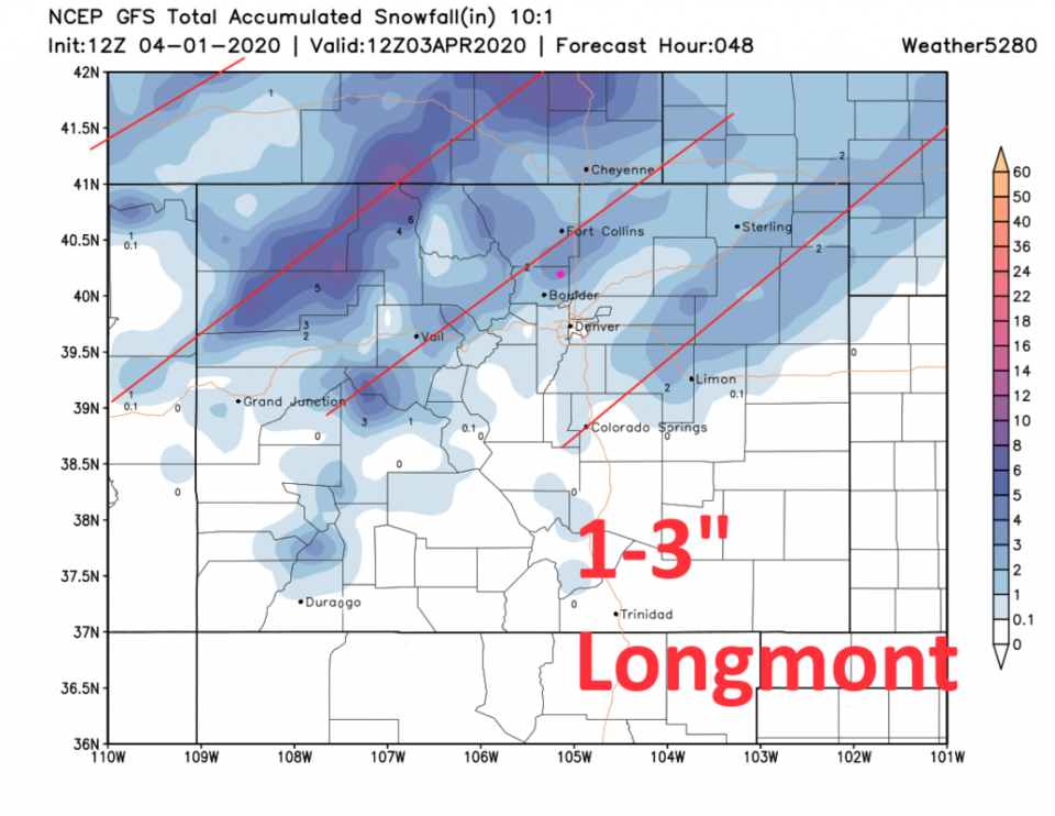
With the jet stream contributing to precipitation formation - we're going to see a banded pattern to what falls. Some folks will get skipped and some will get hit by bonus snow. Taking this run of these models as 'truth,' Longmont gets:
1-3" from the GFS (Figure 8).
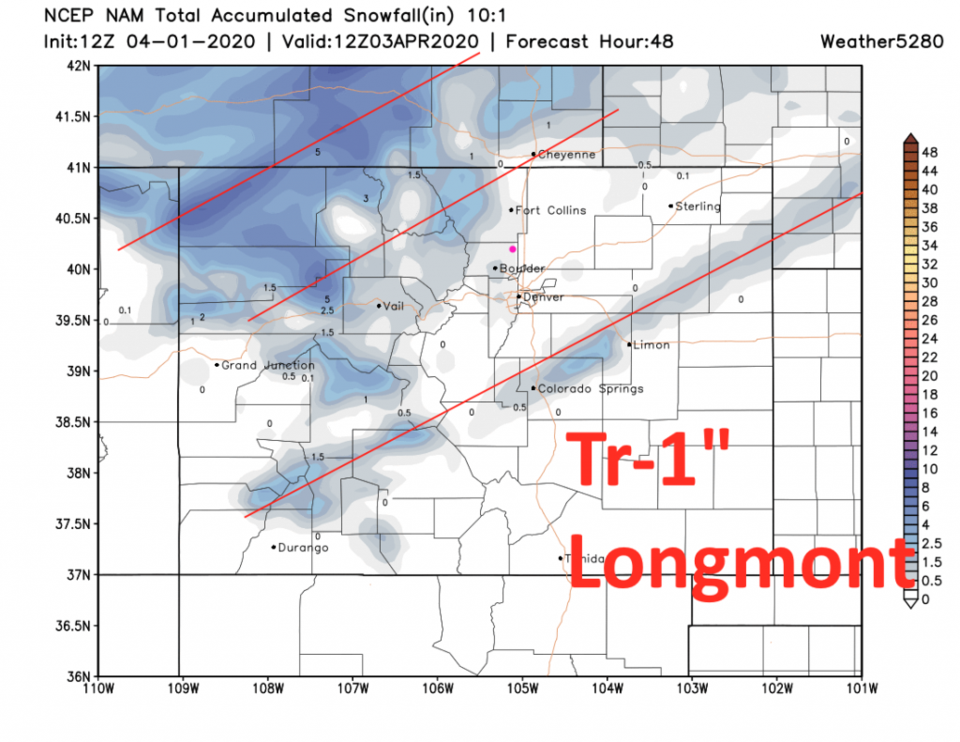
A Trace to 1 inch from the NAM (Figure 9).
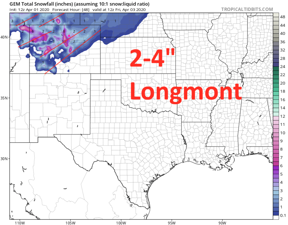
A nice 2-4 inches from the GEM (Figure 10).
I'm calling for 1-3 inches (I guess I'm in the GFS camp this time).
The Longer Range Forecast:
After a cool Friday with nighttime showers - we quickly warm up to above normal temperatures Saturday through Thursday with mostly dry conditions. There is a hint of more unsettled weather late next week (for the 5th week in a row) as a trough digs into the West again (visible earlier in the week out west in Figure 11).