This content was originally published by the Longmont Observer and is licensed under a Creative Commons license.
In Brief:
Change is in the air after really warm wonderful weather. A cool front pushes down just after noon on Wednesday and will cool us about 10-15 degrees by Thursday. Another wind shift allows things to warm again for Friday to 70F. Saturday starts off nice before a stronger cold front makes things cold for the evening and brings rain chances back. Sunday will dawn snowy and very cold. Monday will be cold with snow as well. The next week remains chilly with on and off precipitation. It won't be nice like this week was.
Forecast Discussion:
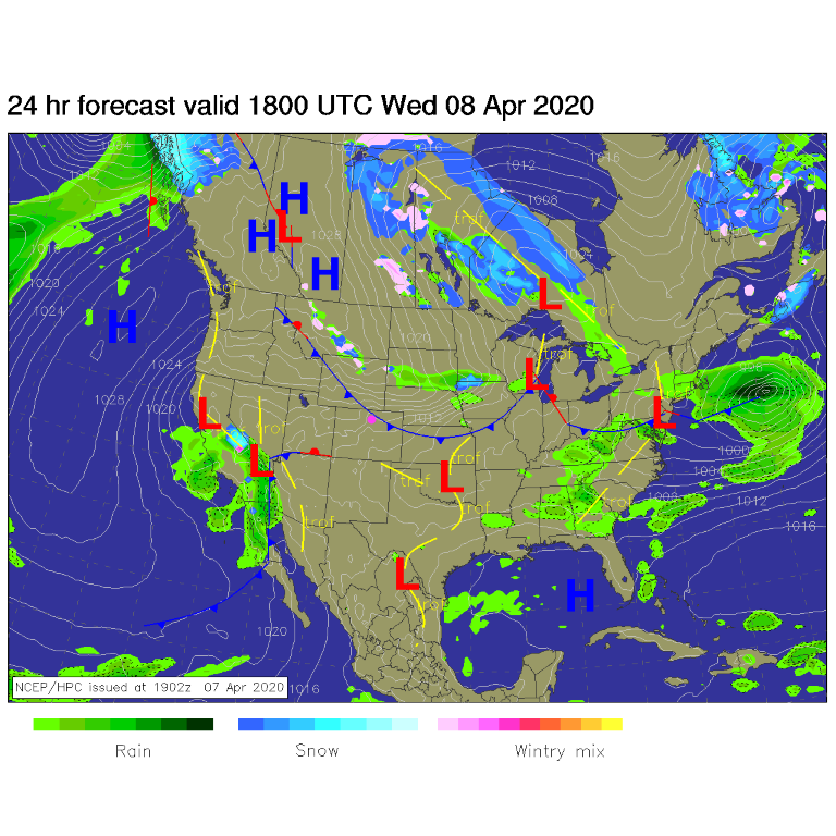
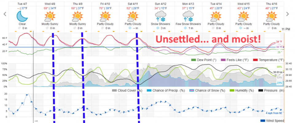
Let's start with what is normal this week: the normal High is 61F and the normal low is 27F. We hit 77F today which is astounding and very comfortable. The first in a series of cold fronts passes Longmont between noon and 1pm (ish) Wednesday (Figure 1 and dashed line in Figure 2). Another minor front will start a warm up and give us a chance of a sprinkle Thursday PM.
The Longer Range Forecast:
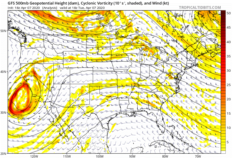
The big picture is seen in the animation in Figure 3. If you watch that big low center off the West coast - it rolls towards Colorado over the next couple of days, then sloshes back to the southwest before becoming connected to the jet stream again passing Colorado on Sunday. This will pump more and more water vapor into the U.S. that the trough can act on.
After that, we have strong north northwest flow slamming us with colder air. A ripple in the northwest flow will kick off showers Tuesday PM and another does it again Thursday morning.
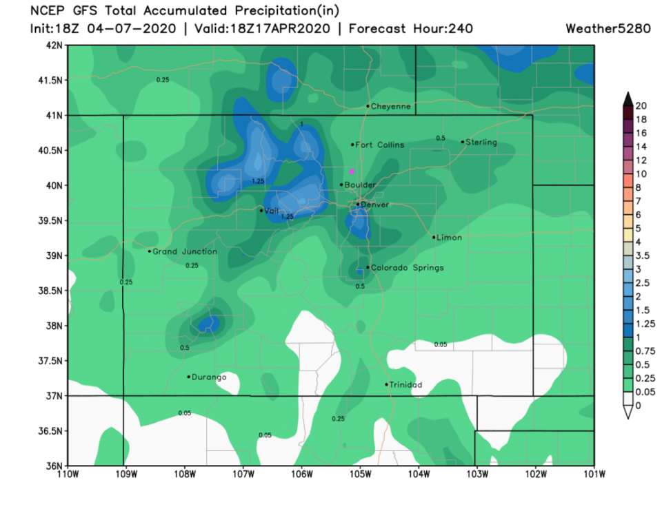
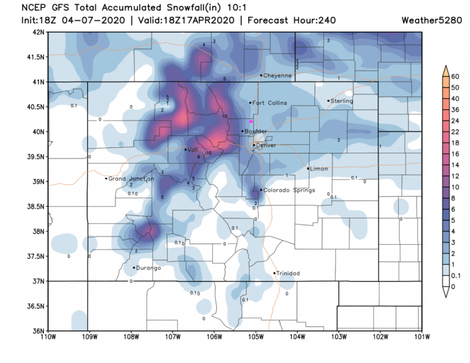
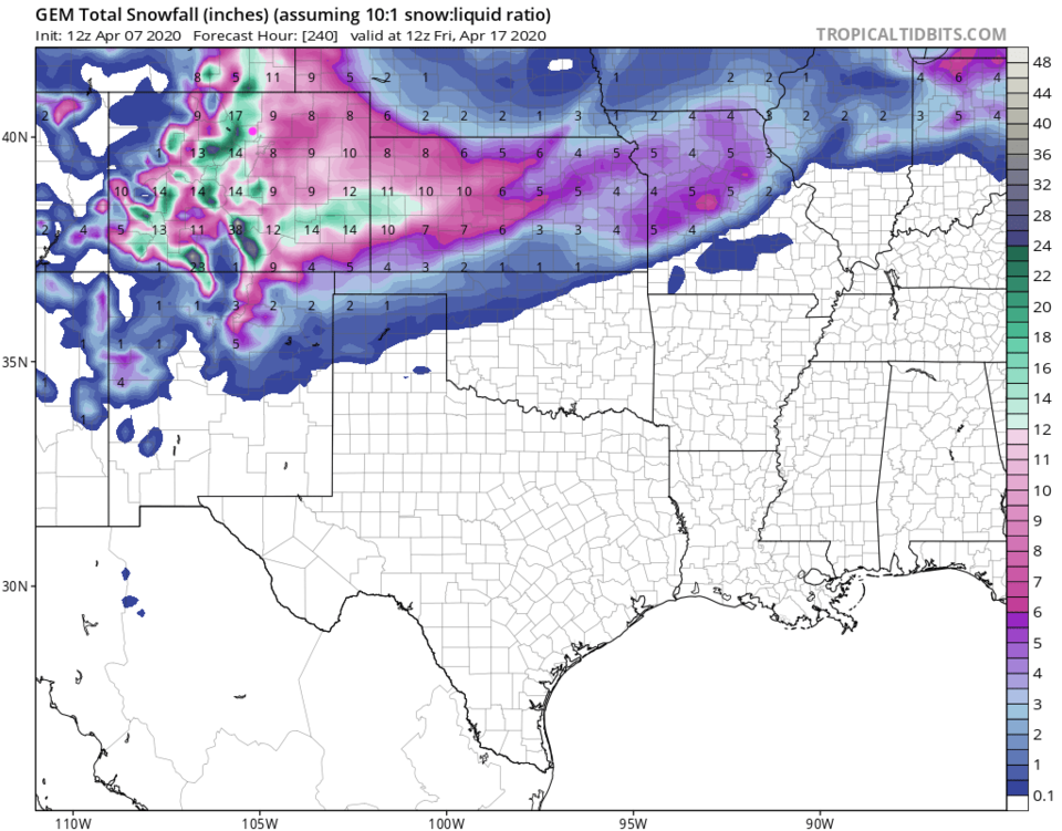
We'll need to refine this next time, but early indications from the GFS gives us 0.25-0.5 inch of water over the next 10 days (Figure 4). That same model give us 1-2 inches of snow over those 10 days (Figure 5). NOTE! The GEM is going crazy with snow. It gives us 10-14 inches of snow over the next 10 days (Figure 6). It was over-done a bit in the last storm, but we'll need to watch this next pattern and series of storms. Come on back!
Easter morning Forecast:
Again, sunrise Easter morning will be 6:27am. Temperatures will be about 30F with northeast winds 10-15mph and cloudy skies with snow falling. (That is quite a change from our last discussion! That is the craziness of disconnected/cut-off lows in the upper air patterns. And it still has plenty of time to change again!).