This content was originally published by the Longmont Observer and is licensed under a Creative Commons license.
In Brief:
A dip in the jet stream will act on Gulf moisture that has arrived over the last couple of days. With winds turning with height in just the right way, we may see some Friday afternoon/evening supercellular thunderstorms with large hail near I-25 and a few tornadoes out on the eastern plains. A line of storms should form later. Then we dry out and warm up to summer heat levels the middle of next week. Keep an eye out for severe weather Friday afternoon/evening!
Update 5/15 9:30am:
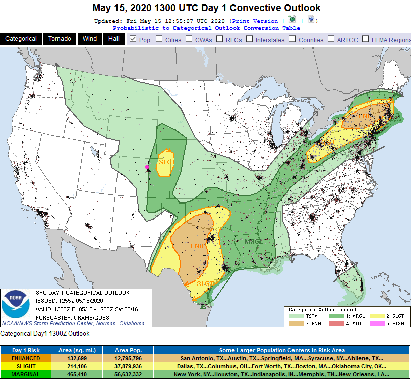
We are still on track to see a couple waves of thunderstorms this afternoon (after about 1-2pm) and again later in the early evening. Severe weather chances (marginal risk) are backed up to I-25 with a slight risk just a bit further east (Figure 2 update). Hail up to 1 inch in size is possible in the risk zones. Storms with some hail and frequent lightning are possible west of I-25. The storms should track from the west southwest to the east northeast today (Figure 1 update, blue arrows). Storm cells, even if they are dumping a lot of water, are going to be moving rapidly, at around 20mph. A few tornadoes may occur out in the slight risk zone (not too far to the east, but far enough).

End update 5/15 9:30am.
Forecast Discussion:
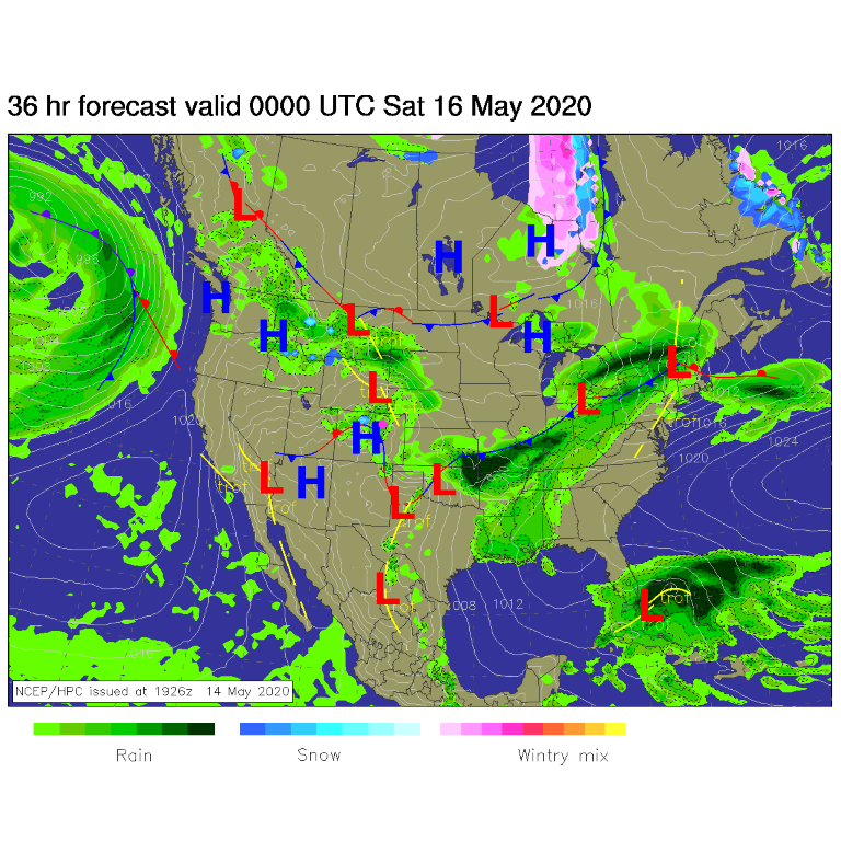
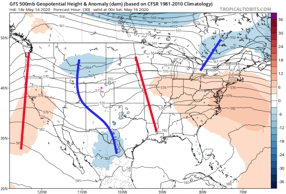
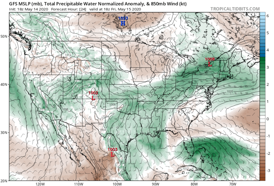
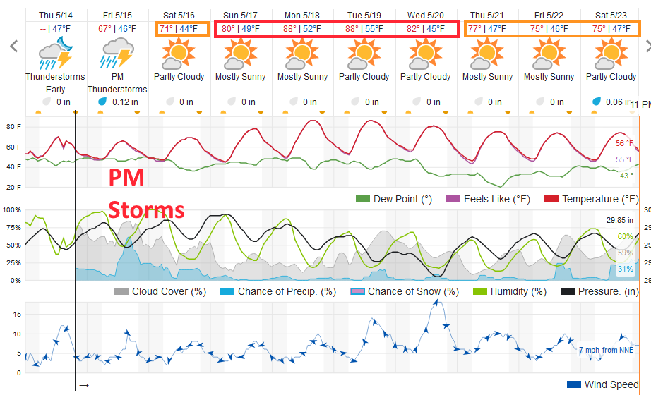
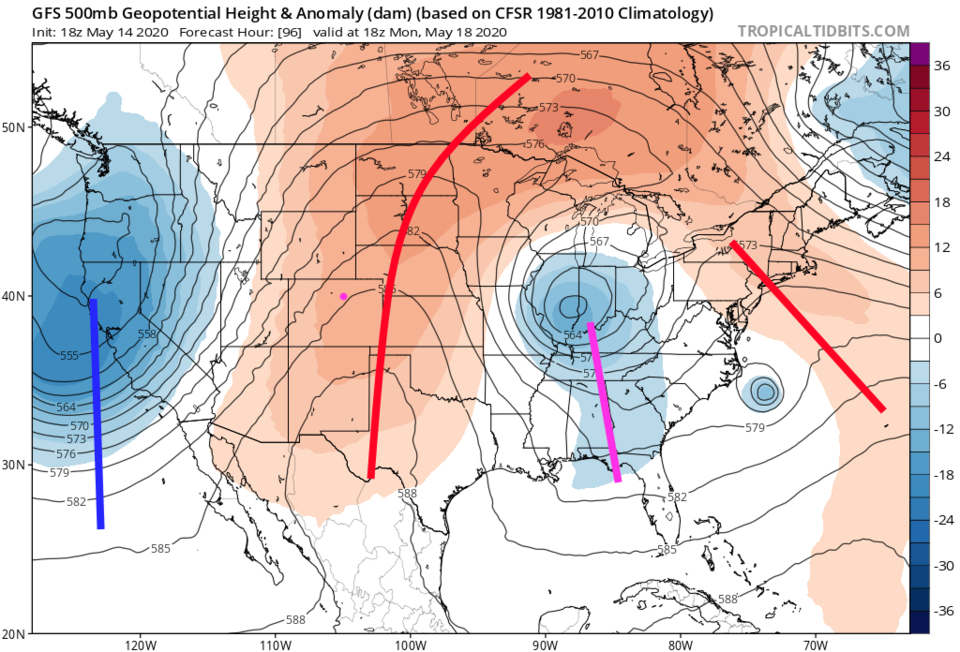
A surface front is still draped across the Rockies and down the Front Range Friday creating a surface convergence region near to home (Figure 1). A fairly strong trough is on its way Friday afternoon as well (sorry, I switched my red and blue lines for troughs and ridges - it is a blue trough line - Figure 2). A ribbon of atmospheric moisture is flowing in as seen in the green coloration flowing counterclockwise around the low in southern Colorado (Figure 3). The greatest chance of storms stretches from 3pm to before midnight (Figure 4).
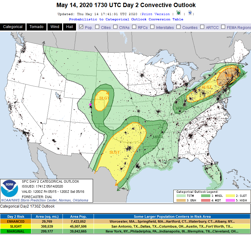
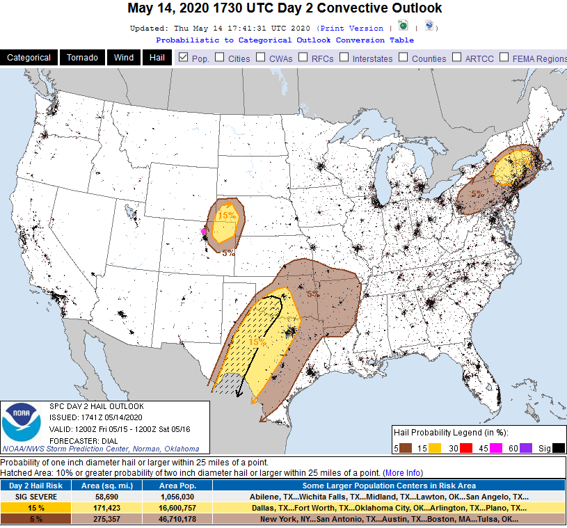
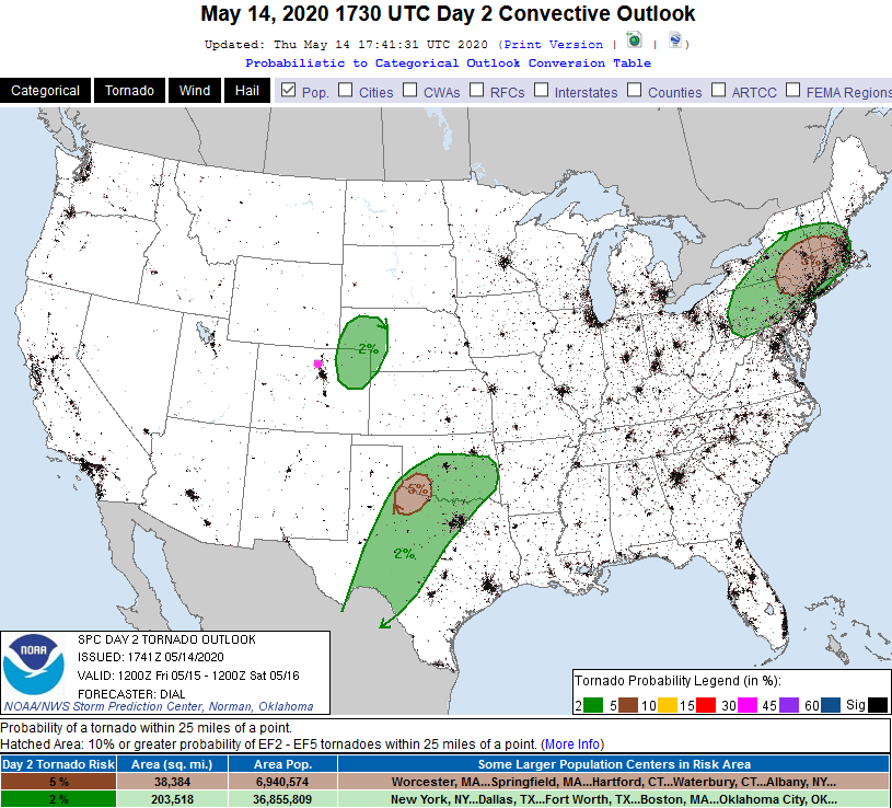
The Marginal risk for severe weather backs up to just a few miles west of I-25 as of the Thursday PM forecast (this may change in the morning - Figure 5). Getting more specific, the risk around Longmont is for hail (and high winds - Figure 6). The tornado chances (Figure 7) are expected to remain further out to the east of town.
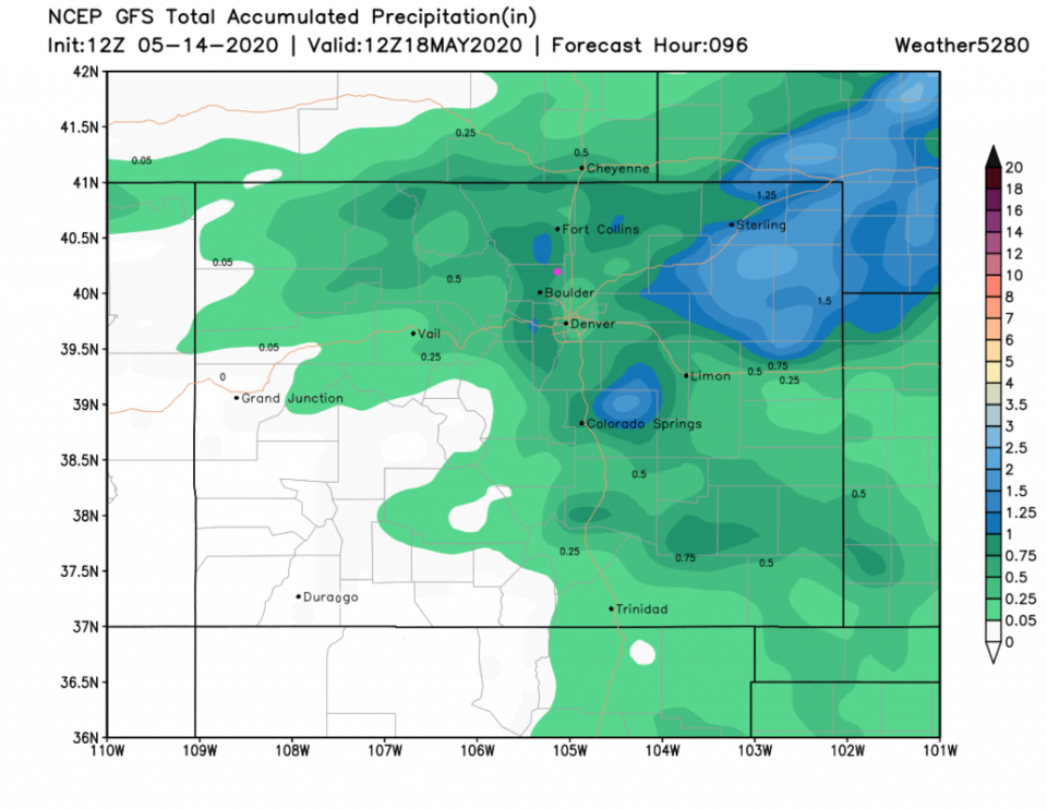
We might see a small chance of an afternoon thunderstorm Saturday PM (it won't be much). The rainfall for our part of the state might reach 0.75 to 1 inch if we get hit by a few thunderstorm cores (Figure 8 - mainly Friday).
The Longer Range Forecast:
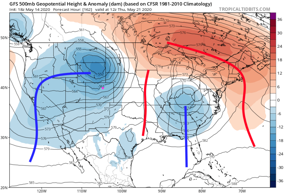
Beyond Saturday, a ridge roars in to stop rain chances (Figure 9) and really bring on the heat; upper 80'sF (Figure 4). With another trough passing (pretty far north of the state) around Thursday (Figure 10) we cool to more seasonable weather (Figure 4).