In Brief:
It will be a mild dry week broken up by a rather good looking mid-week snow storm.
Forecast Discussion:
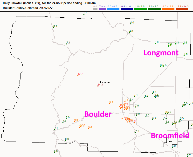
My previous forecast wasn't great around Loveland to Fort Collins (most places got less than an inch). I did well around Longmont and Broomfield (Figure 1). But I gave Boulder only a max of 6 inches and there were up to 10 inches in that town.
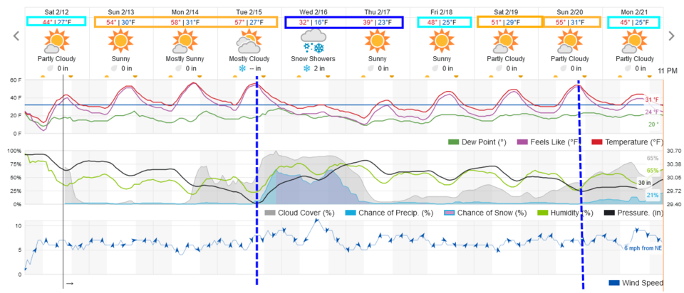
Temperatures rocket to the 50s and almost 60s early in the week (a hint of the ridge-created heat that will be a story in LA for the Superbowl) Figure 2.
The Longer Range Forecast:
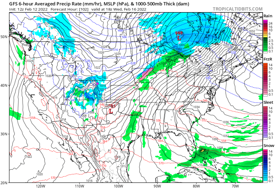
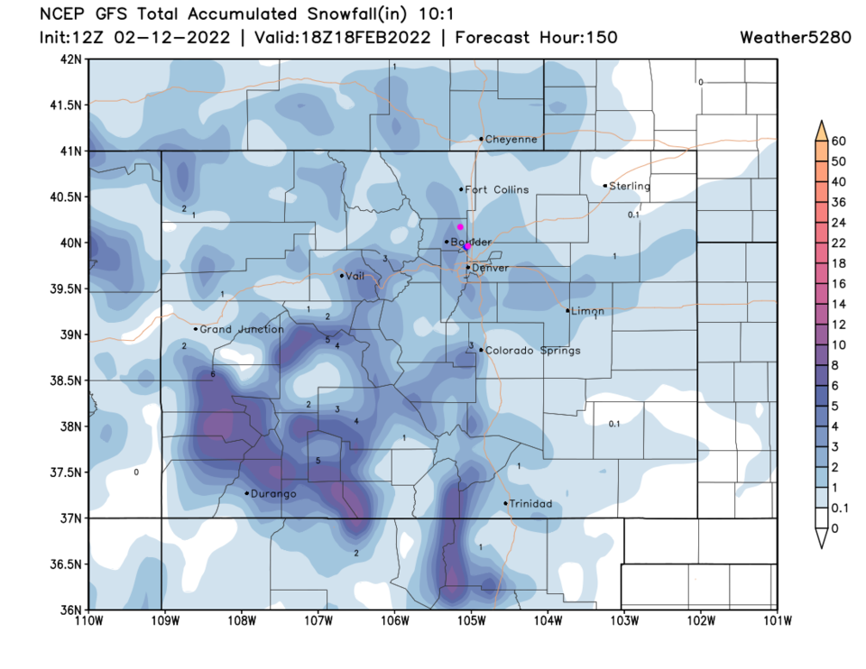
Our next big system starts to affect the area Tuesday evening with a stout afternoon cold front passage (Figure 2 dotted line). A deep trough and upper level low slides over the state Tuesday through Thursday morning (Figure 3). It is snowing most of the day Wednesday (Figure 4) across the state. Even though I think this will be a fairly significant storm, the GFS is pretty modest with only 1-4 inches across the Front Range. I'll post updates here!