Skip to content
Join our Newsletter

The Front Range Forecast: A Spring Snow is on the way

figure5_03232024
Figure 5: the 10:1 snowfall forecast for the next 3 days from the GFS and tropicaltidbits.com

In Brief:

A warm weekend becomes rain, thunderstorms and some snow at lower elevations.

The Forecast Discussion:

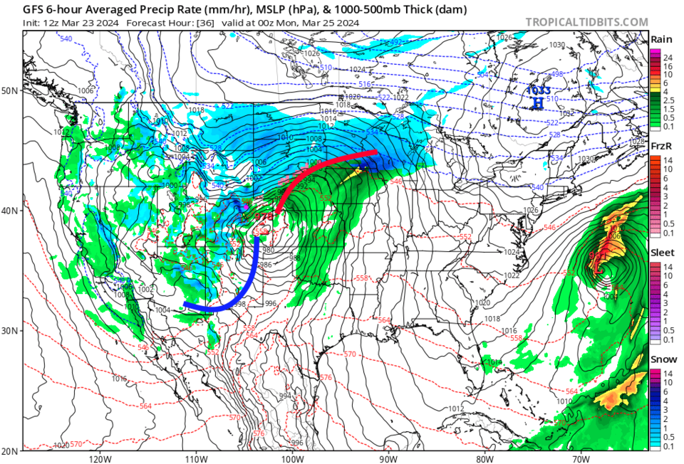
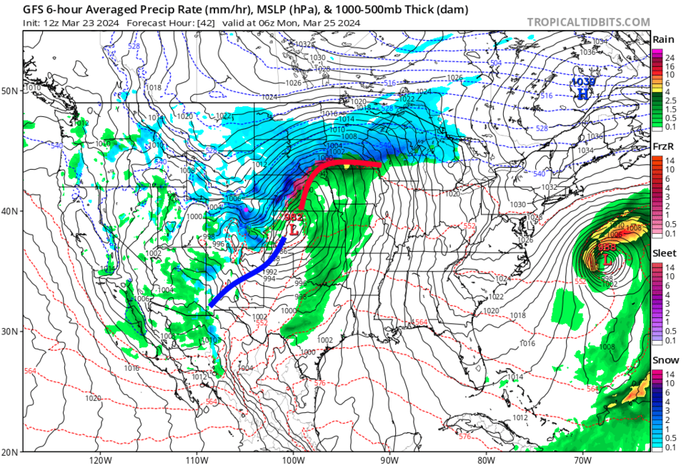
A more Spring-like storm is on its way for Sunday afternoon and evening (Figure 1). This storm will create a more prolonged impact in the mountains (Sun AM to Mon AM, then again Tuesday and Wednesday mid-days). At lower elevations, precipitation will mainly fall between 1pm Sunday and 11pm Sunday (Figure 2 and Figure 3).

The cold front should sweep past Longmont around 2pm. Precipitation will start as rain and thunderstorms with windy conditions and dropping temperatures. Liquid water totals seem to add up to 0.25 to 0.75 inch with locally 1 inch in lucky neighborhoods (Figure 6). Temperatures will be in the 50's Sunday, so we won't see lower elevations switch to snow until evening (the low will be around 20F). The Monday morning commute could be slushy with ice on bridges. Drive carefully//slow down!

Mini-snowfall roundup:

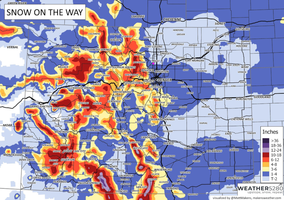
Weather5280.com  1-4" (Figure 4)
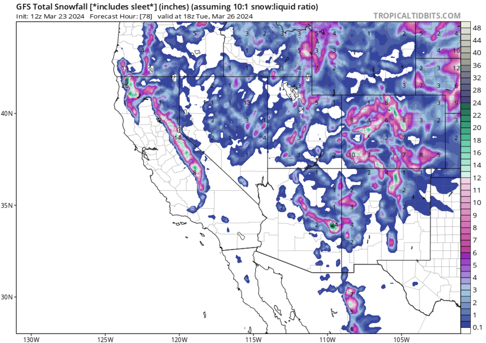
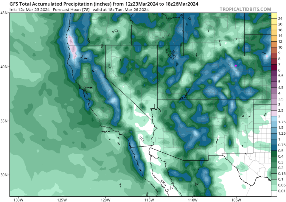
The GFS    2-4"  (Figure 5)
Channel 9    1-3"
Channel 7  2-3"
I'm calling for 0.5-3" in Longmont.

figure1_03232024
Figure 1: the 10 day graphical forecast for Longmont from weatherunderground.com
figure2_03232024
Figure 2: the surface forecast map and precipitation for Sunday PM from the GFS and tropicaltidbits.com
figure3_03232024
Figure 3: the surface forecast map and precipitation for Sunday midnight from the GFS and tropicaltidbits.com
figure4_03232024
Figure 4: the snowfall forecast from Matt Makens and weather5280.com
figure5_03232024
Figure 5: the 10:1 snowfall forecast for the next 3 days from the GFS and tropicaltidbits.com
figure6_03232024
Figure 6: the precipitation forecast for the next 3 days from the GFS and tropicaltidbits.com

The Longer Range Forecast:

Things remain cool at the start of the week (Figure 1) with a return of a few rain/snow showers Tuesday PM. We warm up nicely by the end of the week with indications of a more stormy weekend.


About the Author: John Ensworth

John Ensworth used to work from Longmont as the PI for the NASA through the IGES (The Institute for Global Environmental Strategies). He now teaches technology, algebra, astronomy, meteorology, film school, and Lego robotics to middle/high school.
Read more


Comments


Current Weather

Clear

Clear

50°F

UV Index
0 Low
Pressure
30.29 Steady
Visibility
8 miles
Dewpoint
43 °F
Humidity
78%
Wind
W 1.7 mph
Gust
3.3 mph
Wind Chill
50 °F

Hourly Forecast

Today
1 AM
50°F
Mostly clear
Today
2 AM
49°F
Mostly clear
Today
3 AM
48°F
Mostly clear
Today
4 AM
46°F
Mostly clear
Today
5 AM
45°F
Mostly clear
Today
6 AM
44°F
Mostly sunny
Today
7 AM
47°F
Mostly sunny
Today
8 AM
52°F
Intermittent clouds
Today
9 AM
58°F
Intermittent clouds
Today
10 AM
64°F
Intermittent clouds
Today
11 AM
67°F
Intermittent clouds
Today
12 PM
70°F
Intermittent clouds

7 Day Forecast

Mostly sunny

Thursday

71 °F

Sunny to partly cloudy, pleasant and warmer


Mostly clear

Thursday Night

44 °F

Mainly clear


Partly sunny w/ t-storms

Friday

75 °F

Times of clouds and sun with a thunderstorm in spots in the afternoon


Mostly clear

Friday Night

45 °F

Clear to partly cloudy


Mostly sunny

Saturday

81 °F

Sunny to partly cloudy and very warm


Mostly clear

Saturday Night

44 °F

Clear to partly cloudy


Partly sunny

Sunday

83 °F

Very warm with sunshine mixing with some clouds; windy in the afternoon


Partly cloudy

Sunday Night

48 °F

Partly cloudy


Mostly cloudy

Monday

84 °F

Very warm with more clouds than sunshine


Mostly clear

Monday Night

52 °F

Mainly clear


Sunrise and Sunset

Sunrise
5:52 AM
Sunset
8:02 PM

Based on AccuWeather data