In Brief:
Cool with snow/sleet and maybe rain.
Friday update:
Light snow/sleet 'might' switch over to rain in the afternoon before turning back to snow overnight. We return to a warm up beyond. A good bullseye of snow may hit the nearby foothills. You might see slush in the morning. We return to a warm up beyond that.
End Friday update.
Tuesday Update:
We should see temperatures today and Wednesday in the mid-80's. The record high temperature for Tuesday is 80 set in 1982. The record high for Wednesday is 79 set in 2018. Those should be easily broken.
Our Friday period of showers look less impressive than they did. I'm sorry if you were hoping for a lot of water.
End Tuesday update.
The Forecast Discussion:
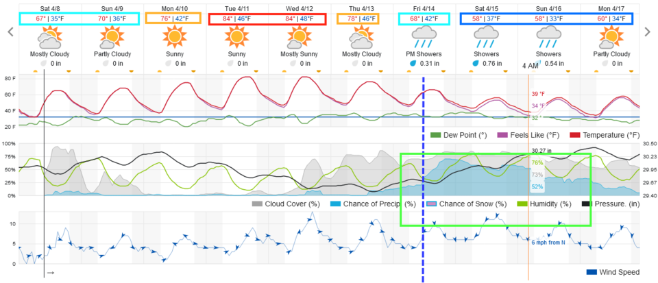
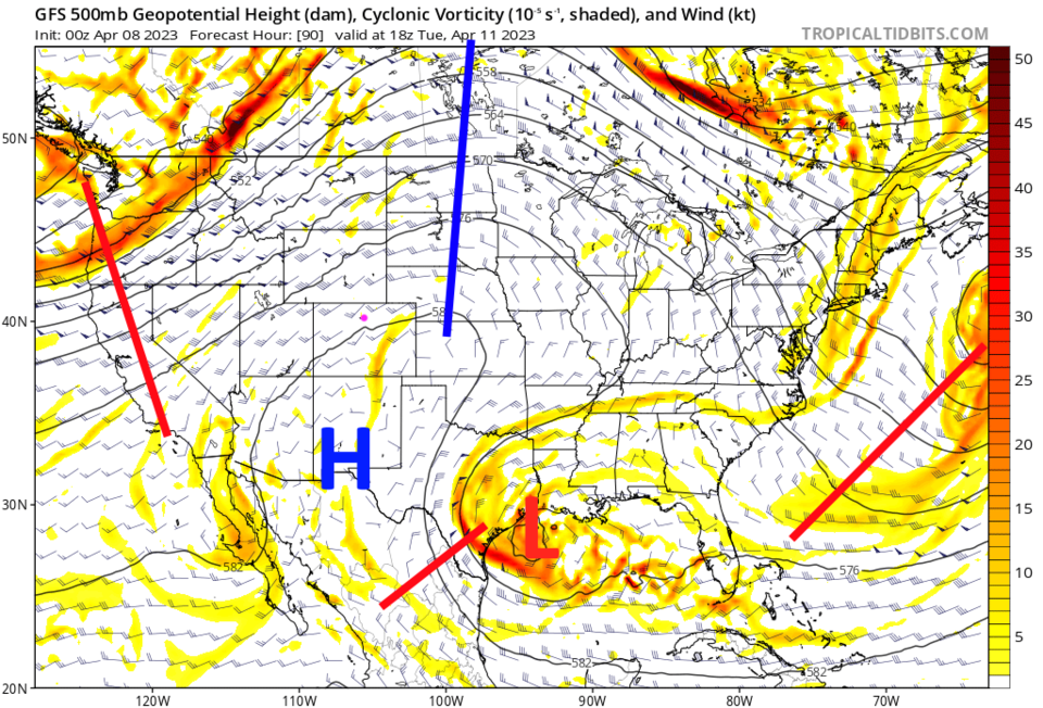
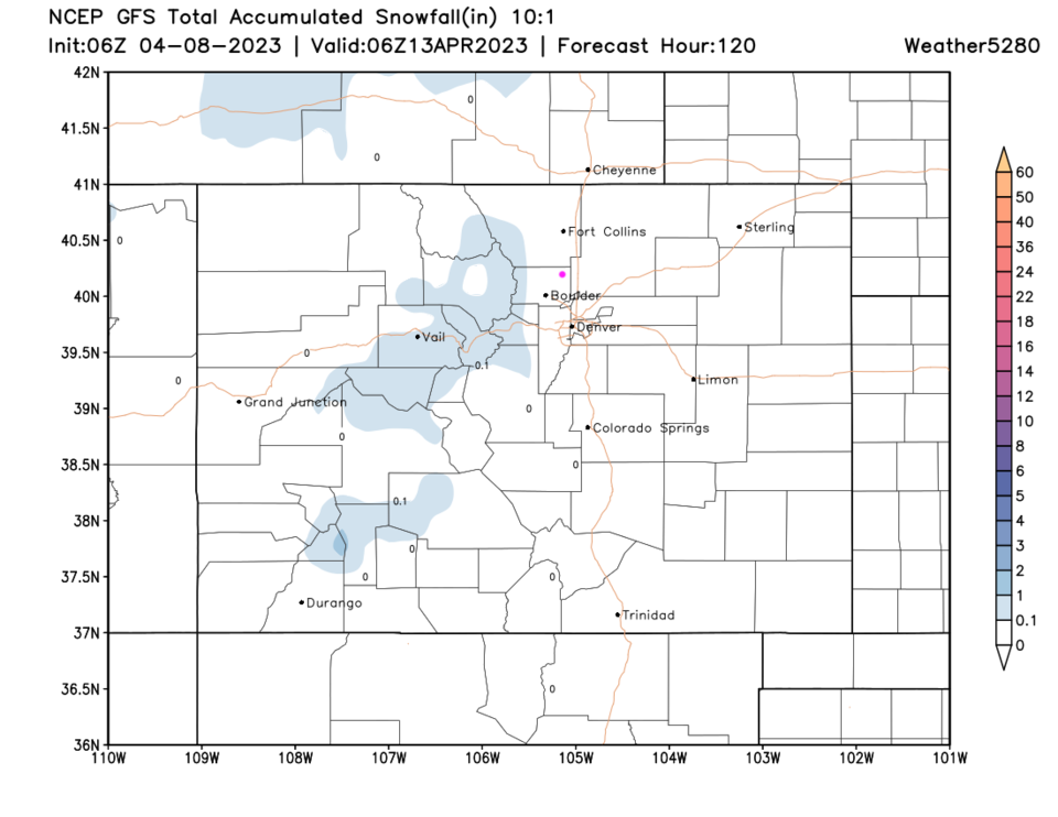
We are about 10 degrees above normal this weekend (normal highs are around 60F). We climb to far above normal by Tuesday/Wednesday with very summer-like temperatures (Figure 1). That is due to a powerful ridge that will dominate the U.S. (Figure 2). We are dry and snow-free through the 5 day forecast (Figure 3).
Easter Morning Sunrise Forecast:
Sunrise Sunday will be 6:31am. The temperature will be 36F with a light breeze (3mph) from the west. Skies will be mostly clear. This will be one of the nicest Easter mornings I can remember!
The Longer Range Forecast:
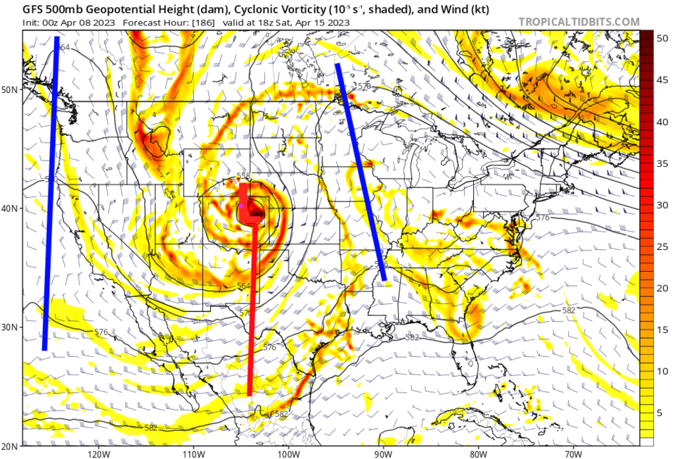
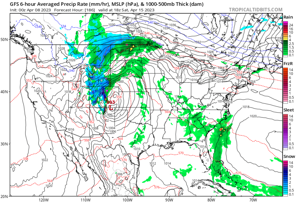
Our next Front will arrive Friday morning with a rapid increase in rain chances (Figure 1). It would be a good time to get your fertilizer down if you haven't already. This system involves a big cut-off low (from the jet stream flow) that rolls over Colorado for a few days (that is what we expect at this time - still 7 days away - Figure 4). We could get our first thunderstorms of spring with this system as well (Figure 5).
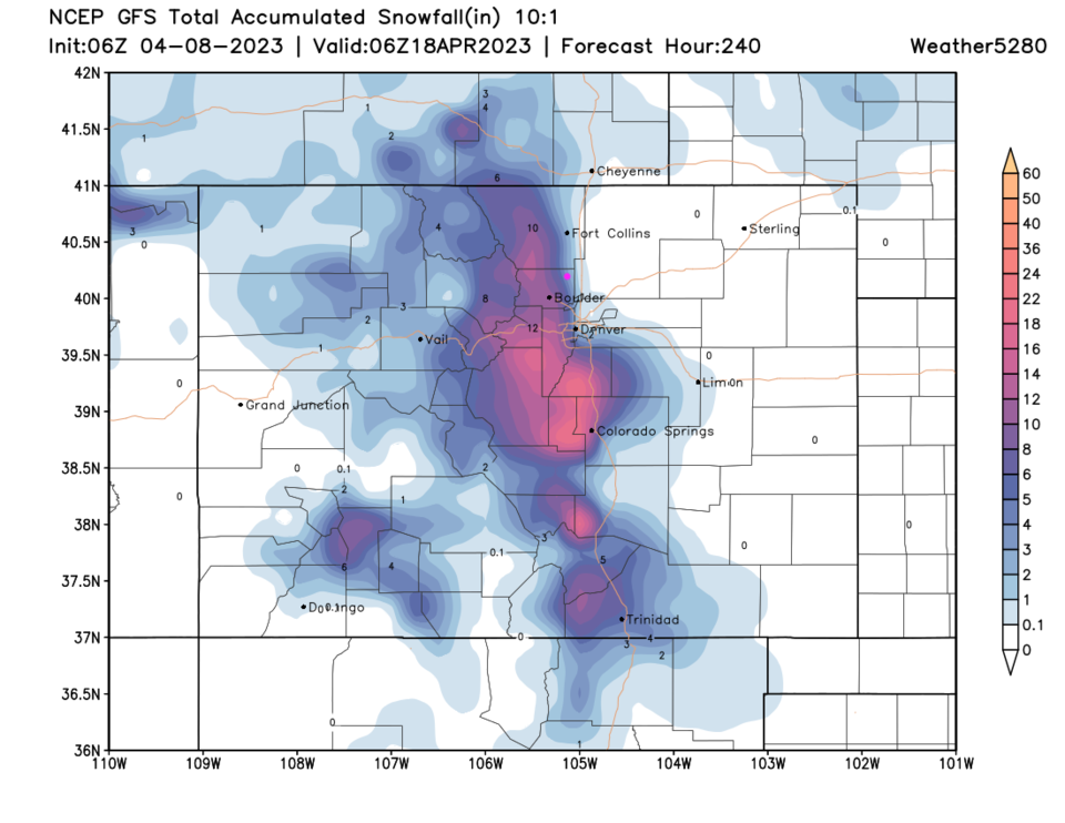
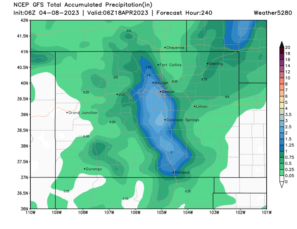
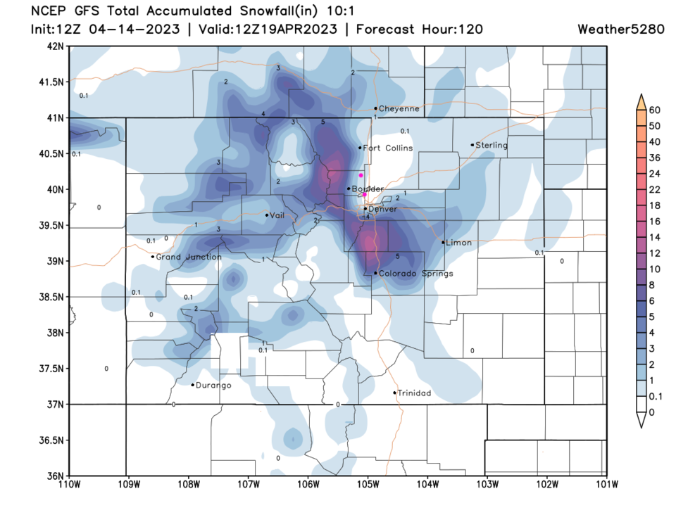
You can see the warm temperature inhibiting low altitude snow, but higher elevations may pick up significant snows in the central mountains (Figure 6). Longmont and Broomfield are on the edge of healthy amounts of water (1/2 to 1 inch?? Figure 7).