In Brief:
A fast moving system brings rain/snow Thursday morning. Cool dry weather returns.
The Thursday Update:
A quick moving short wave/storm is passing over the state Thursday morning. The Palmer Divide (Castle Rock) and areas down to Colorado Springs will see an inch or two of snow. Denver to Broomfield should see snow briefly build up on grassy surfaces in the morning. Precipitation will come to an end by early afternoon. Longmont should see a rain/snow mix before precipitation ends.
It is a hint of more to come this winter!
End of the Thursday Update.
The Saturday Update:
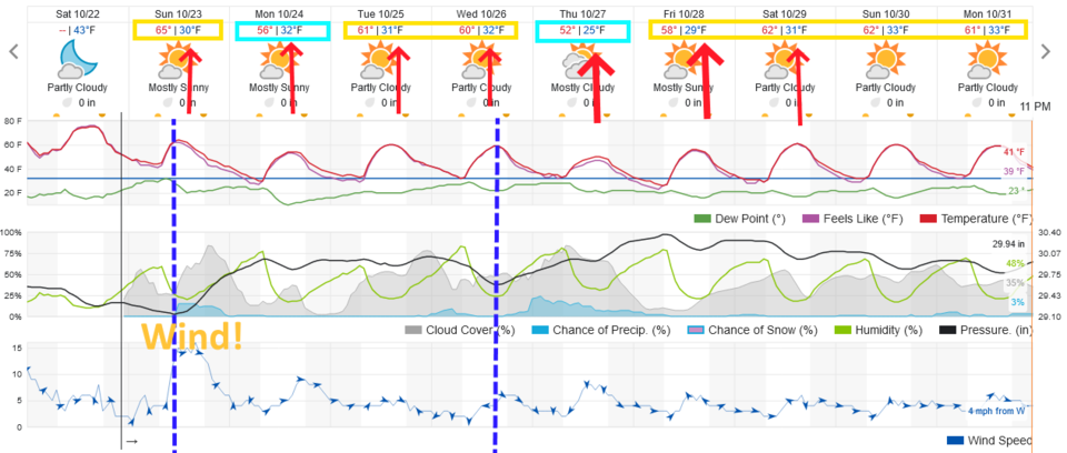
A strong front is coming. (Winter is coming?) A strong cold front should sweep over Longmont and Broomfield around 10am Sunday. A small chance of showers exists after frontal passage (Figure 1 update). The next seven mornings should see temperatures at or significantly below freezing (20's F - see the red arrows) . Late Fall, early Winter weather is here.
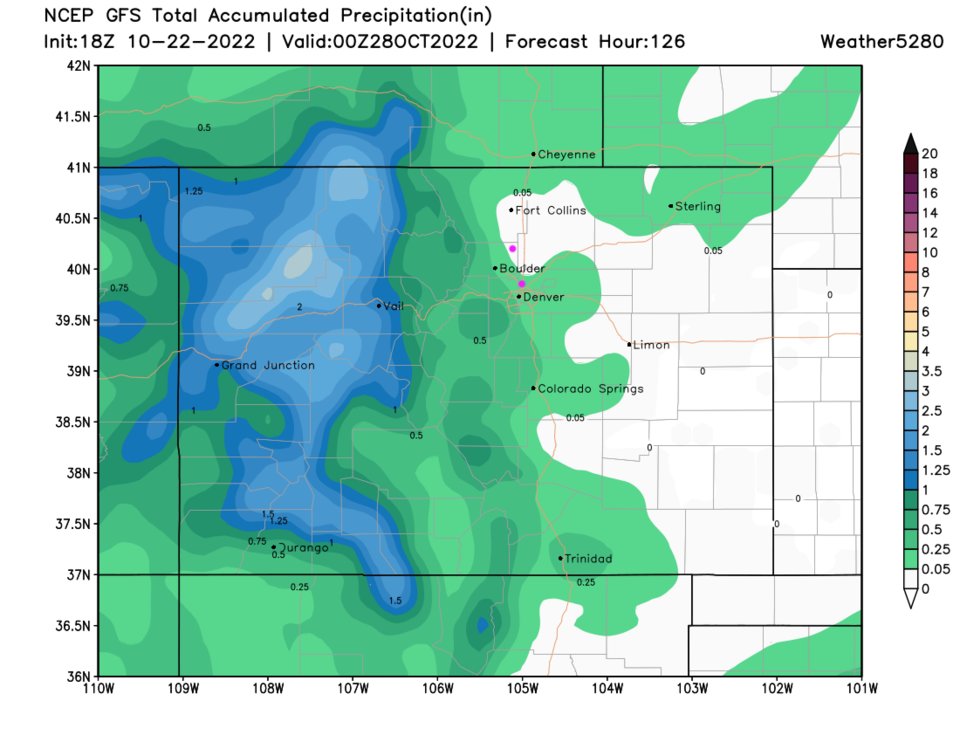
Along I-25, moisture should still be quite limited (below 1/4th inch) for most locations (Figure 2 update). It is possible that many locations along I-25 will see a dusting of snow on bridges, cars, and grass Sunday night into Monday morning before precipitation ends. Location like Estes Park may pick up 1/2 of an inch to a lucky 1-2 inches (Figure 3 update).
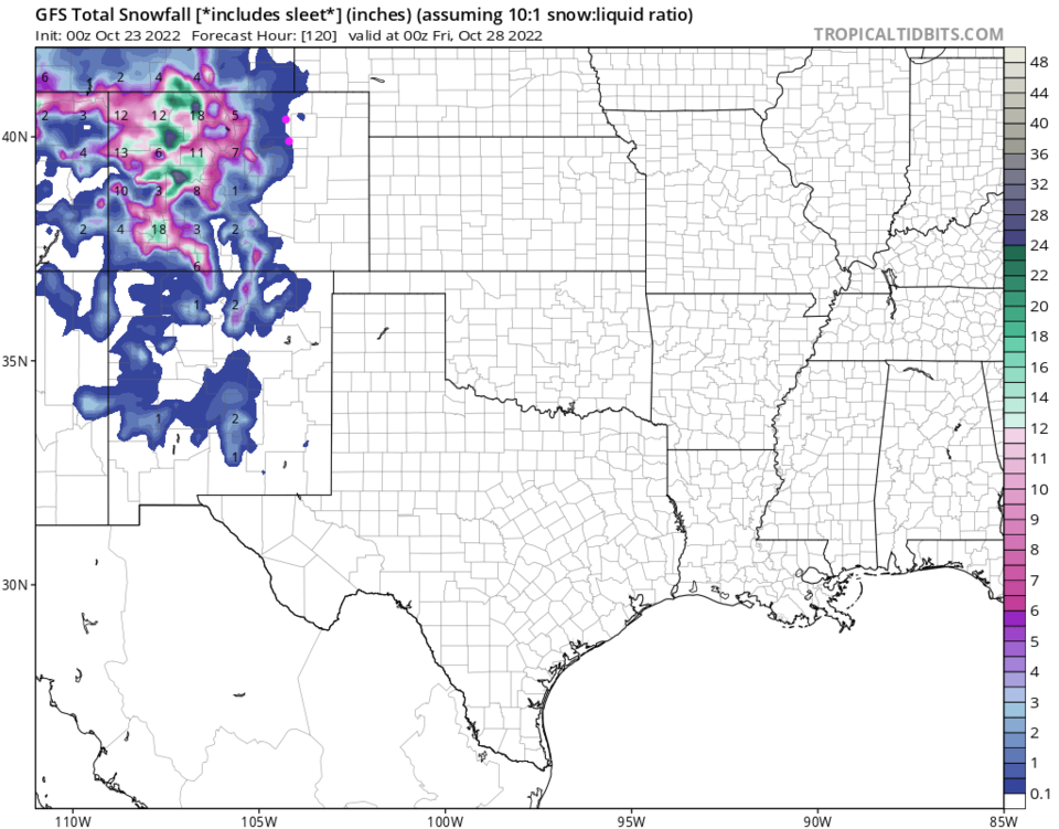
The Western Slopes are the winner with this storm with many locations getting 6-12 inches of snow out west and at the higher elevations.
Early Halloween Forecast:
It looks like it will be dry. Temperatures around 50F at 7pm. Winds will be from the west at 5mph. A very mild nice night for trick-or-treating! I hope to open the Cherrywood Observatory (at the corner of Cherrywood Dr. and Cherrywood Way) for my annual Trick-or-Peek. I'll be featuring Jupiter and the Moon (early on). I might try to point a Saturn as well.
End Saturday update.
The Forecast Discussion:
Figure 1 shows that we may break 80F on Thursday (and will get close Friday and Saturday). There are records in the low 80s that have occurred into November, but we "may" be done with 80s this year after this week (I hope). Expect dry, breezy (fire concerns), and warm weather through Saturday. Nothing else to talk about as the week ends.

The Longer Range Forecast:
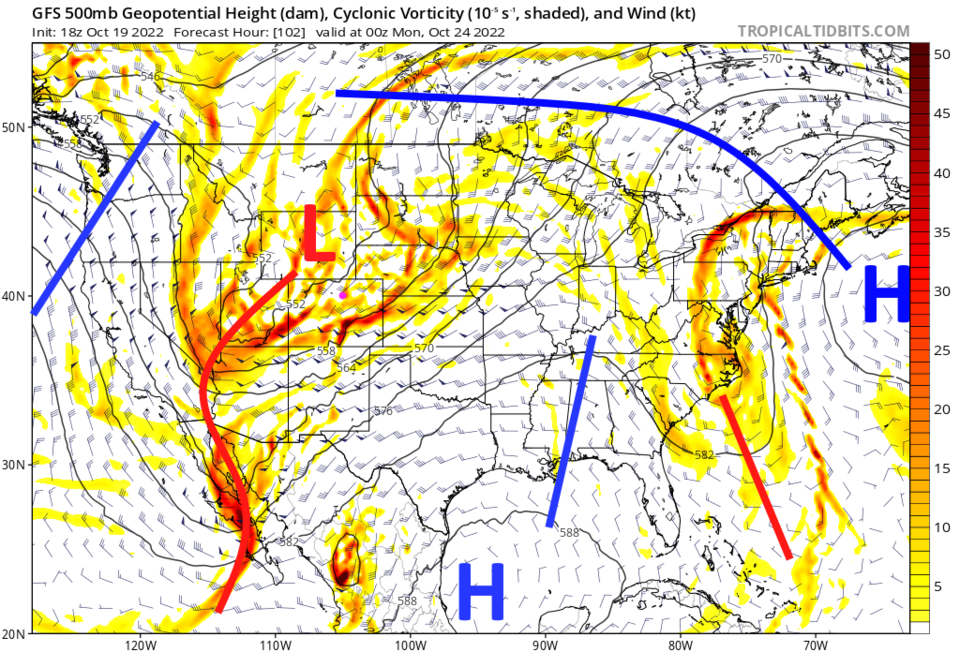
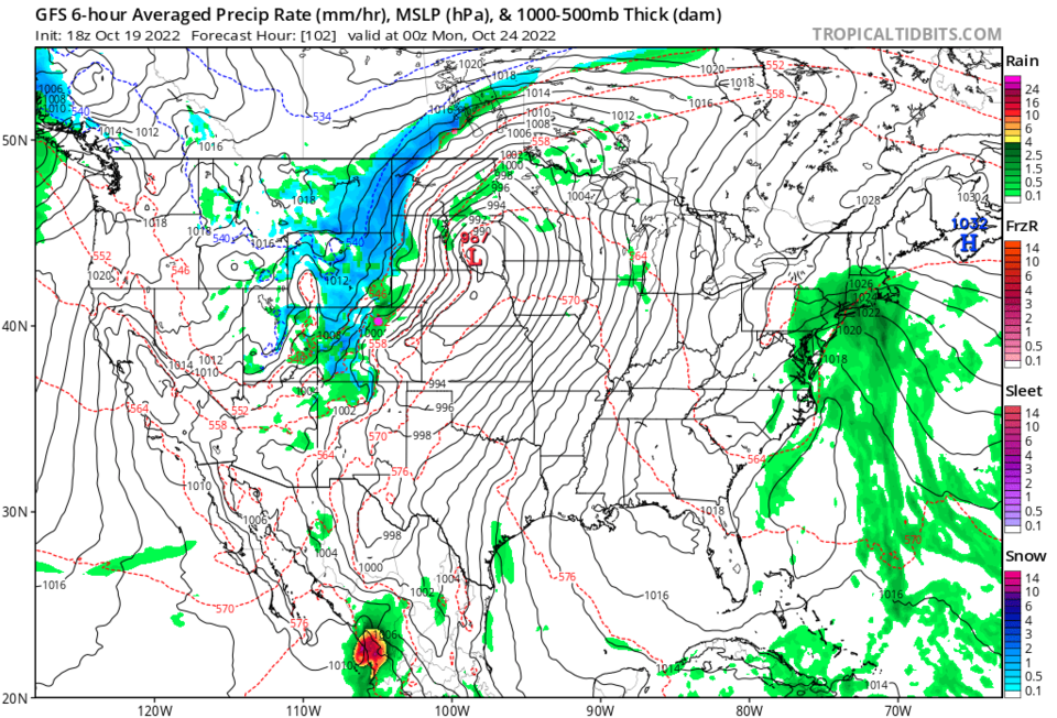
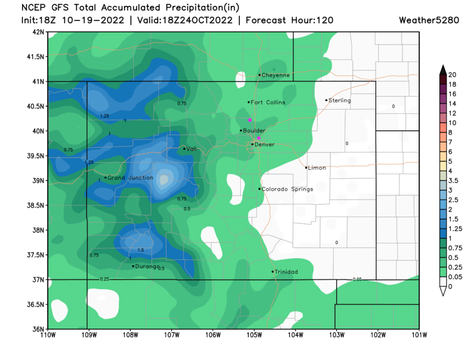
We do get our first stout trough (red line Figure 2) in a while approach the state over the weekend. This kicks off a chance of showers Sunday evening through Monday evening (Figure 1). The storm is pretty impressive for the western half of the state (Figure 3). Rainfall (and snowfall melt) are great for the Western Slopes (Figure 4). Models have increased the showers that make it to the I-25 corridor from zero to at least a tenth of an inch to a local quarter of an inch.
Temperatures will drop to or below freezing. Prepare to take care of sprinkler systems and tender plants outside!